All Activity
- Past hour
-
The defense is the most concerning to me, but they have enough pieces to figure it out. Not too worried about the hitting at this juncture, and pitching consistency should come with time, esp with guys like Bradish coming off injury. You can see he still has the stuff, but not the control he wants yet. Its a marathon. And so far, all teams in the division have issues.
-
Confirmed EF-1 https://www.wcax.com/2026/04/17/nws-confirms-ef-1-tornado-williamstown-thursday/
-
tornado rolled over Reed Timmer
-
Back to back 90+ at KSAV with 3rd so far this spring. Today’s was a doozy at 93!
-
Storm chasers see funnel cloud outside of Rockford IL
-
possible tornado near Rockford IL
-
Ravens new threads are pretty sick. Love all the subtle details, and the 4 different versions. 'Baltimore' appears on road jerseys. And apparently they can be mixed and matched. 3 different helmets, with the standard in the middle
-
About to have a fairly significant cell merger west of Springfield IL. They're out ahead of front all by themselves moving into ever increasing instability and shear with plenty of backing surface winds. If they can get rooted look out, there's nothing in the way. Big overshooting tops.
-
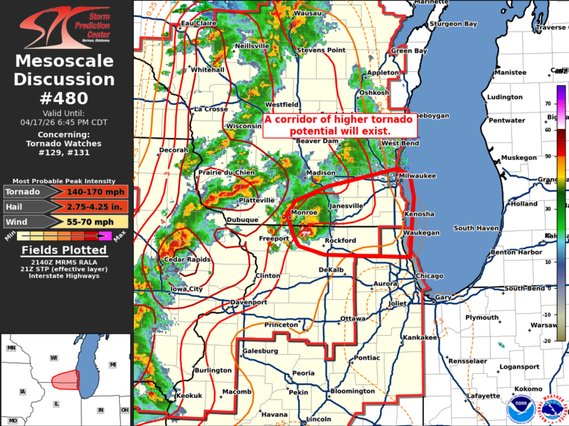
MD on that Rockford cell Mesoscale Discussion 0480 NWS Storm Prediction Center Norman OK 0442 PM CDT Fri Apr 17 2026 Areas affected...Southern Wisconsin and far northern Illinois Concerning...Tornado Watch 129...131... Valid 172142Z - 172345Z The severe weather threat for Tornado Watch 129, 131 continues. SUMMARY...Leading supercells across northern Illinois and southern Wisconsin will likely pose a tornado (possibly significant) and very large hail threat as they move downstream over the next 1-2 hours. DISCUSSION...A pair of leading supercells continues to precede a broken line of storms along the IL/WI border. Regional radar imagery continues to indicate that these cells are rather intense with a three-body scatter spike, a bounded weak echo region, and a recent 3-inch hail report noted with the southern storm. An improving downstream convective environment is noted in recent observations and analyses (0-1 km SRH values remain between 200-250 m2/s2 per the KMKX VWP, and STP values have recently increased to 2-3 per recent mesoanalysis). Additionally, the southern storm will also likely propagate along a subtle surface theta-e gradient draped across northern IL to southern WI. Given these trends and the presence of a well-established updraft/mesocyclone with the southern cell, the potential for very large hail (likely in excess of 2 inches) and strong tornadoes will likely persist for the next couple of hours downstream into southeast WI and far northern IL. ..Moore.. 04/17/2026 ...Please see www.spc.noaa.gov for graphic product... ATTN...WFO...LOT...MKX...DVN... LAT...LON 42138771 42158906 42268948 42378957 42608965 42798955 42968903 43188791 43108770 42848764 42588767 42138771 MOST PROBABLE PEAK TORNADO INTENSITY...140-170 MPH MOST PROBABLE PEAK WIND GUST...55-70 MPH MOST PROBABLE PEAK HAIL SIZE...2.75-4.25 IN
-
I'm guessing 2" or so. Maybe a bit more that melted before it started to stick.
-
MAGA Make April Great Again
-
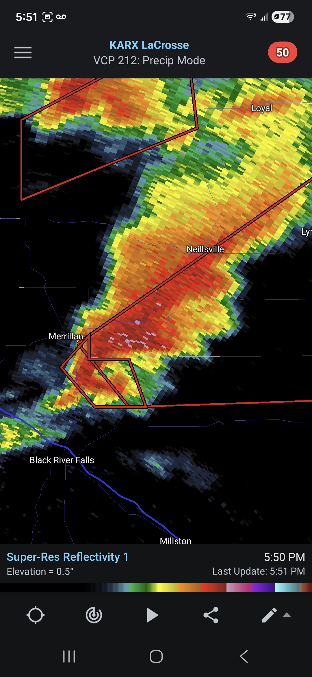
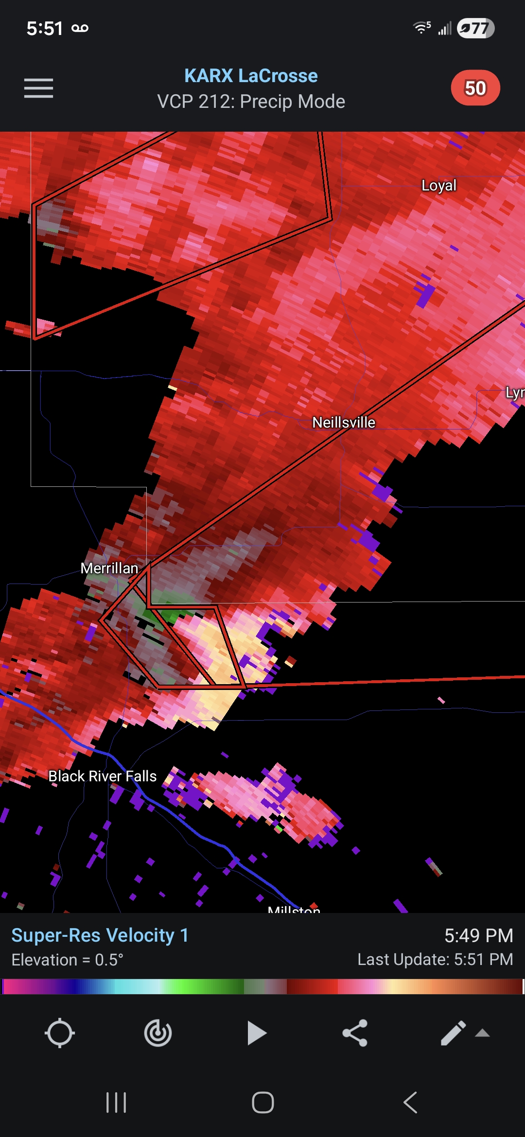
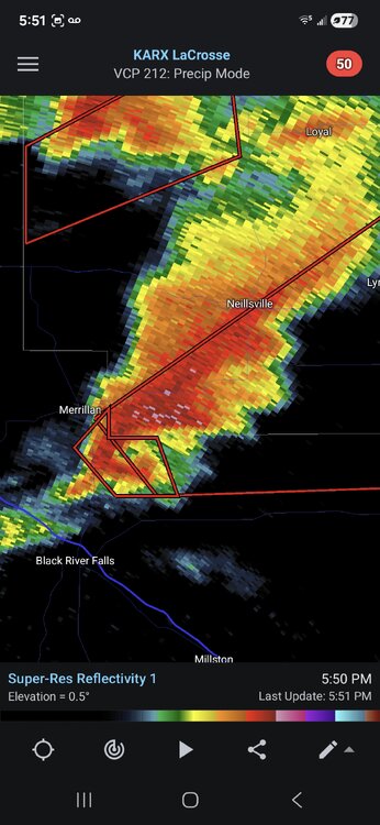
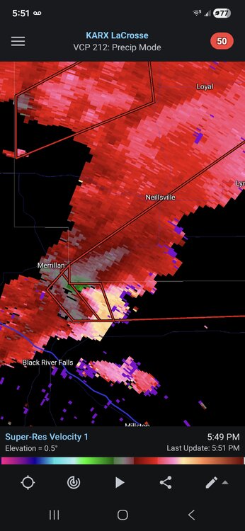
That cell just north of Black River Falls is likely about to drop something (if it hasn't already).
-
Awesome afternoon. 68F. Too bad we cant have this all wknd Sent from my SM-S921U using Tapatalk
-
That sup riding the border is wicked.
-
So far, just a garden variety t-storm in southern WI. Hope it stays that way, too.
-
A moderate risk for tornadoes 100% would have verified today, every storm in that area is spinning up something right now
-
4/18/1996 27 inches of snow over the last three days from an upper level low pressure system raised the snow cover on top of Mount Mansfield, Vermont to an impressive late season 135 inches.
-
It is absolutely filthy with a winter worth of debris on it.
-
-
April sure isn't how I remember it lol
-
Hard to believe this would be a common map before polygons.
-
Damn man, close call there. Saw it hit from water tower webcam. Was legit. Looked like it was swallowing the town.
-
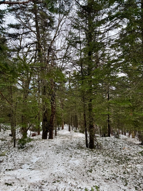
When the snow melted here in March, we had that dirty snow with loads of needles, branches etc. Reminded me of the pics you’d post of the melting pack on the mountain.
-
Why can’t we get that
-
Yes it was. Might be cycling out to a classic hook now. Was the tail end charlie of that initial prefrontal line. This might be the long tracker of the day. Clean uninterrupted juice flowing into it from the south.