All Activity
- Past hour
-

2026-2027 Strong/Super El Nino
LakePaste25 replied to Stormchaserchuck1's topic in Weather Forecasting and Discussion
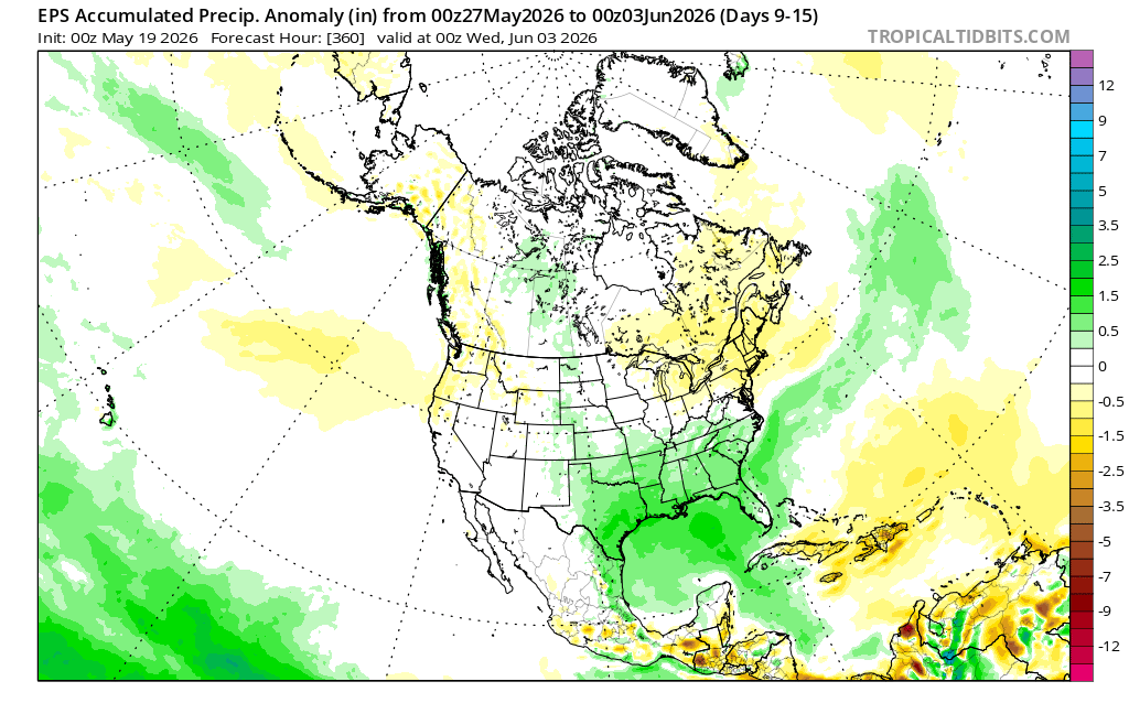
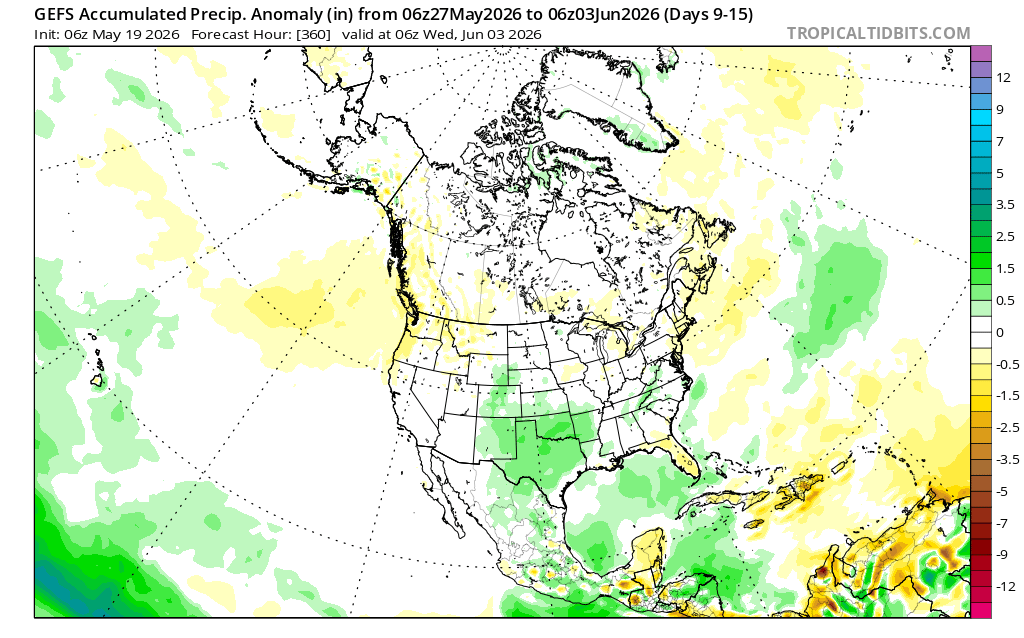
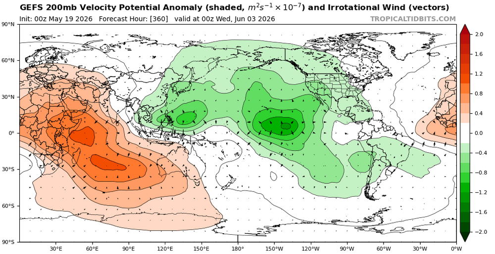
can really see where this makes a difference in +/- precip anomalies. With a traditional Nino look and more suppressed convection in the W pac on the EPS, you get the typical deep +precip anoms in the traditional Nino southern stream belt in the SE with -anoms in NE. whereas the GEFS, with its lingering convection in the W pac, has a more muted precip signal.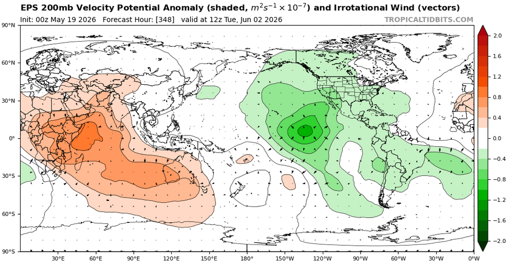

-
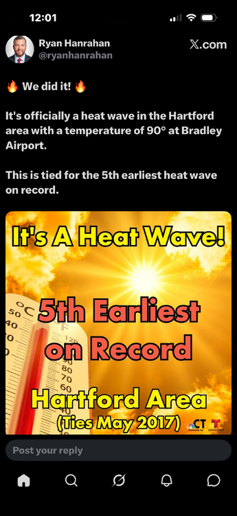
Don't miss working in this at all. 93 at noon
-
Congrats CT!
-
Watch out for tblizz in the trees
-
2026-2027 Strong/Super El Nino
LakePaste25 replied to Stormchaserchuck1's topic in Weather Forecasting and Discussion
The EPS appears to be modeling less lingering convection in the west pac vs. the GEFS and CMCE.
-
I think you might be conflating with your alternate life fantasy here -
-
I have to agree with this. Perhaps there is some sort of relationship with how EL Nino's evolve during the summer and what we experience during the summer in terms of big heat or not, but strong(er) EL Nino events don't really become mature until we're in the dead of summer or even back half of summer. If anything, I would think the correlation would start showing as we moved into Fall
-
I bet ORH pops 90 they're 88 for now but there's literally 0 inhibition to maximizing this bad boy today. 95 here... one more ob before noon proper
-
It’s raging and hard.. it’s iron clad
-
I also saw a tweet that mid/long range forecast accuracy has increased dramatically over the last couple weeks as expected as we begin to move out of meteorological spring.
-
Problem with that idea is that the NINO is not a raging hard one yet. It's formulating... Now ...maybe that's enough? I don't know. But having the NINO in place, already registering an influence in the atmosphere, which this isn't ...yet, is a different animal.
-
NAM seems to be delaying the front by 3 or so hours over priors...that might make the difference for HFD-LWM axis/E
-
Any met want to weigh in on if Spruce Knob WV should be clear enough to stargaze tonight? Seems like it’s my last day to do so for a while.
-
NH Seacoast Thunderstorm season engaged?

-

2026-2027 Strong/Super El Nino
snowman19 replied to Stormchaserchuck1's topic in Weather Forecasting and Discussion
This event is very well coupled and looks much different than 2023. It’s also developing as the most east-based/EP El Niño since 1997 ^“The low-frequency (or "background") El Niño circulation is really showing up in recent runs of subseasonal guidance, with anomalous rising motion forecast to set up and persist across the East-Central Pacific even as the MJO signal keeps moving. The low-level response to this will be persistent westerly wind anomalies at low levels (helping the event to mature and grow to peak), and the upper level response will be increased westerly wind shear across the Western Hemisphere tropics due to outflow from the convection. Really looks like a classic coupled strong El Niño event setting up, in contrast to something like 2023 which had a much more muted atmospheric response.” -
90 before noon here- scorcher
-
93/75. I feel alive.
-
It’s possible this is the hottest day of the summer .. especially with a raging hard Nino knowin for high dews but not high heat
-
Hey yo….hey yo hey yo.. ACATT don’t want to step to me With a dewpoint of 73 Dealing with temps of 93..
-

Central PA Spring 2026 Discussion/Obs Thread
Itstrainingtime replied to Voyager's topic in Upstate New York/Pennsylvania
91 at 11:35am. Fun. -
Hot as balls in DC
-
Strike that, reverse it? 90/74 here now, RH 59%
-
93
-
83 at Pit2. 62 at Pit1 what a difference.
-

2026-2027 Strong/Super El Nino
40/70 Benchmark replied to Stormchaserchuck1's topic in Weather Forecasting and Discussion
Yea, I'm open to an alternate solution, but I think the default expectation should be continued attenuation of the ability of warm ENSO to modulate the north Pacific moving forward.