All Activity
- Past hour
-

2025 Spring/Summer Mountain Thread
Maggie Valley Steve replied to Maggie Valley Steve's topic in Southeastern States
I finally got some rain last evening! My low this morning was 60 which felt so refreshing after a few days of very warm weather. -
Just poking fun at the posts from this morning, I was like why are we looking at 06z. That’s the heart of the cold anomaly. Definitely looks like a great day 80s and not that humid.
-
(in response to Don's chart of the distribution of highs after low of 63) ... Probably the 63 "low" associated with the 95 in 1925 was at end of day as that heat wave ended, so it wasn't a case of 63 warming to 95, but 95 cooling down to 63? Not sure about that but it looks that way. Urelated factoid, I recently updated a data base for NYC and found that the highest average temperature for the entire period of record occurs on July 18 for both max and min. (86, 70).
-
Ha I’m sure it is, was more a joke as DIT says suns breaking out and then you post a satellite that looks mostly cloudy at best, full overcast at worst.
-
Next Saturday should be solidly into the 80's (obviously except immediate coastal probably and the higher elevations) and Saturday night will be into the 60's for lows.
-

July 2025 Discussion-OBS - seasonable summer variability
LibertyBell replied to wdrag's topic in New York City Metro
sucks no 1980 style continuous heat, but at least the peaks are higher this year (for us anyway). -
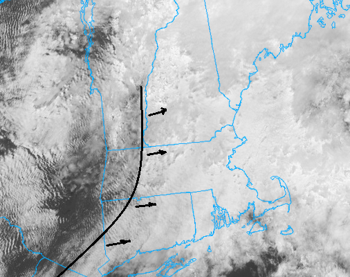
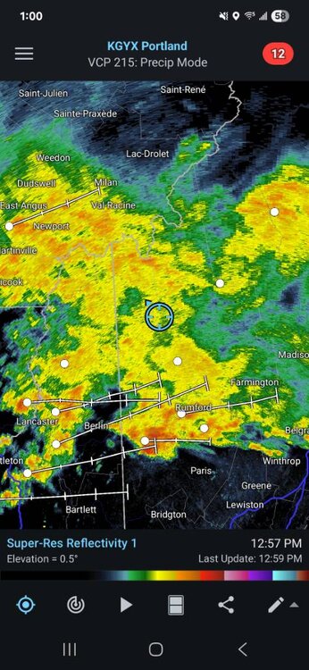
I pulled it from this site and was the last frame in the loop https://weather.cod.edu/satrad/?parms=subregional-New_England-02-24-1-100-1&checked=map&colorbar=undefined
-
Cherry picking the 2 am time period?
-
-
We all know the feeling. I think it's more frustrating to miss out when others are cashing in, then it is when everybody is dry. The same dynamic works with snow; 2" feels wonderful when everybody is getting it (or less), but it's maddening with other nearby are getting 4" or 6". Your luck will turn and the lucky ones this month might be back in the dust bowl.
-
78 / 71 partly cloudy ish now
-
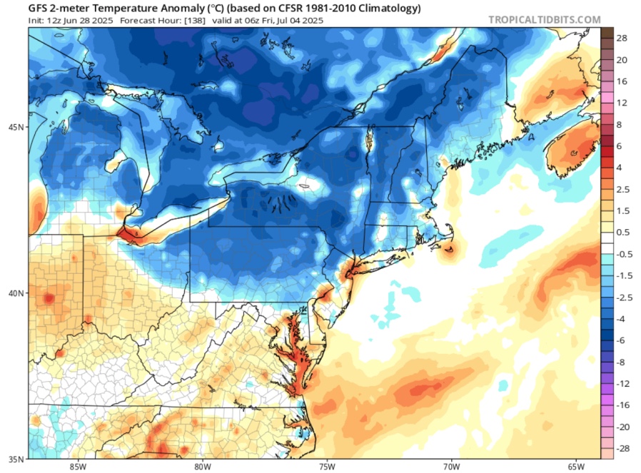
GFS holding onto the frigid 4th!
-
Partly to mostly sunny and 79 at 1:10pm. It's about as uncomfortable as 79 could possibly be.
-
I get some of the other arguments but I’m trying to figure out how being pissed at your mother is assuaged by a change in area code. By the time cells started to become widely used, I got mine in 2000. Thankfully 617 still had room. I imagine I’ll have that one until the end.
-
Is that satellite current?
-
I’ve got a lot of very tiny red insects or maybe larvae the size of a pinhead stuck to the leaves of my maple trees. Any thoughts of what they are? Can post a photo later if needed. Looked via google and there were many different answers, and not sure what geographic areas the answers were coming from…
-
52f miserable degrees in oquossic. Pouring. Sent from my SM-S921U using Tapatalk
-
I frankly see this to be a compromised result comparing the GFS' nasty BD jammed in the butt look from 3 days ago, when the Euro was laze faire warmth and giddy into NH. The GFS sort of caved into the Euro idea yesterday ... but that was probably wrong in doing so some 60%... This is its original look just 'not as bad'. The Euro was too optimistic. Purely my subjective opinion in qualifying the sensible weather day ...but it'll be too late E zones - the day's a legit piece of shit whether we get that late day reach around or not.
-
This has been in the works for a while… it would have happened sooner if the FV3 based models had better verification data.

-
light drizzle and 64 maybe we spike quick later on but most of the day meh
-
It won’t be through until ~6 I don’t think of it happens. And it’s just a line - so not an entire evening ruined.
-
granted the progress of that clearing axis is slowish... probably 30 mi/hr ~ ...and there's thinning/day-glow warmth ahead of it by some. I have the warm sky light appeal here, yet drizzle mist still occurring in tandem. Man ...these sludge air masses get lodged in here E of the terrain and it just takes a planetary collision to mix the shit out
-

July 2025 Discussion-OBS - seasonable summer variability
forkyfork replied to wdrag's topic in New York City Metro
pieces of heat with fronts, above normal overall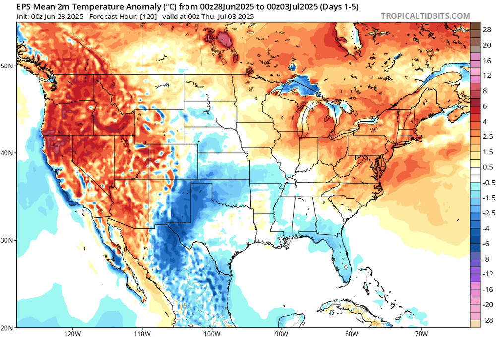
-
"Vacationland" for a reason