All Activity
- Past hour
-
This. There's nothing worth tracking, but anything that pops could quickly become worthy
-
the eye broke up and strongest sfc winds went way east. mid-lower cape had the strongest winds BID aside. yeah it was a big'un, no power for two weeks in East Falmouth, MA. Remnant eye went overhead. Yore
-
 Yes a dud as far as snow goes but at least it was colder than normal (although not by much), rare in recent years.
 -
Moon had an orange tint to it here tonight. Nothing like that.
-
I believe I've mentioned this in another Bob post/thread, but Bob's eye went right over Bristol. We went outside and did some quick cleanup as the eye came through. Pretty surreal - lots of tree damage in East Bay of RI with that storm! No power for 3 days or so, at least at my apartment on 114.
- Today
-
That makes sense given the QBO as well. As of now, there's an obvious disconnect with the SST'S and Atmosphere. So, the NATL SST'S may not factor in too much if that were to continue into Winter. On to the reason of such a disconnect, that probably has something to do with Solar/ tropospheric imo. Mountain Torque could be at play some but, not to the disconnect Magnitude there is I don't think. Jeff may have a better or a more detailed explanation on the Subject.
-
Yeah for fantasy range it’s slightly interesting. Less the storm than the overall steering pattern, which has looked pretty consistent (thus far) for an EC threat if there’s a wave that can ride into the SW Atlantic.
-
 Drill baby drill
 -
Hardly any rain here in Hickory today, just about one tenth of precipitation. The heavier axis of precipitation never retrograded enough to affect us. Point-and-click forecasts up to an inch of rainfall tonight and over half an inch tomorrow. We shall see, but radar returns are quite paltry over the entire southeast at the moment.
-
Looks like the beautiful low humidity mornings are over for now. Low was 70, high was 88 with dew points at mid afternoon in the upper 70's.
-
I saw that also prior to the season starting. He might be the only GM in history to be given a bigger check book but say meh. No thanks
-
I'm just kidding with you.
-

african wave (bang in the middle of the mdr, 0/50)
Kevin Reilly replied to BarryStantonGBP's topic in Tropical Headquarters
It has been on the models off and on but there is blocking in the Atlantic showing up as well. I think that is why you saw the tracks into the Carolinas which is plausible. -
 My friend out west What are we doing to our planet
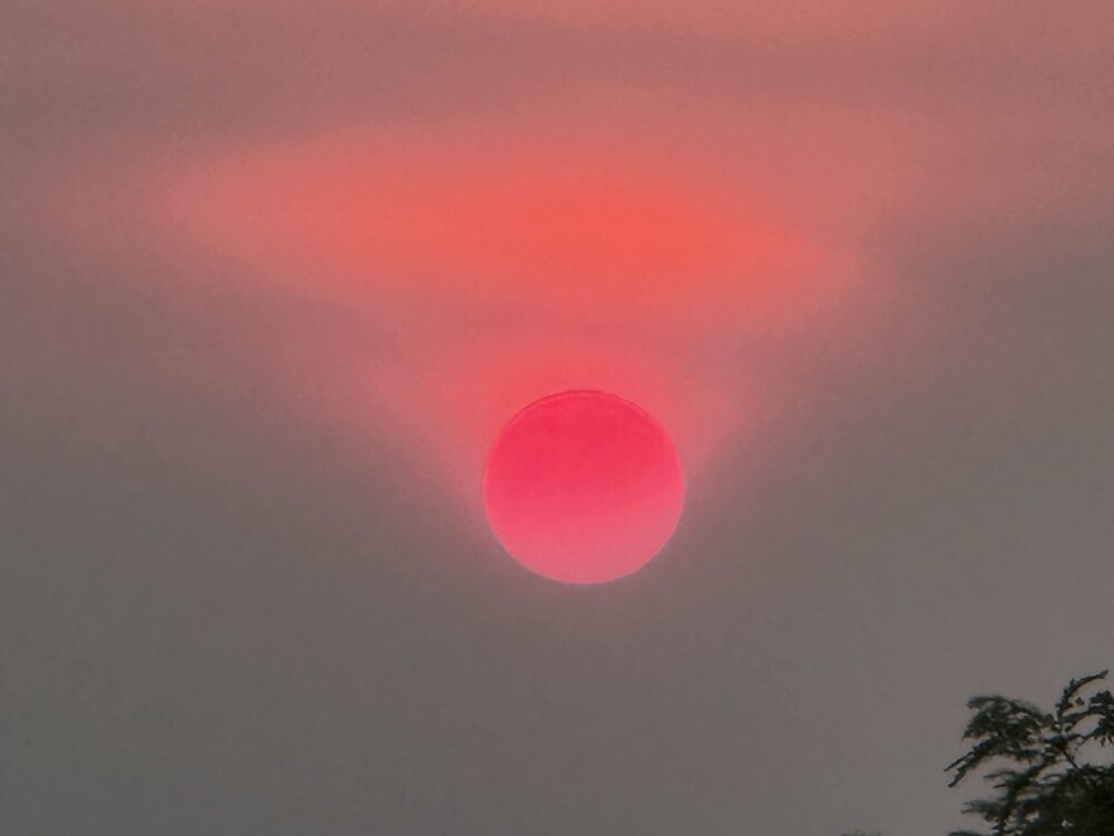
-
Take 1954 Hurricane Carol and transplant 100 or 200? mi or whatever east/southeast, it'd cause a shitload of damage over SE MA. It's not a halficane situation or what not, SST's are relatively warm. If any system to were get caught up in that tropical environment, it wouldn't just go ET in a minute.
-
Yeah it's not even worth discussing. But we do lol
-
Obviously beyond speculation time frame, but the modeled back side winds usually don't verify; chop off at least 30%.
-
Days are getting shorter even faster since the sun sets within the bank of smoke 10-15 minutes earlier than the horizon line every evening.
-
Creppy out there
-
Wow... Your strong nor'easter rating is pretty impressive! My scale is considerably lower... Lol
-

2025-2026 ENSO
so_whats_happening replied to 40/70 Benchmark's topic in Weather Forecasting and Discussion
Should have saved this until tomorrow but whatever here is all of June/July and the 1st of August..thumb.gif.0021e29577555823a16db19042180018.gif)
-
 Pensacola 9” lol there is hope
 -
2025-2026 ENSO
so_whats_happening replied to 40/70 Benchmark's topic in Weather Forecasting and Discussion
To me at least this is telling me we are slowly cooling off the WPAC with no real discernable changes in the central and EPAC with SST. Baby steps. -
2025-2026 ENSO
so_whats_happening replied to 40/70 Benchmark's topic in Weather Forecasting and Discussion
Yea TAO has the cool pool further west and a smidge cooler. Overall though placement of warm anomalies isn't too far off from each other. This is the second weakening of trades that has occurred over the summer last was around early June so I'm curious if we start to see the westerlies that have been stuck around 90E start to wane in any shape and develop further east toward the maritime continent (120-150E). We still keep getting random bouts of a Nino like response even with the -PDO where it is and the weak cool/ neutral SST profile.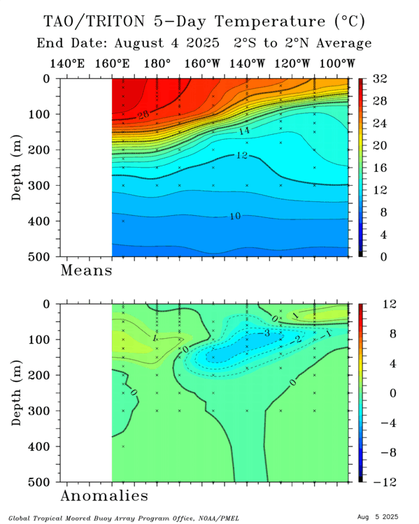
-
 Yep. We reliably get T-storms in the dead of winter, 3” snowstorms though are harder than pulling out a molar with a rusted plier. Have to go down to Norfolk now to get those. Red smoky moon again tonight. Plenty of that these days too.


.gif.e9d1e3089fe326ec88e0a635e4a7cab5.gif)
