All Activity
- Past hour
-

December 2025 regional war/obs/disco thread
weathafella replied to Torch Tiger's topic in New England
So odds are highest in general for January being above average given it is the coldest month of the year climo wise. -
People on here never cease to amaze. Month to date I'm running about -7 on the lows and -9 on the highs. Does it need to snow every 3 days or something? It's been plenty cold and there's snow on the ground. That's what you get in the metro in December, we're not in the northern Rockies.
-
With the back and forth between last rites and "just wait it out" in the ENSO thread you'd expect to see some cliff jumping here.
-
Not a lot going on in the weather world
-
That's not a torch lol
-
Modeling off a little lol forecasted low is 29. Yet according to LWX it's down to 25 already lol
-
6-9” is a big snow, statistically speaking. whatever parallel universe you and beavis live in must be one hell of a place. -2 for using hoss twice.
-
If rain moves in sooner it’s meh
-
You seriously asking me that question ?
-
It can happen but rarely does. Also if you could read hoss, my first post said big snows and high ratio 6-9 isn't a big snow. Yea you need cold air to get big snows but not in your backyard (temps in teens). Take a break being a clown hoss.
-
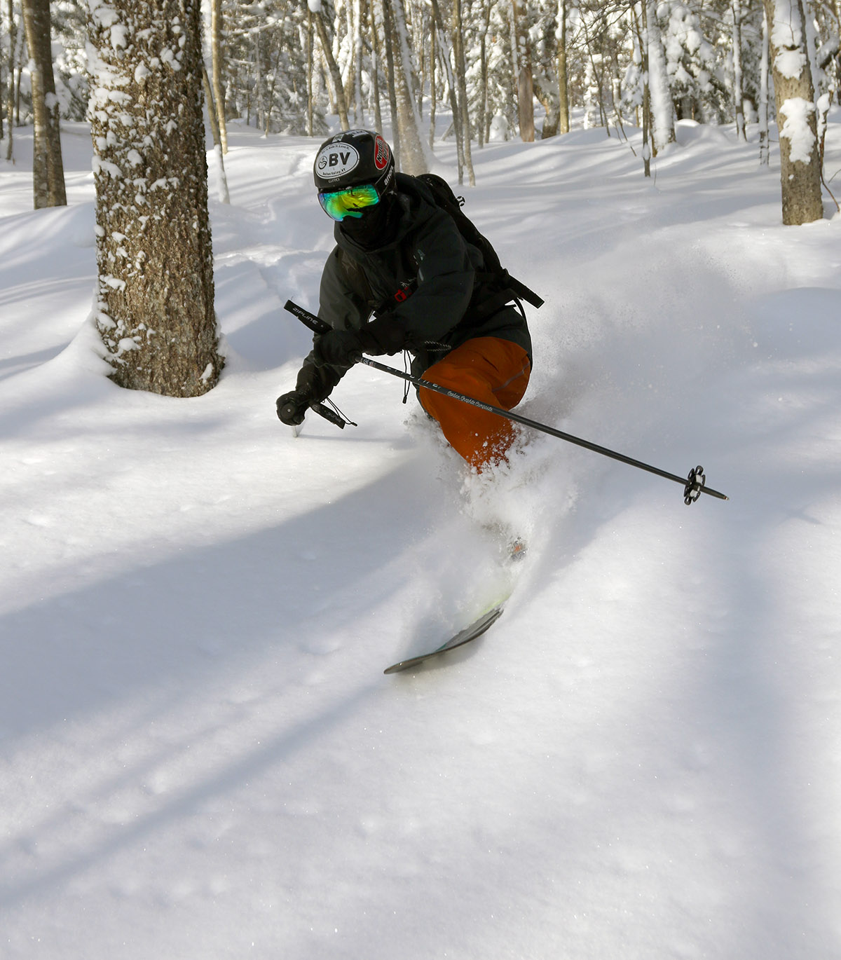
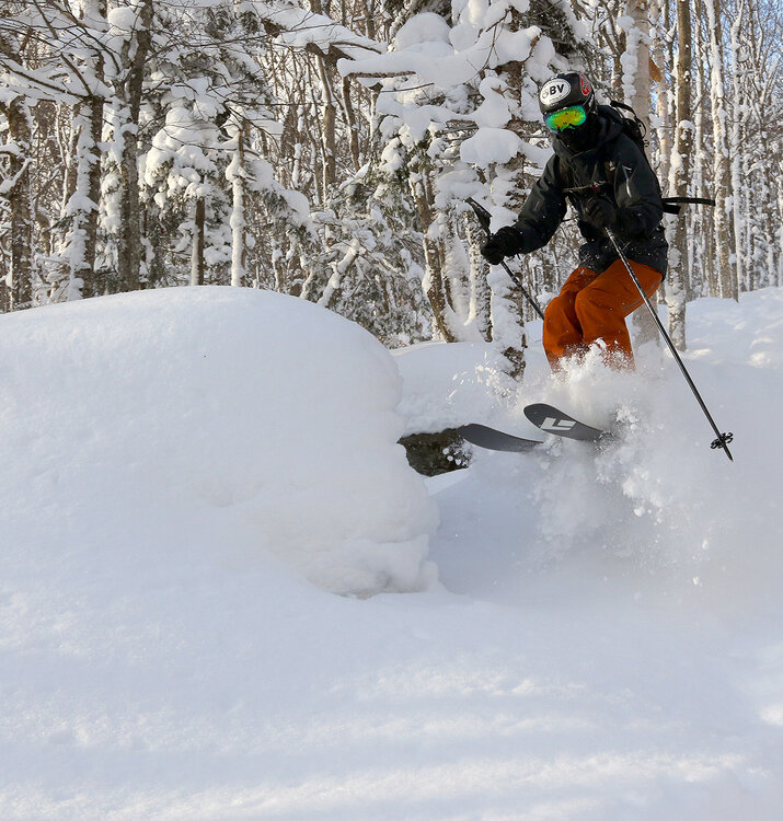
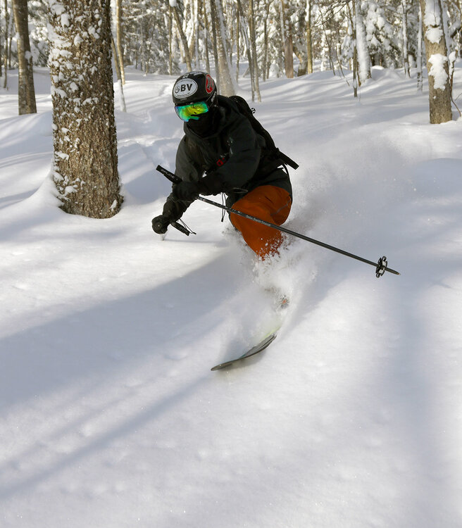
A couple more shots from Sunday's outing that I hadn't had a chance to get in with the first batch of images:
-
I'm running +7 or +8 month to date here, while Boston is running -7 to -8 month to date...but we've still had more snow than Boston even with less precipitation and a warmer base climate. Really is a pretty weird pattern this month - everything is a bit off from normal flow and progression.
-

December 2025 Short/Medium Range Forecast Thread
Daniel Boone replied to John1122's topic in Tennessee Valley
The MJO is what had me concerned when we were discussing modeling may be pushing back west gradually with the big warmth . If it does go six with a GOA Low it could possibly force a deep western Trough . May start seeing bowling balls down the west Coast and then move inland. If that's the case, you may be right about the NAO and it may hook with the Continent Ridge but, the good thing too is that's more rare than the NAO, SER Hookup. If the NAO is Central based, Greenland centered, it's doubtful any mid continent hookup. It may just force that Ridge west and cause it to sharpen between the far western Trough and back building Eastern one. That happened a couple of times in the late 80's and early 90's. . Rather Tricky setup to forecast coming up. Timing of these features is going to affect the Outcome considerably, imo. -
the weeklies can be awful-a couple years ago they showed cold all winter and we baked
-

2025-2026 ENSO
40/70 Benchmark replied to 40/70 Benchmark's topic in Weather Forecasting and Discussion
....or call BS on it beforehand via own obervations. -
2025-2026 ENSO
40/70 Benchmark replied to 40/70 Benchmark's topic in Weather Forecasting and Discussion
Not here it wasn't. -
December 2025 regional war/obs/disco thread
40/70 Benchmark replied to Torch Tiger's topic in New England
I am highly confident. -
December 2025 regional war/obs/disco thread
40/70 Benchmark replied to Torch Tiger's topic in New England
I wonder if that modeled -NAO for late month fades...regardless, it's kind of fake, anyway given it's Scandinavian based. -

December 2025 regional war/obs/disco thread
WxWatcher007 replied to Torch Tiger's topic in New England
Totally agree. No early end to winter in NE this season. - Today
-
December 2025 regional war/obs/disco thread
40/70 Benchmark replied to Torch Tiger's topic in New England
The Pacific trough pattern into mid January is right...it's therafter that is the time to watch. -
December 2025 regional war/obs/disco thread
40/70 Benchmark replied to Torch Tiger's topic in New England
Who predicted a warm start to December?? -

December 2025 regional war/obs/disco thread
H2Otown_WX replied to Torch Tiger's topic in New England
So the weeklies are full of crap iyho? -
December 2025 regional war/obs/disco thread
40/70 Benchmark replied to Torch Tiger's topic in New England
SSW is more for February...the stretch via reflection event is mid to latter January. -
December 2025 regional war/obs/disco thread
40/70 Benchmark replied to Torch Tiger's topic in New England
Agree 100%....especially last part. -

Central PA Winter 25/26 Discussion and Obs
Ruin replied to MAG5035's topic in Upstate New York/Pennsylvania
yesterday watching uploaded abc27 weather the fink as I call him stated and I quote. If you like white christmas this is the closet you will get. from yesterday's snowfall. this week will warm up and thursday will wash the snow away with rain then we go into a warm period. Please oh please let the updated snow for christmas happen