All Activity
- Past hour
-

2026-2027 Record-breaking El Nino
GaWx replied to Stormchaserchuck1's topic in Weather Forecasting and Discussion
Today’s weekly relative update (which has been NOAA’s official way of measuring these for quite awhile now) for last week cooled in Nino 1+2 from +3.9 to +3.7 and in Nino 4 from +0.1 to -0.1. Meanwhile, Nino 3 warmed from +2.7 to +2.8 while Nino 3.4 warmed from +1.8 to +2.0: 02SEP2026 3.9 2.7 1.8 0.1 09SEP2026 3.7 2.8 2.0 -0.1 This is the comparable week in 1997: 10SEP1997 3.8 2.6 1.8 0.5 This tells me that 2026 remains more E based than 1997 and was thus for another week the most E based on record for this time of year. -

2026-2027 Record-breaking El Nino
forkyfork replied to Stormchaserchuck1's topic in Weather Forecasting and Discussion
yes there is -
September 14 2099: The next total solar eclipse will take place over Minnesota. It will be visible in the Twin Cites, depending on the weather. (Note: My g & gg kids will be old folks then ) 1964: The earliest official measurable snowfall occurs in Minnesota with 0.3 inches at International Falls. 1852: Early frost hits Ft. Snelling and ends the growing season. For Monday, September 14, 2026 1937 - The mercury soared to 92 degrees at Seattle, WA, a record for September. (The Weather Channel) 1944 - A very destructive hurricane swept across Cape Hatteras and Chesapeake Bay, side swiped New Jersey and Long Island, and crossed southeastern Massachusetts. The hurricane killed more than four hundred persons, mainly at sea. The hurricane destroyed the Atlantic City NJ boardwalk. (David Ludlum) (The Weather Channel) 1970 - The temperature at Fremont, OR, dipped to 2 above zero to equal the state record for September set on the 24th in 1926. (The Weather Channel) 1987 - Barrow, AK, received 5.1 inches of snow, a record for September. (Sandra and TI Richard Sanders - 1987) 1987 - Thunderstorms developing along a cold front produced severe weather from Minnesota to Texas. Thunderstorms in Iowa produced baseball size hail at Laporte City, and 80 mph winds at Laurens. Hail caused more than ten million dollars damage to crops in Iowa. Thunderstorms in Missouri produced wind gusts to 75 mph at Missouri City and Kansas City. A thunderstorm in Texas deluged the town of Fairlie with two inches of rain in just two hours. (Storm Data) (The National Weather Summary) 1988 - Hurricane Gilbert made the first of its two landfalls on Mexico, producing 170 mph winds at Cozumel. (The Weather Channel) 1988 - Thunderstorms produced severe weather over the Texas panhandle during the evening hours. One thunderstorm spawned a strong (F-2) tornado in the southwest part of Amarillo, and deluged the area with five inches of rain. The heavy rain left roads under as much as five feet of water, and left Lawrence Lake a mile out of its banks. Hurricane Gilbert lost some of its punch crossing the Yucatan Peninsula of Mexico. Its maximum winds diminished to 120 mph. (The National Weather Summary) (Storm Data) 1989 - Unseasonably cool weather prevailed across the south central U.S. Eight cities reported record low temperatures for the date, including Raton NM with a reading of 30 degrees. The afternoon high of 59 degrees at Topeka KS marked their third straight record cool maximum temperature. Unseasonably warm weather continued in the Pacific Northwest. Seattle WA reported a record eight days in a row of 80 degree weather in September. (Storm Data) (The National Weather Summary) Observances: 14 Mon National Live Creative Day 14 Mon National Sober Day 14 Mon Ganesh Chaturthi 14 Mon National Coloring Day 14 Mon National Cream Filled Donut Day 14 Mon National Food Is Medicine Day 14 Mon National Rosa Tequila Day 14 Mon National Virginia Day 14 Mon Gobstopper Day 14 Mon National Eat a Hoagie Day
-
love these cancel winter predictions in September especially when the Cansips model is now predicting the warmest water in the Pacific to be in the central area of the Pacific (Modoki) not along the South America coast. I am suspecting that this upcoming winter will be similar to last winter - for different reasons of course -especially mid -late January through February
-
2026-2027 Record-breaking El Nino
GaWx replied to Stormchaserchuck1's topic in Weather Forecasting and Discussion
Today’s SOI is at ~-26. That’s the 33rd straight -SOI. The 30/90 day averages are at -17.5/-20.3: https://www.longpaddock.qld.gov.au/soi/ -

Central PA Summer 2026 Discussion/Obs Thread
canderson replied to Voyager's topic in Upstate New York/Pennsylvania
Yea but you’re 128 years old. -

2026-2027 Record-breaking El Nino
LakePaste25 replied to Stormchaserchuck1's topic in Weather Forecasting and Discussion
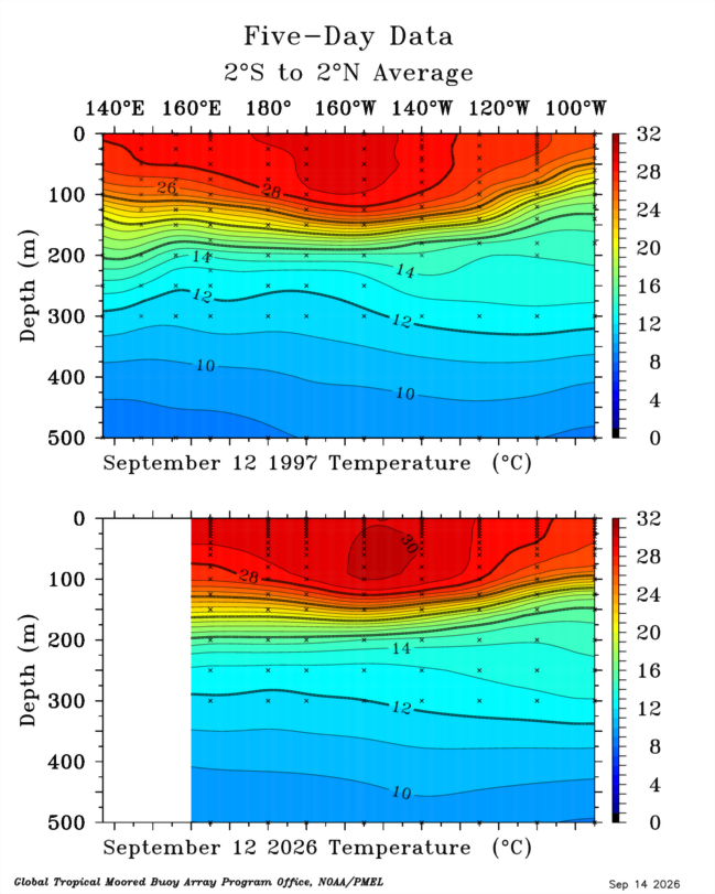
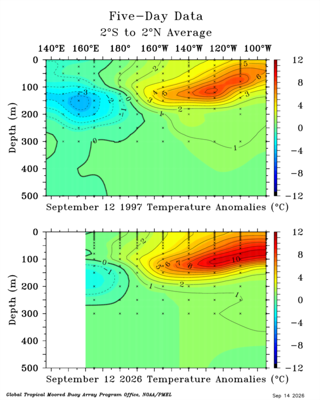
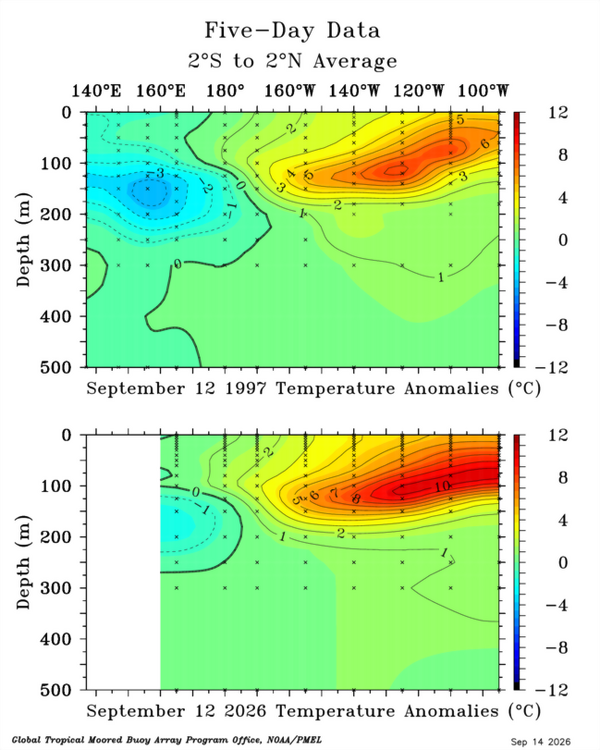
Further east and a much greater volume of warm water than 1997 with the 30C isotherm approaching 140W: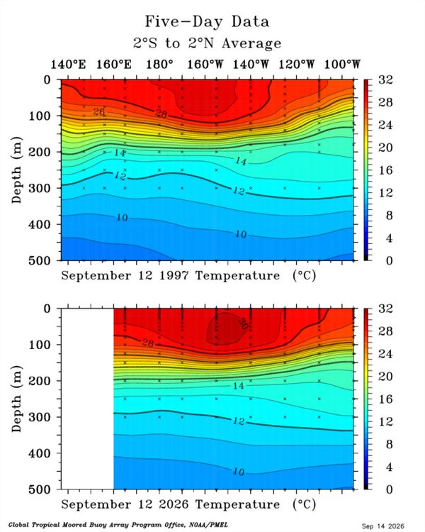
-
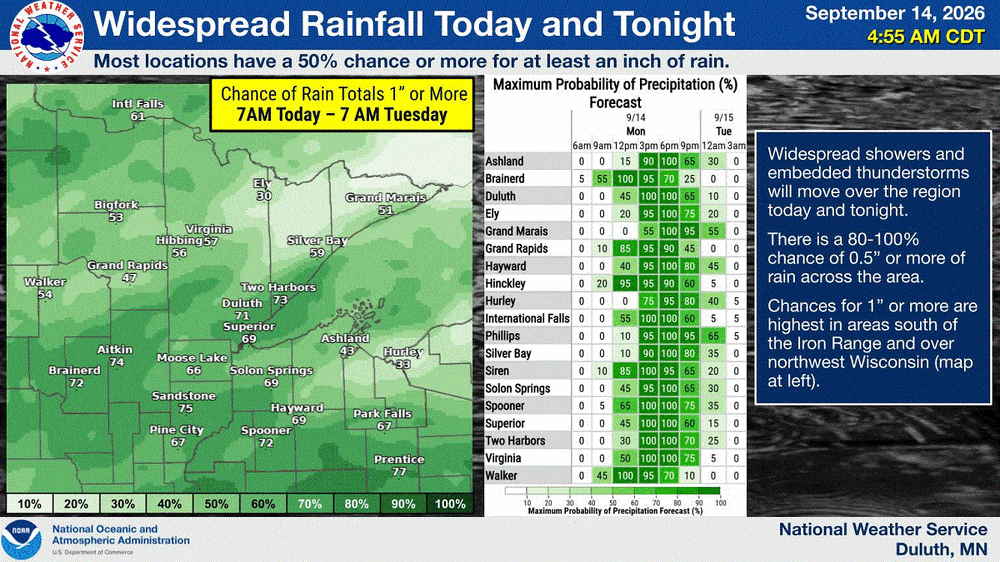
Upper 20's-30's (40's along the shore) across NE MN. Very chilly mid Sept morning. Now let it rain
-
2026-2027 Record-breaking El Nino
GaWx replied to Stormchaserchuck1's topic in Weather Forecasting and Discussion
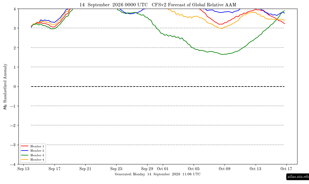
The AAM yesterday finally for the first time this month exceeded an impressive +3 per the following image after several early Sep runs had had that occurring by Sep 7-8th. The delay is typical due to a + bias of the CFSv2. This is saying it will hit an extreme level of +4+ in only ~5 days (~Sep 19th), which is the earliest in its forecast that I’ve ever seen it reach it, and that it will stay +4+ at least through Sep 24th. I’ll keep following these graphs to see if that actually occurs: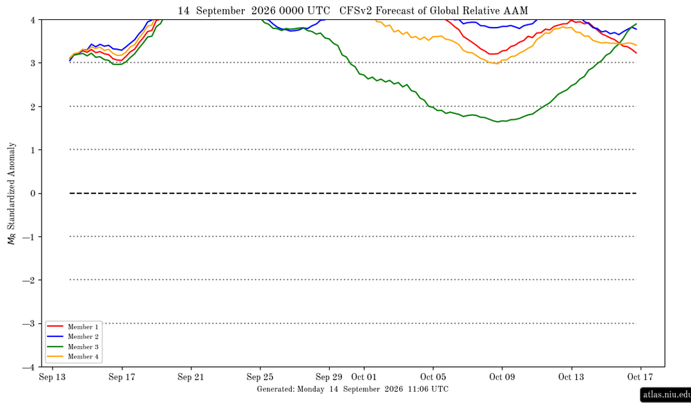
-
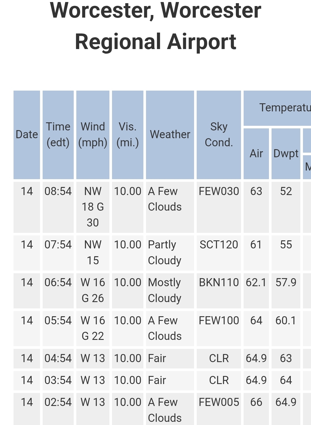
Nice breeze this AM blowing away some of the souptember feel. Should be nice DPs until the end of the week. Enjoy!
-

Septorcher 2026 Discussion - Endless Summer
kdxken replied to Damage In Tolland's topic in New England
Boom. And down we go.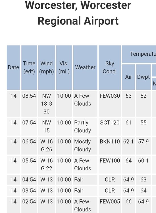
-
2026-2027 Record-breaking El Nino
GaWx replied to Stormchaserchuck1's topic in Weather Forecasting and Discussion
It was initialized at +4.6 for the full Sept averaged out. The mean then has +3.9 for Oct averaged out. There’s no requirement that the highly volatile 1+2 fall immediately for both of these to verify well. -

Mountain West Discussion
mayjawintastawm replied to mayjawintastawm's topic in Central/Western States
About the warmest early morning low I can remember at my house, 72 today. DIA had a low of 74. May go lower tonight before midnight, otherwise it'll break the warmest low record for the date by 11 degrees! Would also tie the record for the second lowest all-time minimum. -

Septorcher 2026 Discussion - Endless Summer
Brian5671 replied to Damage In Tolland's topic in New England
Dry day here is good for the flood cleanup that's ongoing. - Today
-
2026-2027 Record-breaking El Nino
forkyfork replied to Stormchaserchuck1's topic in Weather Forecasting and Discussion
do you really think it's going to immediately start falling -
 https://northrxcanada.com/# canadian drugstore online
 -
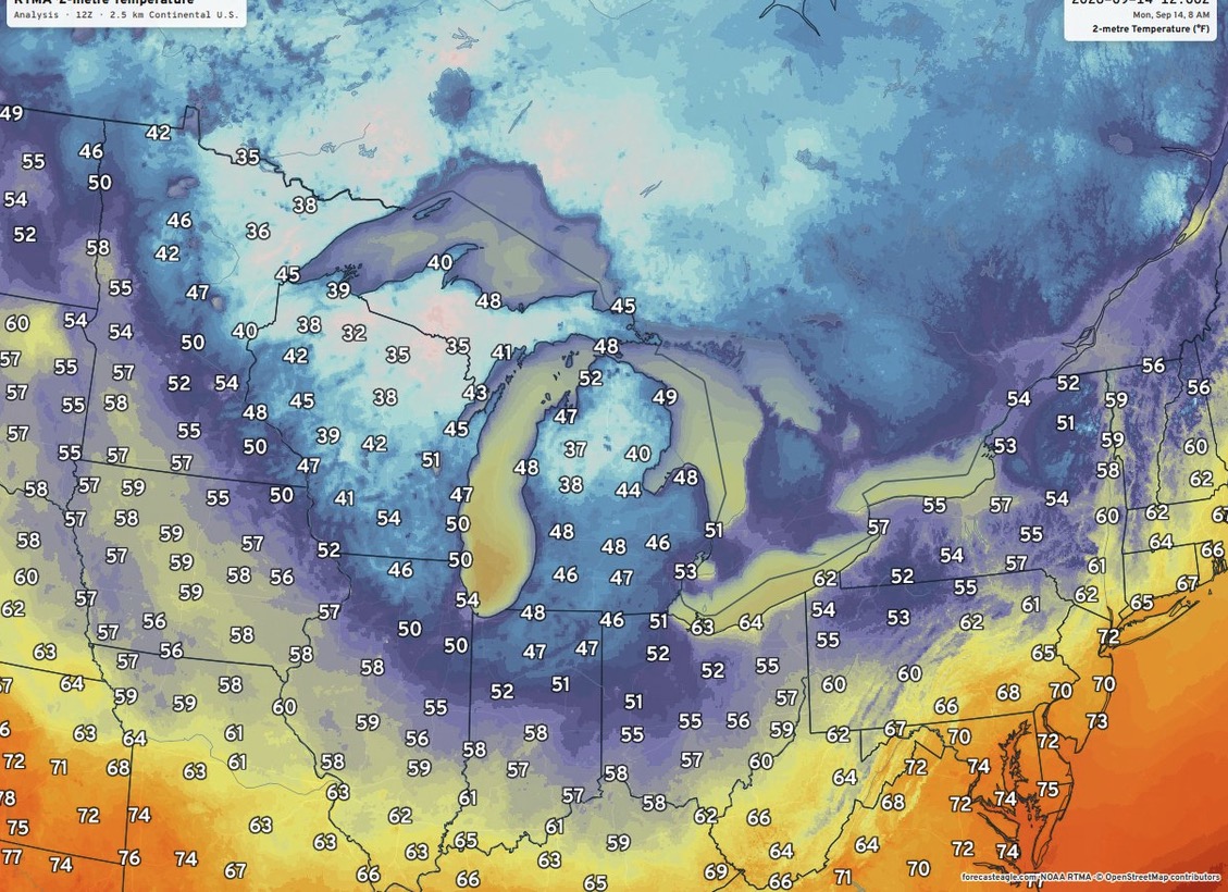
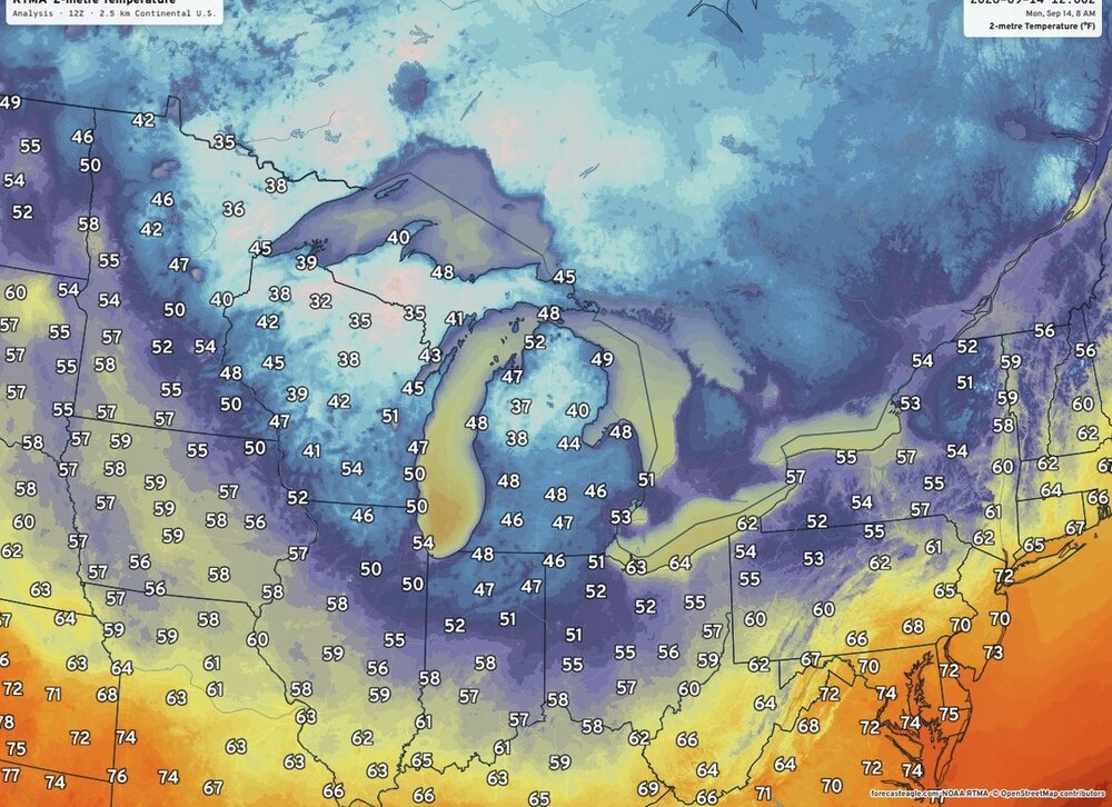
First chilly morning of the coming Fall season over the Great Lakes region.
-
http://indiagenericstore.com/# indian pharmacy online
-

2026-2027 Record-breaking El Nino
A-L-E-K replied to Stormchaserchuck1's topic in Weather Forecasting and Discussion
ready 4 that WAD life -
legit chilly in the apartment this morning after falling asleep with all the windows open, first real season is changing moment
-
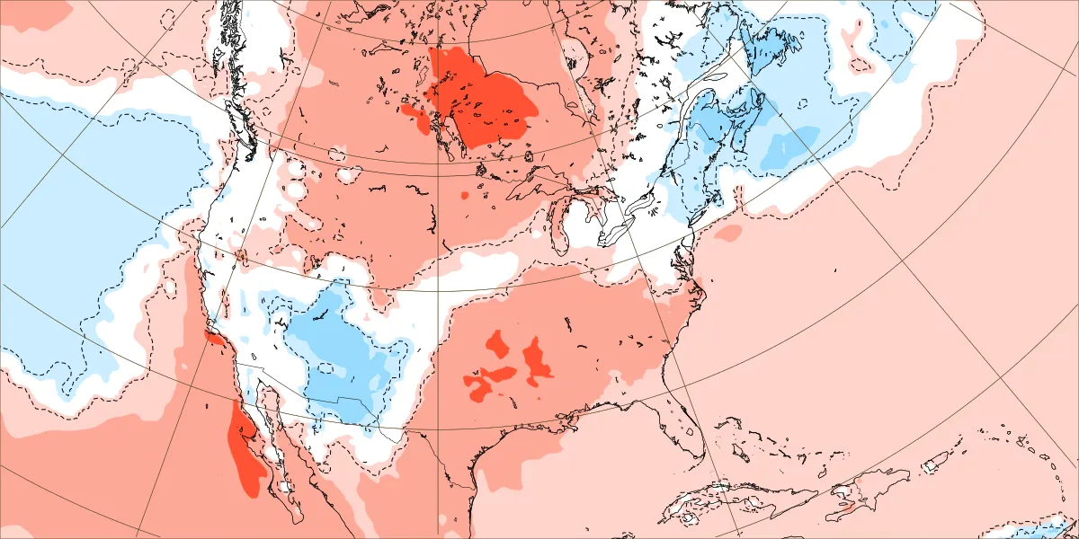
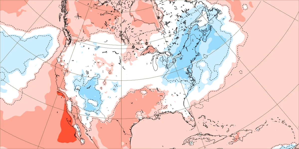
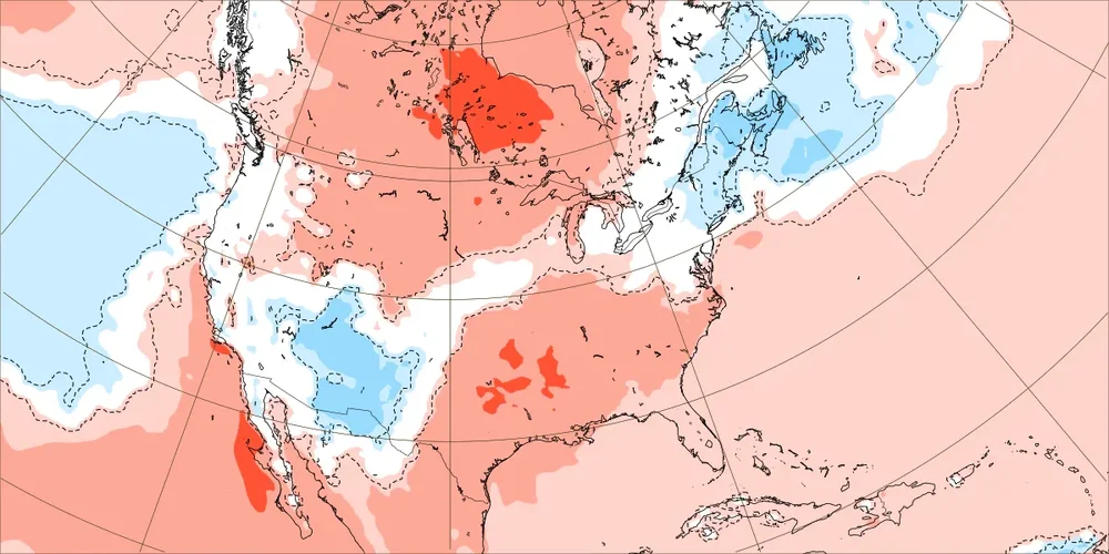
The cool down for late September continues to look less impressive following the record near 600dm ridge this week. EPS new forecast September 21st-28th Old forecast September 21st-28th

-
I swear, next year we're getting 80-degree lows in September, and probably DCA's average low will exceed 70.
-
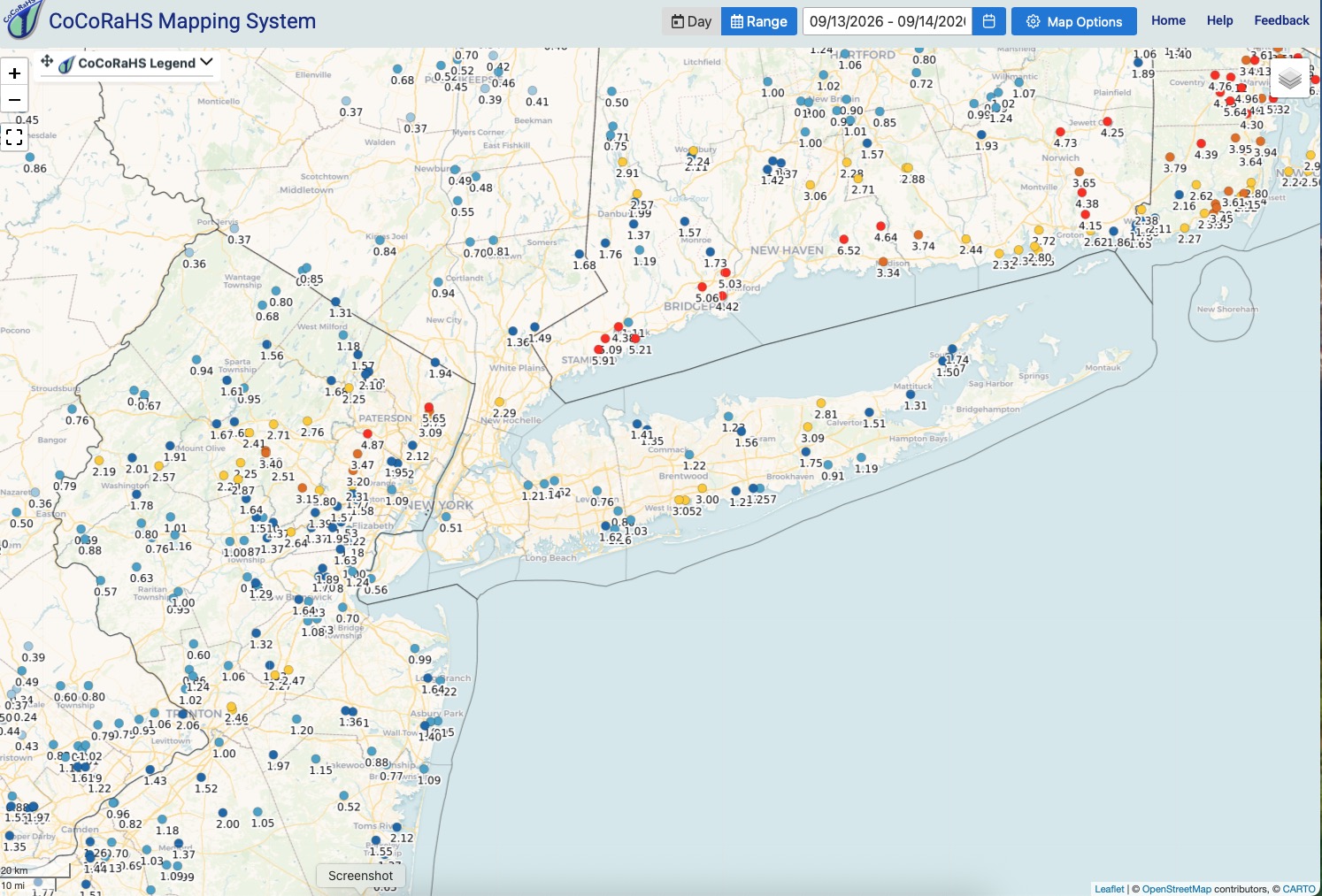
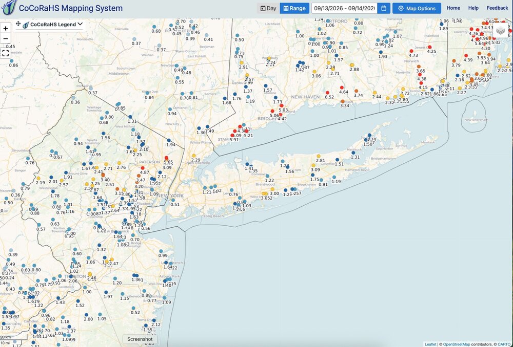
Finished with 1.63" rainfall here. Month: 3.26". Y.T.D.: 44.43", making a run at a 50"+ year. Heaviest rainfall totals from NENJ across Connecticut coast and into R.I. Isolated spots on L.I. got drenched with 3" totals. Nice this morning with a gusty breeze, low dp's and temperatures in the 50's for overnight lows across interior NNJ. Low of 58 here.
-
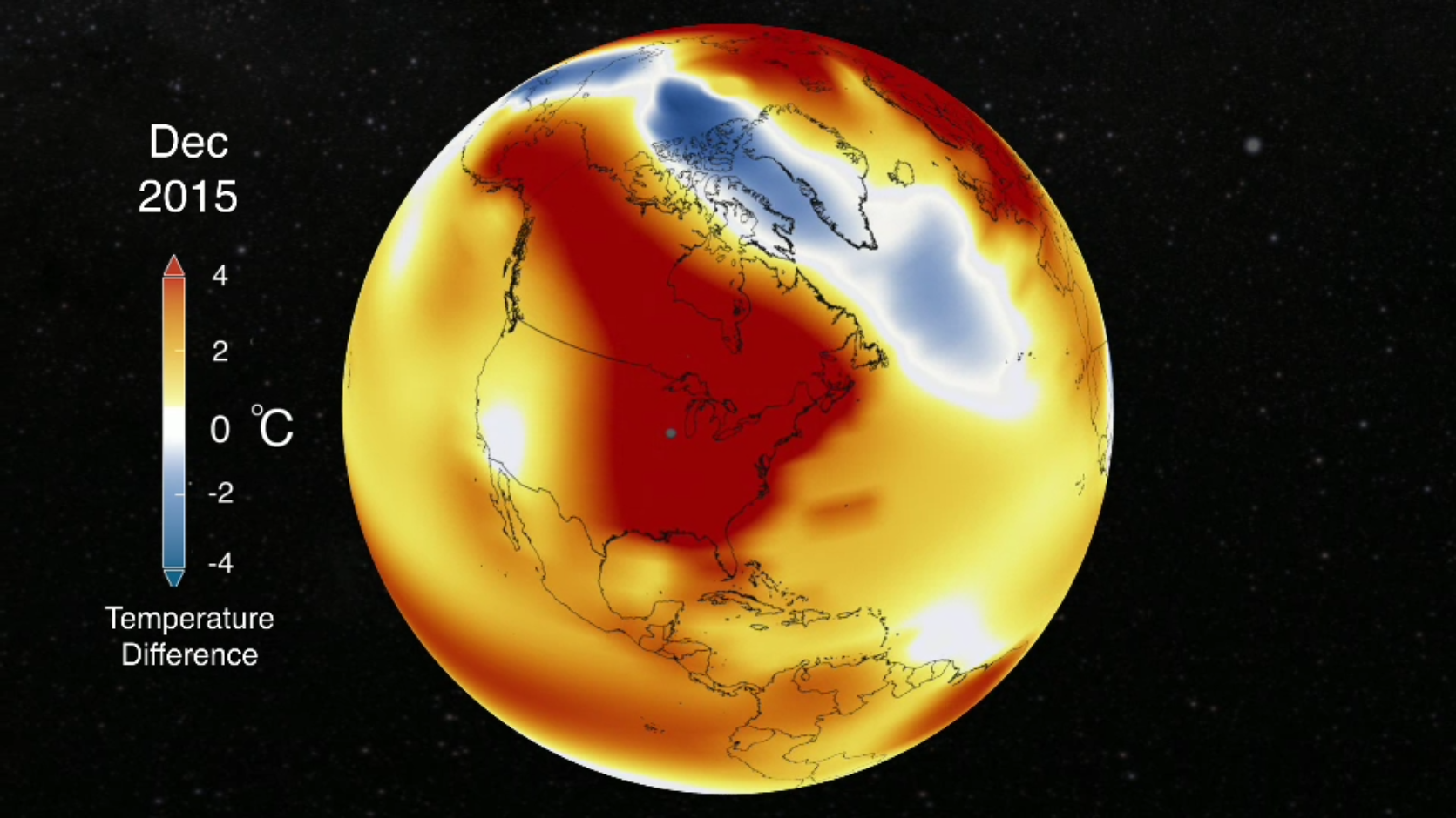
I don't think December will be representative of the balance of the season.
-
There's not much to work with here. I think Feb-March will be a better window perhaps.