All Activity
- Past hour
-
1.12 so far in Purcellville
-
1.70
-
This band coming through Catawba County right now means business. Just went from 3 inches to 4 inches in the past 25 minutes.
-
Yeah. The rain sound is thought i was hearing was wind. Pretty much nothing here yet. .19. Looks like our area will fall short.
-
Pouring here in Thurmont for Colorfest. Not a good day to walk around town.
-
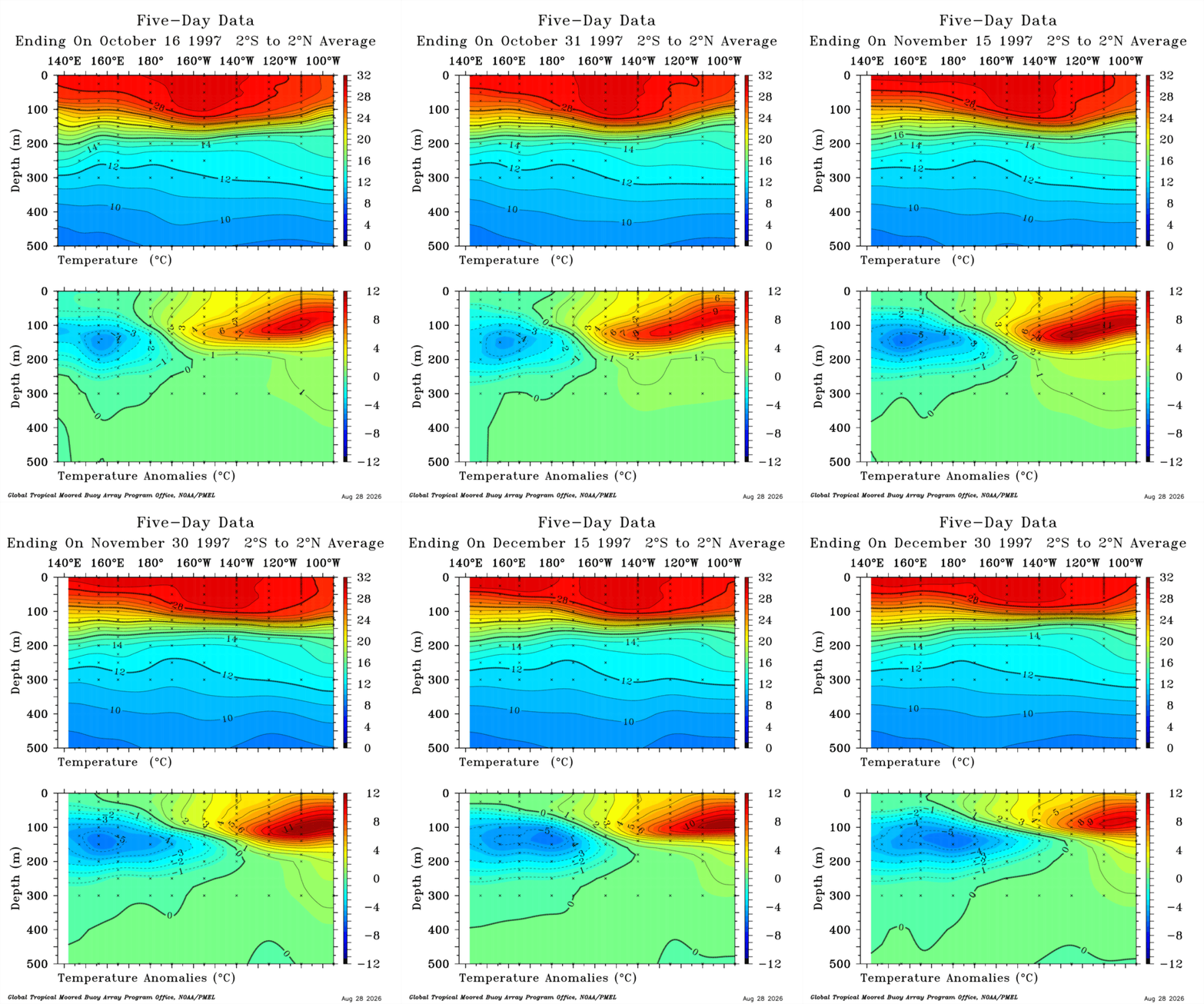
 Again we are roughly about a month and a half earlier than in 1997/98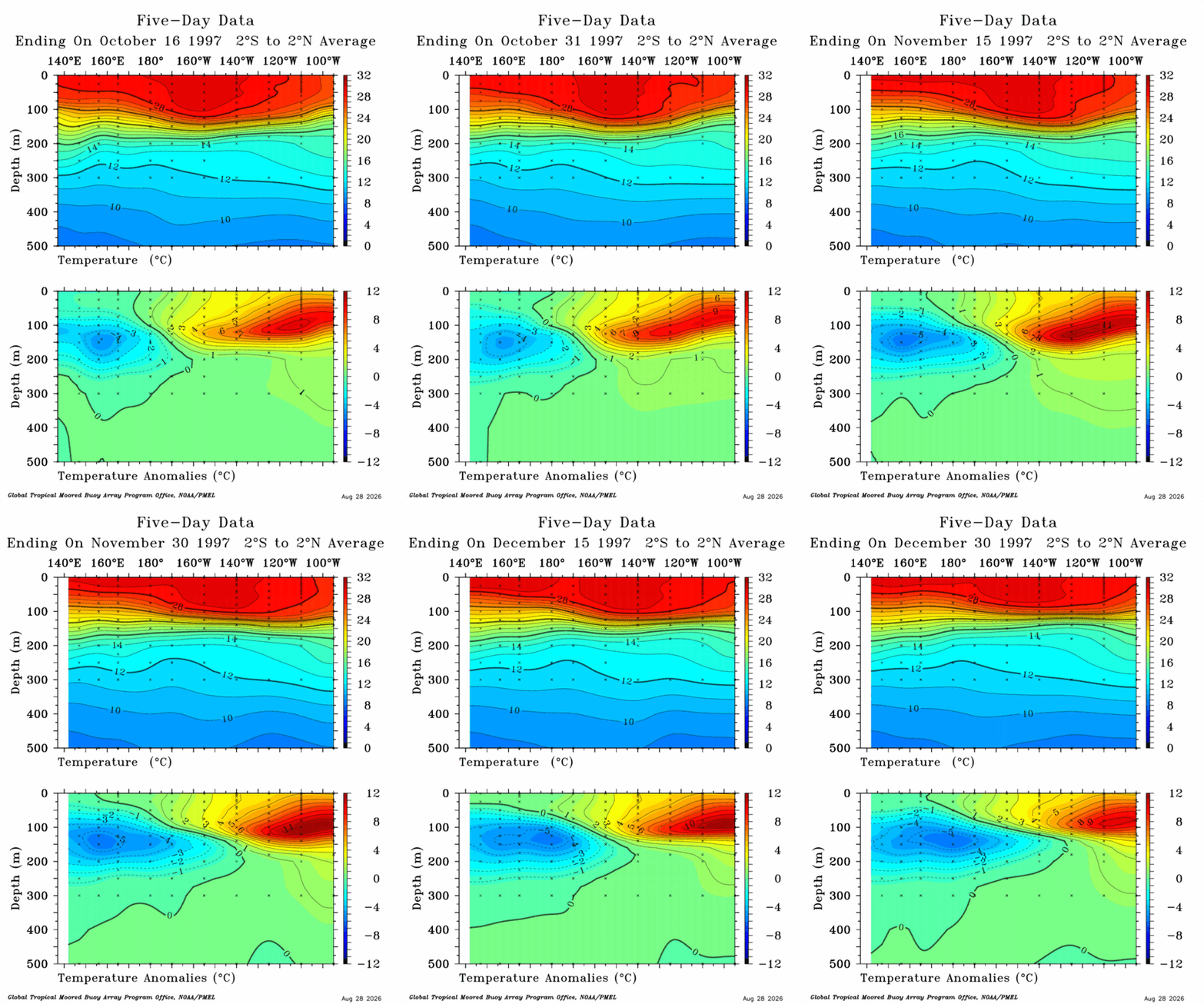
-
 rybelsus classification and rybelsus withdrawal semaglutide otc equivalent https://www.yawcam.com/urlcheck.php?wan=semaoraldirect.com&lan=192.168.1.142&http=80&stream=8081&type=1 amble semaglutide reviewsand http://bbs.51pinzhi.cn/home.php?mod=space&uid=8441160 where can i get semaglutide [url=http://www.osaka-girl.com/cgi/acc5/acc.cgi?redirect=https://semaoraldirect.com]rybelsus copay[/url] when did rybelsus come outand [url=http://la-maison-des-amis.com/user/khqqhhjzdx/]is rybelsus the same as mounjaro[/url] rybelsus and januvia
 -

2026-2027 Record-breaking El Nino
bluewave replied to Stormchaserchuck1's topic in Weather Forecasting and Discussion
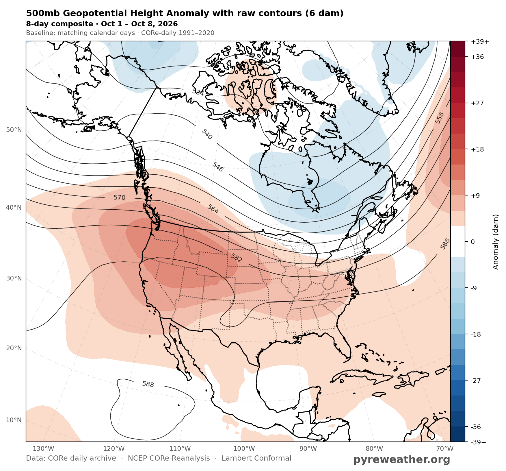
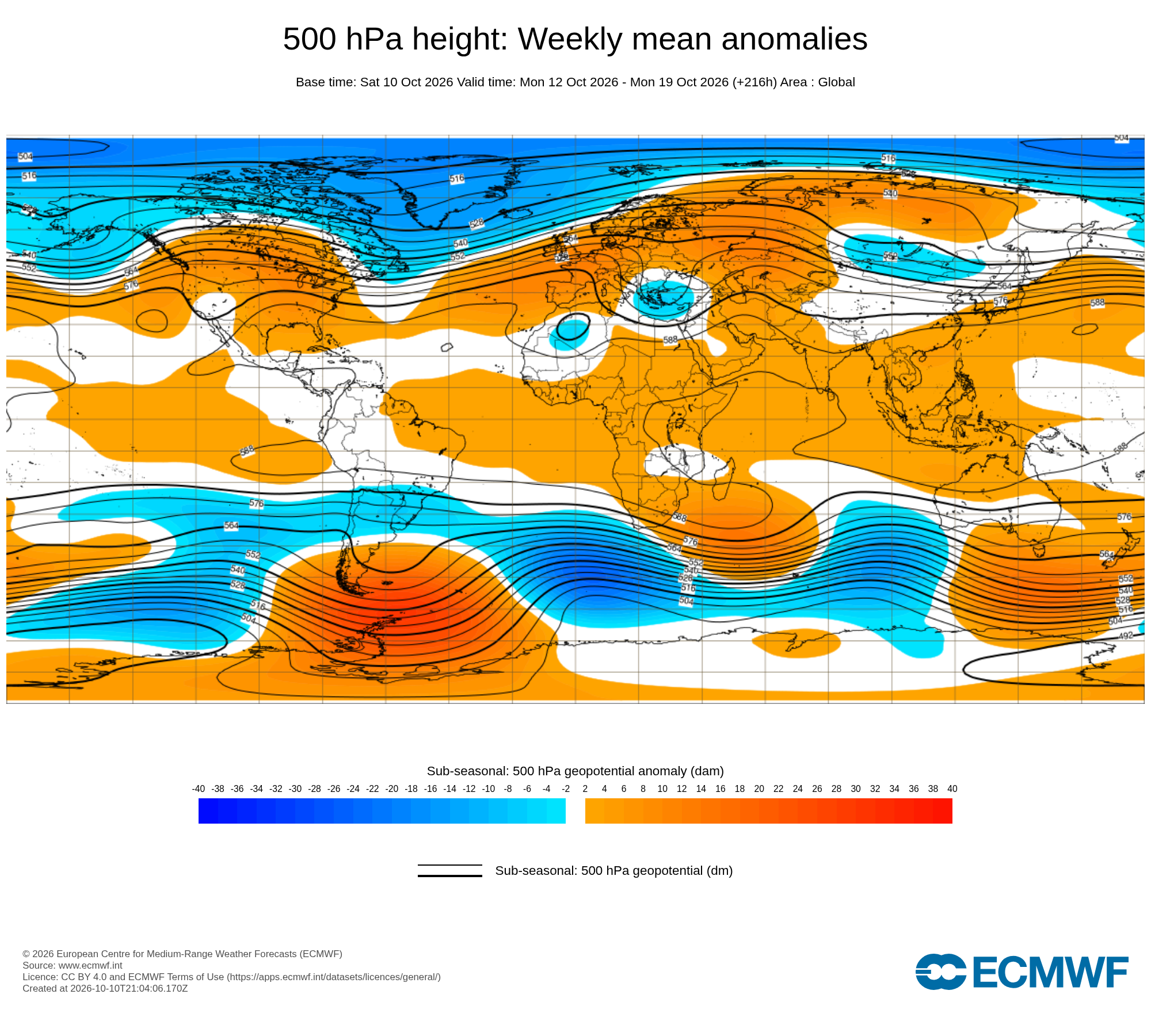
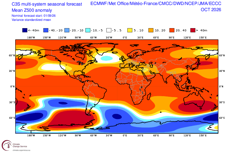
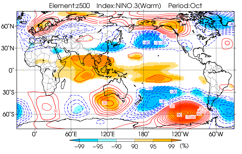
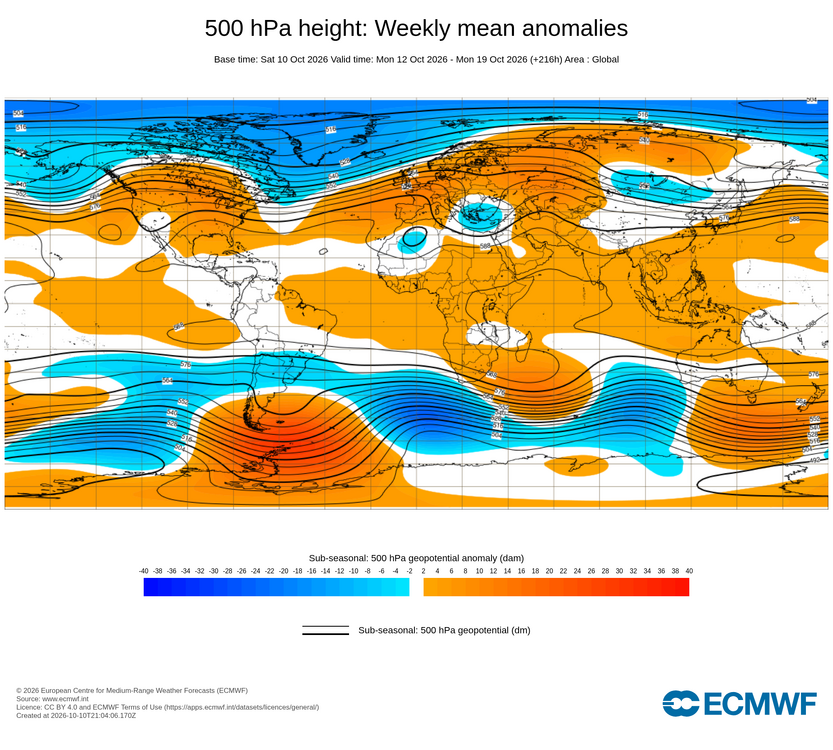
October is continuing the seasonal model error for at least one month out. The seasonal models from early September had the typical -EPO October El Nino ridge near Alaska and NW Canada.This has been the seasonal model forecast error since May. The month to date has the 500mb ridge shifted further south over the CONUS with lower heights near Alaska. The next week will add to this pattern lowering heights more near Alaska and maintaining the CONUS ridge. This will be the furthest south ridge position for an El Nino October. Even when just using the 1972,1982,1997,2015, and 2023 super composite. Month to date Forecast through October 19th October forecast issued in early September October El Niño composite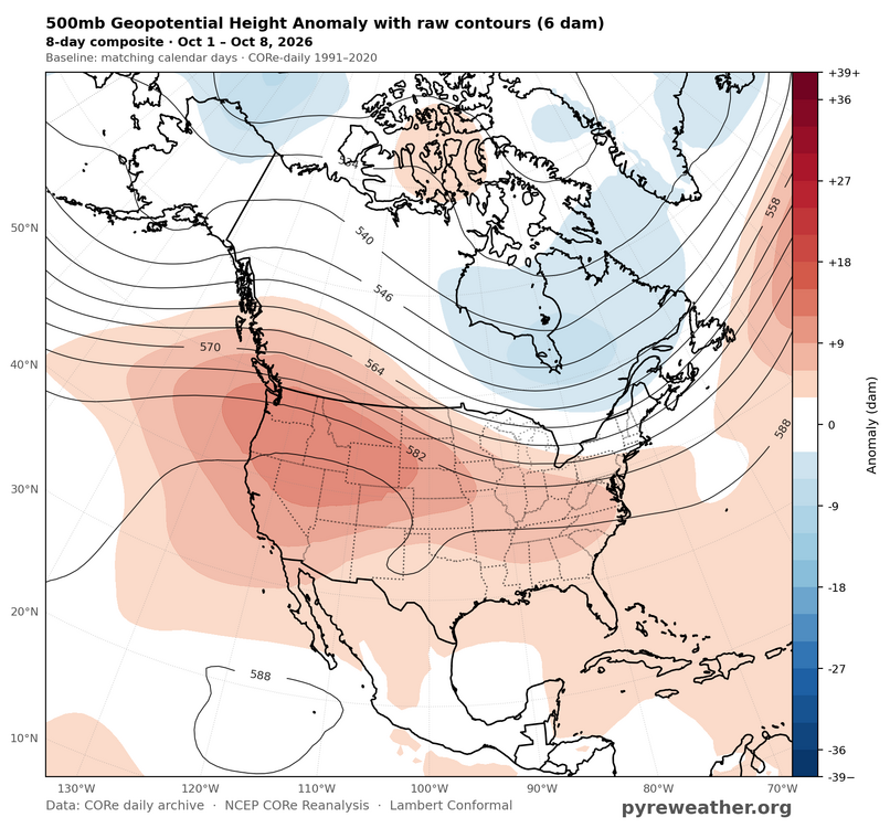
-
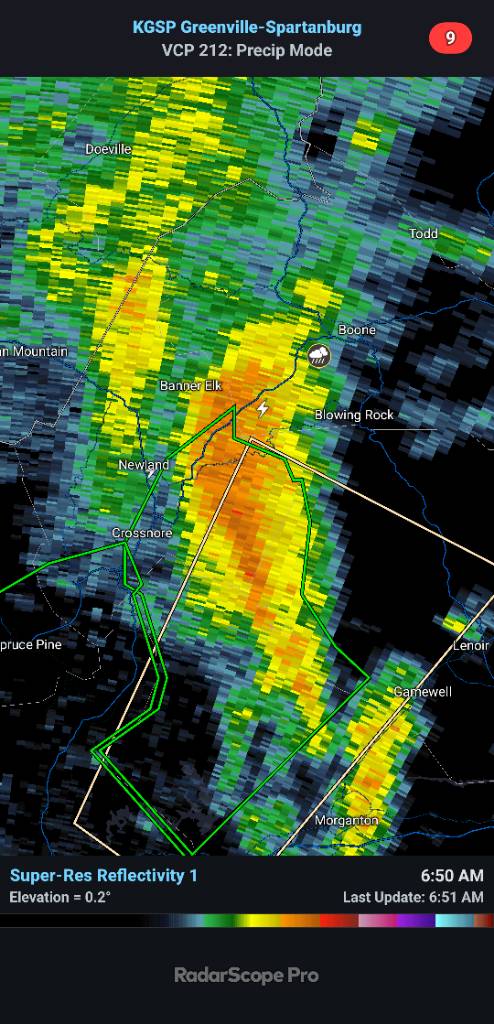
The early morning band that went through McDowell county was intense.
-
http://neuroreliefdirect.com/# gabapentin overdose uptodate
-
I was just checking your station, and I saw that. You got more than twice what I got so far. I'm only at .38" as I type this. Not sure if it's because you got under some heavier rain, it started earlier, or perhaps both.
-
http://neuroreliefdirect.com/# gabapentin overdose uptodate
-
1.54
-
34.9° OVC
-
Yeah rain shield seems much raggedier on the SE side than forecast. 0.35” here so far
-
.83 rain so far today.
-
Just reached 1.00” total so far.
-
the hospitality of the Vermont folks is superior to the northern Connecticut hills, that's why people go to Vermont and Connecticut's hill towns look like ass compared to the majestic mountains of northern Vermont 46/46
-
Holy cow, I was just awoken from a deep sleep by a heavy thunderstorm located within a feeder band of ET Isaias! All of yesterday afternoon when it was so unstable once the sun came out, I had only light rain and no thunder. It came early today instead while still dark starting ~35 minutes ago per radar loop I just saw! Fascinating! The orientation of the thin line has caused the rain to train right over my location since! Edit: I just checked and it’s still 78.1F even after ~0.5”+ of rain fell over the last 55 minutes from this line thus showing how high the wet bulb is!
-
It's been pouring for about an hour without much on radar. Interesting
-
toprol xl generic [url=http://metocardiorx.com/#]MetoCardioRx[/url] lopressor 12.5 mg tablets
- Today
-

2026-2027 Fall/Winter Mountain Thread
Tyler Penland replied to BlueRidgeFolklore's topic in Southeastern States
Another 3" since midnight puts me at 9.03". Still absolutely dumping under this band. Incredible. Lightning now too. Sent from my Pixel 10 Pro using Tapatalk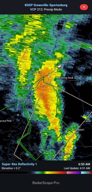
-
6.15” this last line that just came in had wind and the heaviest rain ! .
-
1.29 so far and a healthy rain still going. I'd really love to get to 2"
-
The Mexican shoreline is getting raked by Simon. However, Simon's small core is a frog's hair distance offshore to avoid weakening versus strengthening any further. It's a delicate balance that's preventing Category 5 intensity but not yet detrimental enough to induce weakening. Still, the abrupt change in elevation near the coast and such influence on inflow will still disrupt Simon and should begin to weaken it if the core parallels the coast any closer. Granted, that means very little with respect to flash flooding that is underway with moist low-level southerly fetch within the eastern circulation feeder bands and orgographic lift.