All Activity
- Past hour
-
.thumb.png.4150b06c63a21f61052e47a612bf1818.png)
Clipper Fires In Wednesday Feb 25 Disco/ Obs
HIPPYVALLEY replied to Damage In Tolland's topic in New England
+SN 15°. 1” It won’t last long, but fun after getting skunked on Monday. -
Yeah man, some good rates actually
-

Clipper Fires In Wednesday Feb 25 Disco/ Obs
Go Kart Mozart replied to Damage In Tolland's topic in New England
Cortina Olympics look to this. Absolute Poundtown. -

"Don’t do it" 2026 Blizzard obs, updates and pictures.
dendrite replied to Ginx snewx's topic in New England
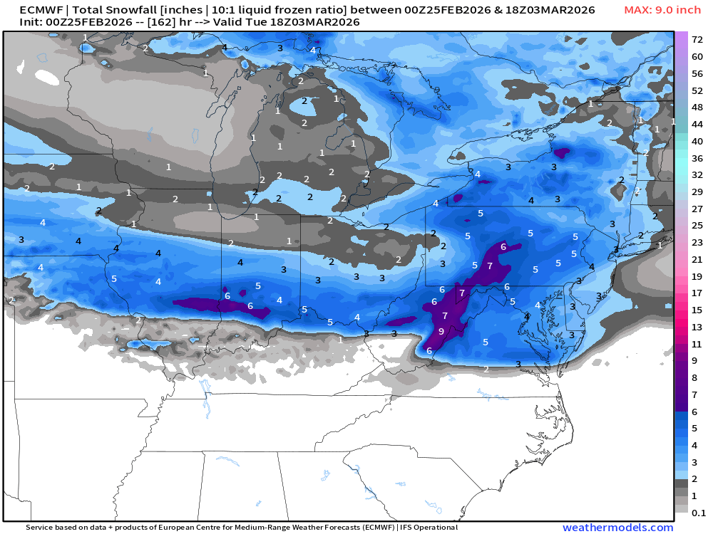
The thing is PVD measures snow pack water equivalent daily at 18z. In the METAR look for the 933rrr remark code which is reported in tenths of inches. The problem is they presumably lost 1.4” of liquid in the pack from 18z Mon (during +SN) to 18z yesterday. 22nd 1.5” 23rd 4.1” (+2.6”) 24th 2.7” (-1.4”) If you’re going to roll with 38” then at least 2.6” w.e. plus whatever the ASOS recorded after that makes a good estimate. KPVD 221751Z 08009KT 10SM OVC025 01/M04 A3011 RMK AO2 SLP195 4/005 933015 T00061039 10011 21011 56019 $ KPVD 231751Z COR 36028G40KT 1/4SM +SN BLSN FZFG VV007 M04/M05 A2928 RMK AO2 PK WND 36040/1751 SLP914 SNINCR 4/37 P0003 60017 4/037 933041 T10391050 11006 21039 53003 RVRNO $ KPVD 241751Z 33010G18KT 10SM FEW020 FEW250 M01/M12 A2977 RMK AO2 SLP081 4/032 933027 T10111117 11011 21050 58005 -
Nice try. Show us the 6z
-
-
Yeah but only for a few days.
-

Clipper Fires In Wednesday Feb 25 Disco/ Obs
mahk_webstah replied to Damage In Tolland's topic in New England
Nice steady moderate snow. Perfect snow growth. 2 inches will be a win if we can get it. -

Clipper Fires In Wednesday Feb 25 Disco/ Obs
The 4 Seasons replied to Damage In Tolland's topic in New England
Just broke 50".gif.d8a5fd33cb7879ada36fb2c2787bffec.gif)
-

"Don’t do it" 2026 Blizzard obs, updates and pictures.
40/70 Benchmark replied to Ginx snewx's topic in New England
Too bad...it was so immensely gut-wrenching for me to have history clutched from my grasp at the 11th hour that I just had to disassociate and go to sleep. I would have been physically ill had I remained awake to bare witness to that....it's like the weather god's afforded me the mercy of anesthesia as they disemboweled me. Just absolutely brutal because it would have been like nothing I have ever experienced with widespread 3' amounts. Two in a row now...on the heels of January 2022...I mused about the comparison in the lead up and that's exactly what happened. One consolation is the mayor of Methuen actually DMed to express his appreciation for my posts on social media alerting them as to the magnitude of the impending storm prior to any OCMs. ..just too bad I kind of threw up on myself concerning amounts up this way- -

Clipper Fires In Wednesday Feb 25 Disco/ Obs
Ginx snewx replied to Damage In Tolland's topic in New England
It's gonna snow where it wants to snow. Snow on snow. Radar looks good 2 to 3 -
Clipper Fires In Wednesday Feb 25 Disco/ Obs
The 4 Seasons replied to Damage In Tolland's topic in New England
Bad timing for schools -
Not enough amplification for that one. Early March is a good window though as long as the arctic dome doesn't overpower the shortwave. Looks like a SWFE type of system on a smaller scale that we had in Jan per the GFS, other models aren't as enthused though.
-
Clipper Fires In Wednesday Feb 25 Disco/ Obs
Go Kart Mozart replied to Damage In Tolland's topic in New England
Some winters it just wants to snow. -
Clipper Fires In Wednesday Feb 25 Disco/ Obs
Johnno replied to Damage In Tolland's topic in New England
Rip page almost 1” new, harder snow right now then any of the daytime Monday lol -
-

Outta gas and Outta Time: Early March Winter Storm finale
TSSN+ replied to Ji's topic in Mid Atlantic
-
Temp dropped from 36 to 31 with the snow at my station
-

Clipper Fires In Wednesday Feb 25 Disco/ Obs
weatherwiz replied to Damage In Tolland's topic in New England
Nice steady snow here! -

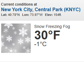
February 2026 OBS & Discussion
donsutherland1 replied to Stormlover74's topic in New York City Metro
Moderate to heavy snow in Larchmont.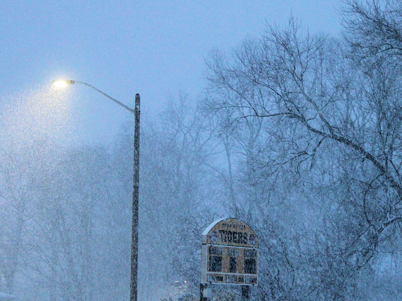
-

Clipper Fires In Wednesday Feb 25 Disco/ Obs
Hoth replied to Damage In Tolland's topic in New England
Geez, where did this come from? I was thinking flurries lol. -
As @DDweatherman would put this one … shits dead
-

Clipper Fires In Wednesday Feb 25 Disco/ Obs
Damage In Tolland replied to Damage In Tolland's topic in New England
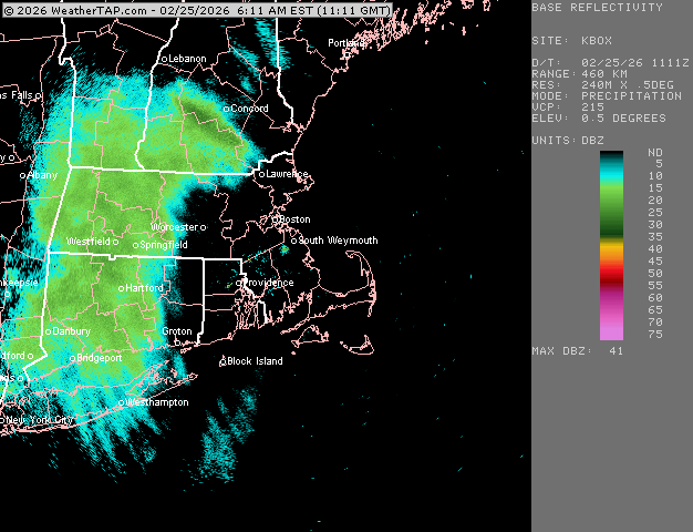
Nice moisture boost with SW winds. This has happened several times this winter in clippers -
Clipper Fires In Wednesday Feb 25 Disco/ Obs
The 4 Seasons replied to Damage In Tolland's topic in New England
-
Clipper Fires In Wednesday Feb 25 Disco/ Obs
The 4 Seasons replied to Damage In Tolland's topic in New England
Yeah, its very heavy didnt expect inch+ per hour rates out of this thing


