All Activity
- Past hour
-
2.75” across Fri/Sat.
-
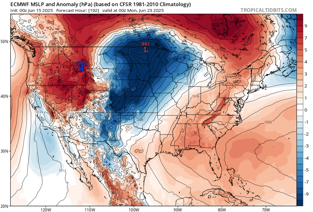
Yeah, the 500mb heights and 850mb temperature forecasts would suggest our first 100° of the season would be possible for the usual warm spots. But a wrinkle may be whether the ridge elongates too much into Canada. Notice how the models have a high over Canada and Bermuda. So there could be a subtle backdoor front nearby. If the Bermuda High wins out than the first 100° for places like Newark could be possible. But it the high to the north is too strong, then more onshore flow in later runs east of NYC and perhaps the 100° potential over interior NJ. We probably won’t know for sure until the period gets under 120 hrs out. But we should at least see mid 90s as a floor. And be could get closer to 100° if the ridge is flatter with more westerly flow.
-
Happy Fathers Day to all the Dads! Woke up this morning to pouring down rain. 1.36” of rain yesterday and so far today .11” of rain.
-
Would 1980 be a good analog for what's about to happen? A rainy and cool first three weeks of June (record cool lows on Tony's daily records posts have been from 1980 lately) and an abrupt shift to hot and steamy from June 20th to September 20th. Although the epicenter of the big heat was St Louis that year, NYC had their hottest ever 62 day couplet (July-August) with both months averaging 80 or higher and August 1980 was our hottest August on record!
-
Finally! It's about time! Would 1980 be a good analog for what's about to happen? A rainy and cool first three weeks of June (record cool lows on Tony's daily records posts have been from 1980 lately) and an abrupt shift to hot and steamy from June 20th to September 20th. Although the epicenter of the big heat was St Louis that year, NYC had their hottest ever 62 day couplet (July-August) with both months averaging 80 or higher and August 1980 was our hottest August on record!
-
Low of 59F. 0.30” of rain last night and overnight. .
-
The strong subtropical warming actually contradicts our current understanding of how the ocean temperatures have changed in the past. The strongest SST warming was expected in the subarctic oceans. But instead the western subtropical basins have seen the greatest warming. But isn’t anything new as the lack of warming in the EPAC has baffled scientists for a while now. https://www.nature.com/articles/s43247-023-00839-w Strongest ocean warming expected in subpolar ocean The observed warming pattern (Fig. 1a) contradicts our understanding of how ocean temperature has changed in the geologic past. SST reconstructions covering the mid-Pliocene, the most recent time when atmospheric GHG concentrations were similar to today41, highlight the strongest large-scale ocean warming over the subpolar oceans (Fig. 1c). Comparably, warmings in subtropical regions are less pronounced, except for the subtropical extension of western boundary currents, where a poleward shift of western boundary currents contributes to a local maximum temperature increase8,9.
-
Midnight thunderstorm dumped over 1.5" of rain here. 2.05" for the weekend. 3.65" for June so far.
-
We have been in a very rainy, cool pattern since the last week of March. That looks to come to a real abrupt end next week as the pattern does a 180
-
Look up KOXB TAF, it gives you cloud heights for the ocean city airport. It was canceled after basically two flights. Today doesn’t look good at all. Need at least 3000 foot ceiling and it’s calling for 1000 all day. I am on 17th street holiday inn and suits ocean front. Have me wife and two boys as well.
-

Central PA Summer 2025
Mount Joy Snowman replied to Voyager's topic in Upstate New York/Pennsylvania
Low of 59 with .3” of rain. Heading out for a little father’s day golf outing here in a bit and it looks like we may actually stay mostly dry. -
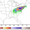
Day 5 outlooked from SPC
-
Tonight looks fairly cool, but yeah…it’s comin. Maybe a mild down toward next weekend…then the ridge tries to really build back in. There is a bit of a BD threat to start the following week…may have to watch that over the next few days.
-
It will not be a dry heat. Euro has dews in the 70s. This is steambath weather.
-
Looks like the last of the cool sleeping nights. Oh well , I guess I'll have to install later this week. Summer had to come at some point.
-
hopefully it's dry heat... how long is this supposed to last? if it's like July 2010, we had dew points in the 40s (45-48) when it was over 100.
-
isn't that when the AMO changed from - to +? our tropics were very quiet before 1995
-
Too much heat will also ruin weekend plans. Can't do much when it's that hot but think core of heat will fall early next week (Mon-Wed).
-
looks like another gloomy day on tap.
-
Yes we are, all major models in agreement for 100 degree heat next week
- Today
-
I cant wait for my 100 degree heat starting next week, enough of this rainy cold nonsense.
-
Yes and here too, no more of this sea breeze nonsense.
-
I’m still cheering on the cicadas
-
Good, let it burn.....
-
the only water I want to see for the next three months is the water coming out of my hose and the water I drink and wash with.