
All Activity
- Past hour
-
Weekend looks like ass too.
-
In a lot of months PDO has higher correlation than ENSO actually. In some months it actually has a higher correlation than PNA! Common sense says that PDO is more secondary, but a 7-year stretch where PHL had 10.7" of snow beating their previous 7-year low over 13.5" during the most -pdo time in history.. interesting coincidence? We were tracking the PDO before that. Last 2 winters we had good cold but I think cold Arctic Summers were a reason for that (which we have again this year).
-

Augdewst 2026: Summer's Last Stand
NoCORH4L replied to Prismshine Productions's topic in New England
Yeah weekend shaping up to look junky unfortunately -

Augdewst 2026: Summer's Last Stand
vortex95 replied to Prismshine Productions's topic in New England
Where has you been? Long-known GFS gets TC spin-up happy after a week. Has been that way for over 10 years. If I had a dime for every time the GFS LR hit New England w/ a hurricane in the last 20 years? -
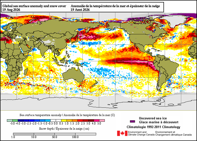
 Even more impressive is +10c spanning almost 2,500 miles. And steady over long periods of time. It would take quite a bit of energy to produce that unnaturally.
 -
Augdewst 2026: Summer's Last Stand
vortex95 replied to Prismshine Productions's topic in New England
The 18z HRRR up'ed the ante big time. The two versions of the RRFS are have the same idea w/ one max swrn CT (what else is new) and another near former stomping ground of @CoastalWx (GHG). NAM/HRRR/RRFS show a weak sfc/925 low developing near the S coast and takes its time moving E, so we get comma head backlash in ern MA. There is a stronger upstream 500 trof moving into the Great Lakes by early Sat, and that would tend to move things along. However, the system impacting SNE has little in the way of reflection at 500. It's all low-level, so standard trof "kicker" rules may not apply here. Weymouth 6" special like last year???? -
Finally looks like some cooler weather arrives at least for a few days
-
 http://tadahealthrx.com/# Cialis over the counter
 -

Summer 2026 Med/Long Range Discussion
SchaumburgStormer replied to Brian D's topic in Lakes/Ohio Valley
Feel free to bump troll me when I am bitching in January, but hoping this super nino at least keeps us in a wet pattern. Will deal with warm shots and rain over CAD. -
Aww Crap
-

Augdewst 2026: Summer's Last Stand
Damage In Tolland replied to Prismshine Productions's topic in New England
Nam and Euro look nothing like that . Just very light stuff -
Super.
-
Great shots! You should pop back up during winter!
-
NAMS a bit further north now...
-
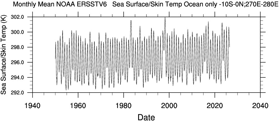
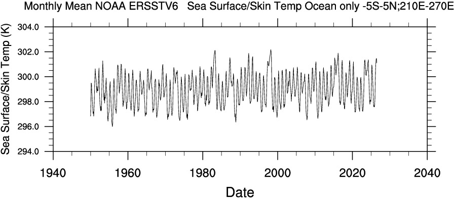
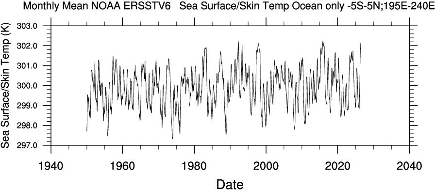
Will be interesting to see the NOAA data for Aug. She's a healthy one right now.
- Today
-
very el nino-like, so not all that surprising. especially so considering the magnitude of the nino.
-
FFA from KPHI Wouldn't be surprised but not saying it will be expanded into NYC and NE NJ - both flooding and marginal severe
-
atl cane season seems heading for all-time snoozer status, meanwhile the east pac wants to shit out storms like crazy and it looks like HI gonna have a season for the ages
-

2026-2027 Record-breaking El Nino
FPizz replied to Stormchaserchuck1's topic in Weather Forecasting and Discussion
Curry also added: "The stadiumwave has been successfully achieved in a packed stadium or other large seated venues, when successive groups of spectators briefly stand and raise their arms. Immediately upon stretching to full height, the spectator returns to the usual seated position." -
we didn't even try
-
SPC has day 1 marginal and slight risk out not really any changes for 2% tornado and 5% hail but wind is 5-15% and also has been extended southward down to the gulf coast states also marginal risk has been extended past i65 maybe Cumberland plateau for 5-15% wind https://www.spc.noaa.gov/products/outlook/day1otlk.html .
-
If this happens in the winter, lord help this board.
-
If i had to bet my life savings, I'm going to say Stephens City, VA.
-
I wonder where the misses will be.
-
After the last 2 days with feels like temps in the middle 120's it actually feels decent today while at 92 with feels like of only 110.
















