All Activity
- Past hour
-

Possible Light Snowfall (1" - 4") on Tuesday Dec 23
eduggs replied to Northof78's topic in New York City Metro
The RRFS actually has additional snow showers for the area (esp N) Tue night. Doubtful since there's not much support and the RRFS isn't reliable at the end of its run. But if the tight thermal boundary stays close to our area and we remain on the cold side, there will be chances for snow. Different models at different times have shown snow chances every day from Tue through Fri. It depends on the track of the very minor shortwaves in the longwave flow and how they interact with the thermal boundary. At some point next week I suspect we'll switch to warmth... but it's not certain yet. -
Same with sunday river, in fact more trails open today then Thursday Sent from my SM-S921U using Tapatalk
-

White Christmas Miracle? December 23-24th
DavisStraight replied to Baroclinic Zone's topic in New England
Maybe a Norlin surprise for some on the coast. -

Possible Light Snowfall (1" - 4") on Tuesday Dec 23
MJO812 replied to Northof78's topic in New York City Metro
.thumb.png.22324d37025248b599b072cc9cfcf0e4.png)
-
Dude. We HEARD YOU. Please seriously consider going for a walk or something. It doesnt need to be repeated numerous times a day.
-

December 2025 Short/Medium Range Forecast Thread
jaxjagman replied to John1122's topic in Tennessee Valley
More like a NINO the AR out west -
Possible Light Snowfall (1" - 4") on Tuesday Dec 23
eduggs replied to Northof78's topic in New York City Metro
RRFS is even further south than 12z. Precip is not quite as robust as 12z but it's basically all snow for our area except maybe ELI. Quick burst then the forcing quickly fizzles. Not much snow for SNE. Good sign to see the south shift but we don't want to lose the signal for heavier banding. -
That will save on my wood pile!!!!!!
-
Possible Light Snowfall (1" - 4") on Tuesday Dec 23
MJO812 replied to Northof78's topic in New York City Metro
Nam was colder and further south -
Possible Light Snowfall (1" - 4") on Tuesday Dec 23
MJO812 replied to Northof78's topic in New York City Metro
Maybe -
Possible Light Snowfall (1" - 4") on Tuesday Dec 23
MJO812 replied to Northof78's topic in New York City Metro
Stop posting -

Possible Light Snowfall (1" - 4") on Tuesday Dec 23
the_other_guy replied to Northof78's topic in New York City Metro
To play devils advocate, LGA has the same low measurement. They both seem low, but support each other -
Latest Euro weeklies really cut back on the below normal cold air for January. Hopefully just a blip...
-
December 2025 Short/Medium Range Forecast Thread
jaxjagman replied to John1122's topic in Tennessee Valley
Me too,i talked about the EAMT last night but if its a strong one you should in general show strong HP into Siberia/Mongolia,weak one its still warm in the SE,dont see that right now.Its flipped in a NIno compared to a Nina,weak EAMT is BN temps in the SE,looking at todays run of the EPS,but it still slightly better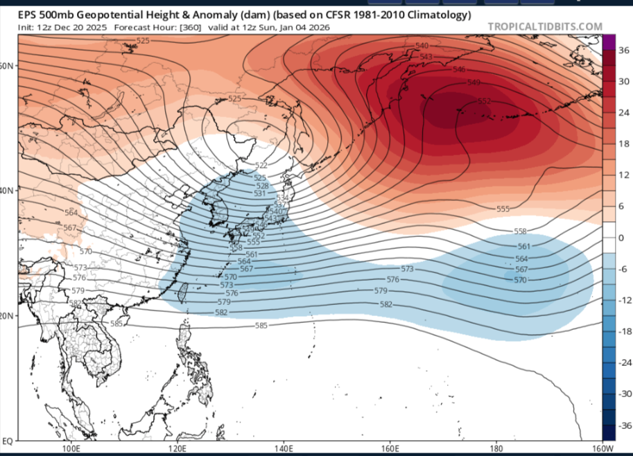
-
Lol
-
Today’s Euro Weeklies weeks all trended warmer than yesterday and AN for most of the US. No trending toward a +PNA mid-Jan like yesterday. Yesterday’s had NN in SE 1/12-2/1. One of the worst runs this season and hopefully coming days will reverse.
-

December 2025 Short/Medium Range Forecast Thread
GaWx replied to John1122's topic in Tennessee Valley
Today’s Euro Weeklies weeks all trended warmer than yesterday and AN for most of the US. No trending toward a +PNA mid-Jan like yesterday. Yesterday’s had NN in SE 1/12-2/1. One of the worst runs this season and hopefully coming days will reverse. -

December 2025 regional war/obs/disco thread
wxmanmitch replied to Torch Tiger's topic in New England
Wound up with 8.5" from this. -
I’ll be honest, maybe it’s just the pessimistic side of me, but I have 0 confidence in much snow at all this winter. After so many bad winters, I find it plausible that we can have almost a total shutout. I see a strengthening PV coming up after new years, and a -NAO block but no help on pacific side. Long range looks like hot garbage to me, at a time where we are prime for our most snow. Looks terrible
-
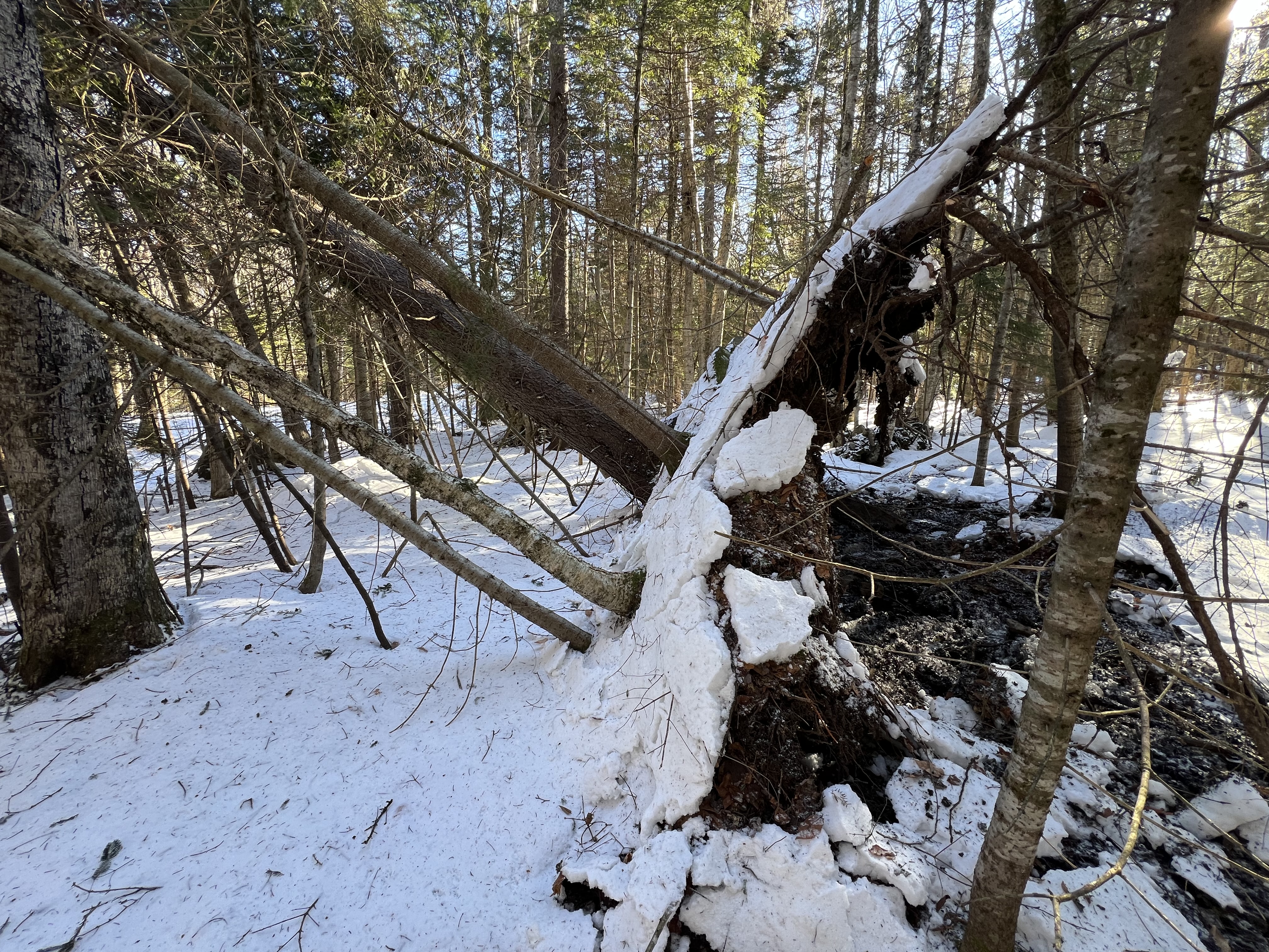
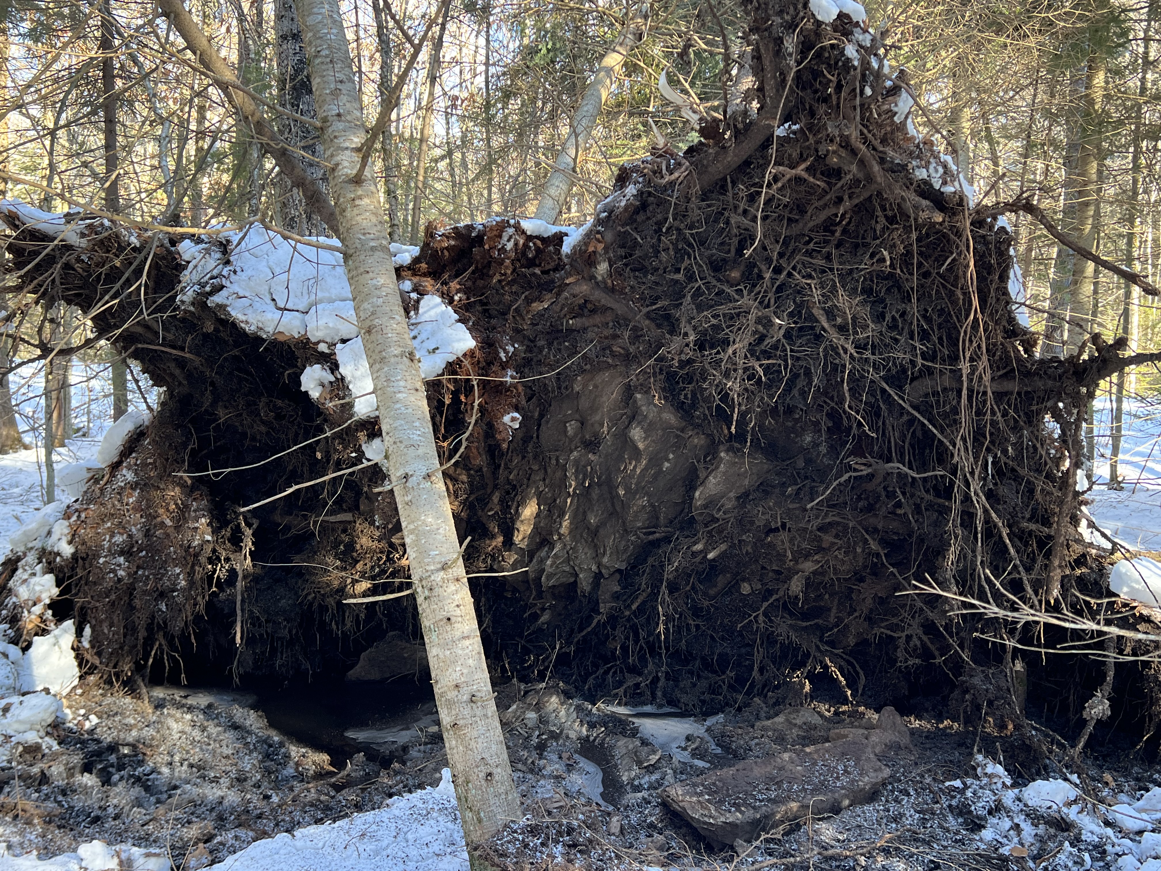
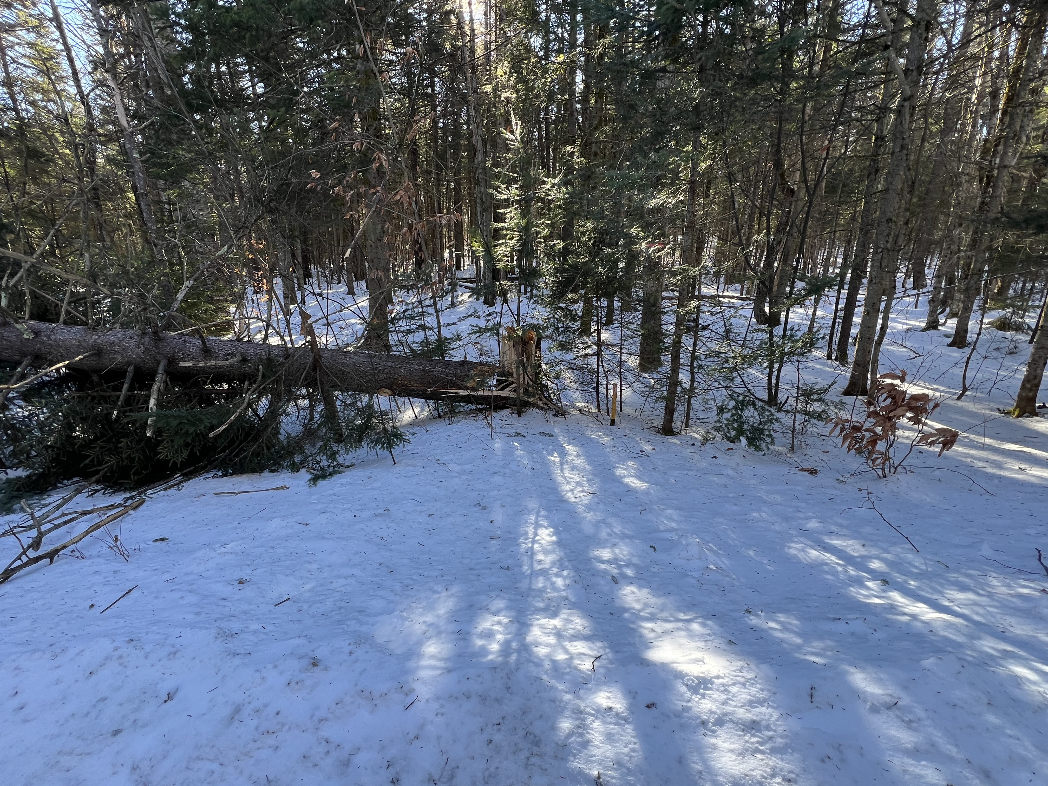
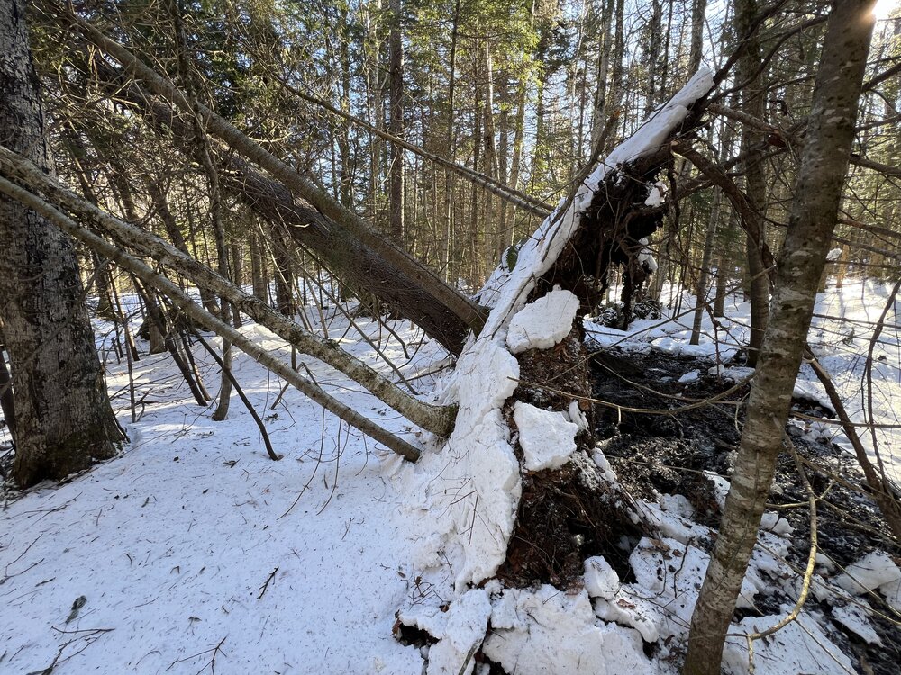
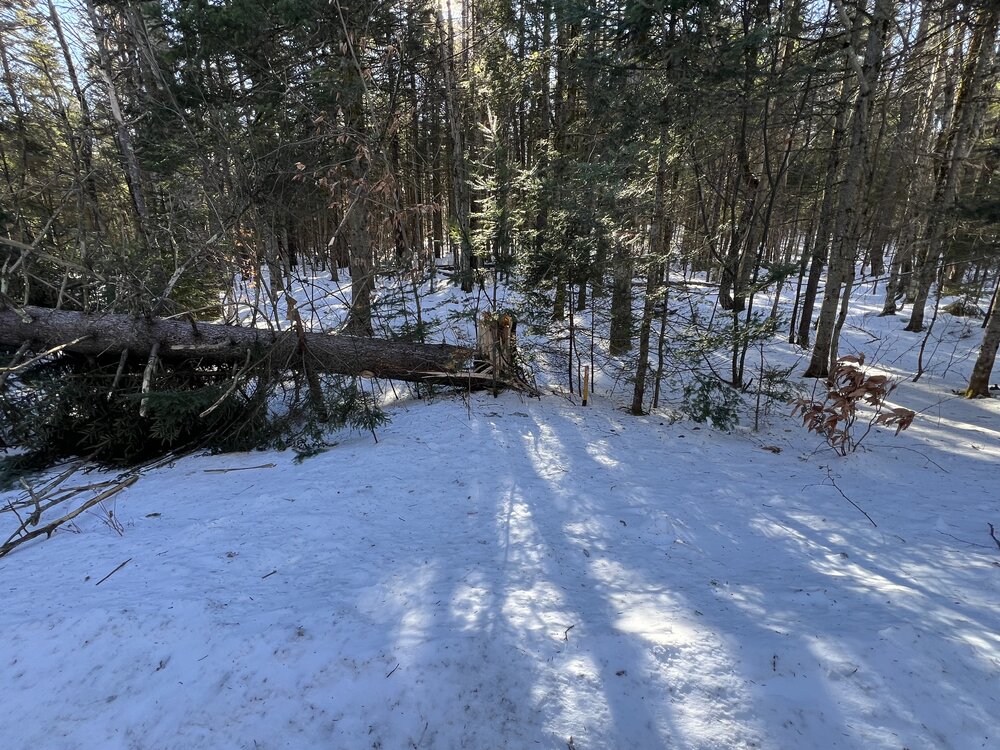
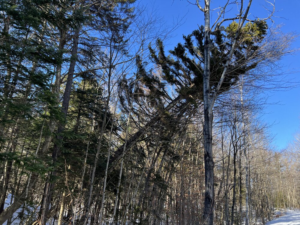
December 2025 regional war/obs/disco thread
wxmanmitch replied to Torch Tiger's topic in New England
Heavy, heavy damage around my property from last night's windstorm. The S to SE winds weren't anything to write home about here, but the W winds last night all hell broke loose! Gusts were easily in the 50-60 MPH range brought down these two large red spruces and several smaller snags (not photoed), one snapped right off and is resting on some live utility lines while another uprooted and is leaning on some smaller trees. There's still about 2-5" of styrofoam snow that survived the cutter. I had 12-14" beforehand. Season total at 33.3".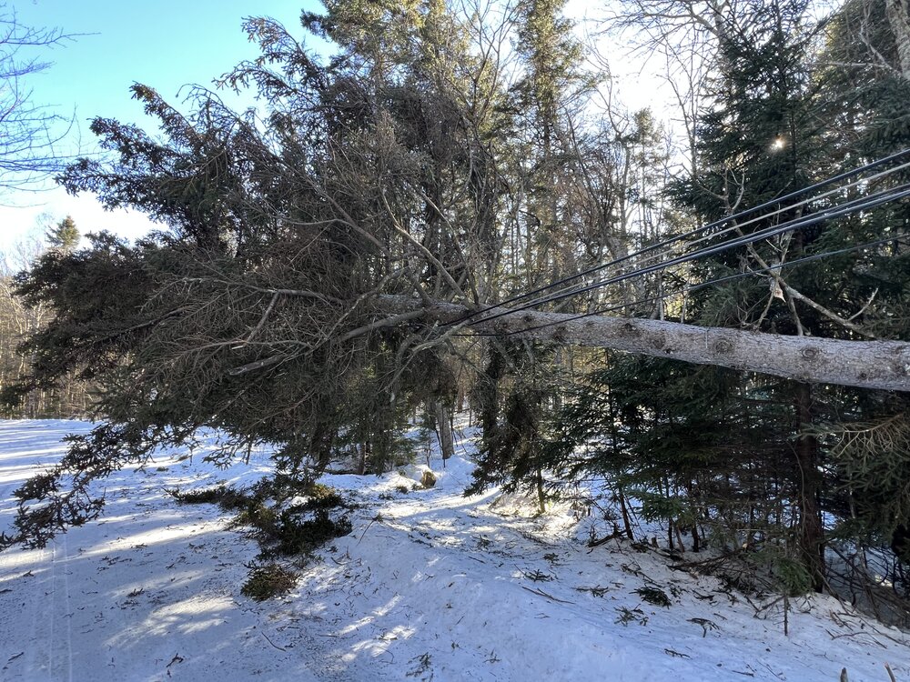

-
Recency bias...the models just got it "wrong" a couple weeks ago, lol Remember all rhe warm-ups that were can-kicked from mid-November through last week?
-

White Christmas Miracle? December 23-24th
CoastalWx replied to Baroclinic Zone's topic in New England
Less than an inch of snow will melt Wednesday. But I’m hoping for 2 or more. Not sure yet. -

White Christmas Miracle? December 23-24th
WinterWolf replied to Baroclinic Zone's topic in New England
Well it will only have trouble accumulating near the shore if the rates suck. I’d take 3-4” and be appreciative. -
White Christmas Miracle? December 23-24th
CoastalWx replied to Baroclinic Zone's topic in New England
Nam still meh. -
Yep. Judah Cohen warned yesterday that the SPV was going to strengthen

.png.0e74730599c64d9e011f9b23c6fa9e14.png)