All Activity
- Past hour
-

2025-2026 ENSO
Stormchaserchuck1 replied to 40/70 Benchmark's topic in Weather Forecasting and Discussion
Nice post Larry.. Jan Natural Gas is the highest priced month of the Winter season, implying this is the most -NAO month, but I think the weak-negative ENSO/-QBO might turn us warmer after December. It will be interesting. I do see -AO tendency in January this year. Also, Nov 24 - Dec 7 typical lag to -NAO is +35 days, so that is most correlated to -NAO Dec 29 - Jan 12 -
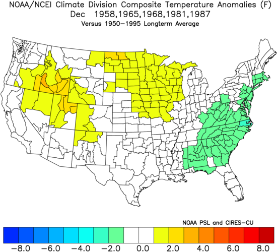
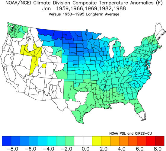
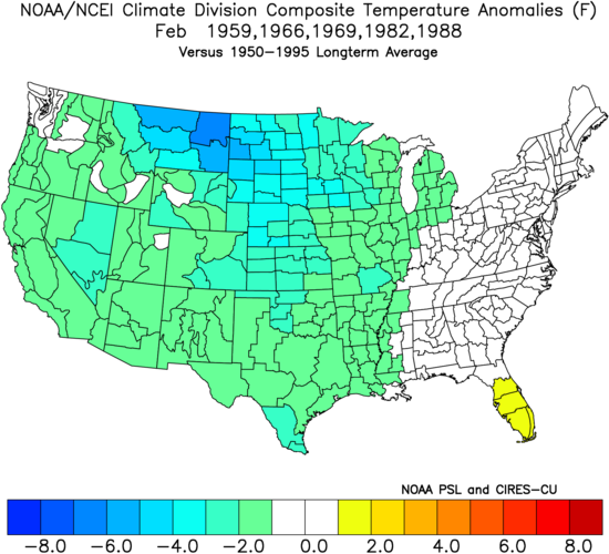
There are 5 major SSW events on record between Nov 24th and Dec 7th:-1958-1965-1968-1981-1987Here’s the Dec temp. anomaly map: E US mainly 1-2 F BN Here’s the Jan temp. anomaly map: E US mainly 2-4 BN, which incorporates extreme cold in places during 1966 (late), 1982 (mid) and 1988 (early): Here’s the Feb temp. anomaly map: E US NN: So, the coldest month regarding E US anomalies was Jan and the warmest was Feb. Feb. might have been even warmer (warmer than normal) had 4 of these 5 winters not been during El Niño, which tends to favor cold in the 2nd half of winter vs La Nina’s colder 1st half. All of this is telling me that should the late Nov major SSW actually occur, the coldest month could easily be Jan rather than Dec, which makes sense considering an assumed several week lag. But, of course, that would remain to be seen especially considering La Niña often favoring Dec as the coldest anomalywise. https://www.researchgate.net/figure/The-SSW-and-SFW-event-onset-date-year-and-type-identified-in-the-NCEP-NCAR-dataset-The_tbl1_267063738
-
2019 following the weak nino
-
I gave up and left before the aurora showed up. Least I got it yesterday lol
-
Very cool to be holding at 32° pretty much the entire event. Never mixed. Once the sun set we picked up a quick half inch. For now the precip remains focused on the region.
-

2025-2026 ENSO
40/70 Benchmark replied to 40/70 Benchmark's topic in Weather Forecasting and Discussion
Yes, I see a lot of January 2006 like jet extension...it was in my analog list. -
 Euro and GFS has been weird for sure. Maybe it’s just that once you tweak one thing you “break” another? We don’t care if it’s more accurate in the South China Sea if it can’t handle confluence over us. I’m sure the European weenies feel the same way about us lol. In the tropical space though HAFS has been outstanding on intensity and the AI stuff has shown promise. In the Atlantic at least…
 -
I can confirm that Eastern NC has NOT been getting more snow. Last year wasn't bad by our standards though. It made us happy.
-
That was a historic cold period in Eastern NC. RDU set a record for most consecutive hours below freezing. A pond at a park near my house froze over, which I had never seen in my life before. My PWS recorded 0 °F, and there was shore fast ice at the Outer Banks. Crazy times.
-
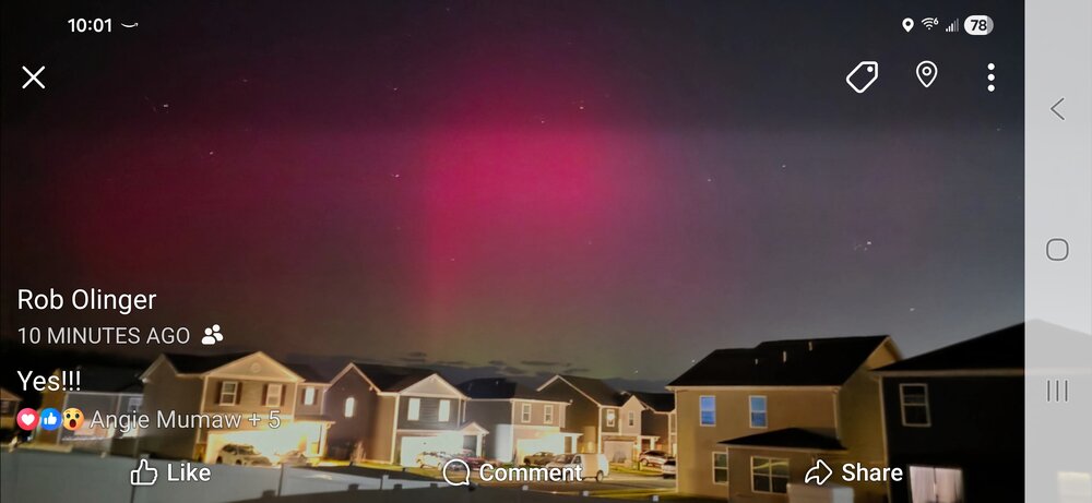
Aurora here!!
-

November 2025 general discussions and probable topic derailings ...
WinterWolf replied to Typhoon Tip's topic in New England
Wait til there’s a bonafide winter threat on the table for SNE…we’ll have to wait until an hour before go time, before we have a handle on what may unfold. Seems like that’s the trend the last several years. We’re going backwards it seems. -
What year did we start into this extremely negative PDO cycle?
-
Its forecast for Melissa was one of the worst I’ve ever seen for a “top tier” model.
-
Anyone have any luck up there?
-

November 2025 general discussions and probable topic derailings ...
alex replied to Typhoon Tip's topic in New England
A better picture. It’s really pretty out.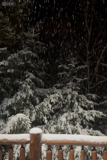
-
BWI: 4.3” DCA: 2.8” IAD: 6.1” RIC: 7.1” SBY: 11.1”
-
November 2025 general discussions and probable topic derailings ...
WinterWolf replied to Typhoon Tip's topic in New England
But, but, but, doesn’t it’s 500mb pressure anomalies score better in Eurasia/Nepal around Mount Everest. -
November 2025 general discussions and probable topic derailings ...
alex replied to Typhoon Tip's topic in New England
Another snowy night. Stake was down to 5” this afternoon with compaction, but we’ve added another inch or so since then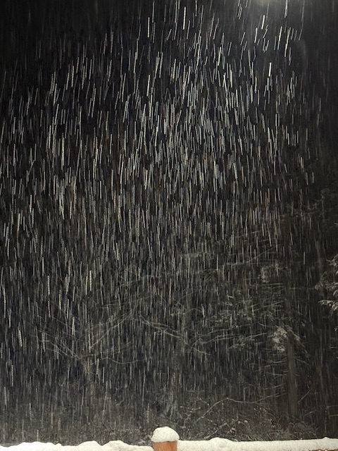
-
There was also this Rehoboth Beach experienced a significant blizzard and "bomb cyclone" on January 4, 2018, which brought heavy snow, strong winds, and whiteout conditions. The storm resulted in a blizzard warning for Sussex County, an estimated 8 to 12 inches of snow, and a Level 1 driving warning issued by the Governor.
-
I was curious so I looked into it a bit. Following a multi year cold ENSO stretch when it did go warm ENSO, 9/12 times the follow up Nino was a moderate or stronger event. I would bet against a super Nino though, given we just had a +2 ONI peak El Niño 2 years ago. Gun to head, I would bet on our next El Niño being either next year or the year after, and being similar in strength to 02-03 or 09-10.
- Today
-
It has been truly horrific lately
-
I set 8 new either record lows or 'cool maxes' between 1/292017 and 1/9/2018, lowest temp was -2.8 degrees. Warmest was 32.8 degrees. Below 20 degrees for 79 hours between 1/5 and 1/8.
-
November 2025 general discussions and probable topic derailings ...
WinterWolf replied to Typhoon Tip's topic in New England
All these updates, and they arguably get worse. WTF? -

November 2025 general discussions and probable topic derailings ...
CoastalWx replied to Typhoon Tip's topic in New England
Gfs is borderline unusable. -
I’m not talking about the longer scale -PDO. Within that are shorter term extreme phases. That’s what’s been killing is. We can snow in a somewhat negative PDO. Look at the 1960s! But past mini extreme -PDO periods (typically 4-7 years where the PDO is below -1 most of the time) are always god awful for snowfall. We have to be coming to the end of this mini super negative PDO phase. None going back 125 years last longer than about 6-7 years.


