All Activity
- Past hour
-
Every run it shifts more east the better chance it gets pushed out so that’s a good trend right there.
-
Suppression is the greatest concern for this storm. I don’t see any possibility of it cutting. It wouldn’t surprise me at all if this ends up a lower mid-Atlantic simply because of the overpowering NS for what seems like years at this point. My hope is that we get enough of a nudge north up to gametime to get in on a few inches here…though I absolutely do not expect to be in the bullseye on this with the way the southern stream wave gets sheared out.
-

January 2026 Short/Medium Range Thread
Holston_River_Rambler replied to John1122's topic in Tennessee Valley
Not sure. My (probably wrong) running hypothesis is that it reviews thousands of scenarios at initialization and then runs with a "given a certain set up "X," "Y" will then happen 90% of the time." Lower resolution helps this approach. -
@mappy Parkton mesonet dipped to 8 degrees last night. That 2.5" of snow depth did wonders.
-
We don't have the same piece of NS coming down to help lift it out of the SW that the Euro has. I doubt we get a similar evolution to our big hits though an improvement from its own baseline is possible.
-

January 2026 Medium/Long Range Discussion
NorthArlington101 replied to snowfan's topic in Mid Atlantic
Would defer to someone else to make sure I’m not crazy. I think phases are largely just timing based and this was a bit out of sync. Out of sync and 8-12” is ok with me though -
Gfs likes the mid Atlantic for the weekend. Gets about .5 liquid up here
-
At 93, the GFS does not want to budge w/ weaning that big hp. 1051 sitting in North Dakota. Might come north a hair, but that maybe will yield yet another suppressed solution?
-

Rise of the Machines: January 18-19 Winter Storm Obs Thread
Chrisrotary12 replied to WxWatcher007's topic in New England
Very snowy weekend. Definitely uplifting -
Baja low a little more east but can't tell if it's gonna do the sit and spin or move out
-
I concur with the terrain enhancement theory.
-
Rise of the Machines: January 18-19 Winter Storm Obs Thread
Chrisrotary12 replied to WxWatcher007's topic in New England
Already melting -
What got in the way of a clean phase?
-

Central PA Winter 25/26 Discussion and Obs
WmsptWx replied to MAG5035's topic in Upstate New York/Pennsylvania
Potentially a good start -
OP GFS pushing the HP further south this run. Not going to be an amped solution for sure
-

E PA/NJ/DE Winter 2025-26 Obs/Discussion
Ralph Wiggum replied to LVblizzard's topic in Philadelphia Region
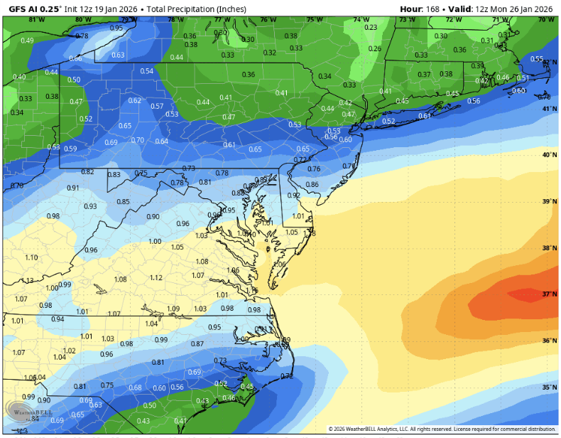
Not surprisingly, the AI GFS took a big jump South to the gfs. And vice versa. This 12z suite is honing in on the Mid Atlantic. -
SFC wise, GFS is about the same vs 6z so far...but does look just a tiny bit less suppressed
-
January 2026 Medium/Long Range Discussion
NorthArlington101 replied to snowfan's topic in Mid Atlantic
Wasn’t a clean phase. AIGFS could’ve smoked us even more. Love where we stand right now. Could always change my mind in an hour -

January 25/26 Jimbo Back Surgery Storm
Brick Tamland replied to Jimbo!'s topic in Southeastern States
Yeah, colder further south on the GFS AI this time. -
The resident UVA poster approves of this change
-
Awesome jump south on the AI GFS
-
Physics based GFS has the SW a bit more east and less confluence in front. Generally seems to moving in the right direction but need to see what happens in the next 20 hours.
-
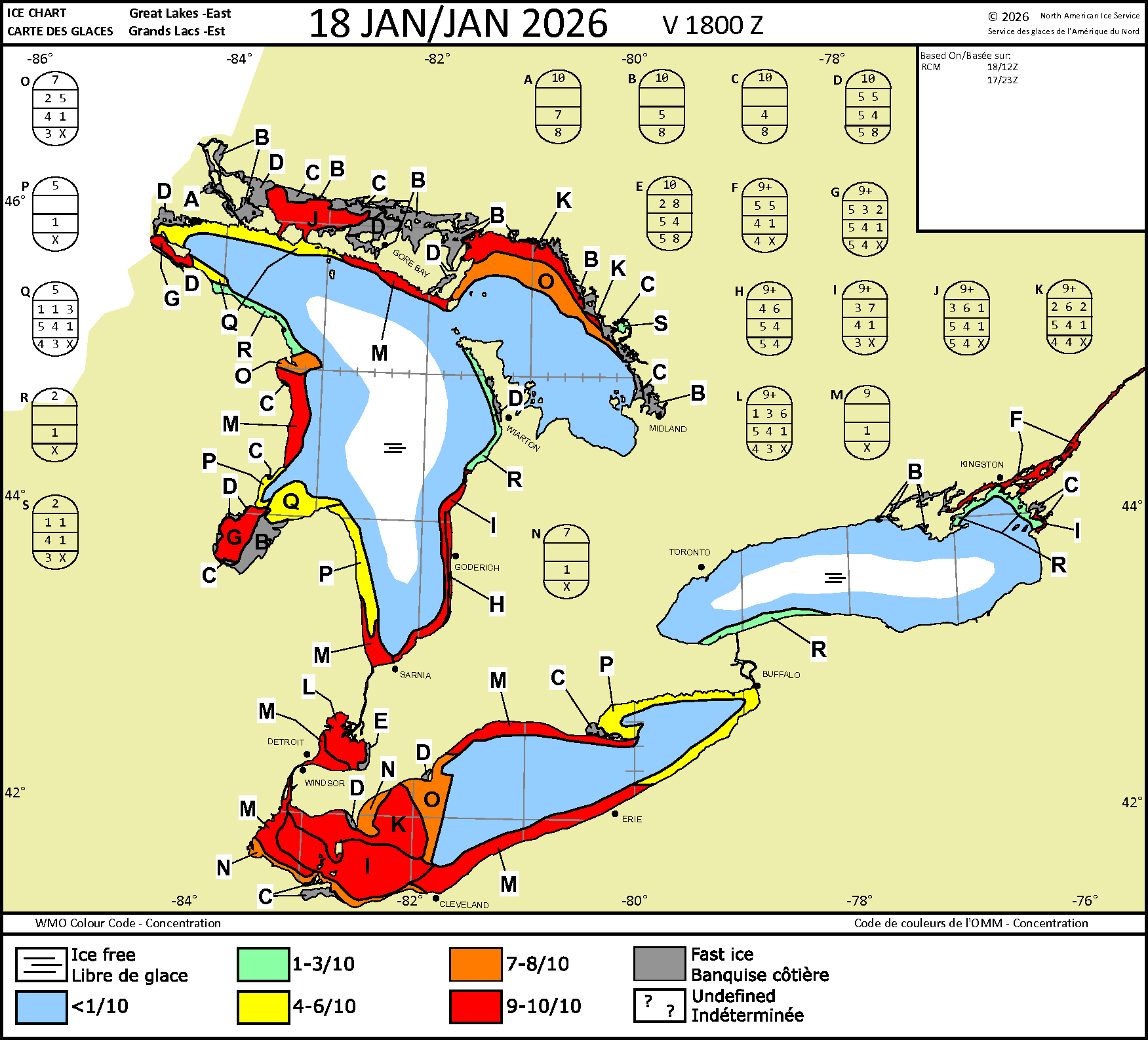
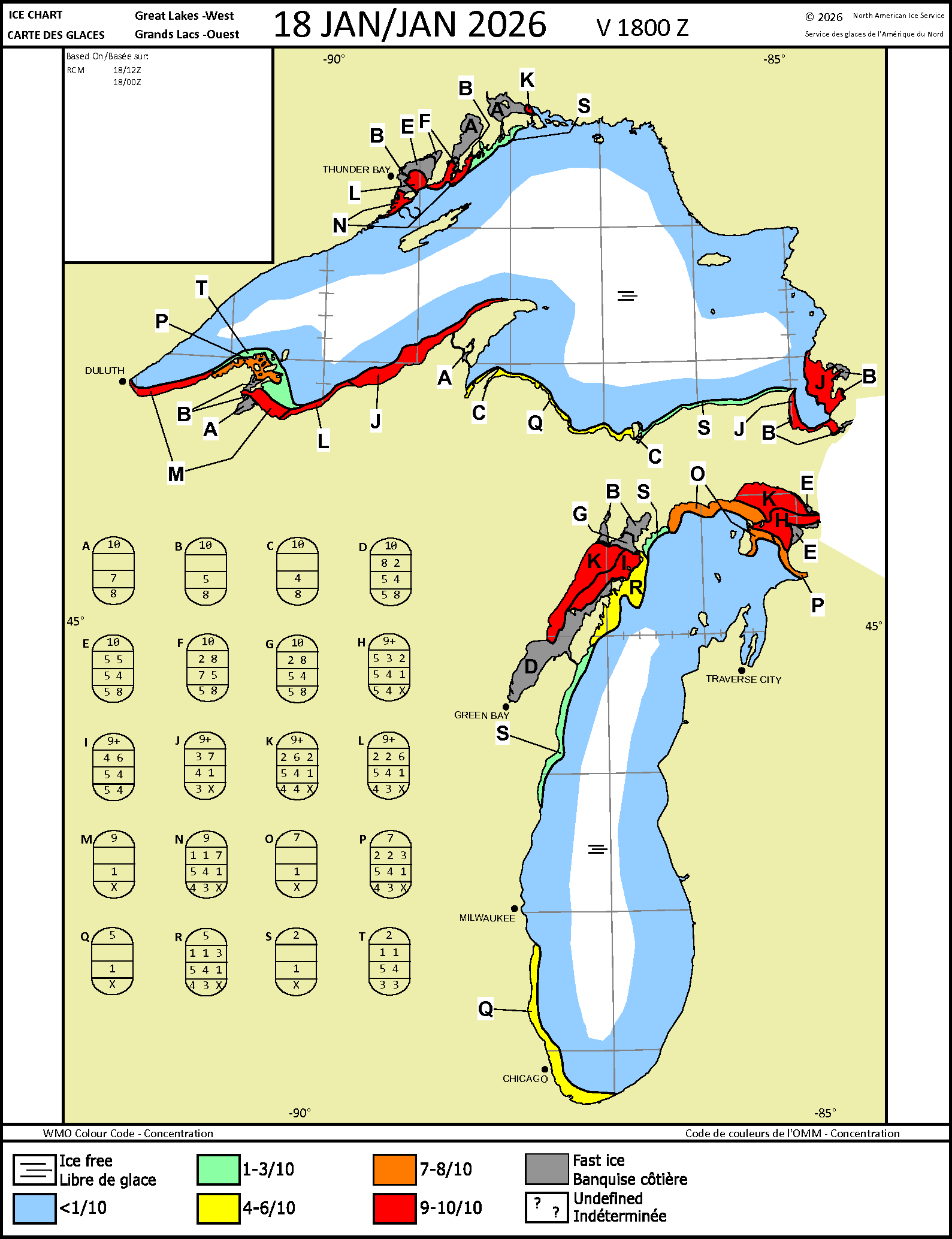
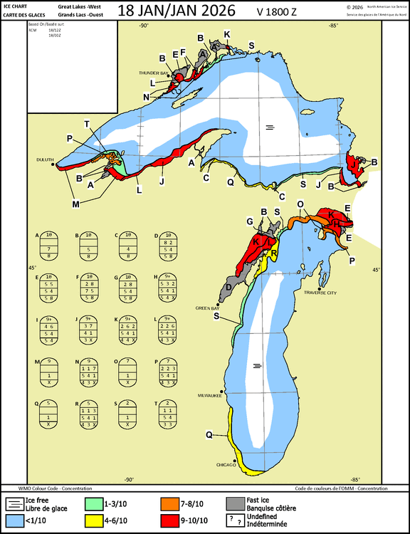
Ice on the Lakes as of Jan 18. This will expand, and thicken quickly this week. Most of the ice is new/thin, with bays being medium thick. N bays of L Superior are thick. The residents of the Apostle Islands (NE of the Bayfield Peninsula) should have driveable ice by the end of the month. They use ferries during non-ice times.

-
Huge jump south of 6z
-
The AI-GFS is like 8-12" of snow for us with no mixing issues whatsoever. Hell yeah baby.