All Activity
- Past hour
-

December 2025 regional war/obs/disco thread
Typhoon Tip replied to Torch Tiger's topic in New England
add the GGEM's 12z improvement.. what leaps out is the extreme general thickness ( hydrostatic hgts) gradient along which this paltry ( for now...) looking low is riding along. The flow is having trouble "kinking" in time... ad nauseam, because of the faster than normal basal velocity. But this elucidates the high potential should that correct just pubes more so... BOOM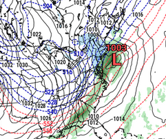
-
I mentioned this yesterday in a post. The orientation of that WPO block is somewhat flattening the PNA ridge. The other primary feature of influence is the southward displaced TPV lobe.
-
Doesn’t matter what any of us think-it’s what the pattern supports and how any storm evolves. Hopefully we can get an outcome where the S/W can dig and amplify close SE of us and there’s some blocking, so any high pressure isn’t booted east, and the storm will develop offshore and keep winds out of the north. We’ve seen that fast zonal flow either brings what we saw yesterday with suppression, or inland tracks/unfavorable lead up to the storm like early in the week. Could we see a good outcome on 12/13 or later in the month? Definitely and I hope so, but we need pretty significant mid latitude pattern changes to what we have now. Those are just facts and it doesn’t matter much whether the MJO is officially Phase 8 or whatever when other factors override it.
-

December 2025 regional war/obs/disco thread
DavisStraight replied to Torch Tiger's topic in New England
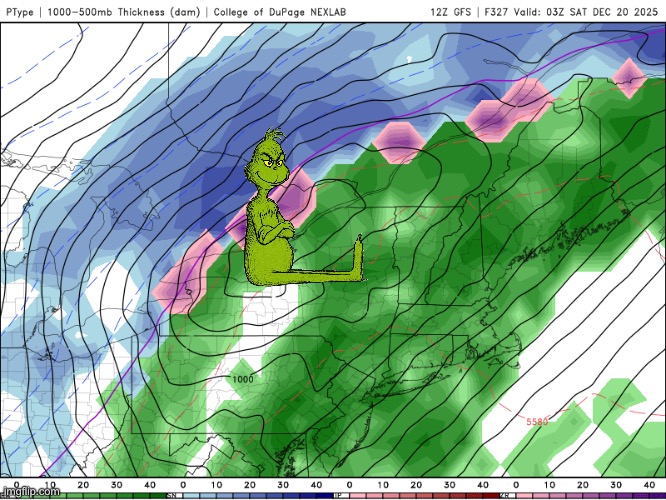
There's the grinch we all know and love. -
Cross polar flow is showing up though…I think we’re always programmed to think this is a good thing in the south but I can’t disagree more. This is likely going to be way too much of a good thing. Pipe bursting cold and snow are usually not synonymous.
-
Presumably the tracked component began on Oct 27 and its motion is prograde at low latitudes so the closer it gets to the center of the circle, the closer to the equator it has tracked. The current location is where the red portion of the track begins (on Dec 5 as posted). The labels around the outside of the graph show that the frame of reference is as follows ... left is around 60 deg W longitude (tropical N Atlantic near Trinidad), bottom is around 30 deg east (east Africa), right is 120 deg E (w Indonesia) and the top of the square is 150 W (south of Hawaii). The component being tracked (almost always a generally prograde motion from west to east, you can see one brief retrograde period labelled early Nov) is anomalous tropical convection. The MJO assumption is that this will anchor the dynamics of the higher latitude ridge-trough pattern that drives the jet stream in the mid-latitudes. So to sum up, the diagram tracks the motion of this forcing over about two months with 45 past days and 15 future days projected. In this case the feature has crossed the equatorial Pacific and moved across at least part of central America where it has begun to drift closer to the equator. It is progged to continue that motion for 2-3 days and then slowly reverse back towards the subtropics. There is no longer-range projection shown but one could assume the later December into January track would take it across Africa into the Indian Ocean. But I don't follow it myself, just aware of what others think it may mean to long-range prospects. Because it's not my main focus I may have some of these details wrong, so perhaps somebody more familiar with the diagram can set us straight. I think the phrase Maritime Continent is a reference to the many islands of Indonesia and the Philippines as well as Australia and New Zealand in general terms. What I would not swear to is that the diagram is meant to convey equal differentials of longitude, it may be somewhat schematic on that, and the scale of the latitude range is not really clear but I assume the circle is the tropic of Cancer and the center of the diagram is the equator. It would probably be rare for the tracked component to get to any latitude much greater than 25 N.
-
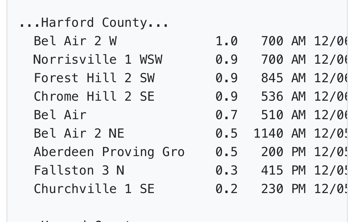
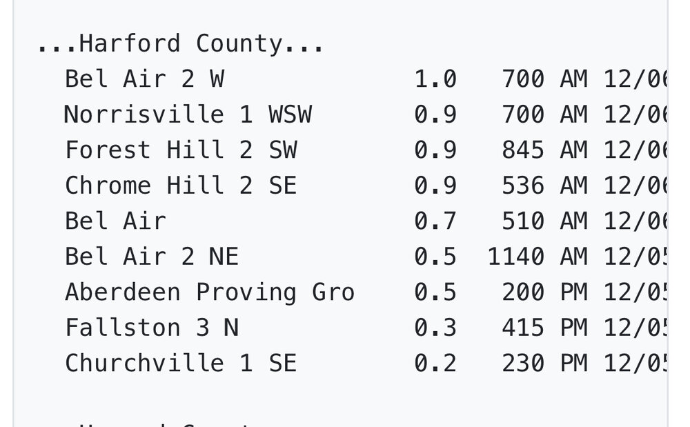
lol @WxUSAF Norrisville slant sticker at it again
-
If we continue to tick that trough further west next weekend, we likely have a shot with the northern energy digging more.
-

Central PA Fall Discussions and Obs
WmsptWx replied to ChescoWx's topic in Upstate New York/Pennsylvania
WGAL just showed the Euro. Sign me up. -
Final shots of the snow (heavily compressed if anyone knows how to seamlessly link to an actual image hosting site please let me know!) before I'm forced to lock myself in a windowless room for finals studying. I've loved getting to track this storm from the synoptic stuff down to radar nowcasting and then getting to enjoy it while it snowed. Thank you to everyone who posted in this thread!


-
I’m curious about why that is? Is there some other teleconnection that is overpowering the NAO to allow these systems to cut? At some point I hope ORH can score better than 00s NYC.
-
Seems to be the new normal given the last few winters. I’ll see snow this week when I head up to Syracuse for a few days for work
-
The whole run looks feasible
-
Can I can him bc it would be funny
-
Amazing pictures! What did you use to shoot them (especially the drone shots as they seem far nicer than what I can get with my mini 2). As others said that bridge shot is something special.
-
BTW @NorthArlington101 Euro has the Monday storm with a significant jump northward to get snow flurries close to the DC metro area. The 12z CMC also had a more consolidated precap field as well FWIW.
-
How you can predict total monthly snowfall on December 6th is beyond me............
-
I'm inclined to agree, although as we get towards the middle of December, suppression becomes more and more likely form a climo standpoint
-
Looking at the bottom image (and from talking to @brooklynwx99 earlier) we need to have that low of Alaska to retrograde off the coast more (which it has been doing in more recent runs) in order to pump up the PNA and get more amplitude for our shortwave(s). Would be fun to have a rather strong storm pop into existence within a couple days of the event which isn't impossible given how the right pieces are all there.
-
Should I stay or should I go?
-
Another Virginia system
-
first of all you know for a fact I am not gloom and doom all the time as we have agreed many times on here. Secondly the only guidance I can believe right now is what is being produced as of today - of course with borderline temps shown today can trend colder in coming days. And of course our time is probably coming as seasonal trends begin to favor more frozen solutions as we get deeper into the winter season.
-
Cold dry warm wet. If we don't have HP the north then Dec 12 will be rain for the city. If we do it'll suppress south to Virginia. NYC metro is a really unlucky spot now for snow. Too south for the marginal/interior tracks, too north for the supressively cold tracks. Only way to get snow now is with benchmark tracks, which not even the fantasy GFS is showing. Likely <3" December---> low snow winter #4 of the 2020s.
-
.
-
Definitely but we will be playing with more cold air this time.