All Activity
- Past hour
-
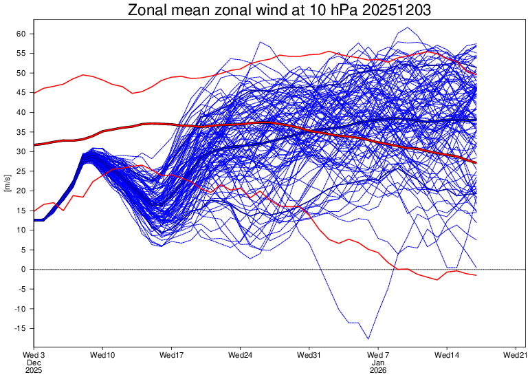
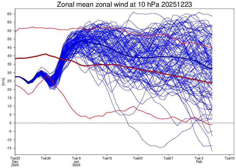
It would be no surprise whatsoever if the Jan SPV at 10 mb is stronger than avg as that’s been what the extended EPS has shown on most runs since Dec 3rd: Dec 3rd run: goes stronger than avg ~Jan 2nd and then gets stronger to end of run (Jan 17th): 12/23 run: goes stronger than avg on Jan 3rd and stays through end of run (Feb 6th):
-
Yes it's low to mid 20s so even if its busts by a few degrees its still 27 or 28 when the precip gets going. Concern is the mid layers and how far ne that warm air gets. The models tend to underdo that. I'll expect mixing up to 78 sw of nyc. But hopefully after at least 3 to 5
-
Man, take a look at these clusters from the EPS 00z run last night. Very clearly we've trended to the getting an actual block to form in the first place scenario. So here's the 5-7 day period now. All of them with the big Atlantic block, and the 3rd one just goes ape with it. Then beyond that, in the day 10-15 range. The leading scenario transitions from that, to a good old fashioned west based NAO block.
-

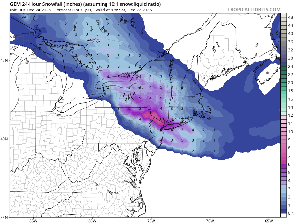
Boxing Night Snow/Sleet/Ice Dec 26-27 Storm Thread/Obs.
Kevin Reilly replied to Mikeymac5306's topic in Philadelphia Region
As I see it now my inkling is that the block is too far east and like most times over past few years the cold air is booted NE and outta of southeastern Pennsylvania. I think our true potential down here in southeastern Pennsylvania is 1-3” of snow then flip to sleet / freezing rain. This is kind of a repeat from yesterday just more energy and moisture to work with. It’s clear favored areas are NE Pennsylvania as far south as Doylestown points east and northeast from there. I would go winter weather advisories southeastern Pennsylvania western New Jersey and winter storm watches northern Montgomery County Bucks County points NE. it would take a fairly strong block to keep the torch of airmass in the central and western United States from advancing east bound. -
More could fall after 7am up there I'm guessing
-

White Christmas Miracle? December 23-24th
moneypitmike replied to Baroclinic Zone's topic in New England
Based on the stationary look of things here, I'm guessing I'm done. 13"--exceeded my hopes and expectations..gif.c006783a9437268963addd0adea108f5.gif)
-
This time the cold air will be in place. The other storm the cold air was coming in after the precipitation started.
-

White Christmas Miracle? December 23-24th
dendrite replied to Baroclinic Zone's topic in New England
Just took a core. 6.4”/0.51” final -

White Christmas Miracle? December 23-24th
WinterWolf replied to Baroclinic Zone's topic in New England
Lol…not the same as the ocean obviously. But ya you’re on some water. -

2025-2026 ENSO
40/70 Benchmark replied to 40/70 Benchmark's topic in Weather Forecasting and Discussion
Oh, I always want to see it at 50mb...sometimes 10mb is too high up to really do much. -
White Christmas Miracle? December 23-24th
moneypitmike replied to Baroclinic Zone's topic in New England
I'm on the water---but it's the Kennebec, not the ocean. About 15 miles up river from Popham. -
Not snow per precip map. It’s a ton of sleet
-

Central PA Winter 25/26 Discussion and Obs
Jns2183 replied to MAG5035's topic in Upstate New York/Pennsylvania
Thank goodness that wind is not hitting until Monday. Sent from my SM-S731U using Tapatalk -

White Christmas Miracle? December 23-24th
TheMainer replied to Baroclinic Zone's topic in New England
Radar looks thin but still nice steady large flakes, groomer barn measuring 7 inches. Fire ripping, home made cinnamon rolls from the wife for breakfast, life is good! -
Absolutely. The models were too cold by at least a few degrees for the storm yesterday. That made much of the coastal plane and immediate New York City Metro area with no accumulation at all. For the last storm two weeks ago, we know the models once again we’re too cold by at least a few degrees in New York City, so even though this surrounding areas had a significant snowfall, New York City was limited to only 3 to 6 inches. I would not be surprised if the cold air is once again being over estimated with this storm, and we know that the north trend probably hasn’t stopped either. I’d expect a significant amount of sleet and mixing up past New York City.
-

White Christmas Miracle? December 23-24th
tunafish replied to Baroclinic Zone's topic in New England
Short while. Maybe a half hour? And even then it was light - only 0.02". I know the peninsula proper and adjacent areas right (and I mean right, like your place) on the water rained for 2 hours, give or take. I'm centered 3mi from the water on all sides and that was enough to make a difference. Driving around during that time, the difference between 35/36° was the line and it was an immediate line. -
26th-27th event, coming at us like a wounded duck.
WinterWolf replied to Go Kart Mozart's topic in New England
I love how some say we need a big move TODAY. No, you don’t need it today, because the storm isn’t until Friday night/Saturday. And all you need is incremental movements today…being your 2-3 days out. And the modeling has been so dam horrendous of late…I wouldn’t sleep on this out east. Wouldn’t take a whole lot to get everyone in the game. So no, you don’t need a big move today at all. You just need some incremental movement in the positive direction. We watch. -

White Christmas Miracle? December 23-24th
tamarack replied to Baroclinic Zone's topic in New England
5.5" and 0.52" LE at 7 AM, currently light SN, might reach 6". That death band extended to within about 5 miles of here, but the 8" at the stake will be plenty for the grandkids. Rooting for 20"+ in south LEW! -
We made this mistake on the storm on Tuesday…swap the snowfall amounts for NYC and Yonkers
-
Interesting to see once again the models lose the warm up in the extended...Should continue to offer chances into January with that look
-

White Christmas Miracle? December 23-24th
CoastalWx replied to Baroclinic Zone's topic in New England
Hopefully @SouthCoastMAcan grab 1-2 this aftn. -
White Christmas Miracle? December 23-24th
40/70 Benchmark replied to Baroclinic Zone's topic in New England
Even I had a pine branch come down right in front of me just as I was finishing shoveling last night....very heavy stuff. -

26th-27th event, coming at us like a wounded duck.
Ginx snewx replied to Go Kart Mozart's topic in New England
SE Ct not WOR -