All Activity
- Past hour
-
I received a welcome 2.04" overnight.
-

2026-2027 Record-breaking El Nino
bluewave replied to Stormchaserchuck1's topic in Weather Forecasting and Discussion
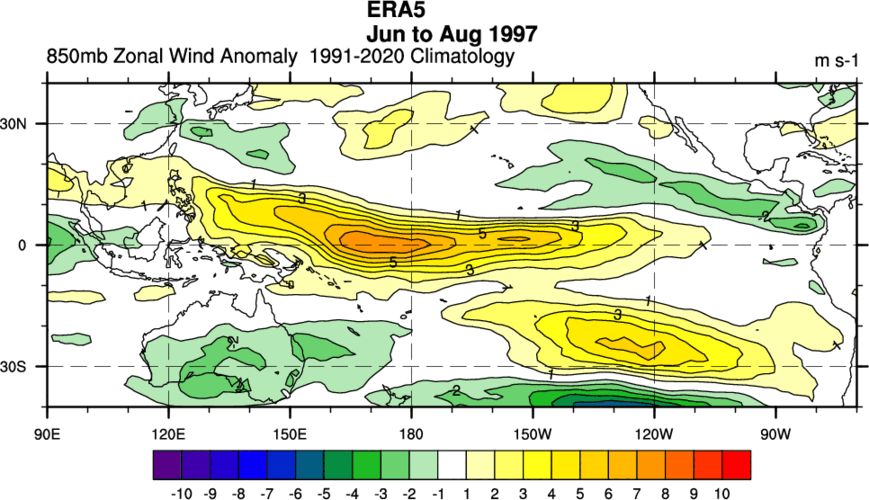
The ECMWF has been the closest but even it’s behind the curve on how east based this has become. The summer WWB pattern was stronger than 1997. So we have the historic warm pool now east of the Dateline.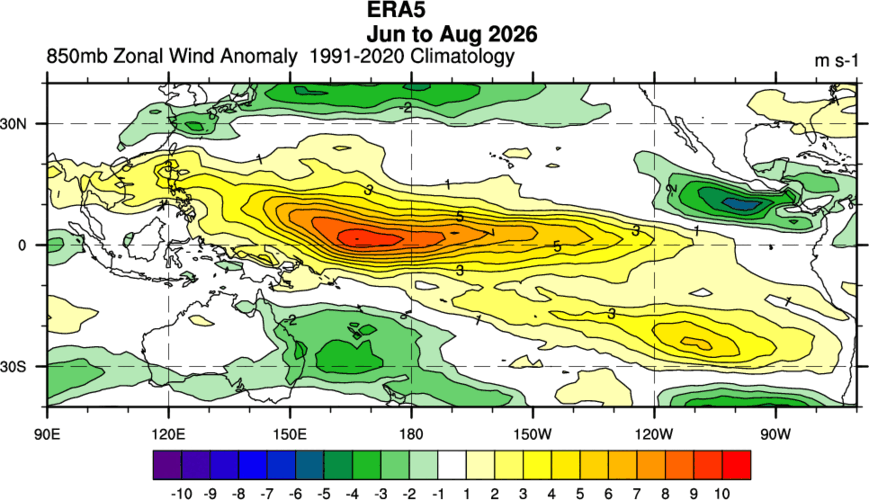
-

2026-2027 Record-breaking El Nino
40/70 Benchmark replied to Stormchaserchuck1's topic in Weather Forecasting and Discussion
Just about all guidance has, but especially the CANSIPS and JAMSTEC....take those data with a grain of salt, as I have been advising all summer. -

Septorcher 2026 Discussion - Endless Summer
Sey-Mour Snow replied to Damage In Tolland's topic in New England
First time turning on the sprinklers since June (hasn’t rained in 72 hours) forgot where the app was on my phone. -
I would say not, but perhaps a bit around P Town.
-

Septorcher 2026 Discussion - Endless Summer
Brewbeer replied to Damage In Tolland's topic in New England
they all look "above normal" now; in the last 10 years more than 70% of the average monthly temps in southern New England have been above normal above normal is the new normal -

2026-2027 Record-breaking El Nino
mitchnick replied to Stormchaserchuck1's topic in Weather Forecasting and Discussion
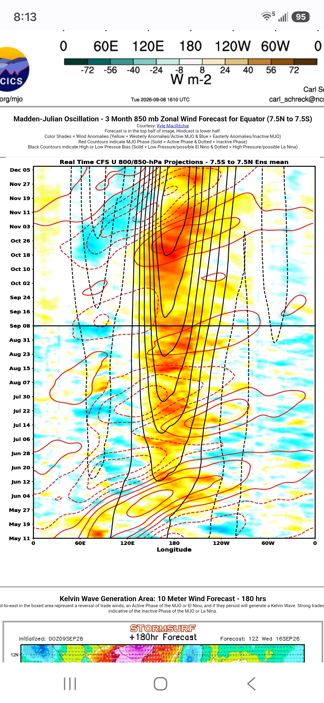
Cfs2 still advertising the mother of all WWB's this Niño for late October into early November.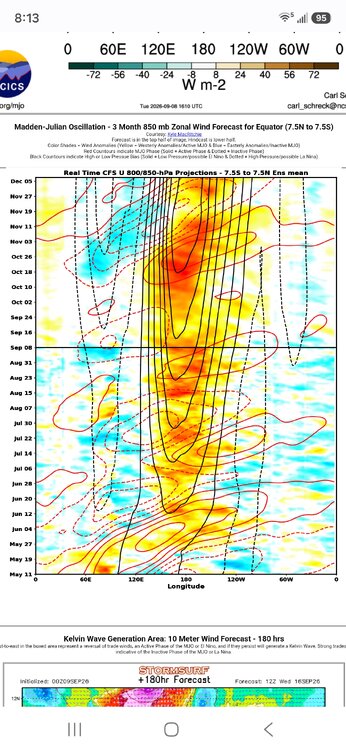
-

Septorcher 2026 Discussion - Endless Summer
Damage In Tolland replied to Damage In Tolland's topic in New England
Which is why we named the thread what we did .. an endless summer -

Septorcher 2026 Discussion - Endless Summer
CoastalWx replied to Damage In Tolland's topic in New England
Drought getting a little serious here. Rivers and ponds are about as low as I can recall and the trees are dropping leaves. This probably is the second driest summer I can remember since moving here in 2013. -
Septorcher 2026 Discussion - Endless Summer
Damage In Tolland replied to Damage In Tolland's topic in New England
That’s not what it’s showing . The point is there’s no coastals or tropical systems or any loaded gulf of America connections with fronts . When you see the whole Eastern 2/3 of the country in a dry , stein look like that , you know it’s going to be dry and boring -
It seems that AI has solved Navier-Stokes. Will this have practical implications for forecasting?
-
Septorcher 2026 Discussion - Endless Summer
CoastalWx replied to Damage In Tolland's topic in New England
Could get quite warm again next week. September looks to be AN overall. -
Septorcher 2026 Discussion - Endless Summer
CoastalWx replied to Damage In Tolland's topic in New England
Endless boredom -

Septorcher 2026 Discussion - Endless Summer
Great Snow 1717 replied to Damage In Tolland's topic in New England
..and to think millions of people voted for him not just one time but 3 times...that is all you or anyone else needs to know about those people.. -
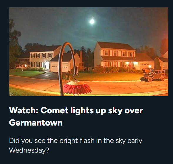
And of course in our age of declining news quality....WUSA9 posts a story calling it a "Comet" sheesh
- Today
-

2026-2027 Record-breaking El Nino
LakePaste25 replied to Stormchaserchuck1's topic in Weather Forecasting and Discussion
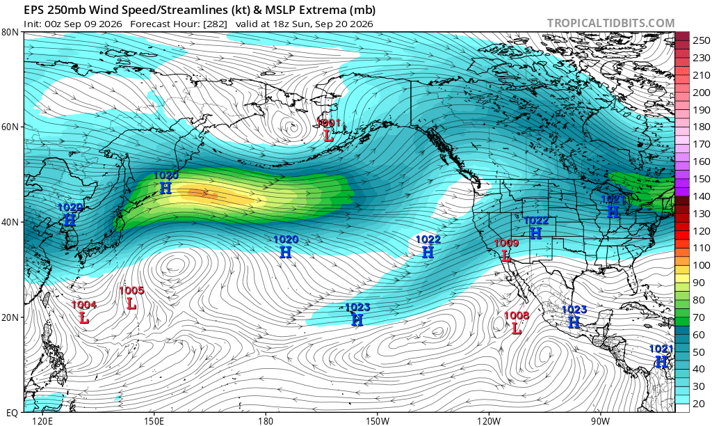
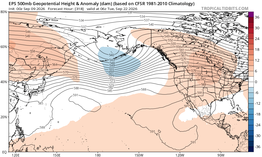
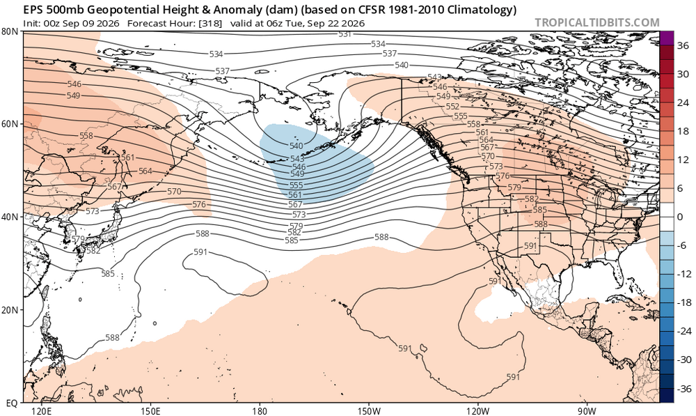
Right on schedule, the northern hemisphere pacific jet is set to seasonally strengthen and the ridging is nearly nonexistent. It’s possible we see the -PDO finally flip by next month. The stronger mid latitude jet and the coastally trapped kelvin waves going up the west coast will both act to flip the PDO to positive.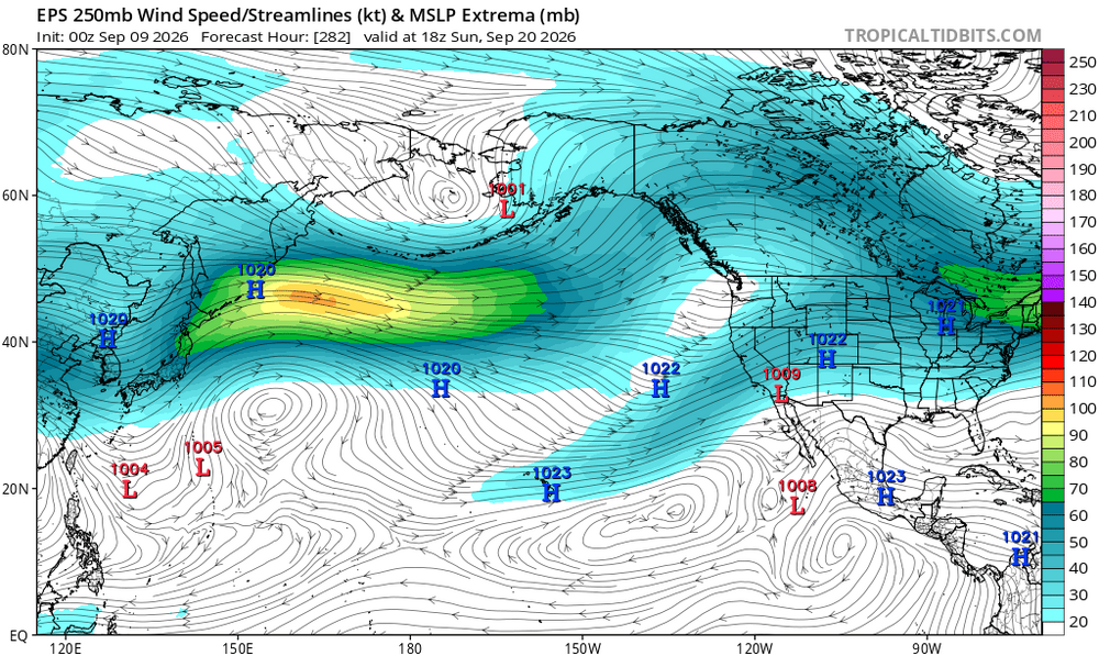
-

Septorcher 2026 Discussion - Endless Summer
SJonesWX replied to Damage In Tolland's topic in New England
nah, damaging drought en route. it's showing that your rainfall over the next 1080 (LOL) hours will be ~1" less than normal. how is that "a very dry stein pattern"?? -
The Des Moines area received massive rain totals overnight. 5.89” and counting at the airport.
-
 cost of propecia without prescription: cost generic propecia for sale :: buying propecia pill
 -
tamoxifen and uterine thickening: who should take tamoxifen - tamoxifen hair loss
-

Central PA Summer 2026 Discussion/Obs Thread
mahantango#1 replied to Voyager's topic in Upstate New York/Pennsylvania
Wxrisk.com *ALERT* AUTUMN IS COMING! --1st TRUE COOL BLAST SEPT 18-21 for eastern US details in New Edition of The Next 3 Weeks Newsletter -
Septorcher 2026 Discussion - Endless Summer
Damage In Tolland replied to Damage In Tolland's topic in New England
Well just showing we are heading into a very dry Stein pattern. NW flow in late summer / early fall is typically dry, Steiny, and fronts come thru with almost no moisture. Tonight’s is a great example -
There was a bolide/fireball/meteor at 2:38:03am EDT. Check your house cameras if you have them! It was in the southwestern sky with a steep angle. Of course the AMS fireballs page is down due to a cyberattack - but from social media posts, it seems this was seen (so far) from as far away as CT and VA - but likely to be wider). The NASA All-Sky camera site won't update until around 9am but it was BRIGHT. Happened to get lucky being out with the dog for 30 seconds right as it happened. Bright green flash. The actual bolide didn't get onto my cameras but the flash(es) sure did. Wyze cams at my place in Odenton and my folk's place in Colesville both caught the flashes. Looked like transformers exploding behind the trees. Would have been more visible if it had happened after the leaves fell.
-
MPO has been fairly warm for September so far at +3.3°. The warm minimums are driving the departures there like in other places. The min departure is +4.0° and the max +2.7. You guys have only dropped to 47° by 9-8 which is the 2nd warmest low on record by September 8th. NYC is actually doing a little better than you guys by falling to 61° which is 3rd warmest. So this isn’t a UHI issue since all locations are experiencing warm minimums regardless of rural or urban settings. Time Series Summary for Mount Pocono Area, PA (ThreadEx) Warmest minimum temperature through 9-8 Click column heading to sort ascending, click again to sort descending. 1 2018-09-08 48 0 - 2002-09-08 48 0 2 2026-09-08 47 0 - 2015-09-08 47 0 - 2005-09-08 47 0 - 1996-09-08 47 0 Time Series Summary for NY CITY CENTRAL PARK, NY Warmest minimum temperature by September 8th Click column heading to sort ascending, click again to sort descending. 1 2015-09-08 63 0 - 1980-09-08 63 0 2 2022-09-08 62 0 - 2020-09-08 62 0 - 2005-09-08 62 0 - 1995-09-08 62 0 3 2026-09-08 61 0 - 2023-09-08 61 0 - 2018-09-08 61 0 - 2016-09-08 61 0 - 2014-09-08 61 0 - 2012-09-08 61 0 - 1996-09-08 61 0 - 1966-09-08 61 0 - 1959-09-08 61 0
-
They are also our "real winters". Long stretches of cold air, frozen lakes, long duration snowcover, ect. I love winter. Not just snow one day and 70 the next day. I'll take a Nina any winter. They also produce huge snowpacks east of Ontario where I'm moving during winters.