All Activity
- Past hour
-
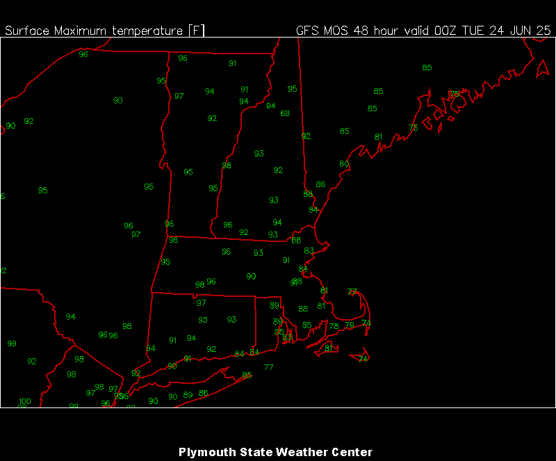
00z MAV for Mon/Tue.
-
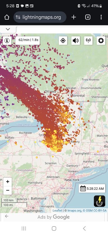
Some activity up there currently.
-
Probably all clear by 10?
-
As suggested by many hear, this thing definitely ended up well west of modeled. Bravo.
-
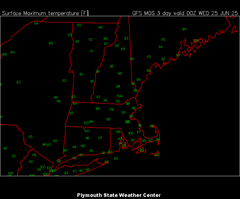
What a special week coming up.

-
When does it end?
-
Yeah I got a tee time to make.
-
Clear this thing out of here so we can roast
-
This pattern seems ripe for a good old derecho series in parts of the US this week .
-
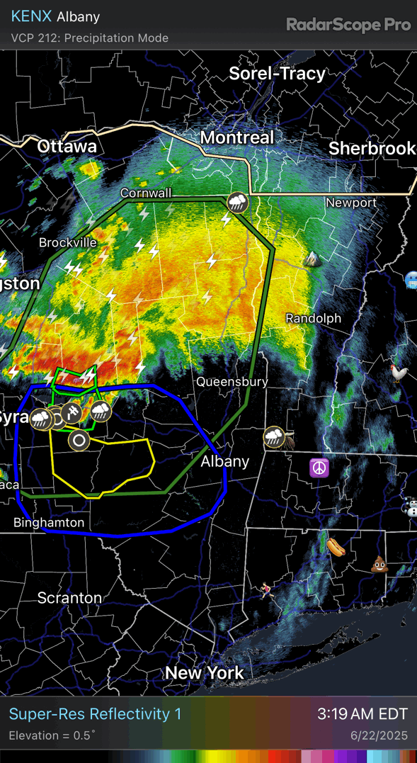
Nice bookend vortices and warm air feed with hail cores throughout its life cycle.
- Today
-
Early confusion
-
I’ll take the rain though.
-
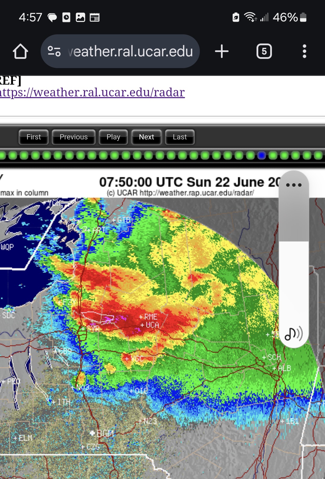
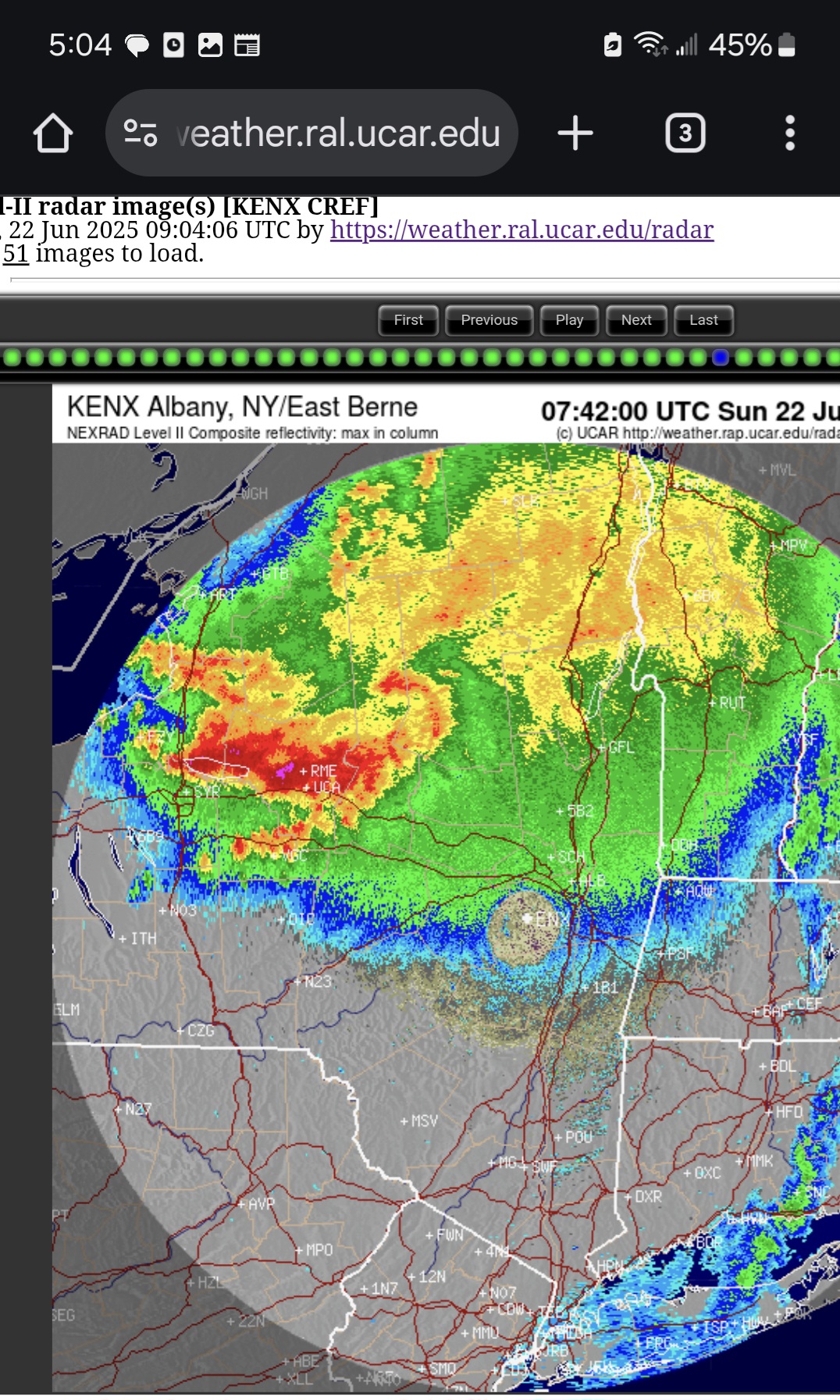
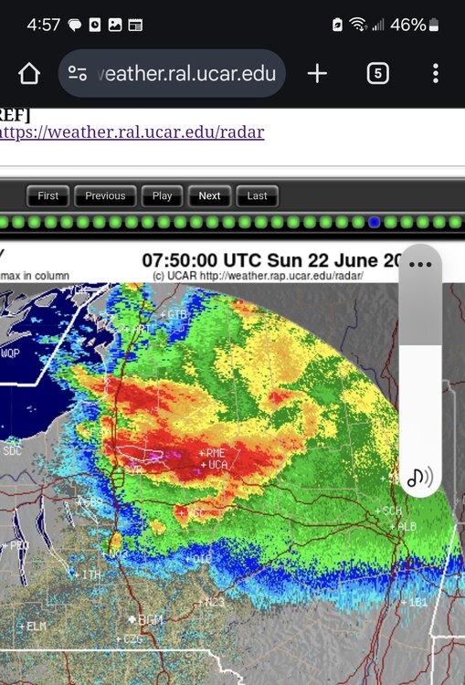
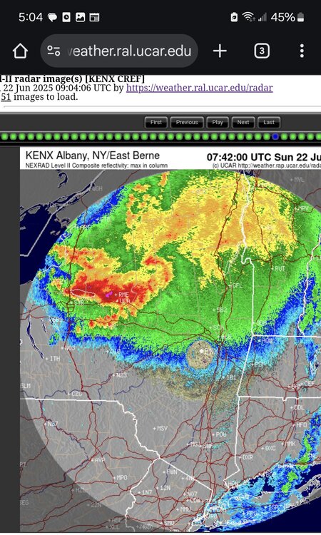
00z 3k nam nailed that diving south into C NY.
-
Mehsoscale AWT
-
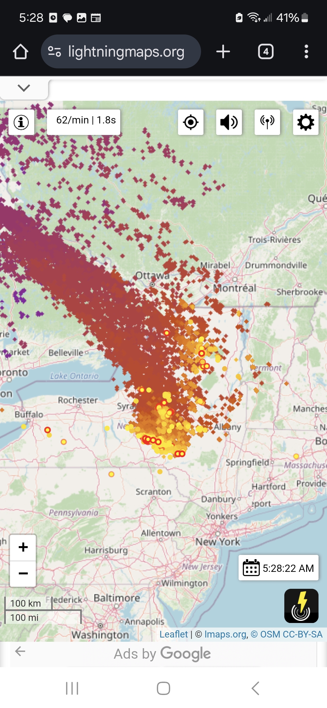
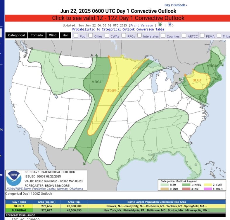
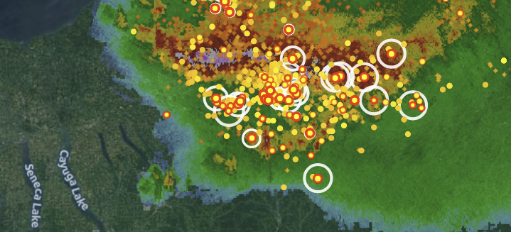
So as it turns out, this is all associated with the thunderstorm complex dropping out of new york, pretty nasty one too with a bookend vortices atm. https://www.spc.noaa.gov/products/outlook/day1otlk.html
-
threat went south but no shortage of moisture there will be flooding somewhere possibly central midd to leb line (nevermind moving too fast), but nothing like NY nice complex ene of the finger lakes I think thats why we were slight earlier and moved.....man thats some rain and lightning
-
lol no summer thread makes sense I guess because it's dead in summer, but man there is some rain coming tonight, i just feel it
-

2025-2026 ENSO
Stormchaserchuck1 replied to 40/70 Benchmark's topic in Weather Forecasting and Discussion
Strong +NAO this June.. will probably be +1.0-1.5 for the month. All but a few days in the beginning of the month have been positive. Here's how that rolls forward into July.. 2012's arctic ice melt record might be safe for another year -
2025-2026 ENSO
Stormchaserchuck1 replied to 40/70 Benchmark's topic in Weather Forecasting and Discussion
For fun.. I'm going to keep running forward with my Energy play re: a hotter than previously expected Summer taking hold in the eastern US and Europe (I think somewhat related to the Solar flares and +NAO). I've created a complex mathematical algorithm to predict Futures market moves for the next-day based on historical data.. and all the Energies continue to run an Up future projection as per this method (HO, RB, CL). This was as of Friday close (5pm, but I didn't run the numbers until now). It's for Monday and Tuesday, % shown is the average expected move (actually x2 since it's 2 days). Just for fun.. since not much is going on. I've hit on Heating Oil 2/3 days so far with a combined total of +0.8%. The signal carries into next week. It will be my 4th and 5th day with a "play", and watch long range models possibly trend toward a hotter pattern for July. -
Same here. 75 now
-
Long storm around noon to early aft, just avg. On radar there was a segment of the large MCS that looked to be bowing and racing SE towards me. Just as it reached it fell apart fast and I didn't have any unusual wind gusts. In awe that my station put out <4mm - it seemed to be a deluge. WUN had over 20mm expected during it.
-
2025-2026 ENSO
Stormchaserchuck1 replied to 40/70 Benchmark's topic in Weather Forecasting and Discussion
Flipping the WPO could be more difficult though.. this is a very high correlation and a uniform map.. notice how basically the whole N. Hemisphere is above average SSTA's before a +WPO Winter Indian Ocean signal is what I like because it's a West-Pacific index, so that makes sense, as the pattern goes from west to east. It is theorized that Indian Ocean SSTs are decadal also, but they do seem to be running a pretty linear trend up since the early 1900s, we are also now in a positive phase. Summer/Fall monsoon there is usually pretty telling about the following Winter WPO. Believe it or not, NE Russia has had negative Winter temp anomalies since 2018 (+WPO) -
11PM EWR: 85 LGA: 82 (wenr up a degree from 951) NYC: 80 New Brnswck: 79 JFK: 78 (up 6)
-
You guys are gonna get your cold. You are gonna get your snow, too. Starting in 2030. I'll be way too old. But get ready. Buy 50 Jebman Shovels, several snowblowers and get some construction equipment. You're gonnabe charging exorbitant rates for snow removal. You guys are gonna get so damn tired of snow you will move south!


.thumb.jpg.6a4895b2a43f87359e4e7d04a6fa0d14.jpg)