All Activity
- Past hour
-

December 2025 regional war/obs/disco thread
Damage In Tolland replied to Torch Tiger's topic in New England
The big winds are about HFD SPD on east and inland.. away from the water -

December 2025 regional war/obs/disco thread
weatherwiz replied to Torch Tiger's topic in New England
yeah soundings are quite inverted there. Looked like though there could be room for a line with thunder/lightning. Probably the only way to draw down any good gusts. -
Very nice job. Can’t say I remember seeing this accumulation pattern before from a clipper. I didn’t notice any available models showing the NW heavy snow band from Sussex into Orange and surrounding areas.
-

December 2025 Short/Medium Range Forecast Thread
nrgjeff replied to John1122's topic in Tennessee Valley
Clippers are hard to get in southern Tenn. Northeast Tenn can benefit from them. Yeah a clipper can happen in Chinook but it'd be tough to get it down here. GaWx is right about the -NAO which could over-achieve northeast only - prolly more like NE USA. GaWx is a good follow even though mainly Southeast. Close enough his posts can be relevant here. Then I have to whine about how I miss clipper action growing up near KC. Felt like two storm tracks work, clipper and Colorado/SW low. Here it's gotta be near perfect with little margin for error. Guess that's what makes snow in the South special! -
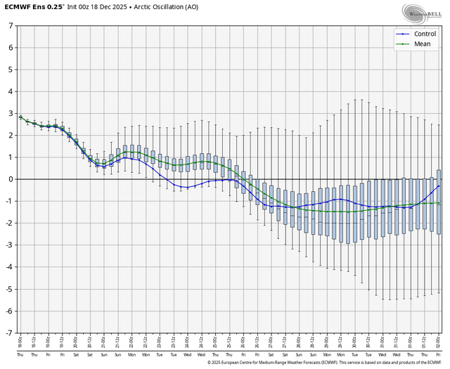
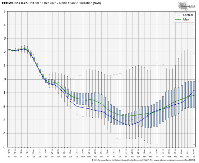
I said about a week ago that if there is to be any ATL blocking it helps if it’s NAO because we need the road blocked closer to us than Norway. Gimme a jack knifed semi with 50/50 and that can buckle PAC flow enough
-
Cape will be inverted I think.
-
I wouldn’t worry too much this far out. Just real interesting to see. That subtle shift west in the central Conus ridge hopefully helps to keep systems from shunting south.
-
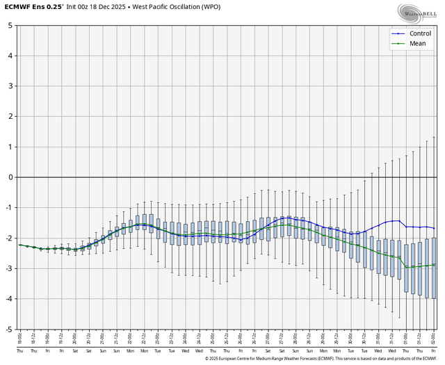
It matches the teleconnection forecast. Not good.
-
December 2025 regional war/obs/disco thread
weatherwiz replied to Torch Tiger's topic in New England
some violence for the Cape on the 6z HRRR -
Congrats Chatham and MVY. Never thought I’d say that in December lol.
-
Op runs go insane with the blocking in early January.
-

December 2025 regional war/obs/disco thread
The 4 Seasons replied to Torch Tiger's topic in New England
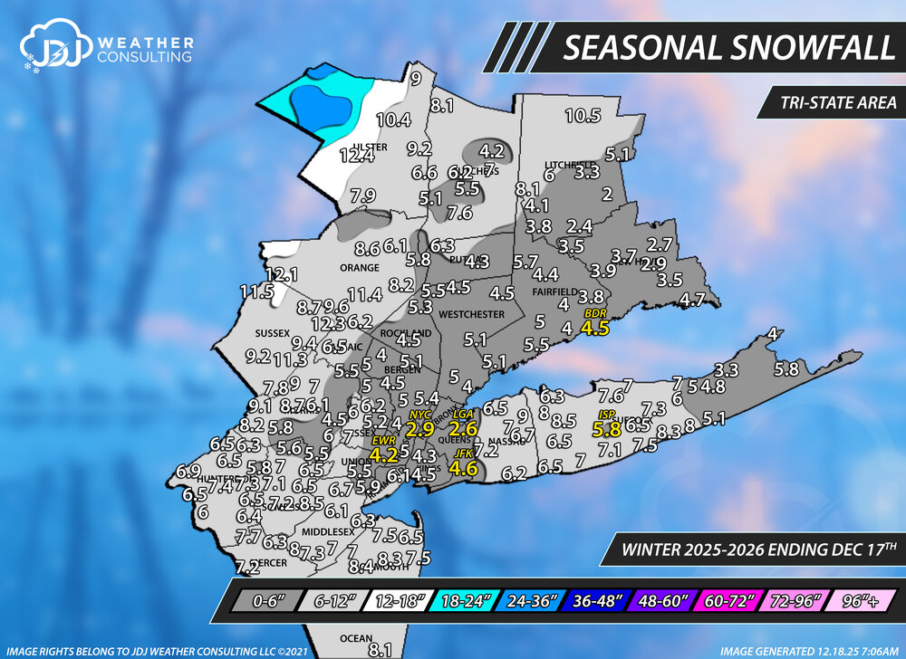
First season to date snowfall maps. This is as of December 17th, 2025. Reports are from cocorahs, COOP, and official climo sites. Contours are based on these reports and NOHRSC Gridded Snowfall Analysis. These are by far the hardest maps to put together so ill be doing them monthly similar to last season.
-
I'll be curious to see wind reports for my area this morning. My PWS doesn't pick up north winds well due to terrain, but it registered 39mph gusts, so I know it was higher than that. And my grill cover got blown off, and it's on quite tight.
-
Nothing can replace the CRAS. CRAS4LYFE
-
-
First season to date snowfall maps. This is as of December 17th, 2025. Reports are from cocorahs, COOP, and official climo sites. Contours are based on these reports and NOHRSC Gridded Snowfall Analysis. These are by far the hardest maps to put together so ill be doing them monthly similar to last season.
-
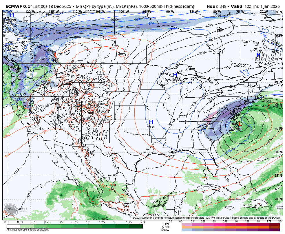
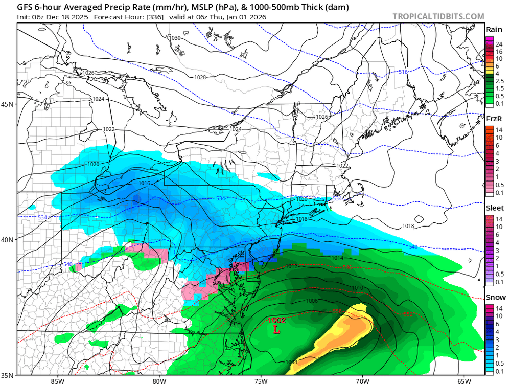
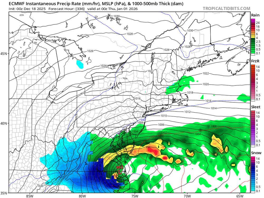
NOT hinting that this will happen, however, the setup COULD yield a storm like this. The storm tries to cut through New England however the blocking forces the storm just south.
-

Central PA Winter 25/26 Discussion and Obs
mahantango#1 replied to MAG5035's topic in Upstate New York/Pennsylvania
18 this morning. -
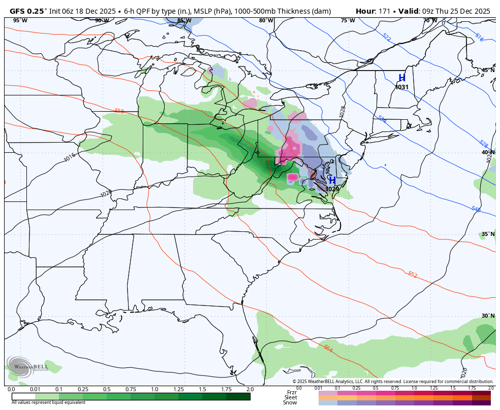
06z euro looks pretty nice for 12/23. A solid 1-3” deal for a lot of folks.
-
Definitely good trends overnight with a stronger NAO block. The operational models also hint at a coastal, albeit for areas south of us right now.
-
Central PA Winter 25/26 Discussion and Obs
mahantango#1 replied to MAG5035's topic in Upstate New York/Pennsylvania
-

Central PA Winter 25/26 Discussion and Obs
Blizzard of 93 replied to MAG5035's topic in Upstate New York/Pennsylvania
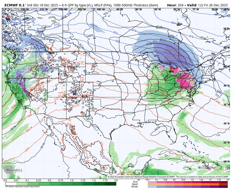
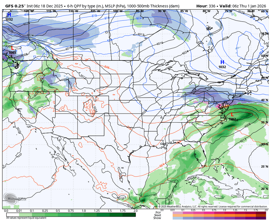
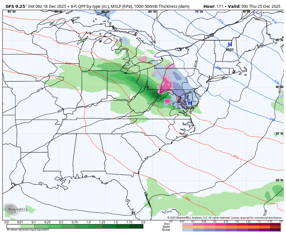
Longer term, the GFS & Euro both are showing the potential of a more significant coastal type of storm towards New Year’s in response to the -NAO blocking pattern that looks to become established the last week of tye month.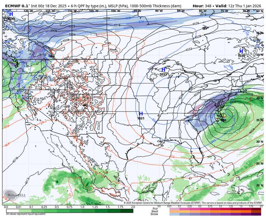
-
Nice
-
Central PA Winter 25/26 Discussion and Obs
Blizzard of 93 replied to MAG5035's topic in Upstate New York/Pennsylvania
The overnight models are still trying to resolve the potential of a weak wave around Christmas that could deliver a mix for many of us.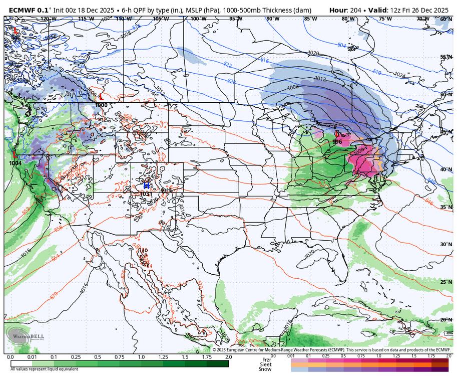
-
Yea this is kinda where I’m at, especially with peak winter climo a few weeks away. NYC metro close enough to watch with keen interest…