All Activity
- Past hour
-
52 for the low. First 40s of the season look good for me at some point this week. That said, with leaves on the trees and my proximity to water it could be a challenge. The overall dryness should help though. Heading up to Mount Snow this weekend for the annual Brewers Festival, which looks to be the coolest one since the first one we went to in 2010. No complaints from me, the air will be just right for drinking.
-
Dude, I understand numbers. All you can do is doubledown on the agenda. At least you don't deny it.
-
 Ageed with the less sunlight and lower angle, being able to cool down at night makes a big difference too.
 -

2025-2026 ENSO
PhiEaglesfan712 replied to 40/70 Benchmark's topic in Weather Forecasting and Discussion
This summer's heat, at its peak in late June and July, was intense. However, outside of that, during the first 2/3 of June and most of August (outside of the heatwave on the 12th-17th) was well cooler than average. -
Looks like after the first week Summer is back on the AIFS ensembles too. And also Stein continues. But definitely a step down as we head for 6 months of Autumn.
-

Mid to long range discussion- 2025
WinstonSalemArlington replied to wncsnow's topic in Southeastern States
BAM Weather: Cold front train likely to continue through mid September -
 We'll probably see more heat but with lower sun angle?shorter days it never feels as bad as June/July heat...we've lost close to 2 hrs of daylight since 6/21
 -
Maybe you don’t understand the difference between climate normals and rankings. Normals keep getting warmer with each 10 year update. So it takes a smaller warm departure for a top ten warmest month or season using the warmest 1991-2020 climate normals.
-
MDT was -1.6 for August thru yesterday. Should end up decently BN in light of the current pattern.
-
Low was 48.6 here, currently 48.8/48.1, wonderful!
-
 names?
 -
59 this morning! Time to break out the solar cover for the pool. Enjoy the cooldown everyone!
-
Not here. And who says I can't go by climate normals? People who push an agenda maybe?
-
INVEST 99L - FAT L (NOW IN THE EPAC: 0/20)
BarryStantonGBP replied to BarryStantonGBP's topic in Tropical Headquarters
LMAOOOO IT MOVED OVER ACCORDING TO CYCLONEEYE 3. South of Southern Mexico: An area of low pressure could form this weekend offshore of the coast of Central America and southern Mexico. Environmental conditions appear conducive for some gradual development of this system early next week while it moves generally west-northwestward at 10 to 15 mph. * Formation chance through 48 hours...low...near 0 percent. * Formation chance through 7 days...low...20 percent. -
2025 Atlantic Hurricane Season
BarryStantonGBP replied to BarryStantonGBP's topic in Tropical Headquarters
It didn’t even begin for Gabrielle then -
Can’t really go be departures anymore since the 1991-2020 climate normals are so much warmer. This has been a top 5 and top 10 warmest summer for the Northeast. Place like Long Island have seen one of their warmest summers like all the 2020s summers. Time Series Summary for ISLIP-LI MACARTHUR AP, NY Top 10 warmest summers Click column heading to sort ascending, click again to sort descending. 1 2025 74.8 6 2 2010 74.7 0 3 2022 74.6 0 - 2020 74.6 0 4 1999 74.5 0 5 2016 74.4 0 6 2024 74.2 0 7 2011 73.9 0 8 2019 73.8 0 9 2021 73.7 0 10 2018 73.5 0 - 2005 73.5 0

-
Coc-a-doodle-goodbye-dews
-
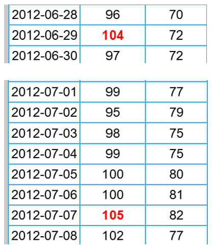
I looked and was surprised to see June was just +0.6 and July +1.4 (DCA). Check out this stretch in 2012 end of June beginning of July. And weren't a lot of people out of power for days after that derecho in late June?
-
 58 degree's on another beautiful drive in to work.
 -
Odd. Harrisburg (MDT) is already -1.6 for August thru yesterday and will end the month much lower. June was only +1.3 and July +2.5. The 3 summer months could easily end averaging barely AN.
- Today
-
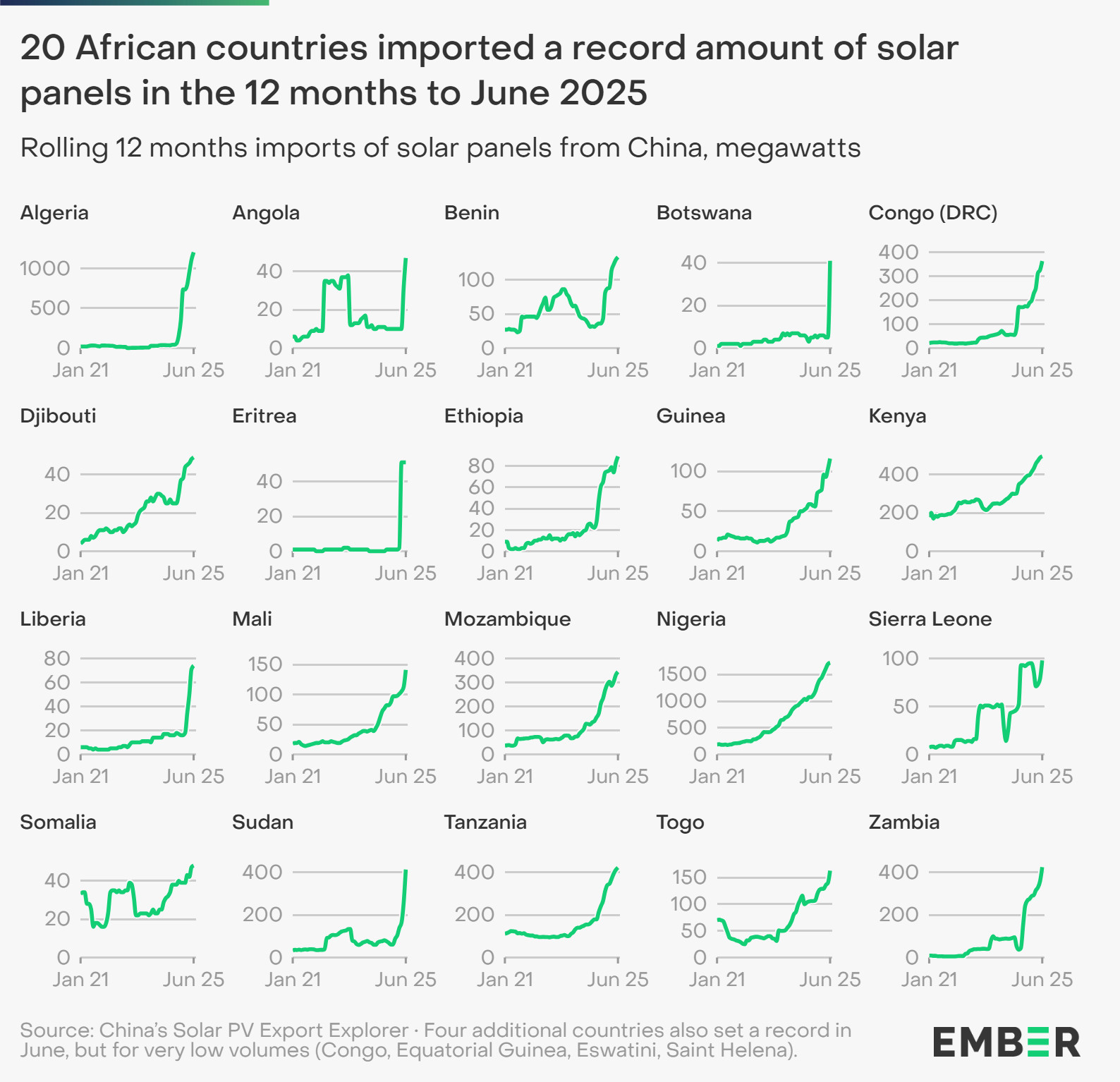
Solar is accelerating rapidly in Africa. This is mainly due to economics, lower cost of solar panels and batteries.
-
49 for me.
-
Glorious morning.
-
Low of 51