All Activity
- Past hour
-
I'm pretty bad at "vibes", and I am not just saying this, I really truly suck at regulating my tone, part of my neurodivergence. So it's possible I sometimes give off too much optimism or negativity than I intend by my delivery. So...statistically this is where I stand. I think we have an elevated threat for a MECS/HECS level snowstorm this winter. For example historically Baltimore has a 7% chance of a 20" snowstorm in a winter season. This year I would put that closer to 25-30% Baltimore has about a 20% chance of a 12" snowstorm in any given winter season. This year I would put that closer to 35-40%. The negative is I also think in the event we do not score one of those events...we have a significantly elevated chance of having a dreg less than 5" snowfall winter. The reason for that is the extreme strength and eastward geographic bias of the current nino. While we are likely to get a significant number of STJ wave opportunities it is also very possible it is simply too warm all winter. What the vibes for that should be I will leave up to everyone else since I apparently suffer from vibe blindness.
-
Maybe not on Mt Tolland…but surprises are lurking for you this winter. For SURE.
-

2026-2027 Record-breaking El Nino
snowman19 replied to Stormchaserchuck1's topic in Weather Forecasting and Discussion
Very strong/super El Niños do “force” a +IOD to develop, I’d agree. It would be near impossible for one not to form with a Nino this strong. Then once it does form it constructively interferes and complements the Nino. As far as the ++PMM (Baja) this year, I believe that’s one of the main factors that caused this El Nino to be the most east-based we’ve ever seen, surpassing the previous most east-based Nino on record (1997-98). The strong +PMM/east-based Nino relationship was discussed in a research paper I shared on here back in the spring and it turned out to be correct -
In Northern Maine? Methinks yes
-
Looks like it's going to scrape the de facto independent country of Taiwan. Google AI had it turning toward Japan the whole time. Traditional models had to fold their FuJian Province, China landfall. This is interesting because it's not a true China typhoon or a straight to Japan storm. They have opposite signs for the Southeast. Not only is the track in between; seasons are in between also. Signs flip in summer or winter. Of course no typhoons in winter, but MJO can echo the effect. So what will happen? I actually won't argue with a -NAO in a couple weeks. Unfortunately the PDO situation favors a Western US dump. East could escape. Heck even Europe could escape, but that also depends on a Scandinavia block. Can we order a Beast from the East for Russia that does not get into Ukraine? Like dealing cards, lol! Oh my! That's a little far from the Tennessee Valley. Unlike with weather forecasts, some things are black and white right and wrong. I'll just leave it there.
-
Ground frost? lol not this winter
-
Let’s dry out the wells.
-
 https://dermatretdirect.shop/# buy accutane with credit card
-
Respectfully, sir...this is an all-time record niño with being the furthest east on record. Warm, warm, warm! Outside chance of a fluke during prime window if we are even capable of getting it cold enough and timed well--but that's about it. I mean that's just the reality of what we're heading into--no sense trying to look for what might be different or whatever...outcome is kinda historically baked in to me.
-
Really wish I could get out and enjoy this perfect autumn weather.
-
folks with the late october calls heading for a bustville
-
https://gabarxdirect.shop/# get high gabapentin
- Today
-
All that red along the central coast will be wiped out when the map updates tomorrow - we got slammed with rain here in Santa Barbara County over the last 36 hours, with thunderstorms still popping up as the ULL spins. https://files.countyofsb.org/pwd/hydrology/Rainfall Reports/rainfallreport.pdf
-
Just a general comment. Vibe in here is too negative. There is model consensus that we will have an active jet stream this winter with above normal precipitation. With a little luck, we will time some of the wet weather with cold enough air for snow. It is not a shut the blinds see you next winter pattern forecast. Relax and let's see what happens.
-
The snow is coming, be careful.
-
Must be nice.
-
gabapentin for chronic daily headache and gabapentin trade name australia gabapentin 100mg uses https://cse.google.sm/url?q=https://gabarxdirect.com https://gabapentin24h.top and http://jonnywalker.net/user/dvevmzdbqg/ gabapentin 100mg capsule uses [url=http://images.google.com.na/url?q=https://gabarxdirect.com]where buy gabapentin[/url] gabapentin 300mg and [url=https://kigalilife.co.rw/author/dkvciyygpm/]gabapentin controlled drug[/url] order gabapentin
-
zithromax 250 mg australia: Z-Pack Supply - how to get zithromax
-
-
gabapentin for chronic daily headache and gabapentin trade name australia gabapentin 100mg uses https://cse.google.sm/url?q=https://gabarxdirect.com https://gabapentin24h.top and http://jonnywalker.net/user/dvevmzdbqg/ gabapentin 100mg capsule uses [url=http://images.google.com.na/url?q=https://gabarxdirect.com]where buy gabapentin[/url] gabapentin 300mg and [url=https://kigalilife.co.rw/author/dkvciyygpm/]gabapentin controlled drug[/url] order gabapentin
-
Yet another head fake…November better not yield another can kick.
-
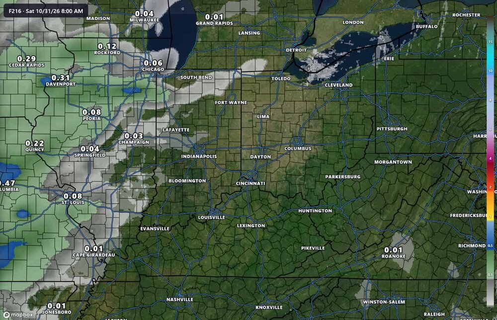
no complaints here, bring on the 60s and dry
-
Who’s saying impressive Brett? We were talking about who frosted and who didn’t. It wasn’t about being impressive. We are exactly where we should be…the step down has been right on track. Do you have complaints(I know dumb question…when don’t you)? And we’ve frosted a couple weeks ago already…which wasn’t even close to November lmao.
-
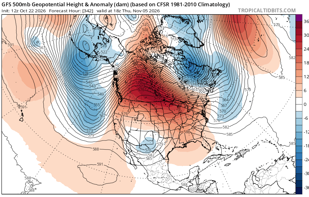
should get used to this look
-
gabapentin 40 [url=https://gabarxdirect.shop/#]gabarxdirect[/url] gabapentin and sleepiness