All Activity
- Past hour
-
Extreme Heat Watch URGENT - WEATHER MESSAGE National Weather Service State College PA 342 AM EDT Fri Jun 20 2025 PAZ019-026>028-035-036-045-046-049>053-056>059-063>066-210330- /O.NEW.KCTP.XH.A.0001.250622T1500Z-250626T0000Z/ Southern Centre-Huntingdon-Mifflin-Juniata-Fulton-Franklin- Southern Clinton-Southern Lycoming-Union-Snyder-Montour- Northumberland-Columbia-Perry-Dauphin-Schuylkill-Lebanon- Cumberland-Adams-York-Lancaster- Including the cities of State College, Lewisburg, Mifflintown, Lebanon, Bloomsburg, Hershey, Lewistown, Selinsgrove, Sunbury, Pottsville, Shamokin, Chambersburg, Lancaster, Lock Haven, McConnellsburg, York, Mount Union, Williamsport, Harrisburg, Gettysburg, Huntingdon, Berwick, Danville, Carlisle, and Newport 342 AM EDT Fri Jun 20 2025 ...EXTREME HEAT WATCH IN EFFECT FROM SUNDAY MORNING THROUGH WEDNESDAY EVENING... * WHAT...Dangerously hot conditions with heat index values over 105 possible. * WHERE...A portion of central Pennsylvania east of I-99 and south of I-80. * WHEN...From Sunday morning through Wednesday evening. * IMPACTS...Heat related illnesses increase significantly during extreme heat and high humidity events. * ADDITIONAL DETAILS...Heat index values and the associated risk of heat-related impacts will be highest on Monday and Tuesday. PRECAUTIONARY/PREPAREDNESS ACTIONS... Check up on relatives and neighbors, and provide pets with adequate water and shelter from the sun. Wear lightweight and loose fitting clothing. In addition to the daytime heat, overnight low temperatures will also be very warm and oppressively muggy. && $$ For more information from the National Weather Service visit weather.gov/StateCollege Banghoff/Bauco
-
That could also be it for the mouth.
-
Okay, so there were no last minute entries or edits, the table of forecasts remains as earlier posted (now two posts back) ... good luck ... by the way, Weather53, your win was two contests back, Jebman is the current (no show) defending champ. I seriously considered adding 2 to my forecasts but that usually backfires so I'll stick with the relatively moderate numbers I had. It would surprise me if this coming heat wave is the only serious attack on 100 all summer, only a small number of years have their seasonal max in June, off the top of my head I could say 1923, 1952, 1956, but more often a June record high is followed by some more later in the summer.
-
- Today
-
Been in the 60s/70s out here in Washington with very low humidity. The heat/humidity combo should be a great welcome back feature this weekend lol.
-
95/75 nearly every day for 5 months is SE US living at it's finest lol. Then break out the giant tiger mosquitos that can drain a pint per bite. The old saying in South Calalacky if you ain't on the coast your toast lol. Usually the first time it gets like that around here I go into a few days of therapy from having flashbacks causing heat trauma related PTSD
-
My puppy was chasing them all over, I think the heat and humidity gets them out and about.
-
Final numbers yesterday were 92/69 with 0.34" of precip. I think the winds hurt the rain collection because it was dumping, but coming down sideways. Still a decent total and brings the month to 3.97" already. This has been a really wet May/June combo. Now to bake.....
-
Again 2 nights in a row. GFS significant backdoor cold front comes through on Wednesday. CMC, backdoor cold front remains to our north for the entire week. It's the difference between a 3-4 day heatwave starting Sunday and a 5-6 day heatwave starting Sunday. Whatever, upper 90s to lower 100s likely at least Monday & Tuesday. Notably, GFS has a second surge of 90+ degree heat later in the period for at least Saturday 6/28 & Sunday 6/29. WX/PT
-
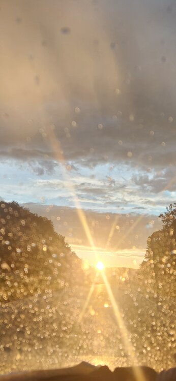
Only 0.09 on the day.. Monthly total 2.78.... Did get a couple nice pics driving home west of Charlottesville on 64 in weakening showers into the setting sun.... Raindrops looking like Christmas lights in the sun...
-
Yes
-
0.70” for the day. 5.22” for the month. Am not looking forward to the excessive heat.
-
The highs in the area were 93-95. But that tells only some of the story as the dewpoints/RH made it feel like ~100-102. I had to go into a house whose AC is broken. It was 91 inside and this was at 8PM. I was soaking wet within 5 minutes!
-
Absolutely no wind but sky is still constantly lit up, rolling thunder and a close cg bomb every 5 minutes still after 70 mins. Picked up nearly 3" of rain last hour. Storms don't look like they are moving much as Erick remnants keep throwing moisture in. Dry air is off to northwest and losing. This storm has ruined me for life I'm afraid. Sent from my SM-G970U1 using Tapatalk
-
Pretty underwhelming here, just some moderate rain at best. I feel like the strongest severe storms pop up on days when there's less risk. Today I think we were in enhanced. It's not like we need the rain anyway. Breeze kicking up now and can already notice a significant drop in humidity.
-
Yeah—I’m just talking about 100° in June. That seems far more rare. I only see 1952 and 1964 on NOWData. There was a 99° on 5/26/2010 from what I see. Assuming something doesn’t muck it up, next week looks pretty anomalous for this time of year.
-
Only 0.17" here today.
-
I had towers go from 0 to almost -70c in minutes. The low cloud base right over bay made almost all strikes positive cg Sent from my SM-G970U1 using Tapatalk
-
After tonight I'm embarrassed I ever thought thunder by us was loud. Being in a high rise overlooking bay/ocean when outflow boundary hit old boundary just after dark, I had basically multiple close strikes every 2-2 seconds for 10 minutes so that it felt like the whole hotel was shaking and it was blue daylight outside. We had to cover our ears it was getting so loud. It was torrential rain and we could not hear it the first 15min. I feel like I was a virgin until tonight. Sent from my SM-G970U1 using Tapatalk
-
And just like that, it's over...
-
And now I'm getting an "f you" cloudburst just to finish it off...
-
Bad day for storms locally but a good day for learning and mulching. Atleast now that I found some of these tools it's much harder for someone to say it's black when it's really white, theoretically of course lol. Not that anyone here would do such a thing.
-
They were last at 100F in 2019. They reached 103F in 2011.
-
This makes me sad. I've had tons of gray tree frogs every spring for the last 20 years or so. This year I have not heard a single one. I wonder what would cause a large population to disappear so suddenly?
-
The only time I can find BDL hitting 100° in June is 6/30/64. Would be impressive if it happens next week.


.thumb.jpg.6a4895b2a43f87359e4e7d04a6fa0d14.jpg)

