All Activity
- Past hour
-

Southern Crippler - Get well soon Jimbo Storm Obs
lilj4425 replied to BooneWX's topic in Southeastern States
I feel like I am gonna be sick. -

Extreme Cold, Snow & Sleet: SECS 1/25 - 1/26
CPcantmeasuresnow replied to TriPol's topic in New York City Metro
That's half an inch of sleet on LI which is nothing. -

Southern Crippler - Get well soon Jimbo Storm Obs
Coach McGuirk replied to BooneWX's topic in Southeastern States
sick -
NWS already started scaling back the warnings. Down to 11-15in in Allentown from the initial 12-18in.
-
FWIW NAM kind of stopped its own bleeding. Still many areas don’t hit the low end of their projected NWS snows, but it as *slightly* better than 0z
-

Southern Crippler - Get well soon Jimbo Storm Obs
CentralNC replied to BooneWX's topic in Southeastern States
Looks at these 4am obs though. Cold air is screaming down the lee side. And those DPs! CITY SKY/WX TMP DP RH WIND PRES REMARKS WASHINGTON NAT PTCLDY 14 -9 35 N24G30 30.60R WCI -5 DULLES PTCLDY 11 -10 38 N15G23 30.60R WCI -5 ANDREWS AFB PTCLDY 14 -13 30 N17 30.55R WCI -3 QUANTICO CLEAR 16 -10 31 N20G33 30.59R WCI -1 COLLEGE PARK* PTCLDY 13 -12 32 N16 30.61R WCI -3 LEESBURG* PTCLDY 10 -6 48 MISG 30.61R MANASSAS* CLEAR 13 -8 39 N17 30.61R WCI -4 GAITHERSBURG* PTCLDY 9 -10 42 VRB6 30.57R WCI -1 -

January 24-26: Miracle or Mirage JV/Banter Thread!
arlwx12 replied to SnowenOutThere's topic in Mid Atlantic
OPM has gone to Monday maximum telework in the DC area. Those who were scheduled to work in the DC area but are not teleworkers get safety leave. More details: Current Status -

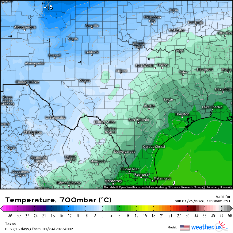
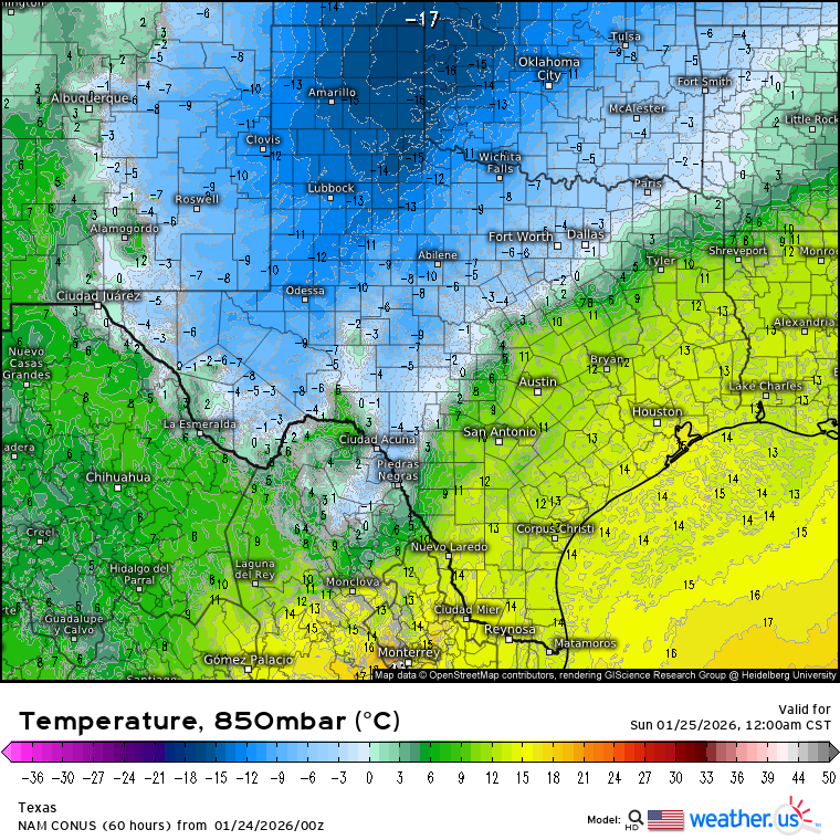
Texas 2026 Discussion/Observations
aggiegeog replied to Stx_Thunder's topic in Central/Western States
850mb front stalls over my head all day tomorrow. Thankfully 925mb sub -5C will freeze a lot of that for me. But depending on 850mb front could shift precip.types around -
10 here
-

“Cory’s in LA! Let’s MECS!” Jan. 24-26 Disco
codfishsnowman replied to TheSnowman's topic in New England
And its going nowhere next week....what a period to build big depth. This can be the big one.Just give us a few two to fours over the next week or so after -
Southern Crippler - Get well soon Jimbo Storm Obs
Coach McGuirk replied to BooneWX's topic in Southeastern States
The forecast low was 17 degrees, it's currently 24.7/0, I have a bad feeling this is going to be a freezing rain nightmare. -
“Cory’s in LA! Let’s MECS!” Jan. 24-26 Disco
codfishsnowman replied to TheSnowman's topic in New England
That's some of the most uniform qpf output I think I have ever seen over a huge area -

Texas 2026 Discussion/Observations
Stx_Thunder replied to Stx_Thunder's topic in Central/Western States
Posting these H7 and 850Mb temp profiles from 0Z GFS, NAM runs tonight for visual reference on why ETX icing, is bound to be majorly impactful Saturday night. As long as 850Mb - 700Mb layer warm-rain processes don't get too much in the way.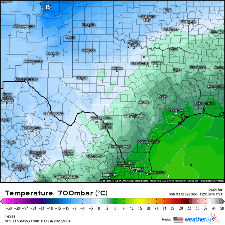
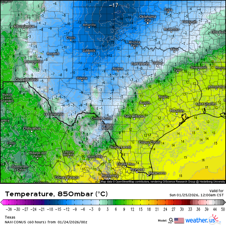
-

January 24-26: Miracle or Mirage JV/Banter Thread!
Jebman replied to SnowenOutThere's topic in Mid Atlantic
In Buda, Texas, Northerly breezes up to 37 mph have dropped temperatures 30 degrees down from our earlier highs in the mid 60s. At this rate we will be subfreezing by 7am. Rain will be freezing on every surface down here. It will then proceed to drop all day Saturday, into the teens Saturday night with persistent ZR. This storm may end as snow here Sunday. Next weekend another storm and trough will bring yet another round of rain, ZR, sleet and even snow to Austin Texas. Is this Texas or Northern Virginia? -
Seems like trends are steady for now. Hopefully a tick south for srn areas. And for Monday.
-
January 25/26 Jimbo Back Surgery Storm
Coach McGuirk replied to Jimbo!'s topic in Southeastern States
Currently 24.8 degrees, forecasted at 17 degrees this morning and 28 for a high. I don't think we get below freezing this weekend storm. I am thinking a bad ZR storm is setting up here. -

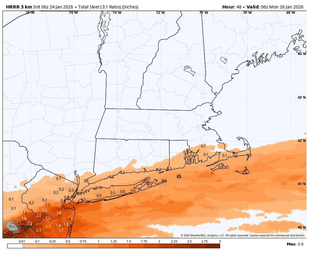
Extreme Cold, Snow & Sleet: SECS 1/25 - 1/26
TriPol replied to TriPol's topic in New York City Metro
06z HRRR is incredible for our area as far as snow and icing. It shows half an inch of ice on Long Island.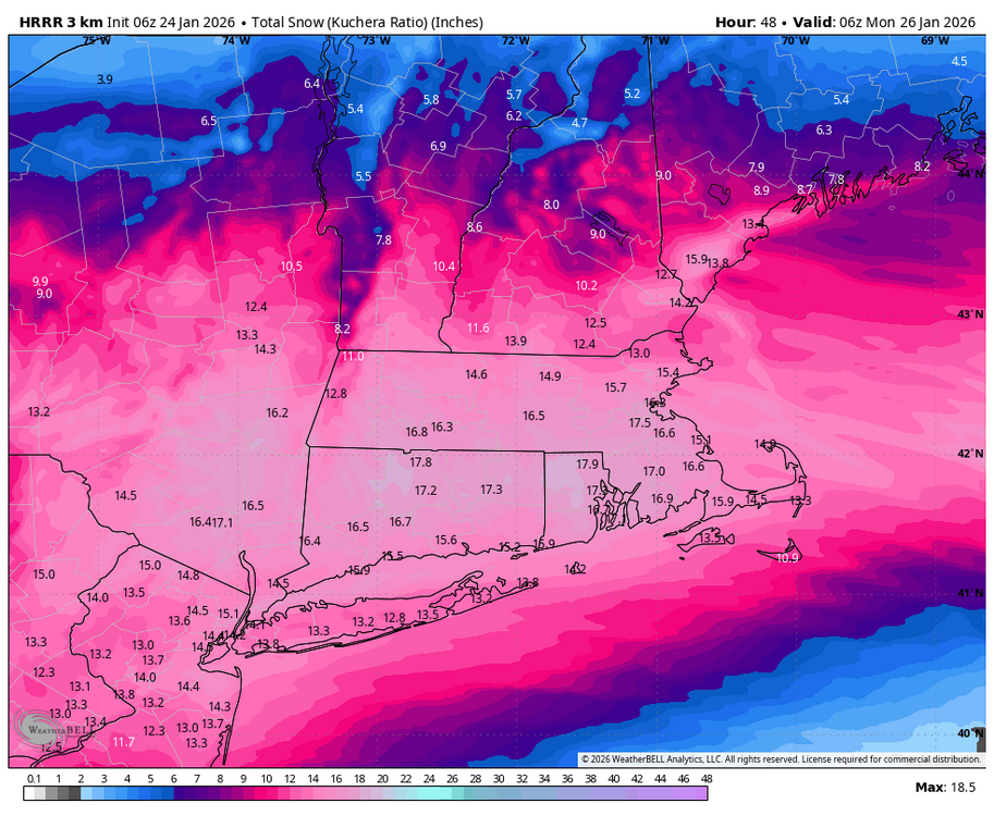
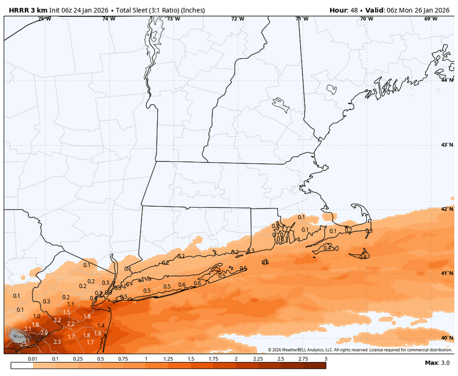
-

Central PA Winter 25/26 Discussion and Obs
Ruin replied to MAG5035's topic in Upstate New York/Pennsylvania
please stunt on us -

“Cory’s in LA! Let’s MECS!” Jan. 24-26 Disco
AstronomyEnjoyer replied to TheSnowman's topic in New England
The 06z RRFS run, oh my. -
3k gets the sleet line up to southern MA but big dump before that
-
6z NAM Total qpf
-
thats how you get two feet in some areas
-
damn I wish I could lock this run in
-
Not sure what is and isn't virga on the radar, but Memphis webcams show a snow covered interstate. Jackson cams are inconclusive.
-
hr 60 still snowing should of waited for total qpf but will probably end up close