All Activity
- Past hour
-
Days and days of steamy pavement, smoke, and moist plumbers cracks..ya love to see it!
-
We are firmly in splotchy season now.
-
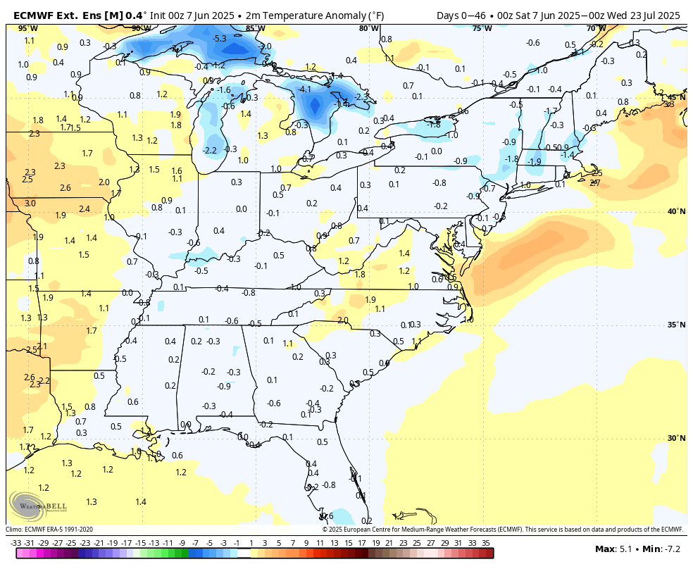
The early season modeling that predicted the worse of the heat being out West is holding true in the very early phase of JJA. Seems that the High pressure tendencies that started many summers ago is present again Northeast of us allowing a more humid airmass, but not extreme heat. Temps may be skewed by higher overnight lows.
-
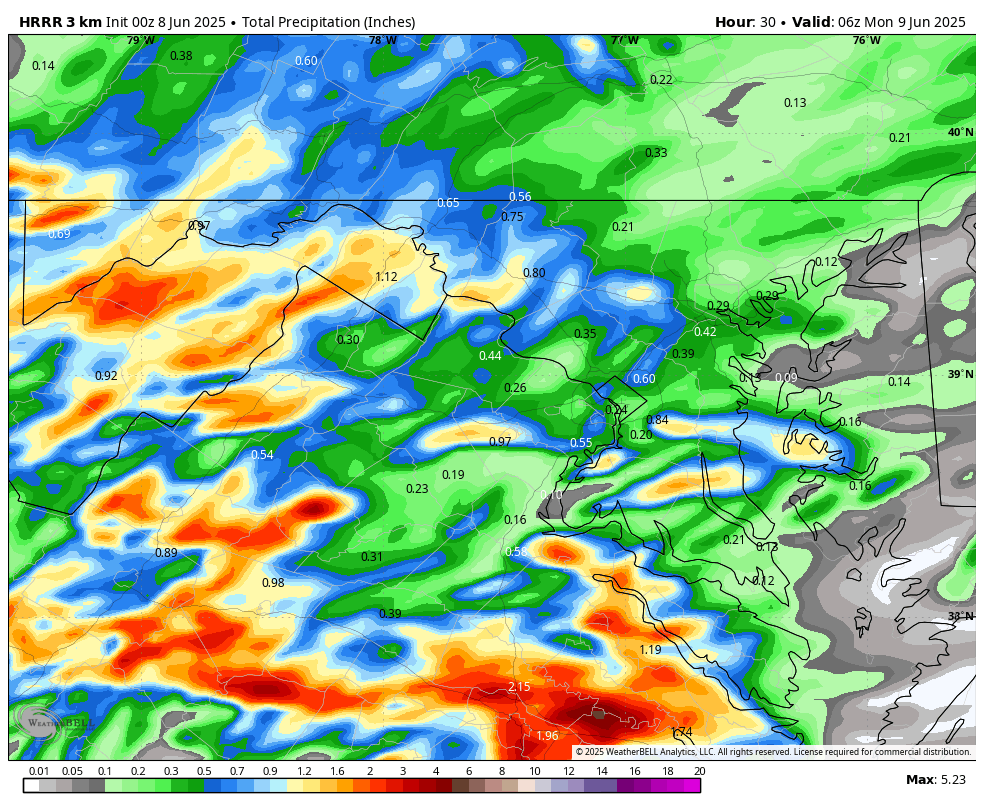
WB 0Z HRRR for Sunday.

-
Can you post the map you're using?
-
Looks like about 1.2-1.4” here. A few 2” pixels SW of me.
-
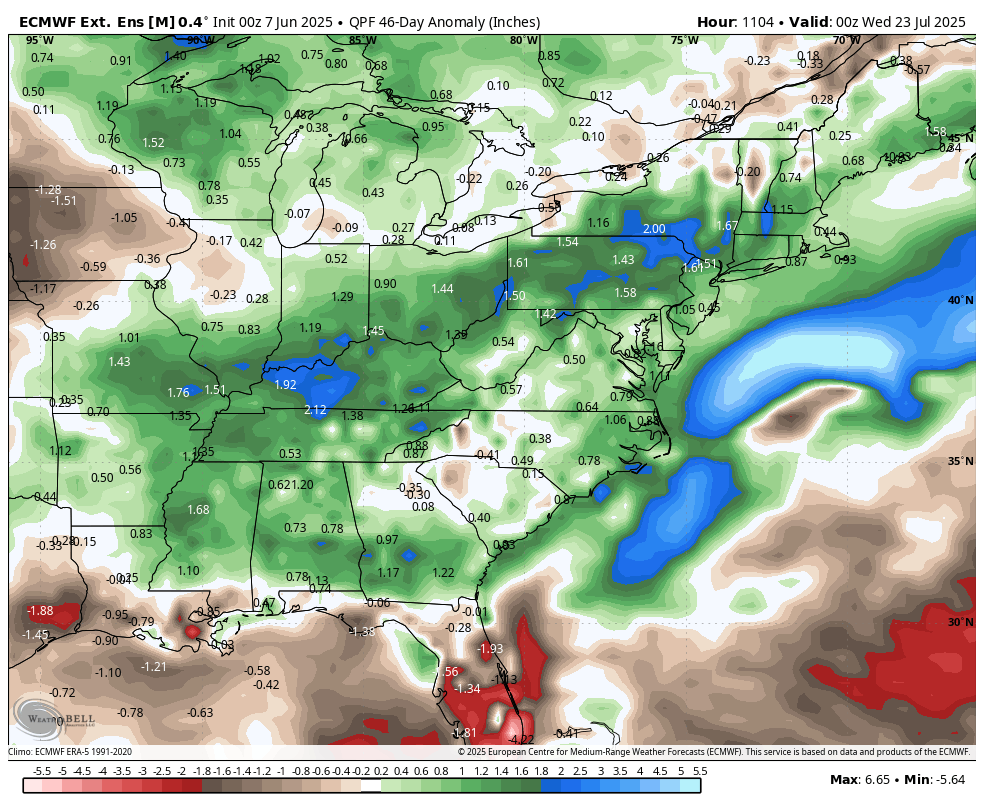
WB latest EPS extended through July 22: no extreme heat; average to slightly above precipitation.


-
I got only 0.12" here today. The early afternoon rain was moderate for a little while.
-
Nice dry evening outside, enjoy it
- Today
-
Highs: EWR: 82 New Brnswck: 81 PHL: 81 TEB: 81 LGA: 79 TTN: 78 BLM: 78 ACY: 78 ISP: 77 NYC: 76 JFK: 75
-
1.11” in Syosset & .42 in Muttontown. Looks like just E of Syosset totals go up to close to 2” by Dix Hills.
-
Glad it was shit day everywhere but in Billerica where the Fed Ex truck read 88 on rt 129.
-
Very hazy this evening from the fires I presume.
-
That was 2 summers ago but there’s new fires breaking out daily up there I read . This will last much of summer depending on wind flow
-
smoke adds a nice hazy summer vibe/tone to the sky, we take.
-
Look at visible . It’s loaded for bear tomorrow
-
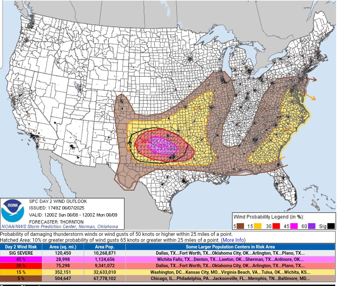
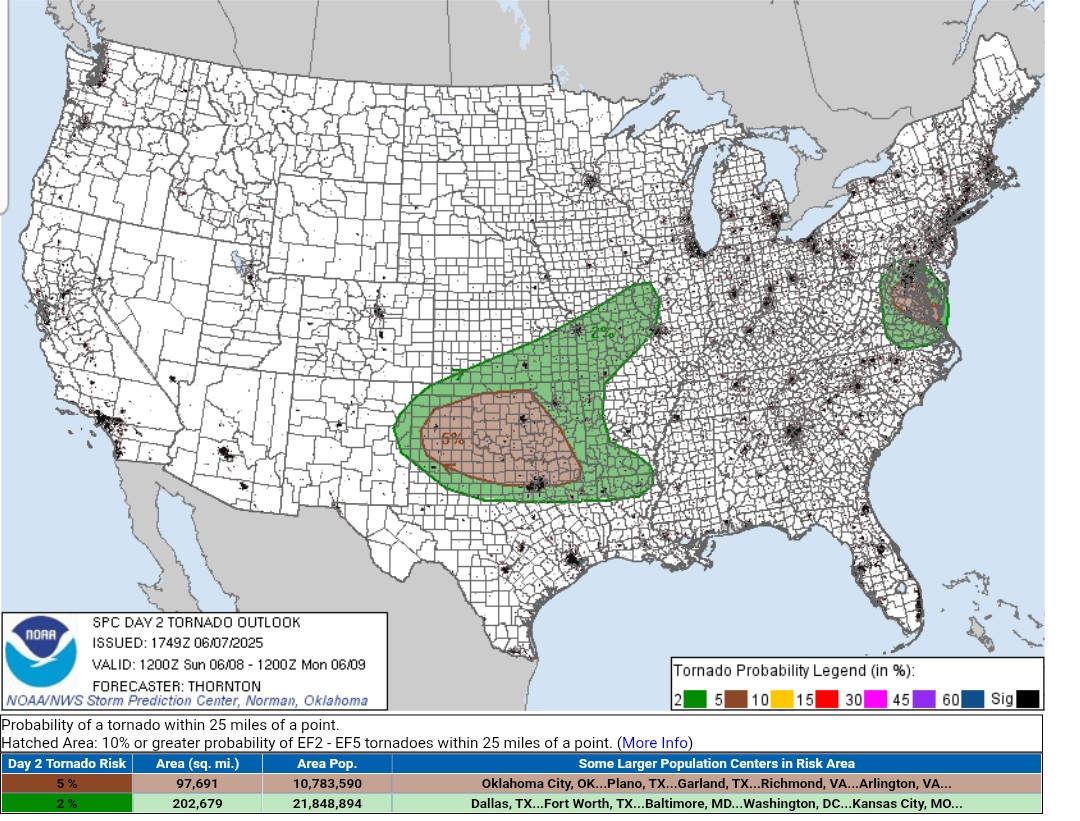
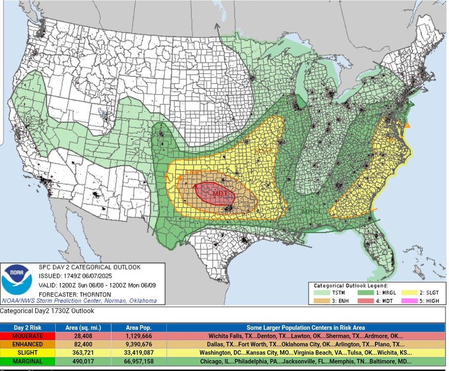
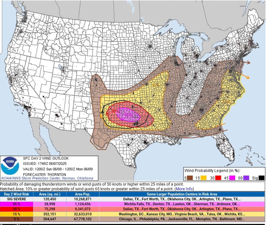
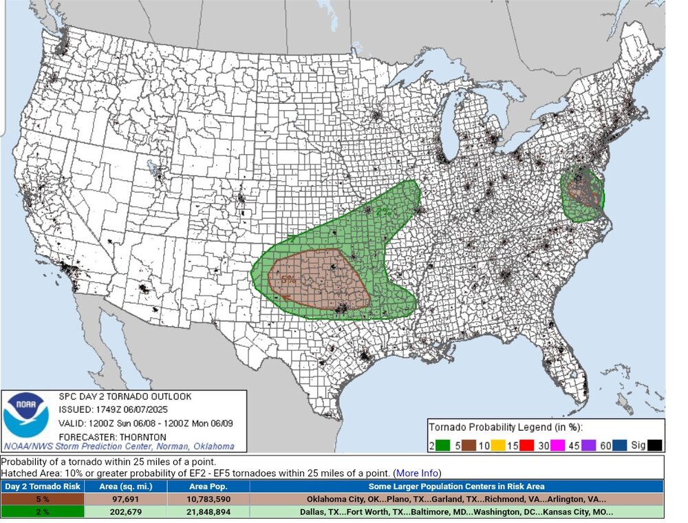
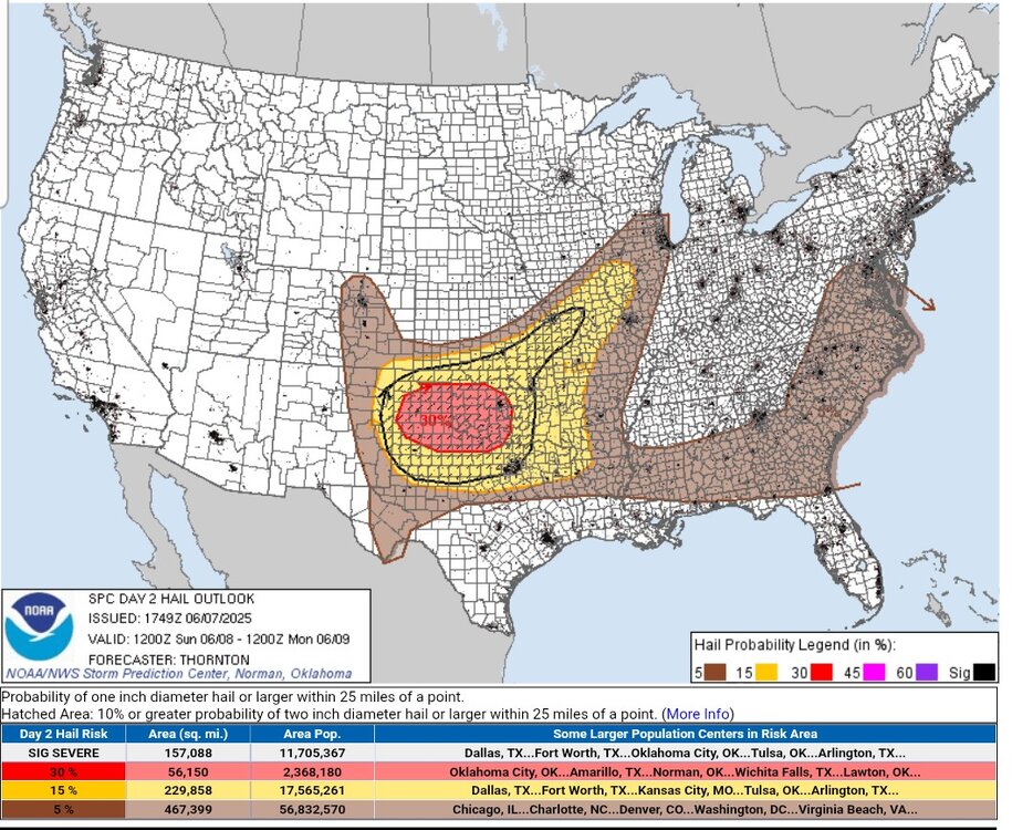
A pretty broad moderate risk area has been issued for North Texas and Southern Oklahoma, including at least a portion of DFW. Main threat seems to be damaging straight line winds, wirh pretty strong wording in the SPC outlook of 80-100 MPH winds. Shear values in/of themselves aren't the most impressive (although still sufficient), but with the NW flow advecting in drier air aloft and strong surface heating expected, downburst potential is unusually high (especially once a cold pool gets established). Very large hail will be a secondary threat with any supercells early on with the steep mid-level lapse rates
-
The smoke today was real bad here. MVL ASOS didn’t get a vis above 5-6sm all day long. Sure, it’s not as bad as that episode of 1-3sm we all had last summer (or two summers ago?)… but it was an extremely noticeable haze all day obscuring the mountains.
-
atleast we might pull off a good sunset tomorrow.. I really hope that crap stays away this Summer though..
-
You're in a bad way.
-
That’ll happen tonight here . And then not burn off until 11 tomorrow only to reveal smoke
-
In all fairness though that's summer in Vermont.
-
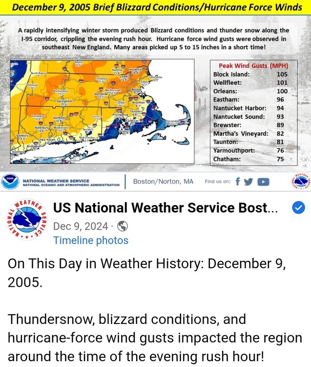
Last post got me to thinking, how long have we been at this? At least 20 years. 2006 was the only time I ever met Kevin and Tip. It was in Brookline at a national weather service conference on the 2005 thunder snow. I remember having to leave early to go to one of my daughter's games. I actually shared a computer with Kevin and no punches were exchanged. Time passes quickly...
-
The rain appears to have missed the Bronx entirely, as the Yankee v Boston game continued with no signs of rain. I am hoping we break out of this pattern of rain on the weekends, especially during daylight hours, so I can take advantage of the pool in my community development. Plus warm sunny days will help heat up the pool, as it is not heated.
-

E PA/NJ/DE Summer 2025 Obs/Discussion
RedSky replied to Hurricane Agnes's topic in Philadelphia Region
How did the Phillies go from the 2nd best record to possibly the worst looking club in baseball in two weeks I doubt they could beat a boomer softball team now