All Activity
- Past hour
-

“Cory’s in NYC! Let’s HECS!” Feb. 22-24 Disco
RUNNAWAYICEBERG replied to TheSnowman's topic in New England
It’s not unless it shows a complete massacre, then it is. -
BroadWing3544 changed their profile photo
-
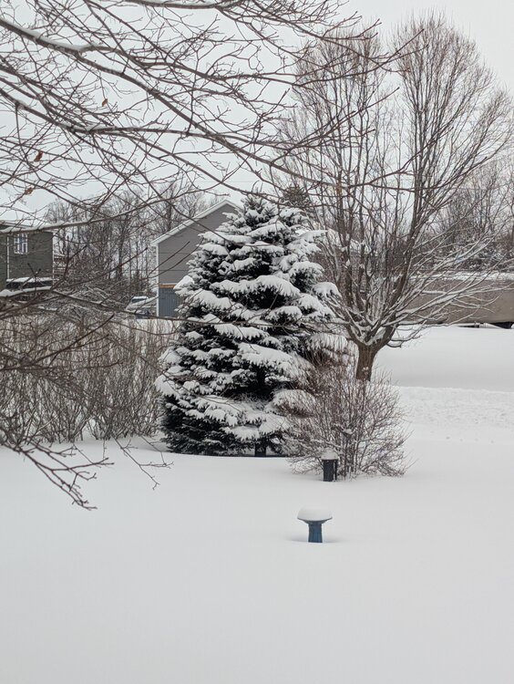
Eyeballing 3 - 4 inches here in Brattleboro, enough to cover dirty snow and S-facing bare spots.
-
-
i knew it was either one of those...lol
-

“Cory’s in NYC! Let’s HECS!” Feb. 22-24 Disco
HoarfrostHubb replied to TheSnowman's topic in New England
Nope. But fun -
NsWx516 changed their profile photo
-
It's getting closer to us... maybe the east ticks were making it act more like a kicker? If we get it to phase then I'll believe in this storm again.
-
Pretty much. It's exit 98. I used to live in Toms River, NJ (moved this year) and hated how it didn't snow there for the past 3 to 5 years except once. Wish I could go there one more time as it much jackpot for this storm.
-
2/22-23 "There's no way..." Storm Part 2
MN Transplant replied to Maestrobjwa's topic in Mid Atlantic
On one level, this is a mess of a forecast because the models are all over the place. On another, this is really just a straightforward event where we lean on climo. It isn't going to accumulate during the day in the metro areas and while the precip blossoms again with the low cranking, the broader shield isn't going to be particularly heavy. 2-4" should cover it for most of us, with less in the unfortunate areas on the tarmac at DCA, and more in the hills. -
Central PA Winter 25/26 Discussion and Obs
paweather5 replied to MAG5035's topic in Upstate New York/Pennsylvania
HRRR looks west again -
That's a 1 not an I. I think intensity is light enough for the NYC metro that not much accumulates until mid afternoon. There's not much forcing away from the sfc low until all the energy gets into the trof and it detonates.
-
GFS warmest at 15z (10:00 Sunday morning) lowest (29) at 12z Mon / 7AM
-
98. 100 is SR-33
-
“Cory’s in NYC! Let’s HECS!” Feb. 22-24 Disco
Bostonseminole replied to TheSnowman's topic in New England
I need a reminder, the 48hr HRRR not very accurate? . -
Lol. Picked up 5 weeks worth of bombs yesterday in my backyard 2 grocery store bags worth.
-
It wastes .3 of nighttime qpf due to a surface torch
-

“Cory’s in NYC! Let’s HECS!” Feb. 22-24 Disco
RUNNAWAYICEBERG replied to TheSnowman's topic in New England
Ray vs DT -
2/22-23 "There's no way..." Storm Part 2
DDweatherman replied to Maestrobjwa's topic in Mid Atlantic
I’ve been watching that, it’s a wildcard as it’s been close on a few runs. no bullshit my phone just autocorrected when I typed east to WEST. #itshappening -

“Cory’s in NYC! Let’s HECS!” Feb. 22-24 Disco
HoarfrostHubb replied to TheSnowman's topic in New England
Go big or go home. he explains it well in the blog. If it comes to fruition or not his reasoning was very good -
yes in southern Monmouth County - know it well lived in Northern Ocean and traveled to work in Farmingdale NJ for years
-
Trailing wave is very intriguing to me. Dives way in compared to 06z. That would be a pretty aggressive change, unfortunately hard to trust the HRRR with that given it is coming in from its boundaries. But would love it if somehow that wasn’t a meso hallucination.
-
Also to note while we get this snow and cold blast all the indicies are in the wrong place. NAO positive, AO positive, and PNA negative... Just means when it flips next month we are in for it.
-
Correct!
-
Are models in agreement on start time? I thought the 0z nam was aggressive in getting snow going tomorrow morning. Have modeld backed off on that
-
I felt a little bad for Ray last night when he put out 18-30” or something for S NH and then immediately after the next 2 models took a decent shift SE





.thumb.jpeg.f5c6ba9d911ec96b3b124f8606aee58e.jpeg)
