All Activity
- Past hour
-
 Buy Tadalafil 20mg: WeekendTabRx - cialis for sale
-
Order Viagra 50 mg online and order viagra Viagra Tablet price http://maps.google.st/url?q=http://sildenrxexpress.shop buy Viagra over the counter or http://www.1gmoli.com/home.php?mod=space&uid=1215048 Order Viagra 50 mg online [url=https://neopvc.com/proxy.php?link=https://sildenrxexpress.shop]best price for viagra 100mg[/url] Viagra online price and [url=http://lenhong.fr/user/hrqndgtxqu/]Cheapest Sildenafil online[/url] viagra canada
-
BWI down to at least 35.
-

2026-2027 Record-breaking El Nino
mitchnick replied to Stormchaserchuck1's topic in Weather Forecasting and Discussion
That's what I told Chuck in the MA forum a bit earlier. -
I was at Walmart around 12:30pm and some younger woman had a full-fledged winter coat on. I was like it's not that cold out yet.
-
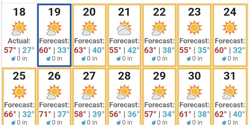
I'll take the weather underground's forecast.
-
It was 34 here just before midnight so it goes down on the 18th for me.
-
29°. Too early in the season.
- Today
-
A little warmer this am, only down to 32F so far
-
Not sure the SE as a whole sees much/any more rain through the end of the month. This weekends system was very welcome as it dropped generally at least 0.5” across most of the state. With the strong offshore low, temps have trended way down this week and a beautiful fall weather pattern looks to be locked in!
-
Hit 41.7 yesterday morning. Picked up 0.61” Saturday which brings MTD to 2.43”
-

2026-2027 Fall/Winter Mountain Thread
franklin NCwx replied to BlueRidgeFolklore's topic in Southeastern States
32 here. Heading out now. Will probably drop below freezing before the sun comes up -
Seeing a great forecast for the week, I went down to work Saturday noon to wash our truck. Much to my chagrin, the camera guy was there installing new cameras in all the trucks, so I couldn't do it. A waste of time and expensive gas, but the real irritation is that we now have driver facing cameras to deal with. Before, we just had outward facing ones. I (along with everyone else) am not happy with it. We'll see how it works out.
-
https://sildenrxexpress.shop/# Generic Viagra online
-
Cialis without a doctor prescription [url=https://weekendtabrx.shop/#]Weekend Tab Rx[/url] cialis for sale
-
Tadalafil Tablet: Tadalafil price - Buy Tadalafil 10mg
-
Generic Tadalafil 20mg price [url=https://weekendtabrx.com/#]Generic Cialis without a doctor prescription[/url] cialis for sale
-
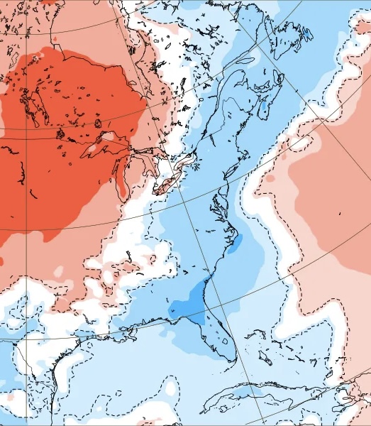
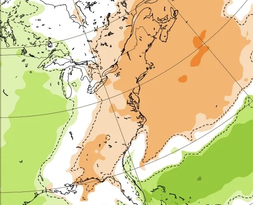
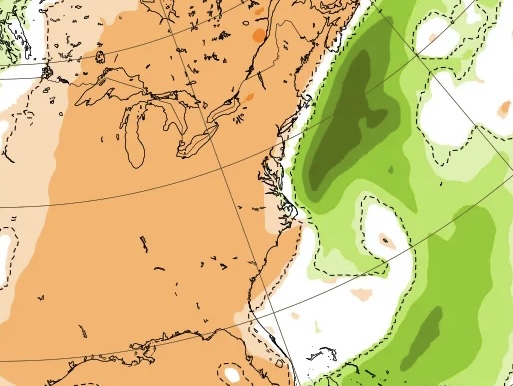
^Further to the above: illustrates the E US cooling power of the offshore storm this week!
-

2026-2027 Record-breaking El Nino
GaWx replied to Stormchaserchuck1's topic in Weather Forecasting and Discussion
1. Temps: Euro Weeklies 10/12 run for 10/19-25: warm E US because there was no offshore storm on model yet 10/18 run for 10/19-25 is much cooler E due to strong offshore storm: thank you storm! ——————- 2. Precip for 10/19-25: 10/12 run: no offshore storm 10/18 run: strong offshore storm keeping it cool in E US!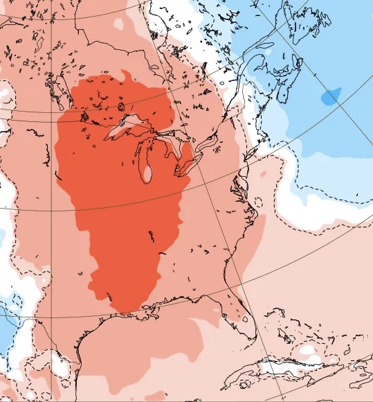
-

2026-2027 Fall/Winter Mountain Thread
Met1985 replied to BlueRidgeFolklore's topic in Southeastern States
Down to 36 degrees. -
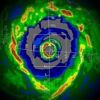
To be clear, our coastal a few weeks ago never became subtropical, but I do find this pretty funny. Tropical Weather Outlook NWS National Hurricane Center Miami FL 800 PM EDT Sun Oct 18 2026 For the North Atlantic...Caribbean Sea and the Gulf of America: Off the East Coast of the United States: A storm-force non-tropical low pressure area is developing along a frontal boundary tonight off the southeast coast of the United States. This low is likely to move slowly and erratically over the next couple of days while it initially remains non-tropical. Later this week, if the system stays over the Gulf Stream, environmental conditions could become more conducive for the low to develop some subtropical characteristics. A subtropical cyclone could form over the second half of this week as the system begins moving generally northeastward, offshore of the eastern United States. Regardless of development, this system will cause high winds, coastal flooding, and dangerous surf along portions of the U.S. East Coast. Please consult statements and warnings from local National Weather Service offices and the Weather Prediction Center for more information, along with High Seas Forecasts and Storm Warnings issued by the National Weather Service. * Formation chance through 48 hours...low...near 0 percent. * Formation chance through 7 days...medium...40 percent. && High Seas Forecasts issued by the National Weather Service can be found under AWIPS header NFDHSFAT1, WMO header FZNT01 KWBC, and online at ocean.weather.gov/shtml/NFDHSFAT1.php $$ Forecaster Papin
-
Fall 2026 Medium/Long Range Pattern Thread
Windspeed replied to John1122's topic in Tennessee Valley
The past few days have been glorious. -
low of 40.3F here this morning - 45F now at midnight. Seeing some upper 30s nearby.
-
https://vigorshieldrx.shop/# erectile dysfunction meds online