All Activity
- Past hour
-

2026-2027 Record-breaking El Nino
GaWx replied to Stormchaserchuck1's topic in Weather Forecasting and Discussion
2011 was moderate La Niña while 2000 was weak La Niña. Also, both were coming off of a prior year’s Niña. -

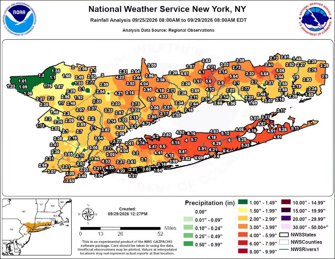
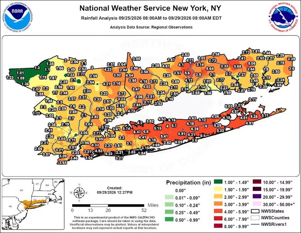
Strong Nor'Easter/Hybrid Storm Late September 2026
Stormlover74 replied to Rjay's topic in New York City Metro
-
First wide spread multi-regional frost/freeze potential 6th-7th?
-
I would not expect that this year....1997 was low, ascending solar with a strong easterly QBO...very odd timing for a super-El Nino. This year fits the bill with W QBO and descending solar. Good luck with early blocking. 1997 is a very poor polar analog...our chances will come later this year.
-

2026-2027 Record-breaking El Nino
40/70 Benchmark replied to Stormchaserchuck1's topic in Weather Forecasting and Discussion
2004 was a weak El Nino...any other warm ENSO years on that list? -
Meh. It's just sitting and spinning and hasn't moved out so we're not 'behind' it yet.
-
Its mainly cloudy..another bust
-
Sprinkles
-
Been having some color here by me for 2 weeks now. Mainly younger trees.
-
yep - sure we haven't had as many extremes as the middle of the country (although early July was pretty insane here), it's just... warm. Yeah, we have below normal periods still (and hopefully one happens in tandem with a coastal storm later in the season!). But the warmth is mostly unabated.
-
light rain
-
 cheap viagra and Generic Viagra online cheapest viagra https://www.dramonline.org/redirect?url=http://sildendirect.shop sildenafil onlineand http://sotoycasal.com/user/elfywduqaj/ Buy generic 100mg Viagra online [url=https://cse.google.com.nf/url?q=https://sildendirect.shop]Buy generic 100mg Viagra online[/url] Viagra online priceor [url=http://bbs.51pinzhi.cn/home.php?mod=space&uid=8395935]viagra canada[/url] generic sildenafil
 -
Recent Josh update on Polo on a farm he was staying at on Baja: includes a nice video of the peak as well as aftermath, which shows that people/farm animals weren’t injured despite significant damage to the farm. The main house he was staying in handled it well though:
-

October Comes Early: Late September Multi-Hazard Hybrid Storm
Baroclinic Zone replied to WxWatcher007's topic in New England
Off and on drizzle all AM -
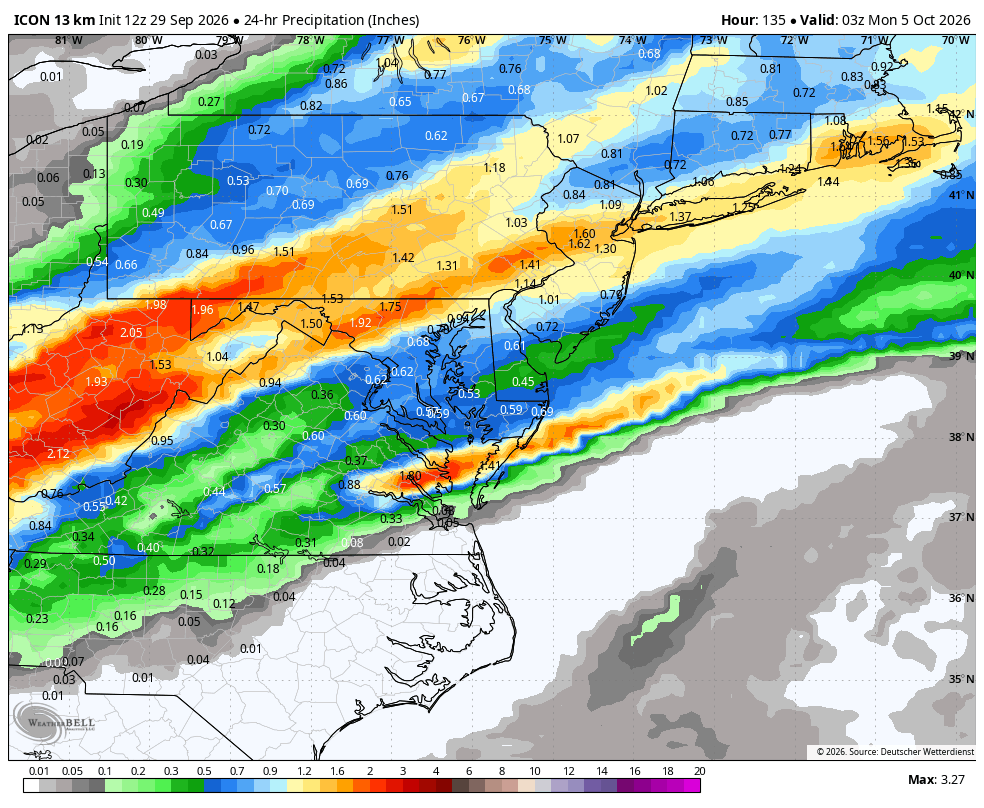
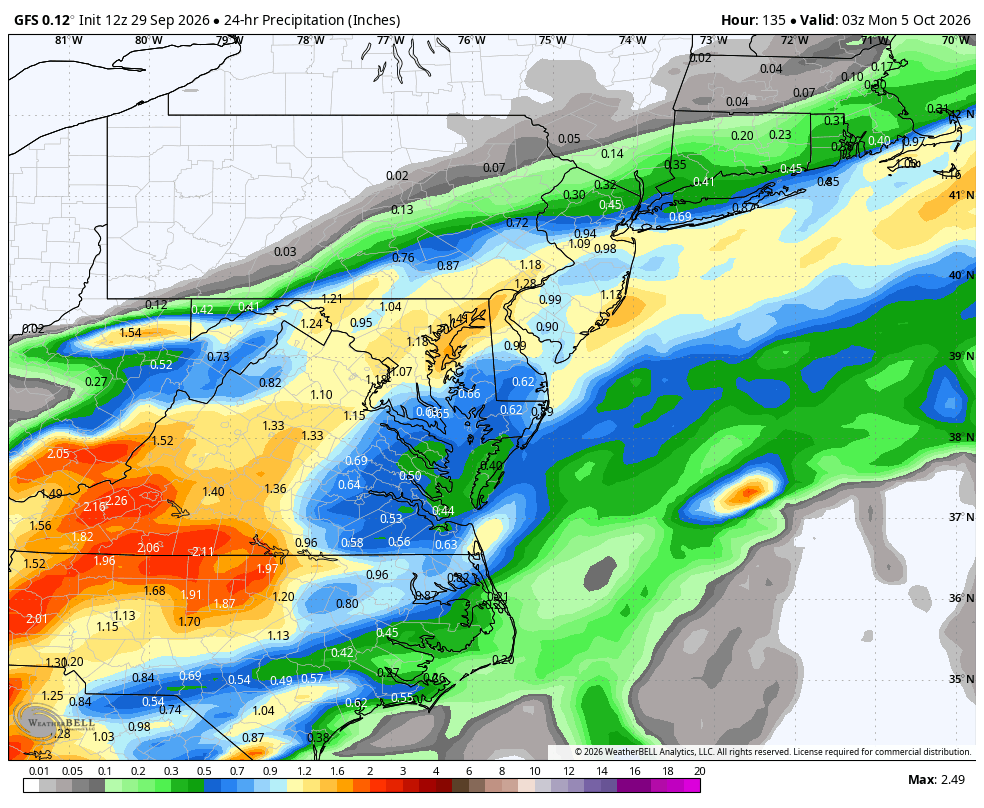
WB 12Z models for Sunday.
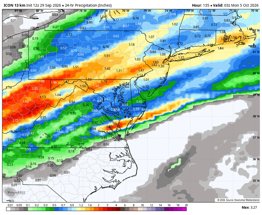
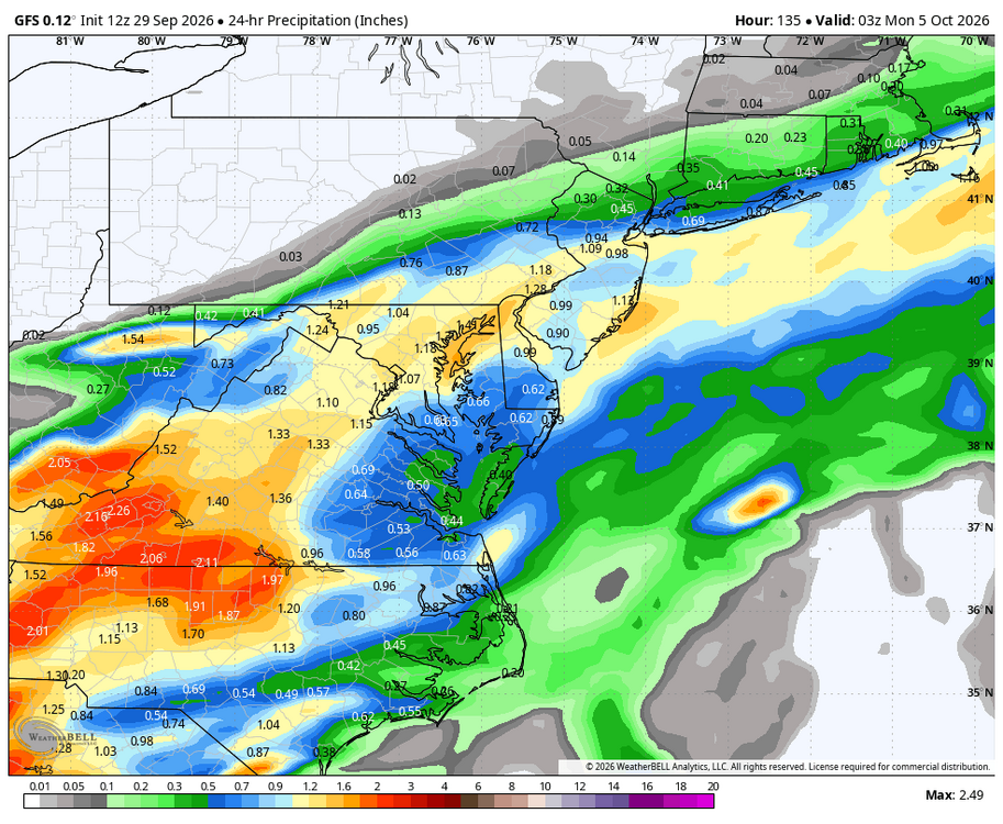
-
Sun was forecasted, but as usual a busted forecast. Has happened all year.
-
ed medicines online: ApexMenMeds - cheapest online ed meds
-

October Comes Early: Late September Multi-Hazard Hybrid Storm
Typhoon Tip replied to WxWatcher007's topic in New England
the problem with orchestrating life behaviors around traditional points of views and perspectives/belief systems is when objective evidence, and math, prove that the old traditional methods are harmful - yet, they remain unwavering. -
Which was a record Nino…signs of things to come. Bad things.
-
office normies loving the early fall weather
- Today
-
I actually saw the sun for 30 minutes before the clouds moved back in
-

October Comes Early: Late September Multi-Hazard Hybrid Storm
Great Snow 1717 replied to WxWatcher007's topic in New England
Perhaps that is why he enjoyed a September torch?? -
2026-2027 Record-breaking El Nino
GaWx replied to Stormchaserchuck1's topic in Weather Forecasting and Discussion
After having finally gotten back to slightly AN since late Aug (that was 1st time since way back in early May), note the recent drop and how cold it was yesterday N of 80N: 2026 having it this cold N of 80N on Sep 28th is per this site technically the coldest this early in the season in 30 years, quite notable! I say “technically” though because it only barely beat 2011, 2004, and 2000. Regardless, the most interesting comparison is to 2012-25, which were all much warmer/AN on Sep 28th: 1958-2002 mean: -11C 26: -13C 25: -7C 24: -9C 23: -8C 22: -7C 21: -8C 20: -5C 19: -5C 18: -5C 17: -8C 16: -7C 15: -8C 14: -7C 13: -9C 12: -9C 2012-25 mean: -7C So, regarding Sep 28th, 2026 is: 1. 4-8C colder than every year since 2012 2. 6C colder than the mean of 2012-2025 Yes, I’m mainly only talking in this post about a point in time and 80N+ is a small area in relation to the N hemisphere (only 1.5%). But it is a very important 1.5% due to Arctic ice. Also, that area is just coming off the coldest late May-early Aug back to 1958 by a good margin, implying the possibility that this overall cooling up there will have legs. I’ll keep following this to see if there’s cooling trend follow-through up there going ahead as this is quite interesting, especially due to its implications on Arctic ice since GW had lead to the greatest warming by a good margin in the Arctic. Is it possible that the massive warming up there is done at least for awhile? Could there be a new cycle that’s just started? @Stormchaserchuck1@bluewave@Wild Weather Monger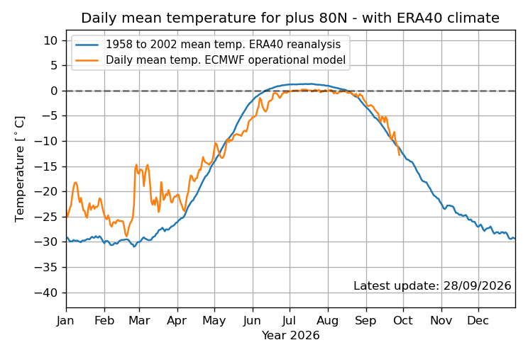
-
Since Thursday is October I'll just put this here Might take a bit to climb on Thursday but we'll definitely see lower 80's within the region. Some of the typical torch spots would have a shot for mid 80's but the warmest llvl temps may get in a bit too late. We probably see a big regional temp spike though between 2-4 PM
-
storm is still being blocked from moving fast enough away from us because of the strong blocking the last few days so it is weakening and spinning itself out more or less - beginning to wonder if the clouds will still be lingering tomorrow especially in the northern and eastern areas of the region - this satellite image is not encouraging - this will have an effect on high temps