All Activity
- Past hour
-
Don't shoot the messenger. The best thing about those who are Mets, you can be 100% wrong just about all the time. Still keep your job.
-

Wednesday Feb 18 Mixed event. NoP refresher?
NoCORH4L replied to HoarfrostHubb's topic in New England
Man, so many weird systems this season. Including this one. Can't pin anything down until it's basically snowing (or not). -
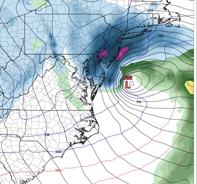
Also, the latitude delta between the primary and coastal is pretty funny. One center in Pittsburgh, the other on OBX. I feel like one of those is gonna move towards the other.
-

Late February/Early March 2026 Mid-Long Range
winter_warlock replied to WxUSAF's topic in Mid Atlantic
Amen brother!! -

E PA/NJ/DE Winter 2025-26 Obs/Discussion
Newman replied to LVblizzard's topic in Philadelphia Region
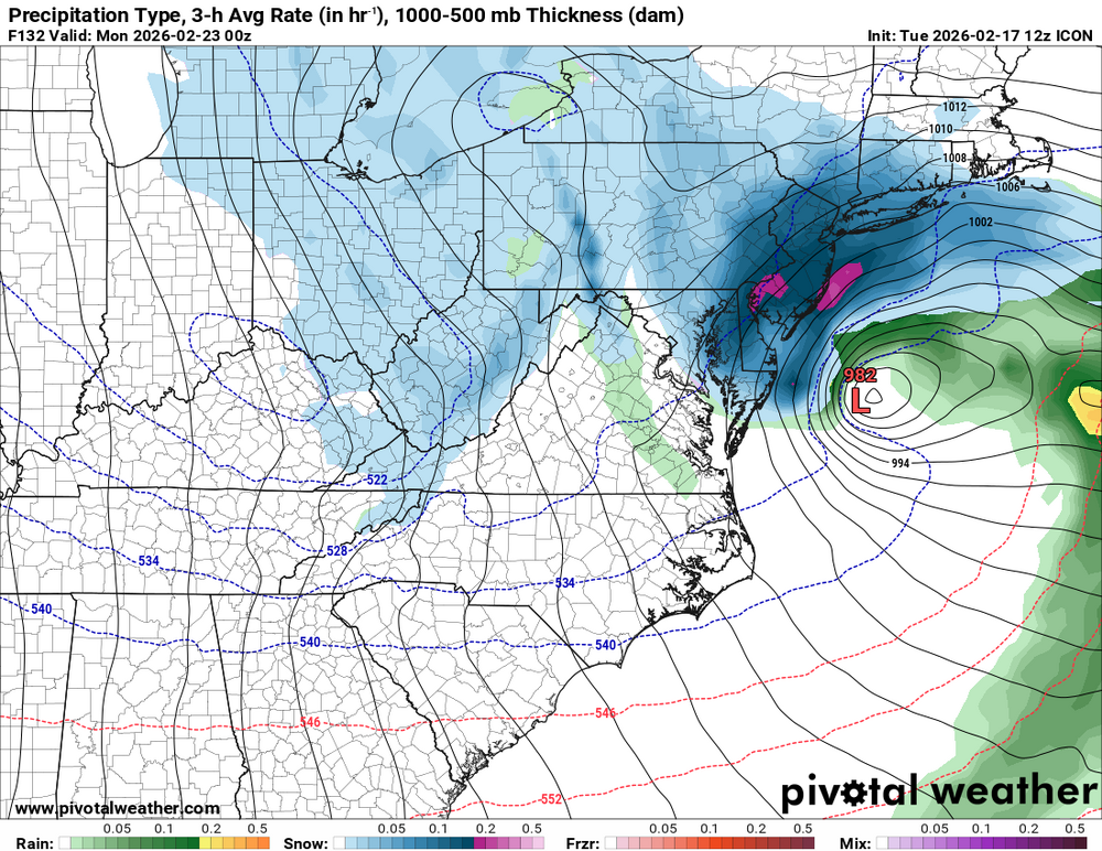
ICON starts us off great at 12z, 18-24" from Philly to NYC -
Whenever we play that game--especially in a Nina--we lose. And if other guidance starts showing later as well then then it's in trouble. I'd be kinda stoked if I were NJ or NY though
-

“Cory’s in NYC! Let’s HECS!” Feb. 22-24 Disco
ineedsnow replied to TheSnowman's topic in New England
-
Yes, but it has trouble getting its crap together before then (plus it's even weaker)
-
“Cory’s in NYC! Let’s HECS!” Feb. 22-24 Disco
ineedsnow replied to TheSnowman's topic in New England
ICON a moderate hit.. would like to see this 75 miles north or so.. but a ways out -
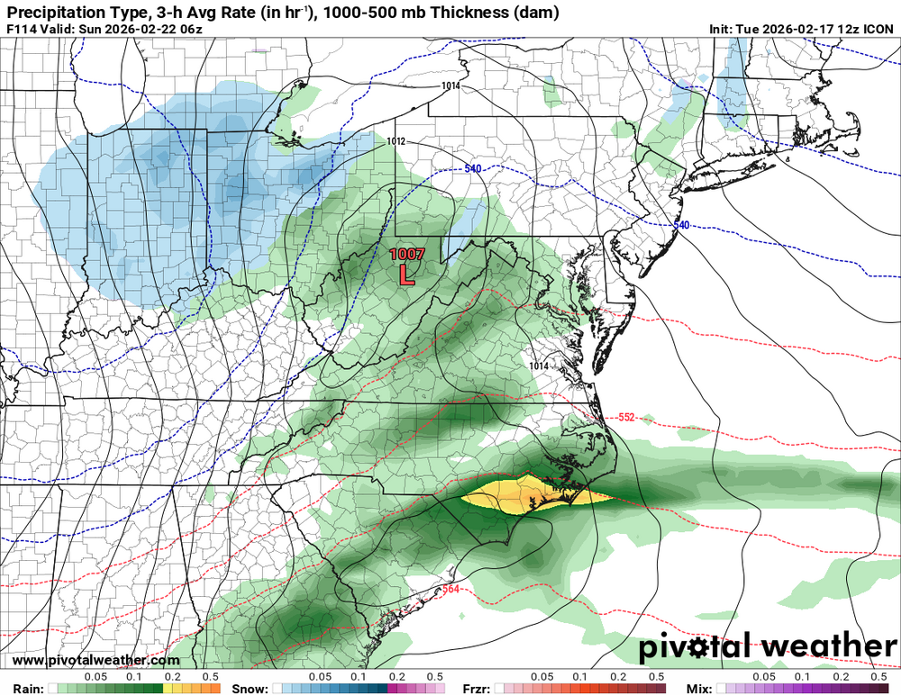
Just need that transfer to be earlier. If the primary makes it to northern WV we are not going to see the CCB in all likelihood. Shift the evolution west/earlier and we’re good.
-
Though I have not looked at it, your description is similar to the 6z GFS.
-
Maybe George Washington can fight back!
-

Central PA Winter 25/26 Discussion and Obs
Mount Joy Snowman replied to MAG5035's topic in Upstate New York/Pennsylvania
Today marks exactly one month that I've maintained a snowpack. Love it. Also, 12z off to a great start as ICON holds for Sunday storm. -
Bring this southwest about 100 miles and call it a winter
-
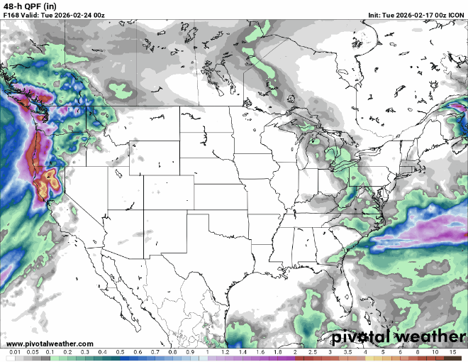
So far, we're running behind Feb 2024 (our driest Feb of 27) for QPF. Have not had a truly powerful storm this cold season here - closest probably the southeast rainer on Dec 19. One could dispute my comment, citing 19.6" on Jan 25-27, but that was a product of freaky high ratios. LE of 0.77" and 10 mph breezes don't spell powerful to me. (That said, the 6 hours of floating feathers 7A-1P on Jan 26 is the prettiest spell of snowfall I can remember. That 6" addition was 98.5% air, far beyond any air/water ratio for a snowfall greater than one inch.)
-
12z icon is now on board and in line with other guidance.
-
New Jersey gets annihilated by the germans
-

Winter cancelled/uncancelled banter 25/26
Stormlover74 replied to Rjay's topic in New York City Metro
Don't you people know reverse psychology -
@psuhoffman made so much sense when he posted last night I believe. Predicting rain/ or "no snow" isn't rocket science. There are multiple different ways that can happen, so just because it doesn't snow doesn't make a person's call right. Especially in this environment good snow is hard to come by anyway. I don't think it's a stretch at this point to say more than half the people on this thread (ant least) are going to see snow Sunday/Monday. How much, and how quickly it changes to snow or mixes etc., we won't really know until Friday at the earliest.
-
Icon!
-

Late February/Early March 2026 Mid-Long Range
Weather Will replied to WxUSAF's topic in Mid Atlantic
ICON is at least in the same world as the others currently on board for a bigger hit west of Bay. -
Sorry
-
South Bend missed its daily record high of 60 by one degree on Monday. 59’d.
-
We can work with this
-
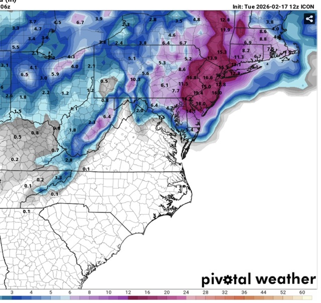
Costal hammer this run. It’s a step in right direction