All Activity
- Past hour
-

Augdewst 2026: Summer's Last Stand
weatherwiz replied to Prismshine Productions's topic in New England
72 dbz to 14k from Albany radar. Must be dropping at least 1.5" hail. -
I’ll be on Big Island till Monday… yikes
-

Augdewst 2026: Summer's Last Stand
ineedsnow replied to Prismshine Productions's topic in New England
Warned now -
 farmacia mexicana online or mexico prescriptions can i buy meds from mexico online http://www.110school.ru/bitrix/rk.php?goto=http://mexisaferx.shop/ mexico farmaciaor http://www.freeworld.imotor.com/space.php?uid=216401 farmacia mexicana en linea [url=https://images.google.tk/url?q=https://mexisaferx.shop]pharmacy in mexico city[/url] mexico online pharmacyand [url=https://www.liveviolet.net/user/fhnyxumeex/videos]mexican pharmacy near me[/url] mexican mail order pharmacy
 -

Augdewst 2026: Summer's Last Stand
Lava Rock replied to Prismshine Productions's topic in New England
all the good ones go south of us and over the lake -
Augdewst 2026: Summer's Last Stand
ineedsnow replied to Prismshine Productions's topic in New England
that storm west of Rutland VT looks like a beast -

Augdewst 2026: Summer's Last Stand
tunafish replied to Prismshine Productions's topic in New England
Let's get a waterspout on Sebago w/o GYX warning..thumb.png.4b14795d5da22e14ad5d4f02b5dc3875.png)
-
Augdewst 2026: Summer's Last Stand
ineedsnow replied to Prismshine Productions's topic in New England
beautiful rest of the week coming up!! This Afternoon Mostly sunny, with a high near 78. Northwest wind around 8 mph. Tonight Patchy fog after 2am. Otherwise, mostly clear, with a low around 54. West wind 3 to 5 mph. Friday Patchy fog before 7am. Otherwise, sunny, with a high near 76. Northwest wind 5 to 10 mph. Friday Night Mostly clear, with a low around 51. Calm wind. Saturday Sunny, with a high near 77. Calm wind becoming north around 5 mph in the afternoon. Saturday Night Mostly clear, with a low around 52. Calm wind. Sunday A chance of showers after 4pm. Mostly sunny, with a high near 76. Calm wind becoming southwest 5 to 7 mph in the afternoon. Chance of precipitation is 30%. Sunday Night Showers likely, mainly after 10pm. Mostly cloudy, with a low around 59. South wind around 7 mph. Chance of precipitation is 70%. Monday A chance of showers before 11am. Partly sunny, with a high near 77. Northwest wind 6 to 8 mph. Chance of precipitation is 40%. Monday Night Mostly clear, with a low around 55. Light northwest wind. Tuesday Sunny, with a high near 79. Calm wind becoming northwest around 5 mph in the afternoon. Tuesday Night Mostly clear, with a low around 56. Calm wind. Wednesday Sunny, with a high near 79. Calm wind becoming southwest 5 to 7 mph in the afternoon -

Occasional Thoughts on Climate Change
Typhoon Tip replied to donsutherland1's topic in Climate Change
Yeeeah... okay. There's a couple of facets here. I agree with you not to ignore "denialism" in the whole of western industrial society and the apparent recent cultural modalities (...largely a result of corruption) to do so. Of course. However, I was talking about certain repeating members of this forum - I have trouble believing their intent is born of mere 'innocence having been misled'. Because the logic has been explained in nothing short of 1+1=2 type certitude, yet won't penetrate? I doubt it - one can tell if one is coming from the blowhards chorus like those your implicating, vs you and I. We are clearly and logically by written material, decipherable as not being of the former ilk/bad social media informatica. Thus, these individuals are either not capable of the intelligentsia, or, they're immoral. As far as an implicit idea of a movement against disinformation? No problem. Unfortunately, it's also going to be a tall task. It's an untenable task. Risking a digression, it's why I think humanity is in its 10 hours. It's a metaphor borrowed from stellar evolution. A large star, perhaps 4+ times the mass of our sun, may burn in the hot end of the main sequence for many millions of years but because it's mass is so large, it's gravity is more intense, so the core temperature/rate of fusion are greatly accelerated. The core of the star starts to fuse iron ... game over. It takes more energy to fuse iron than the fusion of iron gives back to the star, and the core suddenly finds itself without enough thermal pressure to withstand the ... unimaginable power of gravitation crushing down. Core collapse takes place. As it does, it gets to the neutron density threshold and there is a god like bounce at the moment the core is determining a fate as a neutron star, or a stellar mass black hole. In either case, the out going energy of the bounce not claimed by core gravity well, surges through the star to the surface, a 10 hour time in which the sun shines with magnificence and glory ... just like it had for the many millions of years, no indication that anything has happened. Sound familiar.. ? keeping in mind, it's a metaphor. -
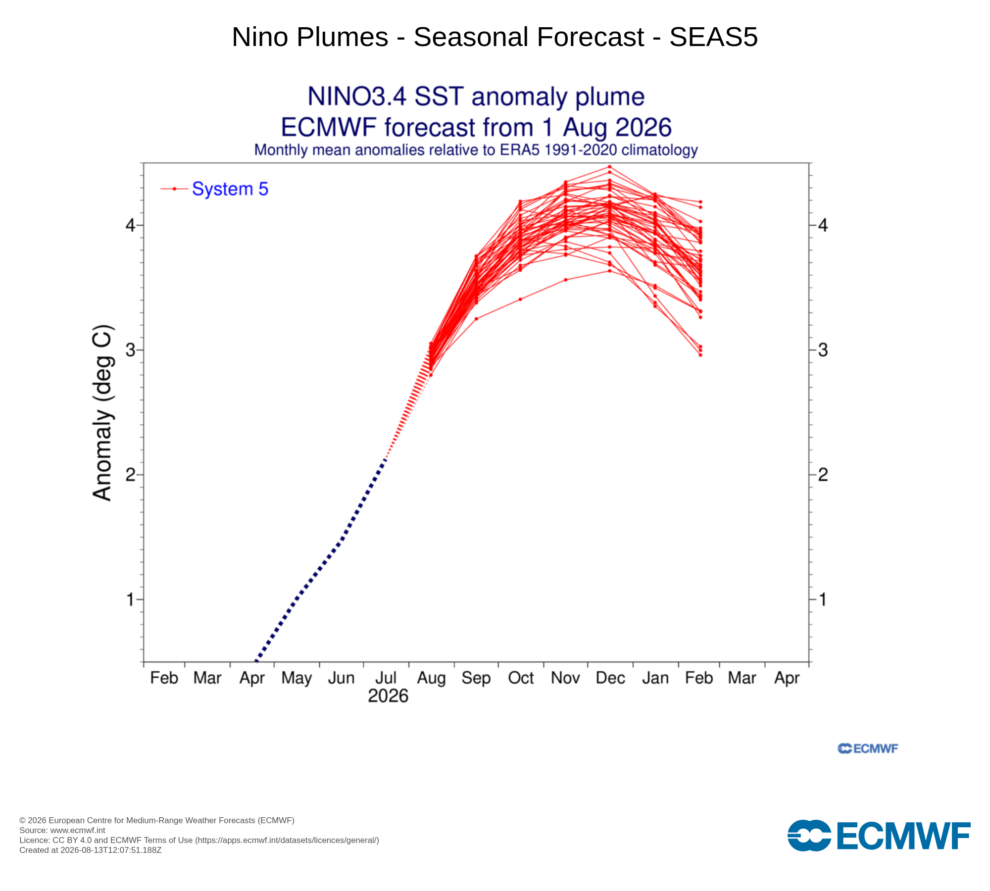
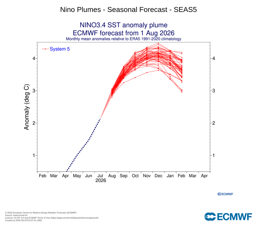
Super ninos in order from 65-66: Boom, bust, boom, bust, boom....I'm a bit concered we're due for bust again based on that random pattern
-
Odds probably favor AN temps/precip and BN snow, but the super nino list is still SSS. Of course we’re embarking on unchartered waters this go around.
-
I mean you can say 1.2" or 35" and have equal chances of being right or wrong, lol
-
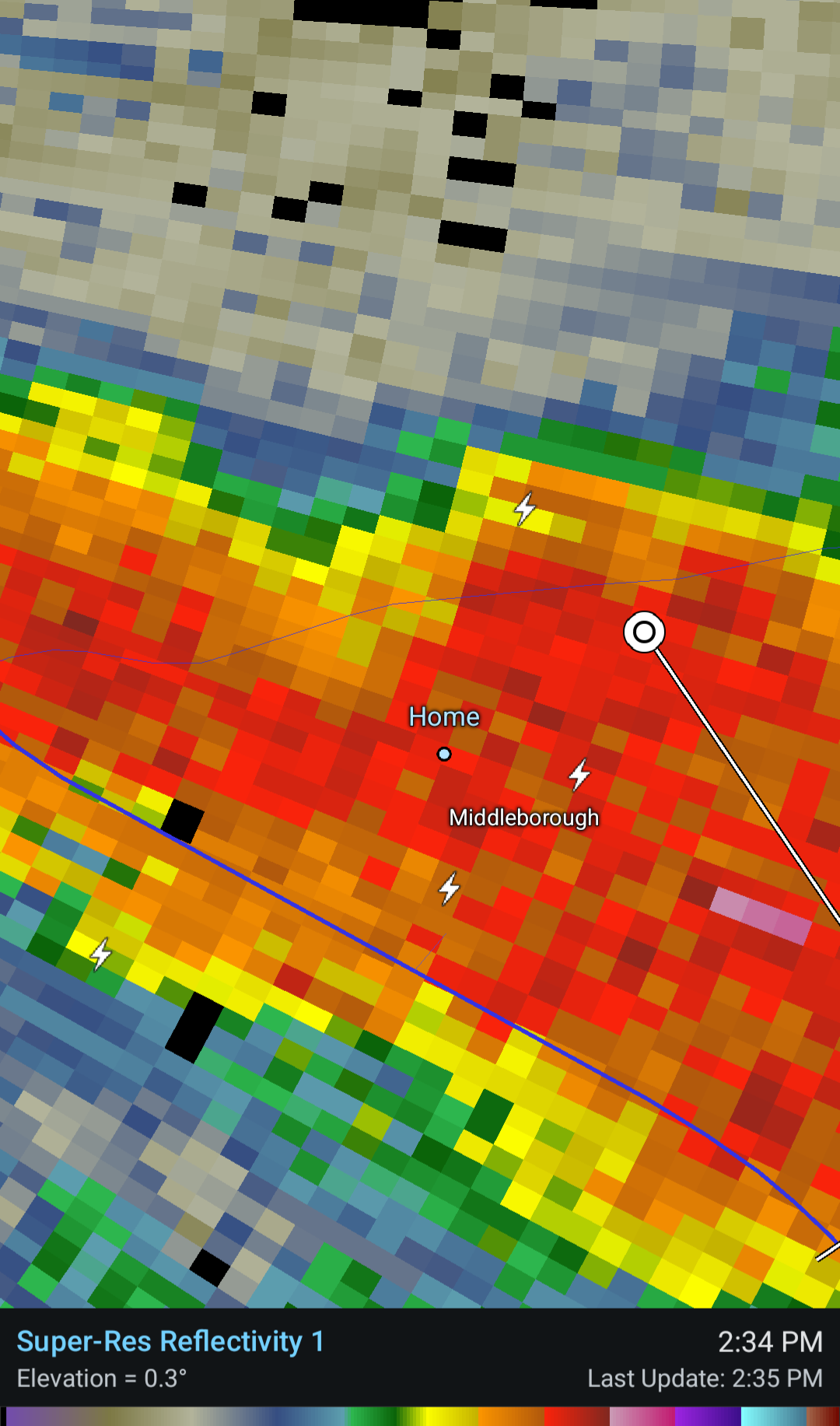
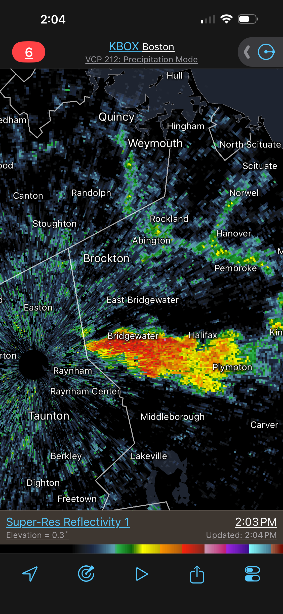
Getting some bigger hail now but still on the smaller side. Rain rate is impressive but little to any wind or lightning. Edit: Spoke too soon

-

2026 Atlantic Hurricane Season
cptcatz replied to Stormchaserchuck1's topic in Tropical Headquarters
I feel like this is the first August in many years where there are healthy waves coming off Africa without Saharan dust, and yet they can't do anything because of the crazy shear. If that shear wasn't there, this could have been an impressive August that we haven't seen in a while. Oh well. -
Getting some small hail and heavy rain now
-

Pittsburgh PA Summer 2026 Thread
colonel717 replied to TheClimateChanger's topic in Upstate New York/Pennsylvania
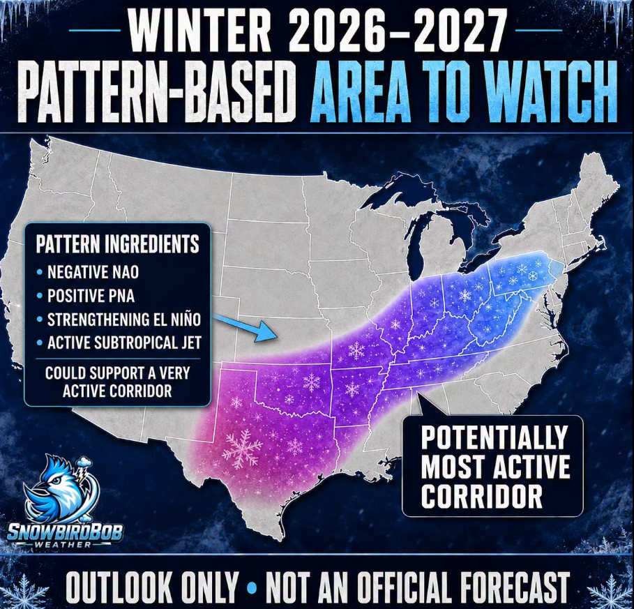
I'm not used to all of the snow positivity this far in advance for winter. Being set-up for the ole rug pull...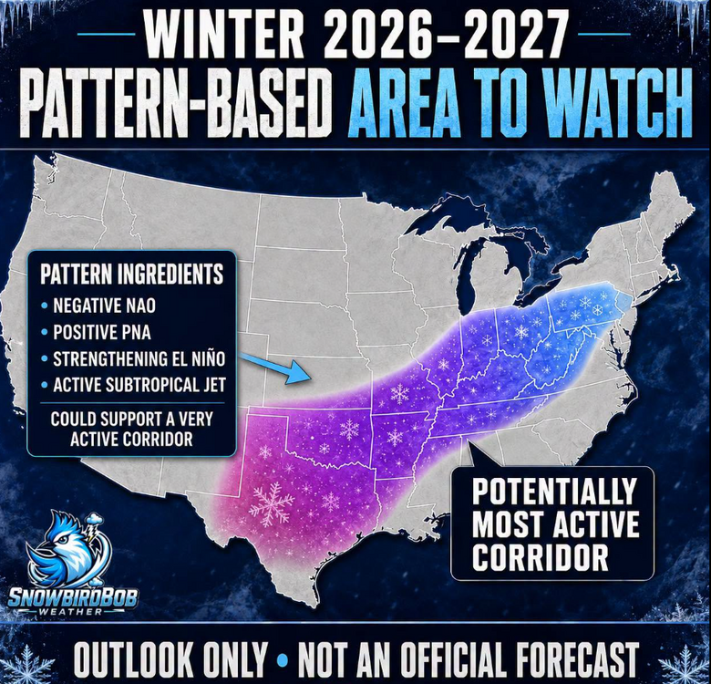
-

Augdewst 2026: Summer's Last Stand
dendrite replied to Prismshine Productions's topic in New England
Thankfully he is nice and safe behind the seabreeze.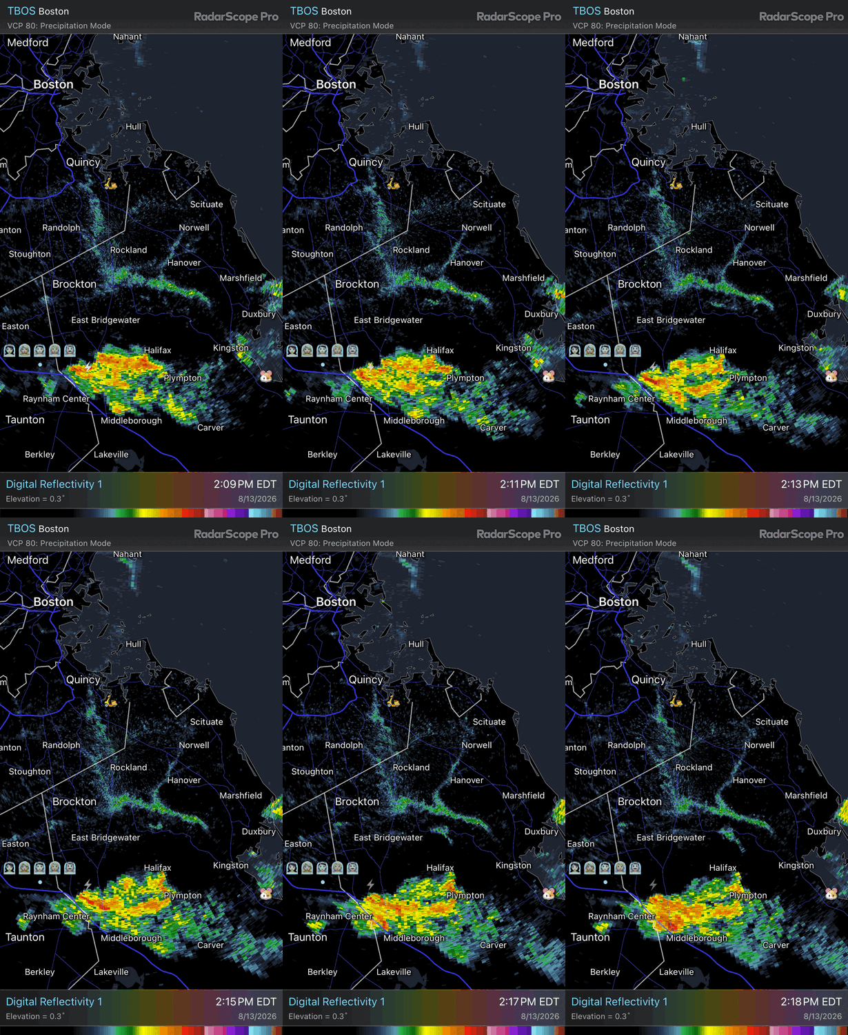
-
Isnt September a part of Summer?.Fall arrives the 3rd week of the month.
-
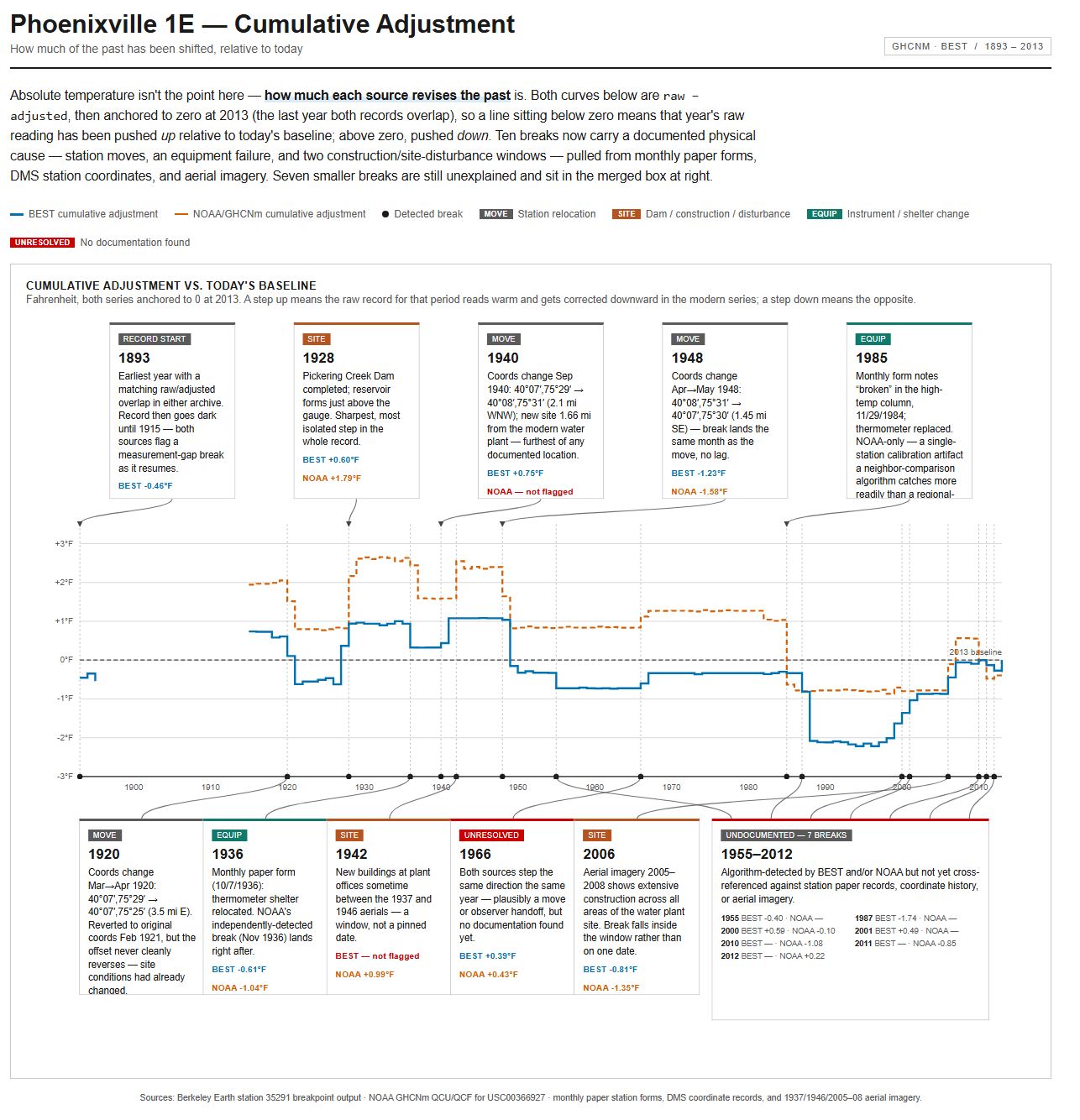
 The main question of this thread is whether the adjustments to raw data are a) valid and b) essential. The deep dive on Coatesville upthread answered these two questions for Coatesville with two resounding YESs for that station. Here is the breakpoint analysis for Phoenixville 1E. It also demonstrates that the adjustments done to the raw data are a) valid and b) absolutely necessary. Note that all of the aerials from 1927 forward show changes at the site--roughly every ten years between aerials--so there is going to be microsite changes. One has to wonder, for all of the time some folks have put into explaining why the adjustments are arbitrary, ad hoc, suspect, etc etc, why they did not just take two hours and look at the easily available documentation on line.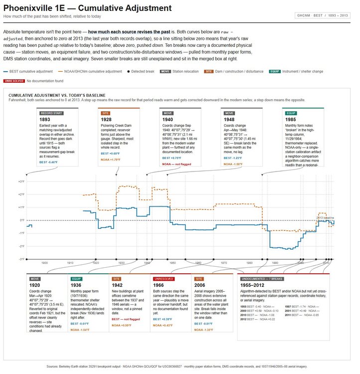
-

Augdewst 2026: Summer's Last Stand
vortex95 replied to Prismshine Productions's topic in New England
And North Haven had tstm wind damage 8/10! All happens and hail HVN (not Weymouth)! Preliminary Local Storm Report National Weather Service New York NY 845 PM EDT Tue Aug 11 2026 ..TIME... ...EVENT... ...CITY LOCATION... ...LAT.LON... ..DATE... ....MAG.... ..COUNTY LOCATION..ST.. ...SOURCE.... ..REMARKS.. 0619 PM Tstm Wnd Dmg 1 N North Haven 41.40N 72.85W 08/11/2026 New Haven CT Law Enforcement Tree down across Washington Avenue in North Haven. Time estimated by radar. -
This year’s contest is going to have an epic spread.
-
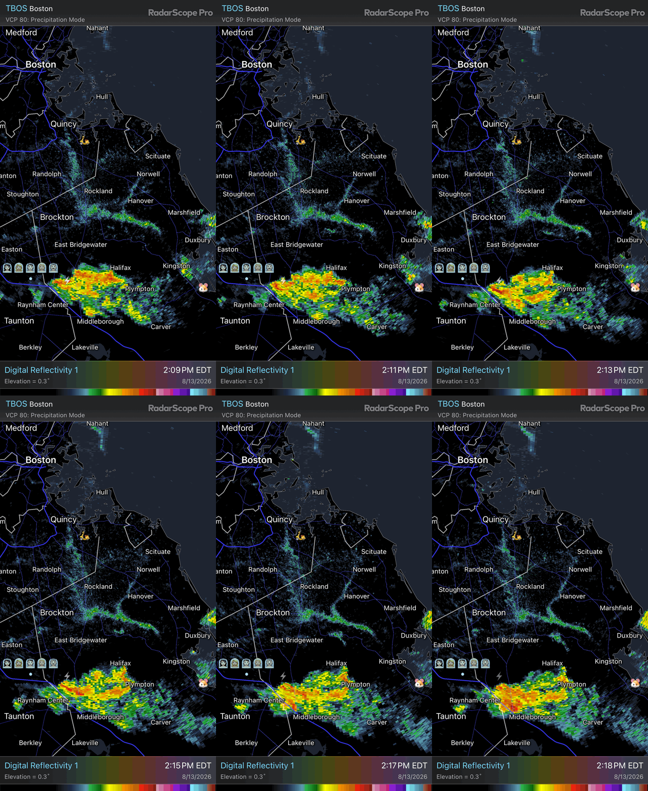
Always fun when you get the rare combination of downpours and thunder while still sunny out. Looks like we may get into that gell popping off around Bridgewater this way.
-
Augdewst 2026: Summer's Last Stand
vortex95 replied to Prismshine Productions's topic in New England
And @CoastalWx still misses the storms! Can he at least hear T to the S?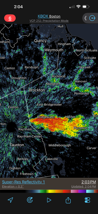
-

2026-2027 Record-breaking El Nino
mitchnick replied to Stormchaserchuck1's topic in Weather Forecasting and Discussion
PDO changes afoot?.png.d67624279b09c7fbdba22ff467c045c8.png)
-
Thanks for posting a recap! I'm glad you had good luck seeing some nice meteors out there in PA. Here it was a complete bust with cloudy skies all throughout the overnight hours. The peak was last night, but as you said there's another chance tonight. There's a pretty good 3 day window -- the night before and night after are usually 60 to 70% of the peak night, so still pretty good. Unfortunately we're expecting a good amount of clouds here tonight, but we'll see. If it's just partly cloudy I'll go out there tonight. It was pretty cloudy here the night of the 11th into the 12th too, so very bad luck during the 3 day period here. I know the Perseid is the most popular shower of the year because it's during the warm summer, but the Geminid shower in December is actually the best shower of the year -- slightly bigger than the Perseid shower. So I'll deal with being out there in cold weather if we have clear skies, especially after having such bad luck last night.


.png.4b11228acd903a96230130d889c1975f.png)