All Activity
- Past hour
-
CP? .
-

December 2025 regional war/obs/disco thread
Ginx snewx replied to Torch Tiger's topic in New England
6z even better
-
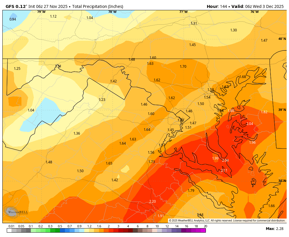
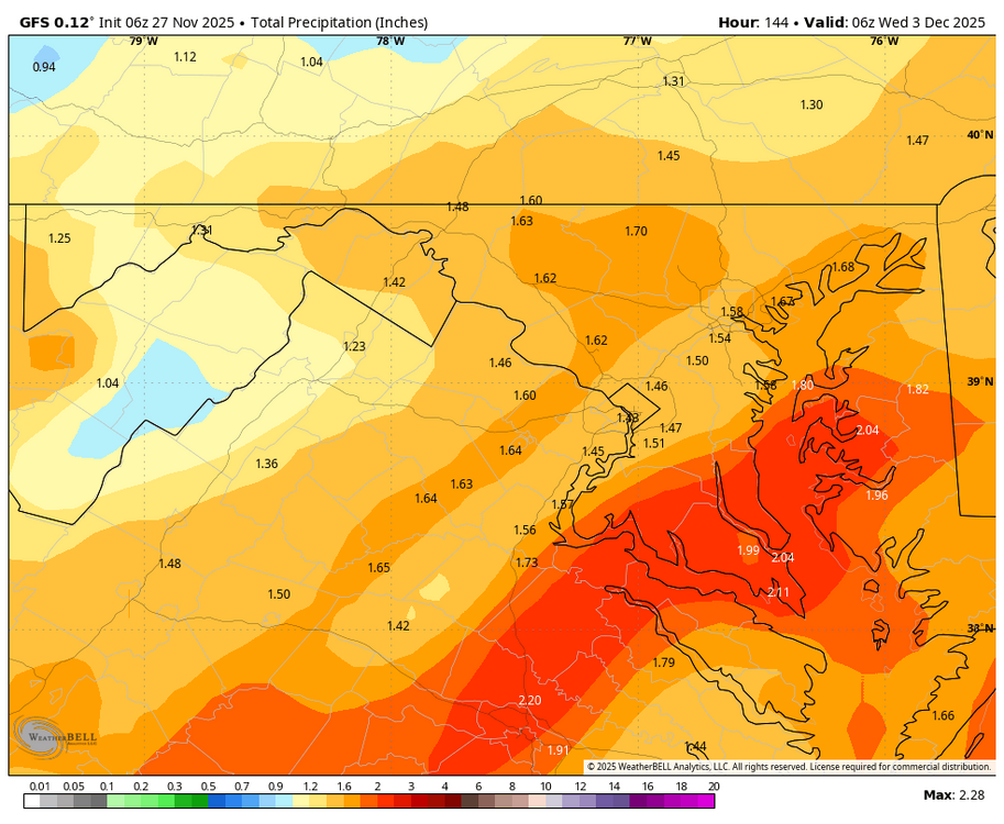
Dec 2-3 with snow interest, especially I84 where the prob for an inch or more is 50%. Dec 6-7 very uncertain due to large scale modeling differences. I would think these are our first two chance for minor measurable CP.
-
Already 40kt KMPO. Difficult to believe we won't have fair amount of G40 kt Friday as the very cold trough aloft sweeps by and can in its wake arrives with flurries. No time for a thread today.
-
NYC still waiting for their first 32° freeze and ISP their first 28° hard freeze. These minimums for the fall are near the warmest for the season. Same for FWN in NW NJ which still hasn’t dropped below 20° yet. Time Series Summary for NY CITY CENTRAL PARK, NY - Sep through Nov Warmest fall min temps Click column heading to sort ascending, click again to sort descending. 1 1998 36 0 2 2009 35 0 - 2006 35 0 3 2016 34 0 - 2010 34 0 - 2001 34 0 - 1963 34 0 - 1902 34 0 4 2025 33 4 - 2011 33 0 - 1985 33 0 - 1948 33 0 - 1907 33 0 5 2015 32 0 - 1983 32 0 - 1968 32 0 - 1954 32 0 Time Series Summary for ISLIP-LI MACARTHUR AP, NY - Sep through Nov warmest fall min temps Click column heading to sort ascending, click again to sort descending. 1 1983 30 0 2 2025 29 4 - 2011 29 0 - 2006 29 0 3 2009 28 0 - 1985 28 0 4 2024 27 0 - 2016 27 0 - 1998 27 0 - 1980 27 0 - 1979 27 0 - 1977 27 0 - 1971 27 0 5 2012 26 0 - 2010 26 0 - 1988 26 0 - 1984 26 0 Time Series Summary for SUSSEX AIRPORT, NJ - Sep through Nov Warmest fall min temps Click column heading to sort ascending, click again to sort descending. 1 2025 22 4 - 2011 22 6 - 2009 22 0 - 2006 22 0 2 2024 21 0 3 2023 20 5 - 2017 20 0 - 2016 20 8 4 2021 19 0 - 2020 19 0 - 2012 19 5 - 2004 19 0 - 2001 19 1 5 2015 18 0 - 2010 18 0 - 2003 18 0 - 2002 18 0
-

Central PA Fall Discussions and Obs
Voyager replied to ChescoWx's topic in Upstate New York/Pennsylvania
The good thing about the Tuesday event is that I won't be working and in the truck. The bad thing is that it may cancel a long awaited dermatologist appointment I had made way back in July. They were booked solid until December when I set it up. -
Lakes areas looking at their best start to winter in a long time. Models yo yoing on extent of SER going into December but a lot of systems over the next few weeks with an active STJ. Will help the drought areas, 90% of NC is in some level of drought now
-

December 2025 regional war/obs/disco thread
Baroclinic Zone replied to Torch Tiger's topic in New England
Goalposts narrowed overnight. Models converging on storm impacting the area. Still a lot to parse out. Someone is gonna cash in. -

Central PA Fall Discussions and Obs
Blizzard of 93 replied to ChescoWx's topic in Upstate New York/Pennsylvania
Happy Thanksgiving everyone! Hopefully this storm trends in the right direction today as we feast and then continues looking good as we enjoy the leftovers this weekend! -
Central PA Fall Discussions and Obs
Blizzard of 93 replied to ChescoWx's topic in Upstate New York/Pennsylvania
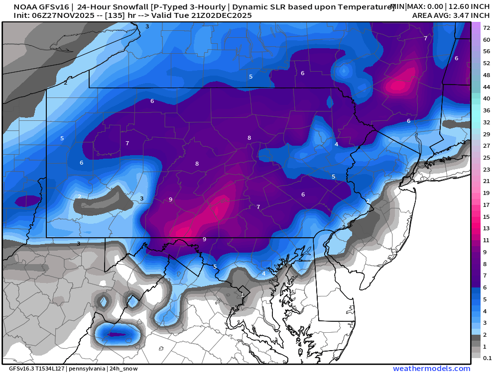
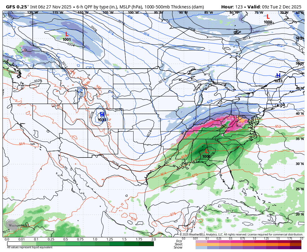
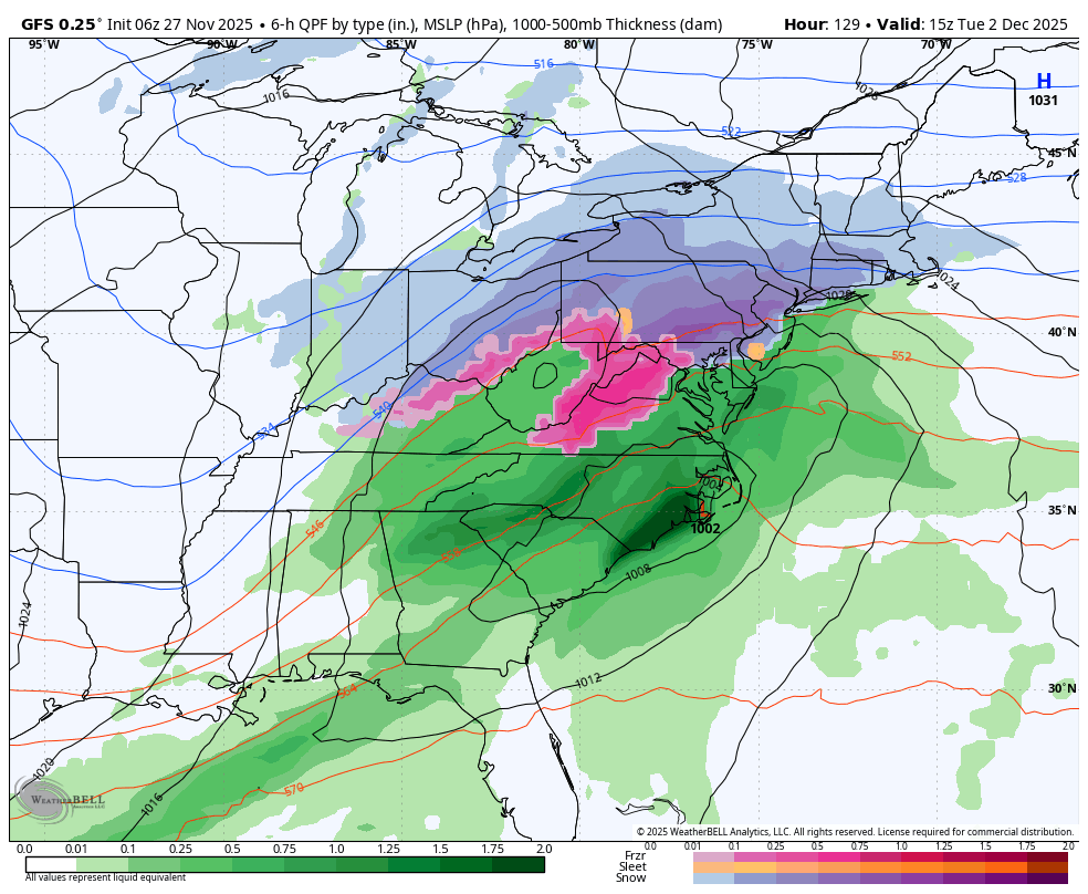
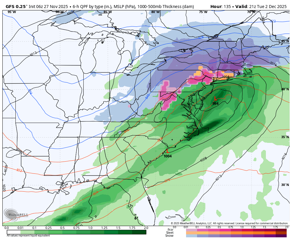
6z GFS snow map for just the Tuesday chance.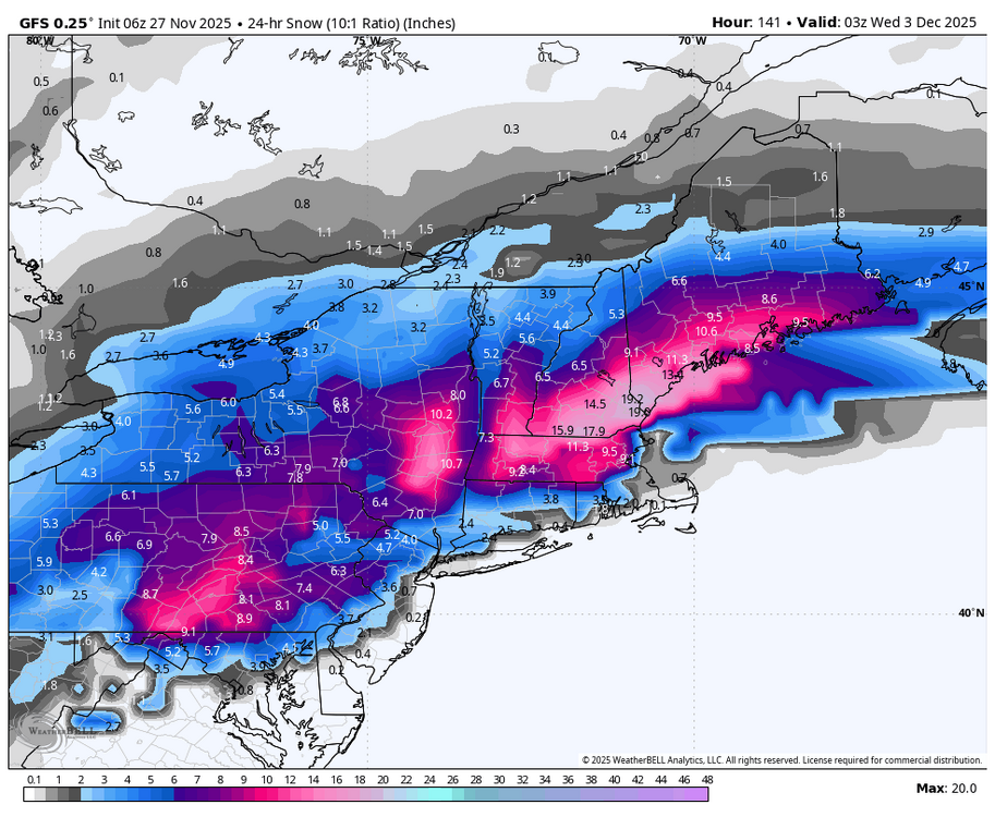
-

December 2025 regional war/obs/disco thread
mahk_webstah replied to Torch Tiger's topic in New England
Hesitancy at GYX but EPS doesn’t look that far off the coast. -
Central PA Fall Discussions and Obs
Blizzard of 93 replied to ChescoWx's topic in Upstate New York/Pennsylvania
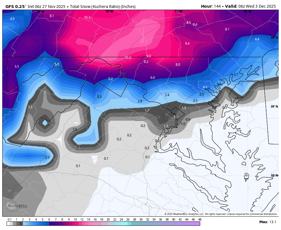
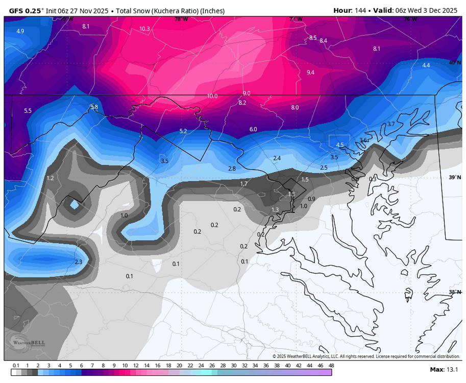
6z GFS delivered a good thump of snow, with most of us staying snow for a good portion of the potential Tuesday event below mixing to ice or rain.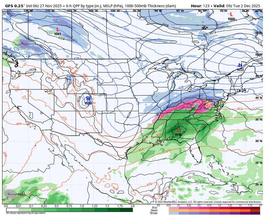
-
Cold air may be a partially separable issue, but seasonal trend would support a weaker/flatter system vs something stronger and inland a bit.
-
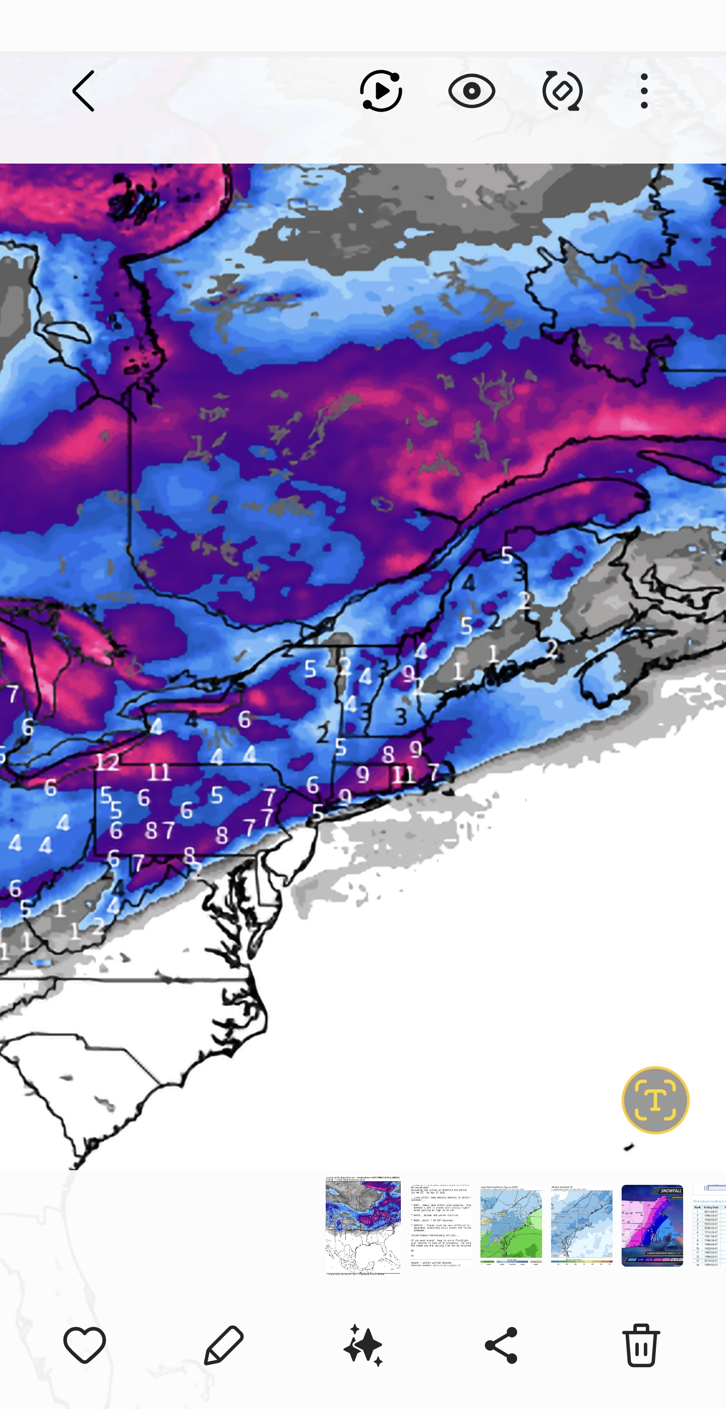
Best 24hr snowfall map off the Gefs from 6z up top and 0z on the bottom. Definitely shifted south.
.thumb.png.7646bfec79cf29b134e67735aa38b33d.png)
.thumb.png.5546615431aa7ba0c9a471d59cd19c3b.png)
-

Central PA Fall Discussions and Obs
mahantango#1 replied to ChescoWx's topic in Upstate New York/Pennsylvania
DT is optimistic about this winter. - Today
-

December 2025 regional war/obs/disco thread
Torch Tiger replied to Torch Tiger's topic in New England
-
Snowstorm incoming?
-

December 2025 regional war/obs/disco thread
moneypitmike replied to Torch Tiger's topic in New England
Pics? -
Best Mid-Atlantic winter storm of the last 50 years
notvirga! replied to PrinceFrederickWx's topic in Mid Atlantic
March 93 will always be my favorite. About two feet of snow mixed with sleet and the biggest snow drifts I’ve ever seen. At the time I lived in Frederick county va—western part of the county with some elevation. Did not get 40” like places on the other side of the mountain in West Virginia but it was still awesome. Was also far enough west to pick up about 14-15 inches from the mid dec nor’easter that winter -
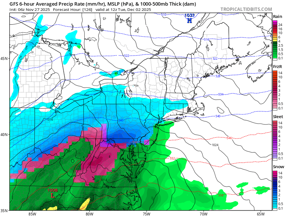
Gfs wants to give us some snow TV Sunday night from the Midwest system as an appetizer.
.thumb.png.3c325c0fec674f7129fa9ca7fc13d6f8.png)
-
Colder for New England
.thumb.png.1a6feafa846af0471a03da218f08e259.png)
-
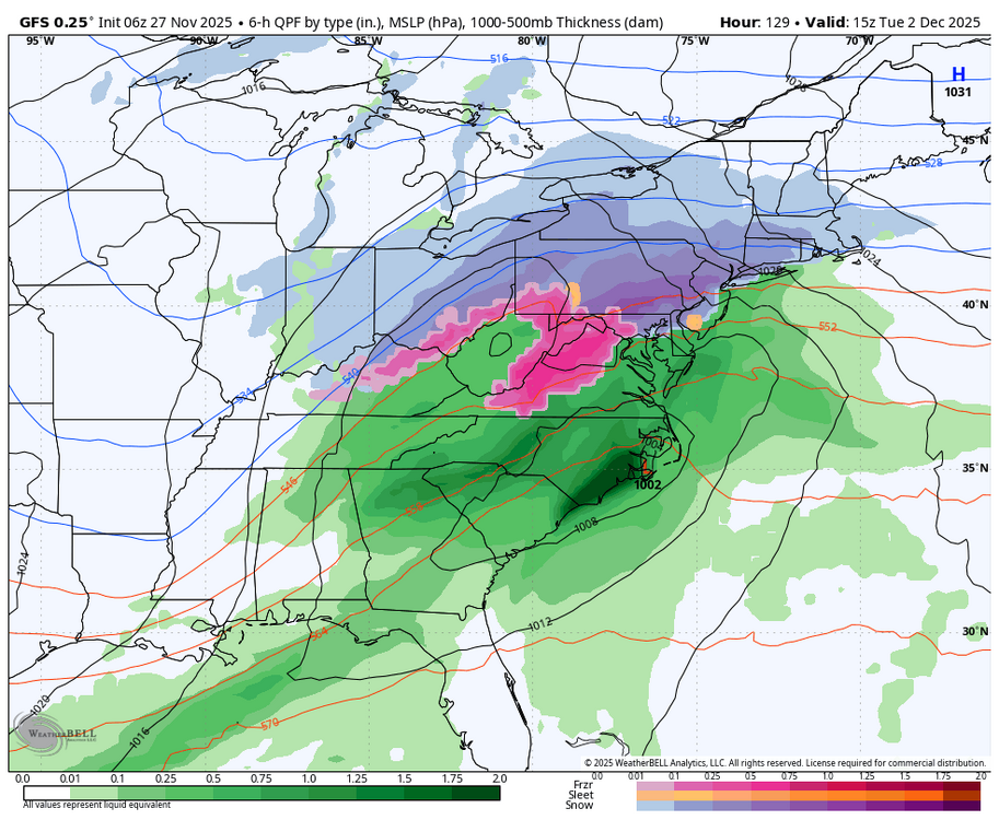
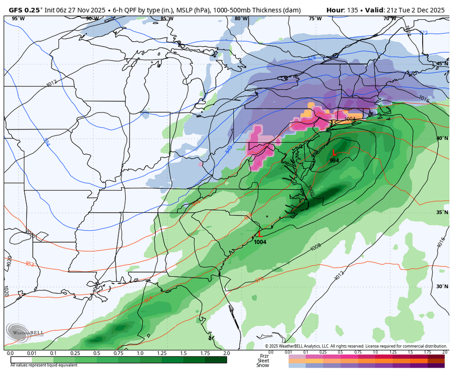
WB 6Z GFS: snow to rain flip in Northern zones.
-
Thump before chancing over to ice/rain.
-
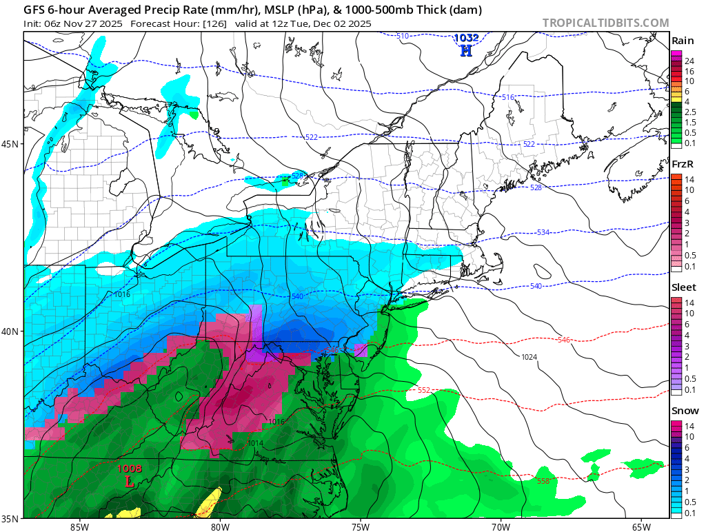
6z gfs high stronger, low more south. It’s better for northern sections.
-
December 2025 regional war/obs/disco thread
Ginx snewx replied to Torch Tiger's topic in New England
Skyne Euro IFS nice hit Tossing the Euro? Ray you say the GFS fits your analog year. Isn't that confirmation bias? Way too early to toss anything


.png.beb0c7dafd70fc90432c6cf6ce6220fe.png)
.png.b3ff0f21f487ebe4ab34fa9f9a3bad98.png)


.png.32104ef3e2741d752594a0a8c1e79f9f.png)

.png.780f6550794b02ae5d2c35f6f1e02b17.png)