All Activity
- Past hour
-
can we all agree that after friday no more 80 degree weather maybe until next spring?
-
Another dreary dark cloudy day and the people who get paid to forecsst get it wrong again
-
Tomorrow will see partly sunny skies, along with temperatures topping out in the lower and middle 70s. Thursday and Friday will be unseasonably warm days to mark the start of October. Highs will reach the upper 70s and lower 80s across the region. It will turn somewhat cooler during the weekend and a strong cold front will likely move across the region Sunday or Sunday night. The ENSO Region 1+2 anomaly was +4.7°C and the Region 3.4 anomaly was +3.1°C for the week centered around September 23. For the past six weeks, the ENSO Region 1+2 anomaly has averaged +4.40°C and the ENSO Region 3.4 anomaly has averaged +2.83°C. Both ENSO regions have set new all-time records. The ongoing strong El Niño, will continue to strengthen through the mid-fall. The SOI was -16.10 today. The preliminary Arctic Oscillation (AO) was -0.287 today. Based on sensitivity analysis applied to the latest guidance, there is an implied near 100% probability that New York City will have a cooler than normal September (1991-2020 normal). September will likely finish with a mean temperature near 68.4° (0.8° below normal). Supplemental Information: The projected mean would be 0.4° above the 1981-2010 normal monthly value.
-
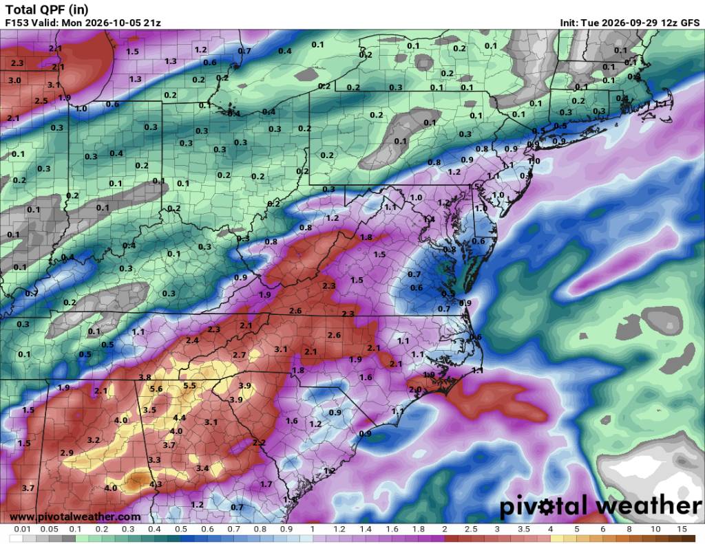
New GFS run is a complete cave. Glad this isn’t a snow storm or the 12z euro into 18z gfs would’ve made this place a bloodbath.
-
 https://apexmenmeds.com/# online ed pharmacy
 -
generic sildenafil: SildenDirect - Buy Viagra online cheap
-
How... just how... This weekend showed signs that we've finally turned the corner and that the niño was actually kicking in. How is it even possible that it was yet another rug pull and a repeat of late May... Is there ever going to be a wet pattern?
- Today
-
Low 60, high 86. Dew point in the upper 60s most of the day.
-
 Peak seems a solid week early for you? Perhaps drought is playing a role?
 -
Sure looks that way.
-
2026-2027 Fall/Winter Mountain Thread
strongwxnc replied to BlueRidgeFolklore's topic in Southeastern States
Sure does. Getting on my grass tonight since this weekend will be out. . -
 CAPE changed their profile photo
 -

October Comes Early: Late September Multi-Hazard Hybrid Storm
Layman replied to WxWatcher007's topic in New England
Thanks for the details - much appreciated! We drove past a patch today in Portsmouth that were so bright and vibrant. Really pretty this year. -
viagra canada and sildenafil online Viagra without a doctor prescription Canada https://www.google.cg/url?q=https://sildendirect.com Viagra online price and https://armandohart.com/user/ydicedhoqy/?um_action=edit buy Viagra over the counter [url=https://cse.google.al/url?q=https://sildendirect.com]sildenafil online[/url] cheapest viagra and [url=https://mantiseye.com/community/harcwtidjf]over the counter sildenafil[/url] buy Viagra online
-

2026-2027 Fall/Winter Mountain Thread
Met1985 replied to BlueRidgeFolklore's topic in Southeastern States
Looking like some more beneficial rainfall this weekend. Sent from my SM-G998U using Tapatalk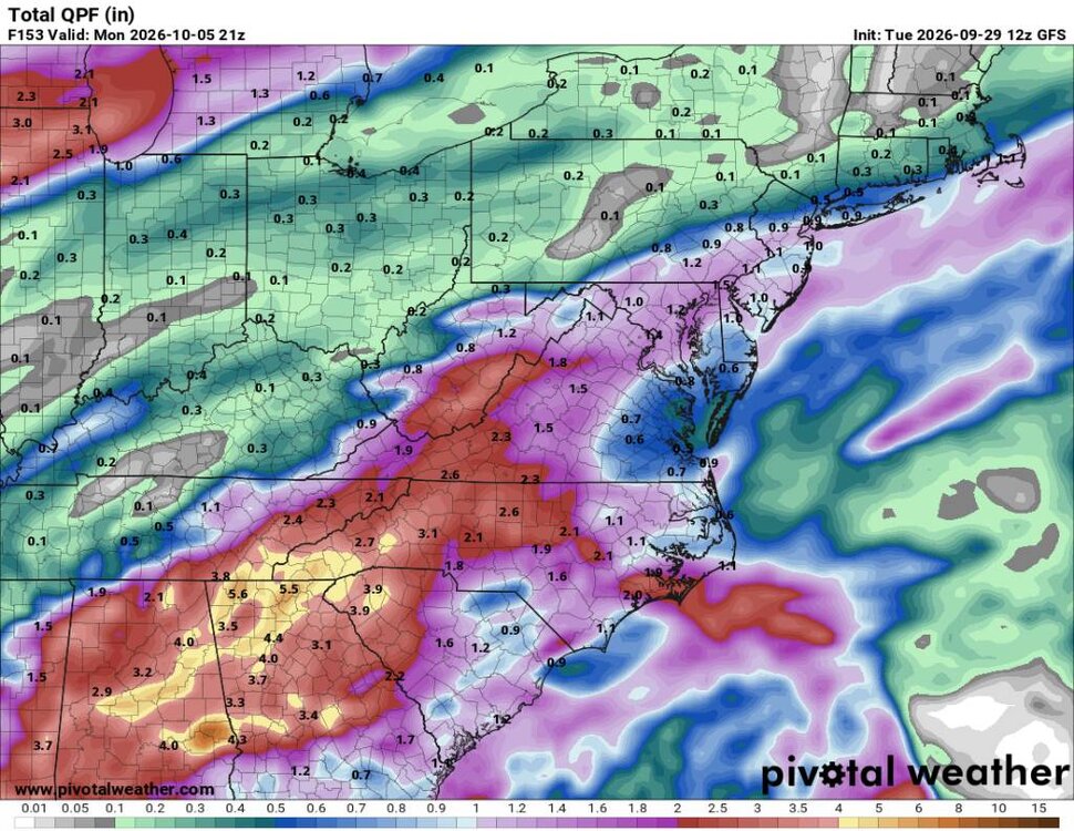
-
buy erectile dysfunction pills or cheap ed pills ed rx online http://leadertoday.org/topframe2014.php?goto=https://apexmenmeds.com how to get ed pills and https://gikar.it/user/mgnoafkudt/ cheap ed treatment [url=https://alt1.toolbarqueries.google.ac/url?q=https://apexmenmeds.com]order ed meds online[/url] where can i buy ed pills and [url=https://bold-kw.com/user/imlqkpectd/?um_action=edit]ed meds by mail[/url] cheap ed
-

October Comes Early: Late September Multi-Hazard Hybrid Storm
tamarack replied to WxWatcher007's topic in New England
"Swamp maples" are almost always red maples (Acer rubrum) on a wet site. The wetness lowers fertility and keeps the roots somewhat cooler than on well drained sites, probably causing that early turning (as you guessed). The color is common for most red maples (excellent this year), though there's a variety of sorts that turns yellow (also good). -
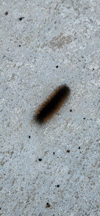
Far NW winter coming
-
October Comes Early: Late September Multi-Hazard Hybrid Storm
Layman replied to WxWatcher007's topic in New England
Is there a specific reason why the swamp maples always seem to turn early and be so vibrant? My simple guess is something to do with the moisture in their environment, but I was curious if there's some solid known reason. Or, am I just imagining they turn early to begin with -
Pattern change cancelled?
-
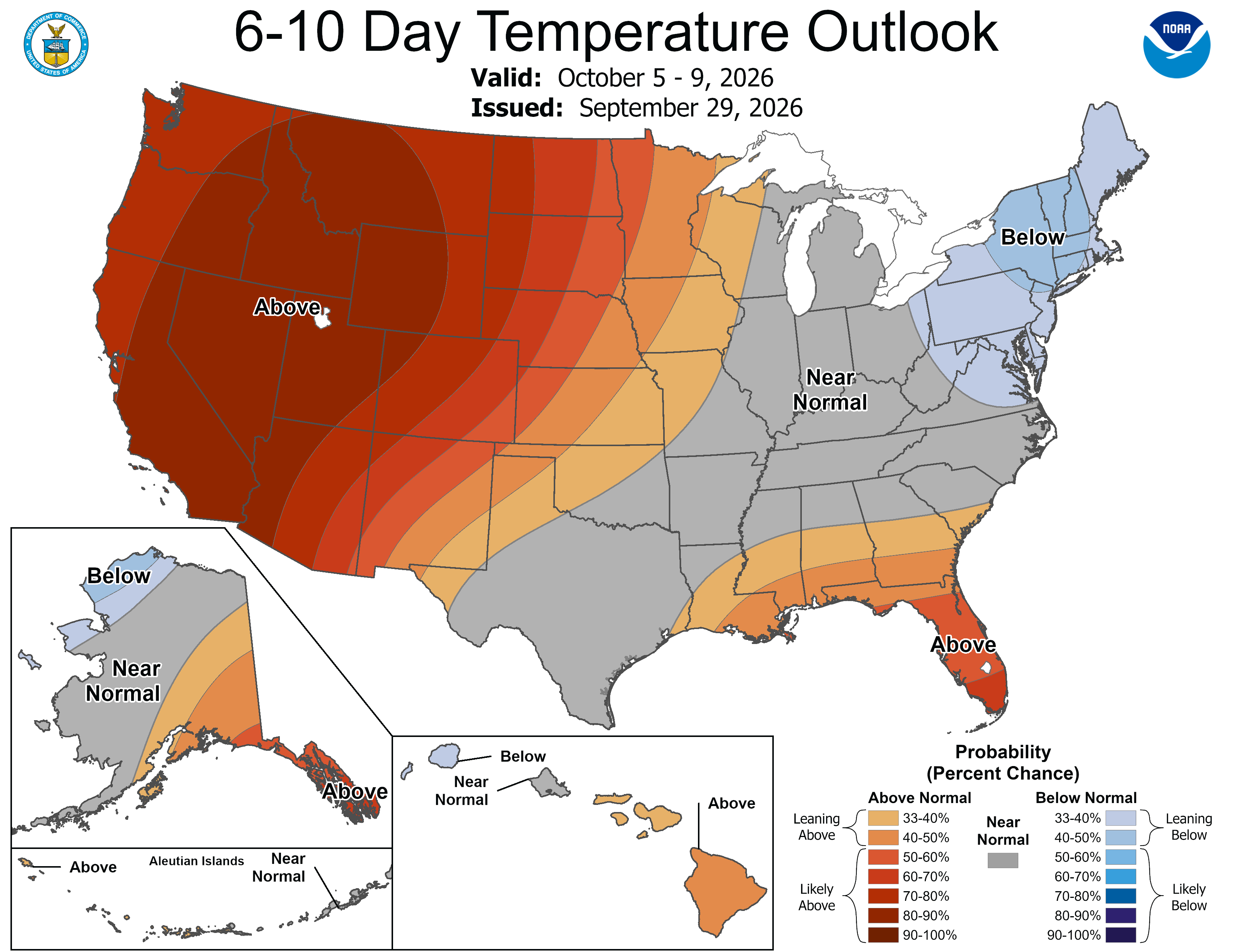
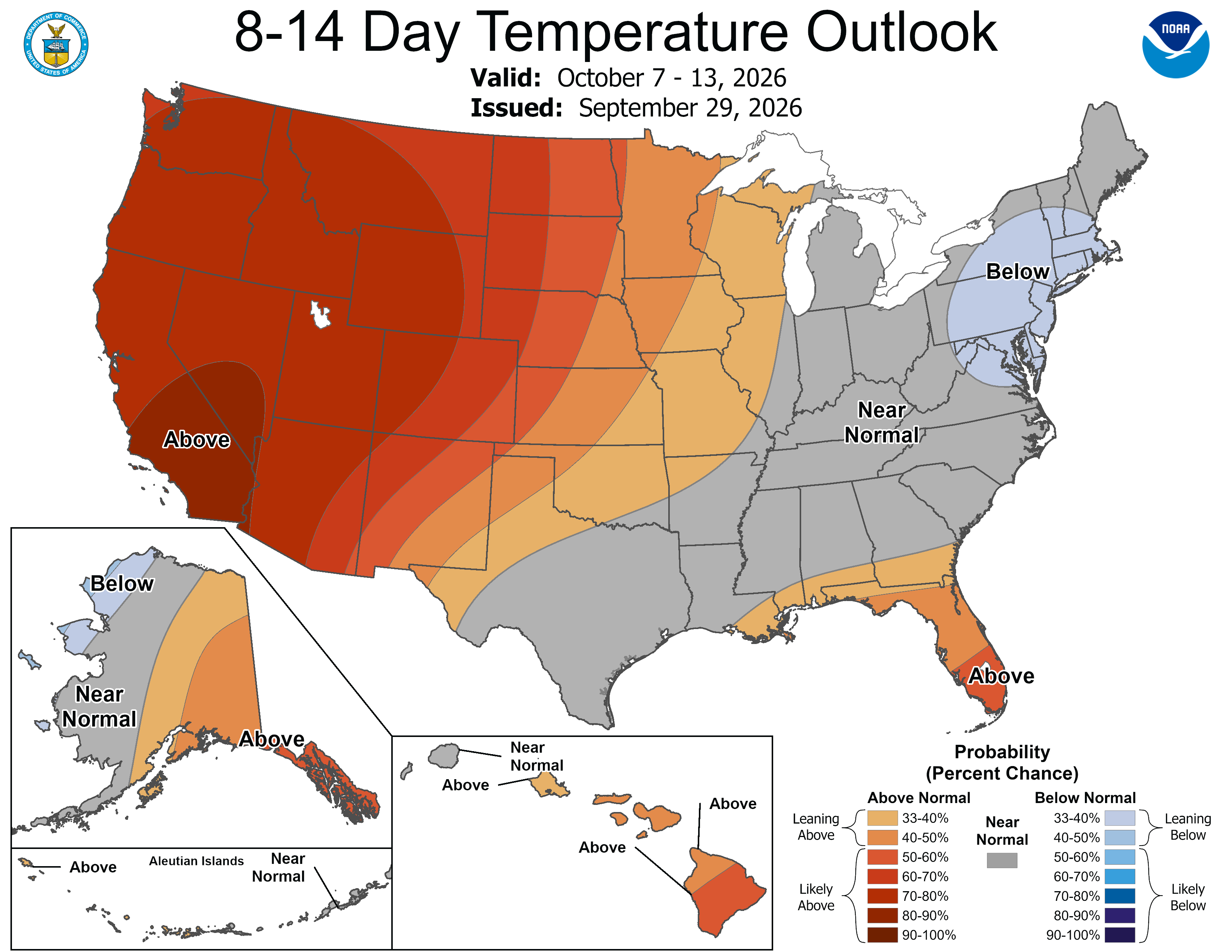
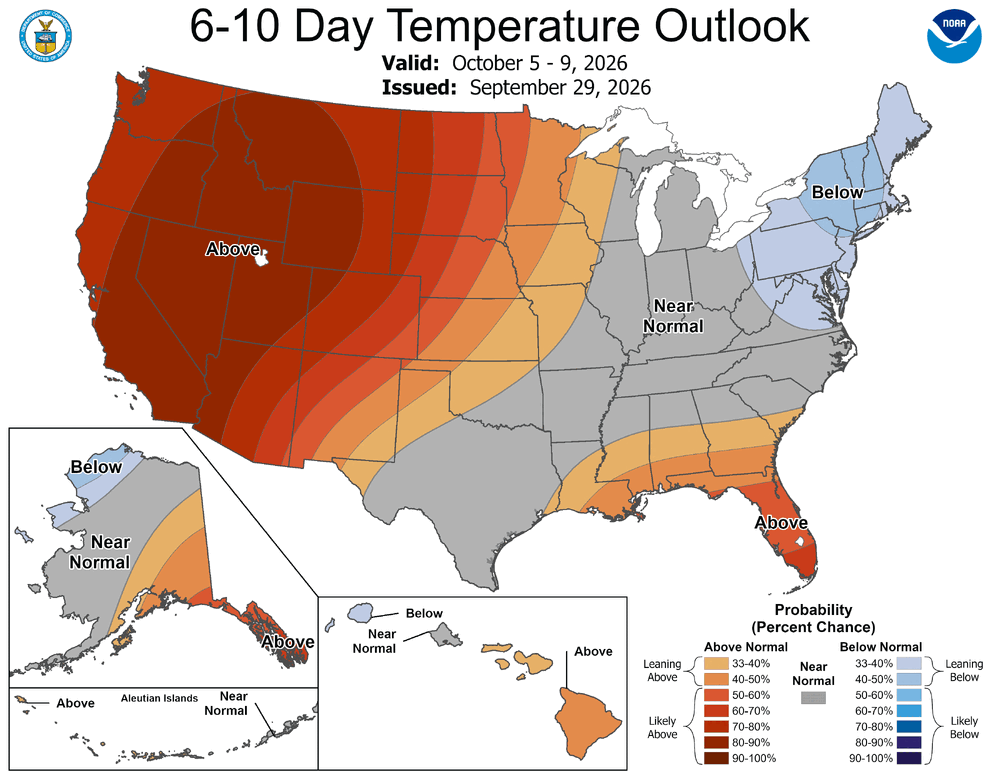
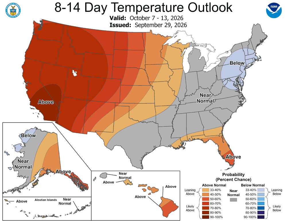
Cooldown on the way
-
This is a huge moisture plume for the central US
-
The Natty Blend suggests most of our area might not be the target for significant rain- with the frontal passage itself as well as low pressure that may form on the slowed/stalled front to our south. Close though and subject to change based on the suite of model inputs it uses.
-

2026-2027 Record-breaking El Nino
PhiEaglesfan712 replied to Stormchaserchuck1's topic in Weather Forecasting and Discussion
I thought the historic storm was in March 1993, not in December 1992. I always remember the winter of 1992-93 this way: (1) my youngest sister being born (December 29, 1992), then (2) her baptism (late January 1993), and finally the snowstorm (mid-March 1993). I don't remember the storm happening first (in December 1992). I found this storm (which was right before my sister was born), but it appears further south: https://products.climate.ncsu.edu/weather/winter/event/?e=128 -
Pretty big differences wrt the interaction between the northern and southern h5 vorticity on the Euro compared to GFS, thus quite different outcomes at the surface. Ofc this will vary from run-to run on the ops at this range.
-
NAM and HRRR are caving now, too. Getting some practice for winter I guess.