All Activity
- Past hour
-

Wounded Duck Strikes Back: Dec 26 & 27th Winter Storm Obs
EastonSN+ replied to WxWatcher007's topic in New England
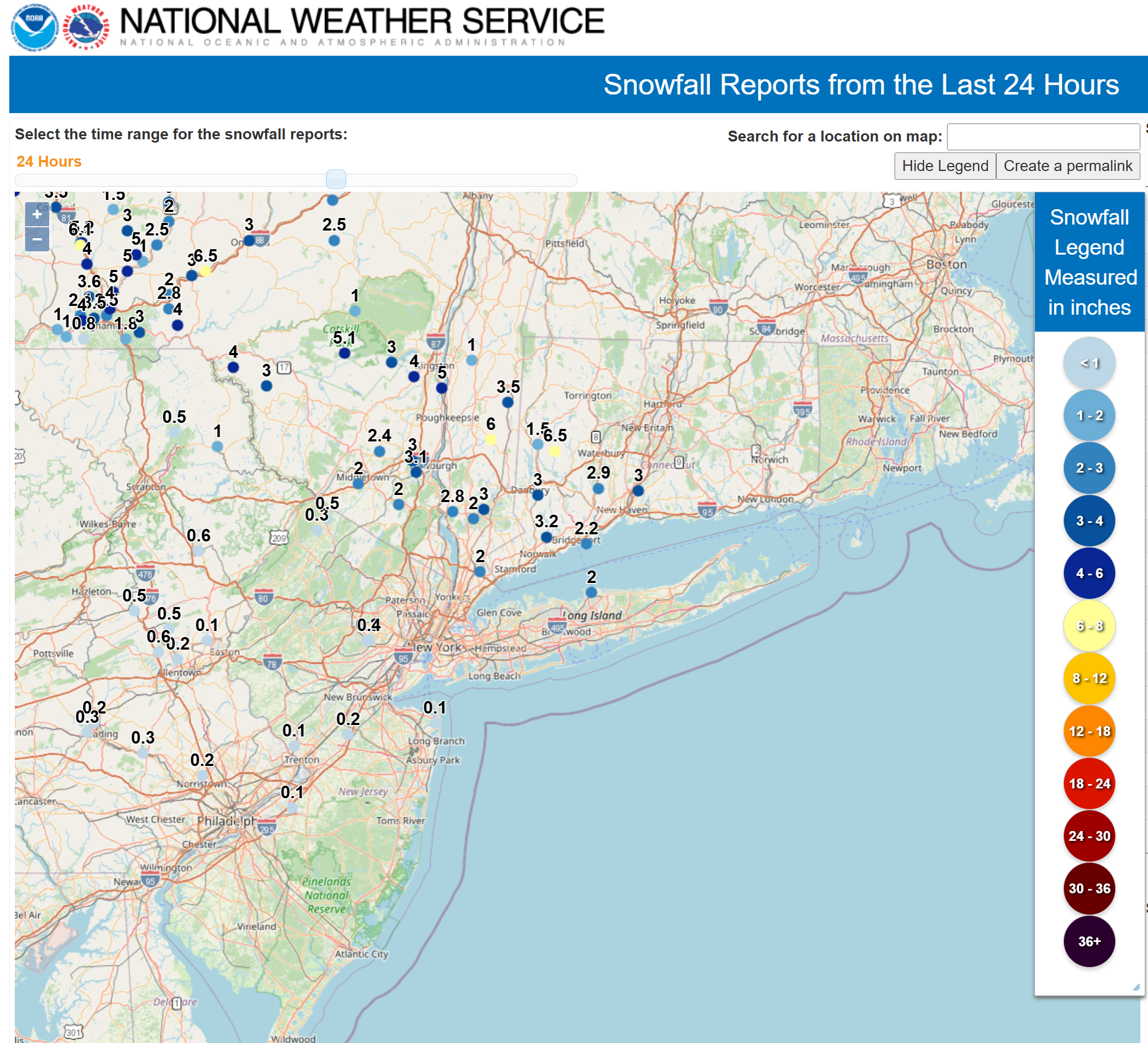
New Haven County may end up with the Jackpot -
Upton says 4-9” out here, highest Nw Suffolk
-

Wounded Duck Strikes Back: Dec 26 & 27th Winter Storm Obs
OrangeCTWX replied to WxWatcher007's topic in New England
Somewhere between 3 and 3 1/2 inches here.. -

Wounded Duck Strikes Back: Dec 26 & 27th Winter Storm Obs
Damage In Tolland replied to WxWatcher007's topic in New England
She came on the .. I mean she came in like a wall after 2 minutes -

2025-2026 ENSO
40/70 Benchmark replied to 40/70 Benchmark's topic in Weather Forecasting and Discussion
There is my +PNA. Looks like the blocking reprieve won't last as long as I thought since the Strat and troposphere are remaining uncoupled, but I did get the strengthening PV right. -
People on here are clearly confusing hail and graupel.
-
Denied again! The NAM wins!
-

Wounded Duck Strikes Back: Dec 26 & 27th Winter Storm Obs
weatherwiz replied to WxWatcher007's topic in New England
I am right on the edge on some of the heavier echoes so it can't be too far away. -

Wounded Duck Strikes Back: Dec 26 & 27th Winter Storm Obs
WinterWolf replied to WxWatcher007's topic in New England
You know it…very impressive start. Beautiful dendrites…accumulating at a phenomenal rate. -
There's a state of emergency, and winter storm warnings throughout the state -- they won't cave in that easily lol. News media was going crazy this morning about this being the biggest storm in years. We had more snow two weeks ago. Mother nature is a thing of beauty.
-

Wounded Duck Strikes Back: Dec 26 & 27th Winter Storm Obs
DJln491 replied to WxWatcher007's topic in New England
send that band to Hartford, right on the edge of it just sitting there -
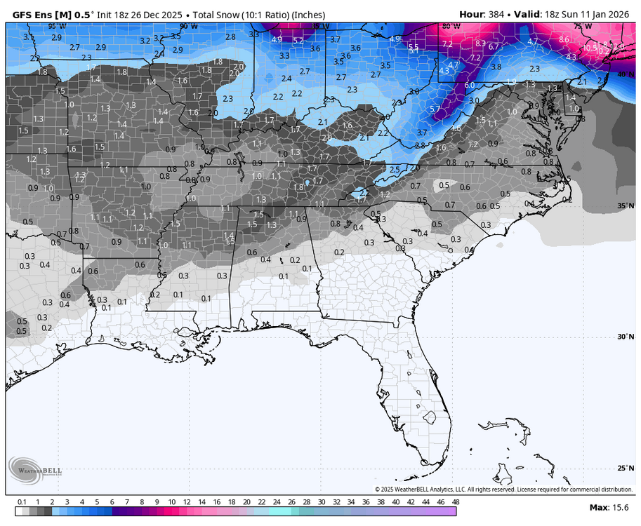
Finally getting a bit of a signal on the 18Z GEFS:
-

Central PA Winter 25/26 Discussion and Obs
WmsptWx replied to MAG5035's topic in Upstate New York/Pennsylvania
I think Ruin has the same type of setup my parents use. Thermometer in the kitchen says 33 in lower Huntingdon county when the nearest recording shows 29. There is no way something in your kitchen is reliable and accurate. -

Central PA Winter 25/26 Discussion and Obs
MAG5035 replied to MAG5035's topic in Upstate New York/Pennsylvania
I typically put heavier stock on stuff like the 3k NAM and the HRRR when we get into the short and near term range with these mixing events. They just handle the finer mesoscale details and thermals a bit better than the globals, which can broadbrush things like accums in our area when it comes to CAD, terrain effects, downsloping etc. I think the big thing in this situation might be that the mid level features ended up a bit further NE and we ended up more towards what the NAM suggested. Like I said in a post response a page or two ago, the big warm air intrusion is above 850mb.. up nearer to the 700mb level but mainly around 750-800mb. If your looking at the typical maps to determine snow (850, 925, even 700mb temps), you might think things are good for an all snow column. Soundings of the full column were/are important for this one. I think NYC still has a chance to do okay because when the low jumps to the coast later it will cool that warm nose a bit and they may hold on to mostly snow even if they mix early. But we’ll see. On the line there is the biggest snowfall since 2022. -

Wounded Duck Strikes Back: Dec 26 & 27th Winter Storm Obs
CT Valley Snowman replied to WxWatcher007's topic in New England
We snow -

Wounded Duck Strikes Back: Dec 26 & 27th Winter Storm Obs
ORH_wxman replied to WxWatcher007's topic in New England
Been awhile since I’ve seen such a cold storm on the south coast. -
Yep we just can’t catch a break. It’s either a BL temps issue/not sticking or a fast moving warm nose bringing down accumulations.
-
Congratulations to the NAM. I almost can't believe it.
-
Wounded Duck Strikes Back: Dec 26 & 27th Winter Storm Obs
Damage In Tolland replied to WxWatcher007's topic in New England
Let’s Fing go ! -
Wounded Duck Strikes Back: Dec 26 & 27th Winter Storm Obs
Damage In Tolland replied to WxWatcher007's topic in New England
Flurries to steady snow in 3 minutes -

Wounded Duck Strikes Back: Dec 26 & 27th Winter Storm Obs
metagraphica replied to WxWatcher007's topic in New England
Started about 30 minutes ago here. Closing in on 1/2 an inch. 23 degrees. -
.thumb.png.4150b06c63a21f61052e47a612bf1818.png)
Wounded Duck Strikes Back: Dec 26 & 27th Winter Storm Obs
HIPPYVALLEY replied to WxWatcher007's topic in New England
It’s 19/7 here. Lots of dry air to overcome. -
No, had sleet earlier. It’s snowing but radar is breaking up and the dry slot of hell is on my doorstep. The forecast of 7-11” ain’t gunna do it here.
-

Wounded Duck Strikes Back: Dec 26 & 27th Winter Storm Obs
The 4 Seasons replied to WxWatcher007's topic in New England
3" in one hour in North Haven, not my ob. 6" in Pawling, NY 6.5" in Woodbury, CT
-
2025-2026 ENSO
40/70 Benchmark replied to 40/70 Benchmark's topic in Weather Forecasting and Discussion
I did.