All Activity
- Past hour
-
 no prescription pharmacy paypal: best online pharmacy no prescription or reputable online pharmacy no prescription
 -
http://quickph.com/# us pharmacy no prescription
-
Seems like parts of the Detroit area have seen at least several inches of rain from tonight's round, and possibly more on the way...
-
The 18z ECMWF operational is more gradual with Lowell's northward turn and is slower with the capture of both Karina and eventually Lowell by the mid-to-upper trough. Lowell passes by at a further distance from Ni'ihau and Kauai before turning back towards the NW as the trough fills/weakens. The 00z GFS is much faster with Karina's capture, and the trough has a stronger influence on Lowell, impacting both islands. To be clear, at this range, both OPs are too close for comfort, and I am sure this is going to further fuel speculation tomorrow. Here is the 00z ECMWF. Still misses to the west, but it appears to be a closer pass than the 18z run:
-

2026 Mid-Atlantic Severe Storm General Discussion
dailylurker replied to Kmlwx's topic in Mid Atlantic
Congrats PA as usual. That will just bring us clouds all day Thursday to cap any chance of anything interesting. I've heard thunder like twice this summer. Most boring thunderstorm season i can remember. - Today
-
.thumb.jpg.6a4895b2a43f87359e4e7d04a6fa0d14.jpg)
Central PA Summer 2026 Discussion/Obs Thread
Yardstickgozinya replied to Voyager's topic in Upstate New York/Pennsylvania
That's pretty incredible. I don't know how much of this is going to come through, i'll echo @pawatch and say, stay safe out there.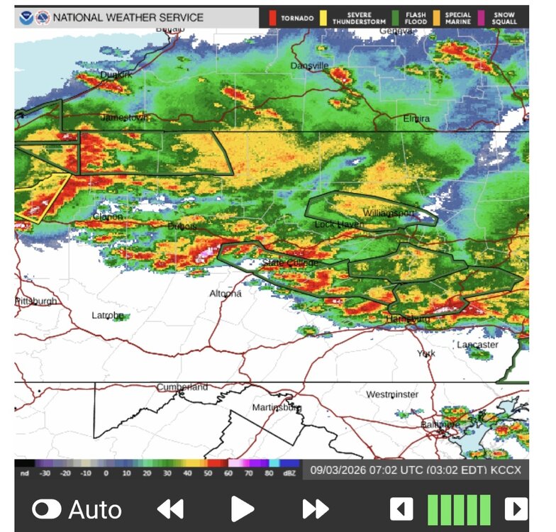
-

Septorcher 2026 Discussion - Endless Summer
vortex95 replied to Damage In Tolland's topic in New England
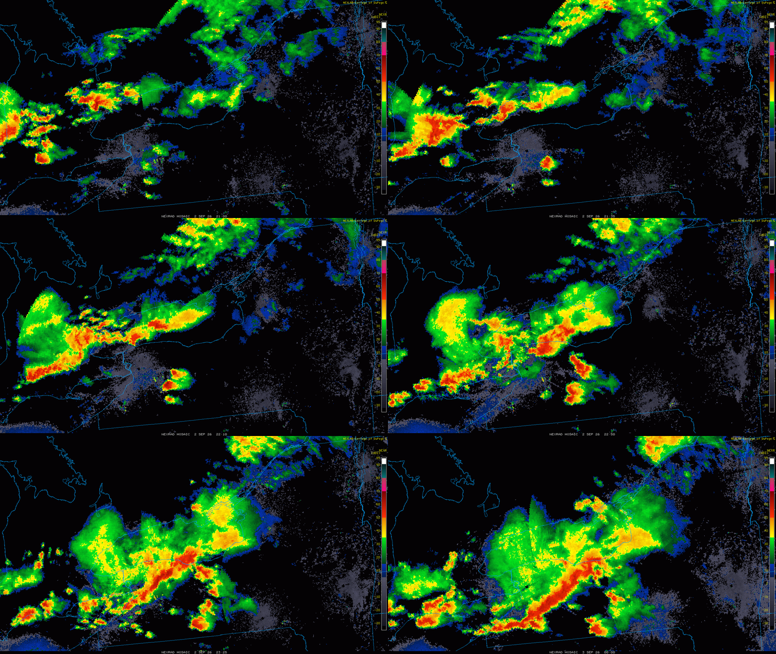
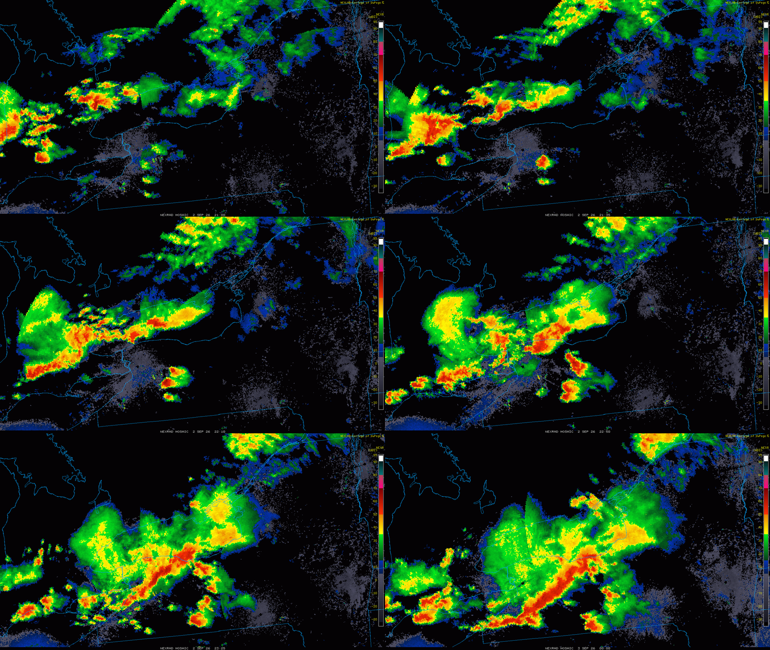
And that Elba NY unreal HP supercell Wed. Look at the radar loop. Classic splitting and merging supercells and then a raging SQLN same area right after? Again, WCWGT???? At least NW flow is living up to is name for nasty cells somewhere in the NEUS.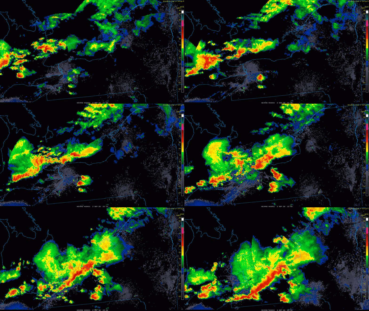
-
ORD had a low temp of 78° yesterday, which tied the record high min temp for the date of 78° (1913).
-

Chicago Weather Records Tracking
Chicago Storm replied to Chicago Storm's topic in Lakes/Ohio Valley
Chicago/O'Hare had a low temperature of 78° on September 2nd, which tied the record high minimum temperature for the date of 78° (1913). -
Peaked at 96° at ORD and MDW yesterday. ...2026 90°+ Day Tally... 15 - MDW 14 - ORD 14 - RFD 13 - PWK 13 - ARR 12 - UGN 12 - LOT 10 - DPA
-
Also, see this ydy in wrn NY? That is *unreal* supercell structure for the East! https://x.com/voglerweather/status/2095284232893473216/ Radar loop shows classic splitting supercells and then a raging squall line into the same area. Why can't we get that?
-
Well damn, looks like round 2 for Detroit right now...
-
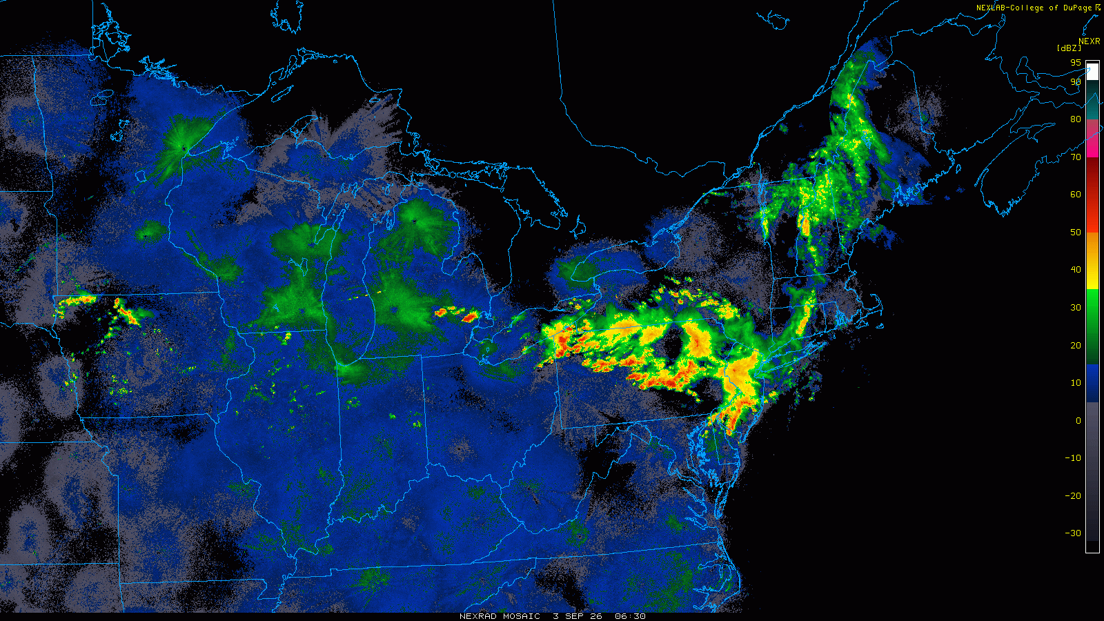
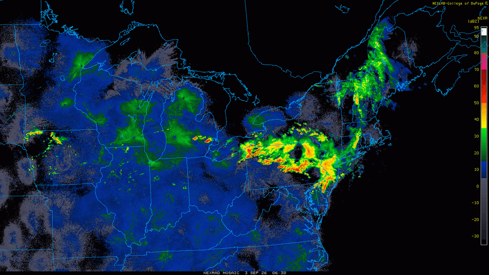
Darn it! You'd think w/ the BDF getting much farther SW than fcst, and a general rule about 50 mi N of the front when EML-type NW flow, we'd have a nice nocturnal MCS right over the DC area now, but it's still way N still in PA/NJ at this hour, which has got hit repeatedly in the last few days. Also, the squall line that came through early aftn ydy, you'd think that would have meant convection firing farther S as that what usually occurs in NW flow Two days ago the axis was just to our NE, and moves S for ydy aftn, but apparent has moved back N? Odd. Maybe today finally w/ the svr risk axis fcst right through us, but it was ydy also.
-

2026-2027 Record-breaking El Nino
GaWx replied to Stormchaserchuck1's topic in Weather Forecasting and Discussion
This is the first time I recall seeing the white shading, which is warmer than a +5C anomaly, on the TAO surface maps. It is within the E section, in a narrow corridor just S of the equator and E of 110W. -
Monday, August 31 - Thursday, September 3, 2026 Convective Episodes
vortex95 replied to weatherwiz's topic in New England
No "Holy Sh*t!" from @weatherwiz? -
Monday, August 31 - Thursday, September 3, 2026 Convective Episodes
vortex95 replied to weatherwiz's topic in New England
One chaser I know way back always put in his signature file: I FEAST ON THE SMORGASBORD OF ATMOSPHERIC VIOLENCE!" @weatherwiz should come up w/ a similar tagline! -
Monday, August 31 - Thursday, September 3, 2026 Convective Episodes
vortex95 replied to weatherwiz's topic in New England
Good points, just don't less recency bias influence you! I go back to the big snowstorms this past winter, and you still act like, "never any good winters again!!" 4 lousy snow years/storms until Jan 2026, and you act like it was 40 years! And I hear things like, "PVD gets 37" and I only get 24" -- "WORST STAWM EV-A! -

Central PA Summer 2026 Discussion/Obs Thread
pawatch replied to Voyager's topic in Upstate New York/Pennsylvania
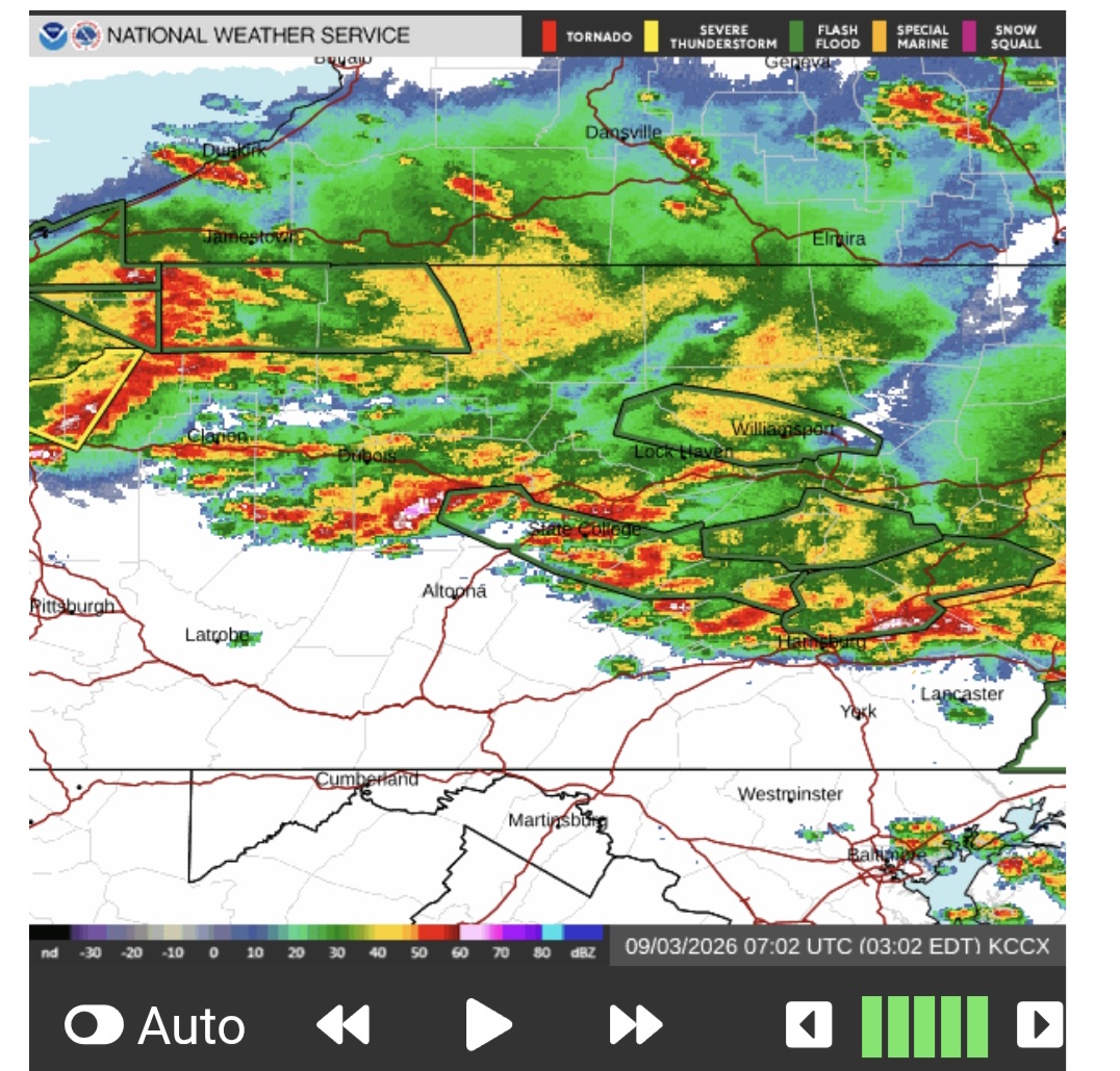
We’re getting hit hard up here. Everybody be safe. -
There could be a flash flooding risk in the Milwaukee area Thurs night into fri morning. Train going to be riding that stationary front. Milwaukee doesn’t do well with these events
-
https://mapplemed.shop/# cheap canadian pharmacy
-
 How funny would it be if we average +PNA in the seasonal mean, stemming from similarities in the arctic domain and not necessarily the equator. Just about everyone would miss it, assuming it's ENSO.
 -
Some historical cases where RI cycle/markedly improved upper-level outflow at and after landfall. Andrew Aug 1992 S FL Andrew was undergoing RI at at landfall, and the eye was actually 1 C warmer 1 hr after landfall. I recall the last recon pressure was 932 mb, and they estimated 926 mb for landfall, but readings on land n the eye found 922 mb in post-storm analysis. Charley Aug 2004 SW FL Charley was undergoing RI those last 12 hours up until landfall as upper-level outflow was improving due to favorable trough interaction upon recurvature. A very compact hurricane that maintained its inner core w/ usually high winds well inland all the way to MCO (G108mph there). Fay Aug 2008 SW FL Fay was a disorganized TS at landfall, but in the next 6 hours, satellite presentation improved big time, and eye formed on sat/radar, and its symmetry was outstanding (on the VIS image link below, it even developed a subsidence ring around its CDO, which is a telltale sign of strong TC on sat). It was the only time I have seen NHC increase the winds for a TC significantly inland (60 to 65 mph - winds over Lake Okeechobee). https://upload.wikimedia.org/wikipedia/commons/thumb/5/50/Fay_19_aug_2008_1615Z_Cropped.jpg/960px-Fay_19_aug_2008_1615Z_Cropped.jpg?utm_source=en.wikipedia.org&utm_campaign=imageinfo&utm_content=thumbnail http://ultimatechase.com/chase_accounts/Images/Tropical_Storm_Fay/RAD_KMLB_N0R_ANI.gif Harvey Aug 2017 TX Harvey was undergoing RI those last 12 hr to landfall, and the eye remains intact very well some distance inland. Look at this EIR loop of Harvey, Very strong, practically ideal, upper-level outflow develops not long before and after landfall as evidenced by the large anticyclone cirrus plume. https://www.youtube.com/watch?v=8qjhW6lxkws These are just some examples. There are many others.
-
But we have Lowell and HI for it all to focus on now. Let the games (hysterics) begin!
-
There is another effect overlooked here, actually two. 1) I would argue there is a "tropical landscape effect," meaning lowlands/swamps/marshes and a general tropical marine air mass that is not far inland provides at least neutral moisture/latent heat to keep things going better or maintain than say and area that is not like that, but not a desert either (brown ocean effect). 2) Look at the mid-level WV loop for the past 3 days. One, you have a trough nearly stationary over NE Mexico. Two, watch what happens over the FL PH. An upper low cuts off and deepens. Now look at the 250 mb analysis. I attached the 03/00z ECMWF fcst 03 hr 250 mb. Edouard moved directly under a large upper level ridge center. Note that a small cyclonic center is right over Edouard's center, but that is ok b/c TCs often has a tiny cyclonic low even at this level. So upper level conditions became nearly ideal aloft for outflow given two upper troughs either side of the TC, and a upper level ridge directly over it. This can and does result in intensification at times, at least the mid-level circulation and for satellite presentation, for a TC moving inland. Recall before Edouard's landfall, there was some shear evident, and the convection was pulsing in blobs. At 1230z on landfall day, after struggling a bit satellite, a big blow up of convection occurred directly over the center, and radiated out uniformly, which is a solid sign of intensification, and often this is due to an improvement of the overall environment, In this case, the small amount of shear likely lessened, and that resulted in less dry air being pushed into the core, so Edouard "made its move," so to speak. And once inland, continued improvement aloft and the dry slots on radar vanished, and we got a solid/coherent precip swirl area, as tiny as it was! Overall radar presentation improved *after* landfall! So the brown ocean effect, or the "tropical landscape effect," does not tell the entire story I think. When upper level conditions improve markedly at and after landfall, this positive offset can intensifies the TC, or slow weakening. In Edouard's case, since it was a mdt TS at landfall, it has not much to "lose," so to speak, say compared to a Cat 3 landfall. Yes, sfc winds will come down regardless b/c of friction, but system itself structurally improves quite a bit, and I think this is what happened to Edouard. I'll give some actual historical examples in the next post.
-
online pharmacy no rx: trustworthy online pharmacy and no prescription pharmacy paypal