All Activity
- Past hour
-
9/17 yesterdays highs: TEB: 87 LGA: 85 EWR: 84 ACY: 84 New Brnswck: 84 PHL: 84 TTN: 84 BLM: 83 NYC: 82 ISP: 80 JFK: *80
-

Septorcher 2026 Discussion - Endless Summer
dendrite replied to Damage In Tolland's topic in New England
Finished with 1.12” -
Going to get some grass seed down on the bare spots tomorrow before the rain. Of course the weeds are prolific as always filling those in…
-

Central PA Summer 2026 Discussion/Obs Thread
WmsptWx replied to Voyager's topic in Upstate New York/Pennsylvania
Forecast high for next Wednesday here in Clearfield: 55°F. Time to dust out the sweats. -
You’re surprised by that given the forecasted rain?
-
Blip
-
thanks, the FRL is the one we are shooting for, going counterclockwise as you described...hope the weather and my knees hold out
-
no flash flooding here
-
I know I'm geeking out right now, but I can't believe that Tool's album Aenima came out 30 years ago yesterday.
-
Euro dried up a good bit at 6z. Typical model dancing. Going from 2”+ to under 1” if it was snow we know the board meltdown would be on lol
-
I hope!
-

Septorcher 2026 Discussion - Endless Summer
40/70 Benchmark replied to Damage In Tolland's topic in New England
Take...bring it. -

2026-2027 Fall/Winter Mountain Thread
Met1985 replied to BlueRidgeFolklore's topic in Southeastern States
We need this. Sent from my SM-G998U using Tapatalk.thumb.jpg.5c6ff36ce637523820ca7a7db12e5d8d.jpg)
-

Central PA Summer 2026 Discussion/Obs Thread
Mount Joy Snowman replied to Voyager's topic in Upstate New York/Pennsylvania
Looks like we'll be stuck under an easterly flow pattern for much of next week. If it results in this that would be quite something..... -
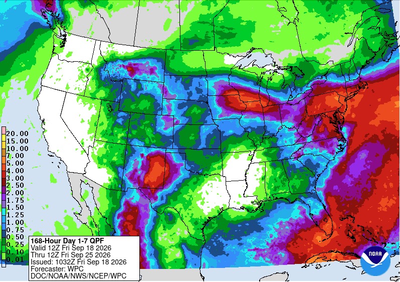
With a moisture rich atmosphere Sunday onward with high PWATS fully expecting locally heavy downpours such as we have seen over the last few months. Rainfall rates of 1-2" per hour are certainly able to produce Flash Flooding conditions especially with very wet soils ongoing at most locations.
-
 Generic Tadalafil 20mg price: menon36 - Buy Tadalafil 10mg
 -
The area near the Azores is now Invest 99L.
-
I would say it's a tic worse than 1957, though due to the orientation of the GOA low, as it's more elongated towards the Bering sea, as opposed to poleward in the direction of AK in 1957. Would need to see monthlies to confirm, but given the expected retrogression of that low during the evolution of the season, that is likely a limiting factor with respect to periods of cross polar flow during the second half....so news flash, second half probably won't be as good as 1958...no $hit-
-

2026 Atlantic Hurricane Season
Retrobuc replied to Stormchaserchuck1's topic in Tropical Headquarters
I am doing an Ironman 70.3 in Wilmington NC in mid Oct. I fully expect tropical activity around that time..... -
WPC day 1-7 precip total is 3”+
-
I know it's instinctive to look at the colors on those maps and feel compelled to projectile-vomit, but it's really not far off of a bast-case scenario given the hand we are dealt. I have no issue with this composite...we have a bit of breathing room in terms of latitude with respect to the pig-ridge to the north, and the GOA low isn't pressed up against the coast out west. We can't see the composite seasons, but that looks a great deal like 1957-1958 to me.
-
No way. October these days almost always has at least one 80 F day. A couple years ago it even hit 80 on Halloween. A sufficiently torchy November also sometimes has 80 F days.
-

2026-2027 Record-breaking El Nino
bluewave replied to Stormchaserchuck1's topic in Weather Forecasting and Discussion
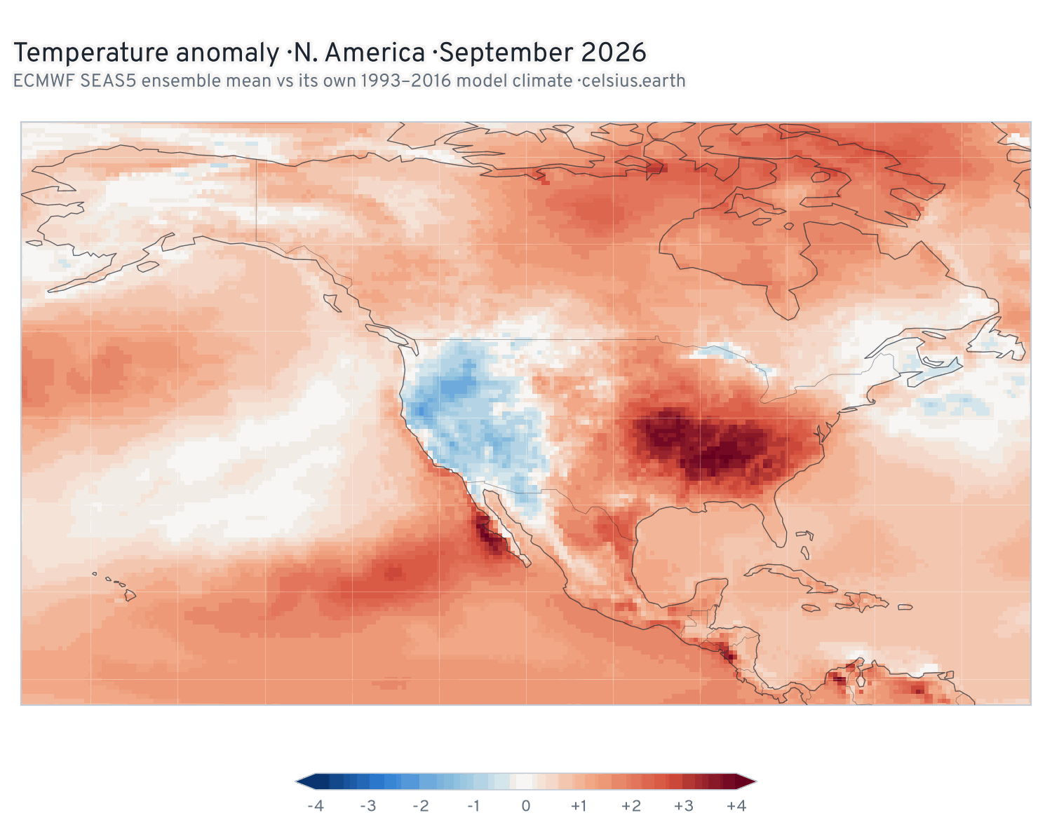
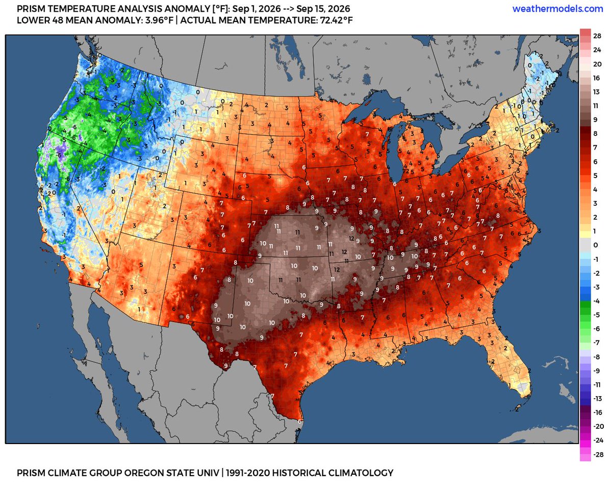
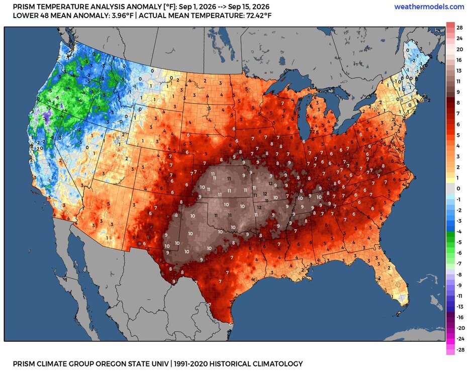
I like the Euro monthly forecasts issued on the 5th which have been doing a pretty good job compared to some of the other guidance.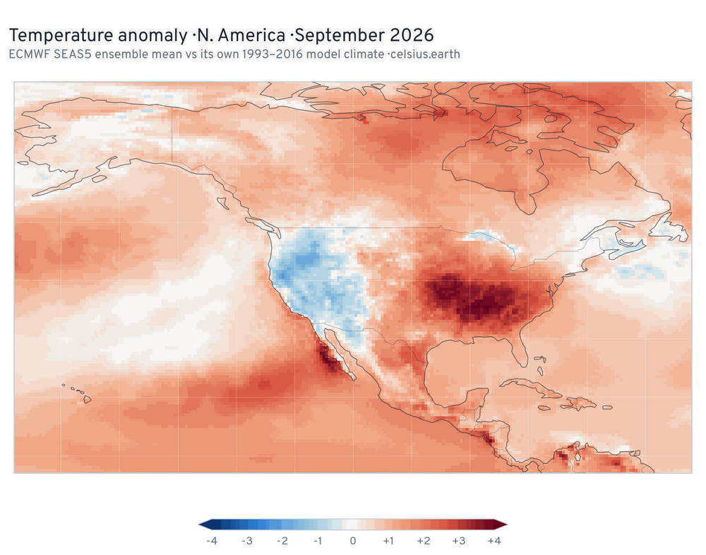
-

Septorcher 2026 Discussion - Endless Summer
Lava Rock replied to Damage In Tolland's topic in New England
Had planned for some seeding, but just too dry and not going to tax the well water. 1.05" on the month which isn't doing anything. we dry. -
Looks like WPC coming on board for a a potentially very wet stretch coming up. Too soon for details on placement of heaviest of the totals but looks like more Flash Flood Watches for some part of this sub forum are in the cards over the next week. PWATS once again modeled to rise to AOA 2". Chances of locally excessive totals for some over the next 7 days increasing.







.jpg.8245456dea671d3187fda328fbc0d11d.jpg)