All Activity
- Past hour
-
Ride the train of storms and just hope you end up on the right side of any boundary that may reside within the region. Certainly plenty of potential moving through the second half of the month. Someone is going to cash in the poker chips
-
Different wave spacing/event mechanism - when you say "also" it kinda sorta sounds like "same", whether you meant that or not. So ... just sayn' It matters, because the CMC in fact has nothing from the same prospect that the GFS designed.
-

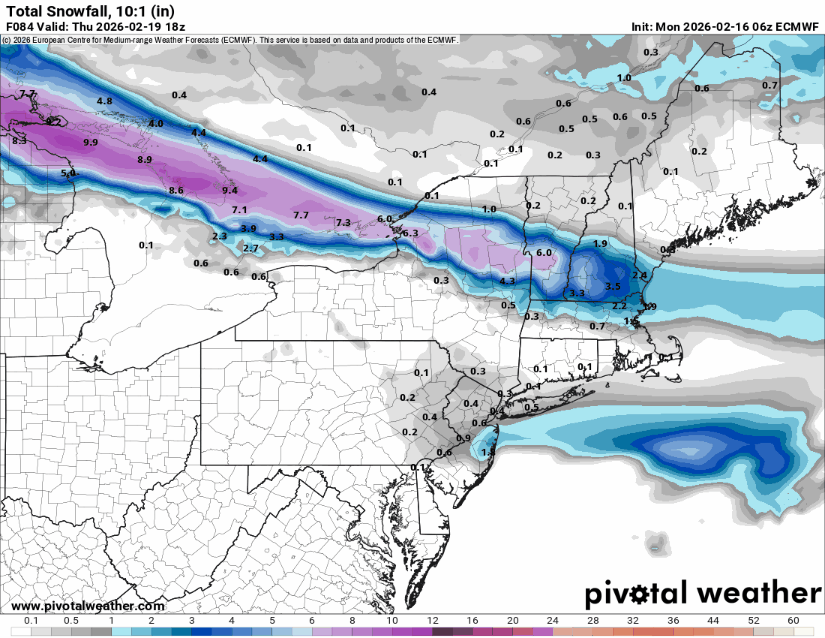
Presidents' day Snow potential
WeatherGeek2025 replied to WeatherGeek2025's topic in New York City Metro
i said 1.5 inches for Central Park. -
Not quite 0.5" based on CoCoRaHS. A modest overperformance.
-

Wednesday Feb 18 Mixed event. NoP refresher?
dendrite replied to HoarfrostHubb's topic in New England
- 1 reply
-
- 1
-

-
Maybe for you down in the tropics. also, as an aside, we were playing a Rhode Island based card game yesterday (don’t ask) and one of the cards came up as Cumberlandite
-
Congrats kid. Good work on deleting your 2-4 inch post.
-
usually not within 8 days
-

Winter 2025-26 Medium/Long Range Discussion
DocATL replied to michsnowfreak's topic in Lakes/Ohio Valley
This is insane. . -
I've always found it odd how models don't seem to understand climo. They always produce these rare events beyond day 3. I've probably had 100" of digital snow in the past 6 weeks. Odd for a place that averages like 10" a year lol.
-
.88
-

Winter 2025-26 Medium/Long Range Discussion
WestMichigan replied to michsnowfreak's topic in Lakes/Ohio Valley
I'm not saying it hasn't been dry overall for the last several months, but you can't say that about January. I would question your dry low water content claim by saying even if the ratios were high we still ended January with a decent amount of water equivalent precipitation.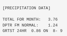
-
Broke out a separate thread for Wednesday. NAM be damned
-
.thumb.jpg.6a4895b2a43f87359e4e7d04a6fa0d14.jpg)
Central PA Winter 25/26 Discussion and Obs
Yardstickgozinya replied to MAG5035's topic in Upstate New York/Pennsylvania
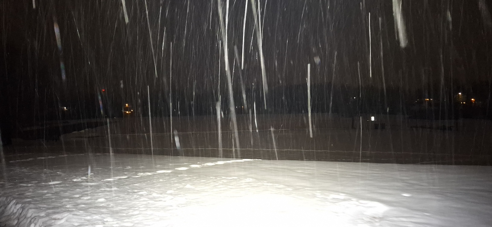
It snowed here just long enough to get in a decent walk last night. I ended up with a dusting. Until yesterday there was very little grond showing in my general area. I'm still holding on to a few inches of snow in most spots. The 1.75" sleet, top layer seems like it will be the last thing to go. I snapped a few photos last night on my walk just to show what i'm still holding onto around here . The top picture was taken at the entrance of the ABWE religious organization in Fairview⁹ township, which sits on the north facing bottom of elevated terrain. The bottom picture was taken at Roof park in Fairview township, which has unidirectional sun exposure and still holding on to it's snow very well considering what it's been through the past couple of days. Any exposed ground I did find on my walk last night was still frozen solid at the surface.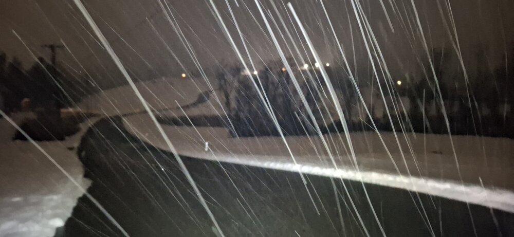

-

Is we back? February discussion thread
Damage In Tolland replied to mahk_webstah's topic in New England
Either Wednesday or Friday will have some ice here . Not sure which one yet . -
NWS has some rain for delmarva Wednesday-Sunday in the mid to upper 40s. Same for Ft. Meade MD with the exception for Sunday a chance of snow mixed. The extended forecast has 50 into March 3rd. We could use the rain before the summer. Feel sorry for the DC are with that sewage spill in the Potomac.
-
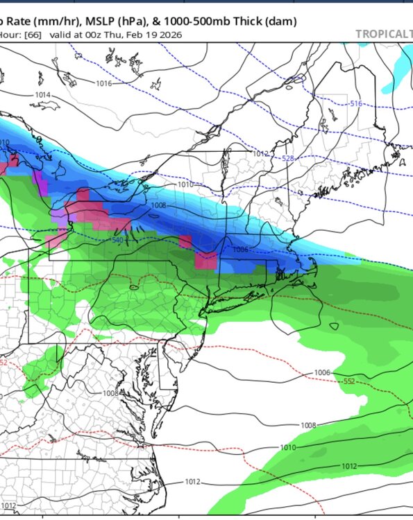
Can we keep the streak going? Still some uncertainty on what happens Wednesday. GFS has a Pike region minor event. Euro keeps the snow in CNE largely with a bit into N Mass.
- 1 reply
-
- 1
-

-
Not only the AI. Euro had 2 hits in the MA on the 12z run for next weekend and 0z lost both of them. It's just a fact that the models struggle past day 3 and are snow happy. Really takes the "fun" out of this hobby.
-
https://x.com/nwsnewyorkny/status/2023372785259589845?s=46&t=RL_eyYCTlbw4VWItr6PagA
-
agreed wait till Wednesday morning at the earliest to pin down the timing
-
Can you send me a link with the totals? I'm not seeing the totals anywhere. https://forecast.weather.gov/product.php?site=NWS&issuedby=OKX&product=PNS&format=txt&version=1&glossary=0
-
6z nam is north of the euro now
-

February 2026 OBS & Discussion
WestBabylonWeather replied to Stormlover74's topic in New York City Metro
You better not start a thread -
Wednesday looks doable on the GFS. Euro has cooled a tad. Brings some snow south into Mass. a compromise would be good.
-
Is we back? February discussion thread
Damage In Tolland replied to mahk_webstah's topic in New England
Euro op vs NAM/ GFS/ AI’s for Wednesday. Probably ends up snowy north of 90 and mix south