All Activity
- Past hour
-

2026-2027 Fall/Winter Mountain Thread
Met1985 replied to BlueRidgeFolklore's topic in Southeastern States
Drizzly and rainy today with a current temp of 59 degrees. -
 Certainly was not directed at me
 -

October Comes Early: Late September Multi-Hazard Hybrid Storm
CoastalWx replied to WxWatcher007's topic in New England
That was more for Kevin posting that. -
I completely forgot about the ice storm. All I knew then was tropical. We average somewhere between 100-125 at SLK so being above that is interesting. For 2015-16 winter was a disaster.
-
“Lame” is good for us SE folks, especially those of us with elderly loved ones. Many in the SE US, even well inland, have had a very rough 2016-24. I was heavily affected by 5 storms. I’ll always take the very rare quiet season over that, especially because it will likely not be quiet next year.
-
-

October Comes Early: Late September Multi-Hazard Hybrid Storm
TheBudMan replied to WxWatcher007's topic in New England
Not sure which is worse, @CoastalWx giving the great Walt Drag a or his own kid ! That better have been for Kevin ! -

Strong Nor'Easter/Hybrid Storm Late September 2026
guinness77 replied to Rjay's topic in New York City Metro
Heads up for you LIRR commuters…winds have already been a problem, two downed utility poles by Bethpage will mess up your commute on the Ronkonkoma branch into tomorrow morning. This has been going on since 1pm today. -
Question is will we pay for it with 80s in the back half?
-

October Comes Early: Late September Multi-Hazard Hybrid Storm
dendrite replied to WxWatcher007's topic in New England
Lol…I’m not sure why anyone here would let the few usual meh’ers get to them. -

October Comes Early: Late September Multi-Hazard Hybrid Storm
WxWatcher007 replied to WxWatcher007's topic in New England
GDM really hasn’t budged much through all of the model flip flops. I think we have a good sense that this is going to be close to the coast, but intensity is still up in the air. -
BTV about 94" and SLK about 133". Of course, the Jan 1998 devastating ice storm was mixed in too that doesn't show up on the snow totals. The snow was crappier further east in NNE.
-
How was that winter in NNE?
-
Septorcher 2026 Discussion - Endless Summer
Damage In Tolland replied to Damage In Tolland's topic in New England
70’s most of next week after the rain Monday. Retorch! -
Septorcher 2026 Discussion - Endless Summer
WxWatcher007 replied to Damage In Tolland's topic in New England
It’s coming -
'97-'98 wasn't a horrific winter over interior SNE (ORH had 54.7")....Dec/Jan was actually above avg for snow....it was a horrific February that was the killer....which is ironic in an El Nino.
-
Whoa
-

2026 Atlantic Hurricane Season
Tallis Rockwell replied to Stormchaserchuck1's topic in Tropical Headquarters
Lamest Hurricane season ever. I am ok with that given that last decade. -

October Comes Early: Late September Multi-Hazard Hybrid Storm
jlauderdal replied to WxWatcher007's topic in New England
30 minutes away, I wont be denied high winds this weekend. I was up there a couple of weeks ago on a dewey day and it was in the mid 50s and howling at the summit. "Mount Greylock is the highest point in Massachusetts at 3,489 feet." -

Strong Nor'Easter/Hybrid Storm Late September 2026
wthrmn654 replied to Rjay's topic in New York City Metro
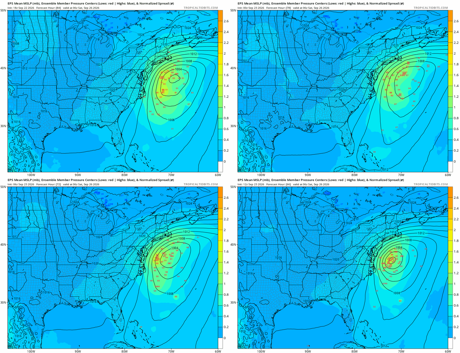
The trend for the eps is a tighter and tighter cluster each run it looks like..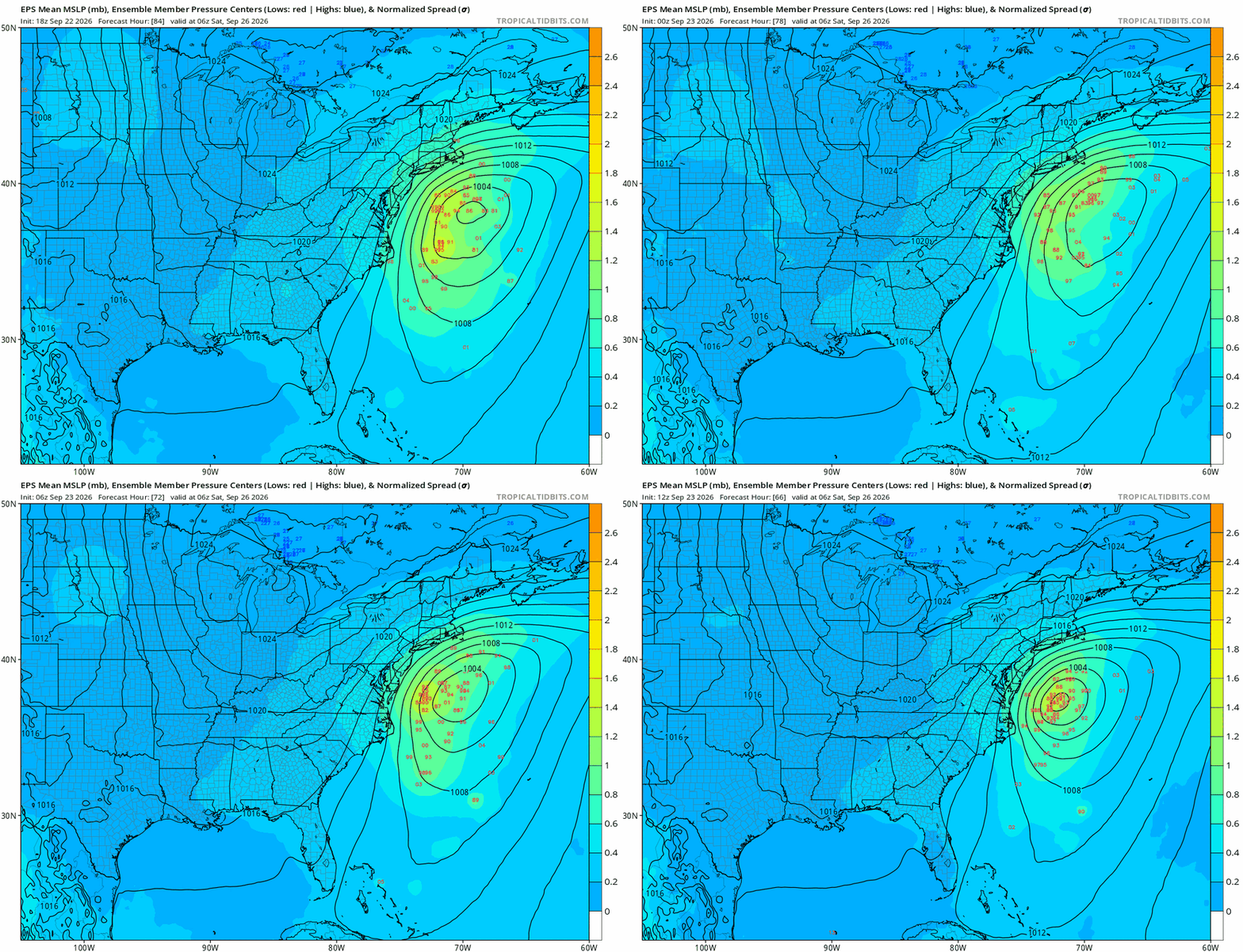
-

Strong Nor'Easter/Hybrid Storm Late September 2026
EasternLI replied to Rjay's topic in New York City Metro
AIFS-ENS sure seems to favor the idea of this thing having some impact... -

Septorcher 2026 Discussion - Endless Summer
powderfreak replied to Damage In Tolland's topic in New England
Today we frosted, car was still frozen at 9am.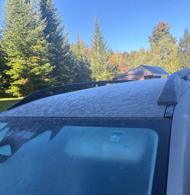
-
You sold on actual surface temps being warmer than 1997-98? As I mentioned earlier 1997-98 is definitely the odd duck for strong ninos in that Feb was the warmest rather than coldest month.
-
Yes it does indeed feel like late September. My high temperature for yesterday was only 59°. I hit 94°earlier this month, amazing how much variability can occur in September.
- Today
-

October Comes Early: Late September Multi-Hazard Hybrid Storm
Bostonseminole replied to WxWatcher007's topic in New England
511 WWUS71 KBOX 231933 NPWBOX URGENT - WEATHER MESSAGE National Weather Service Boston/Norton MA 333 PM EDT Wed Sep 23 2026 MAZ007-015-016-019>024-RIZ005>008-240900- /O.NEW.KBOX.HW.A.0003.260925T1200Z-260927T0000Z/ Eastern Essex MA-Suffolk MA-Eastern Norfolk MA-Eastern Plymouth MA-Southern Bristol MA-Southern Plymouth MA-Barnstable MA-Dukes MA-Nantucket MA-Bristol RI-Washington RI-Newport RI-Block Island RI- Including the cities of Plymouth, Bristol, Nantucket, Boston, Vineyard Haven, New Shoreham, Newport, New Bedford, Falmouth, Gloucester, Quincy, Mattapoisett, Chatham, Provincetown, Narragansett, Fall River, and Westerly 333 PM EDT Wed Sep 23 2026 ...HIGH WIND WATCH IN EFFECT FROM FRIDAY MORNING THROUGH SATURDAY EVENING... * WHAT...North winds 20 to 30 mph with gusts up to 50 mph possible. * WHERE...Portions of eastern, northeastern, and southeastern Massachusetts and northern and southern Rhode Island. * WHEN...From Friday morning through Saturday evening. * IMPACTS...Damaging winds could blow down trees and power lines. Power outages are possible. Travel could be difficult, especially for high profile vehicles. PRECAUTIONARY/PREPAREDNESS ACTIONS... Monitor the latest forecasts and warnings for updates. &&