All Activity
- Past hour
-

Hoisting the Sultan Signal: Heavy Rain Event July 5-7
Typhoon Tip replied to WxWatcher007's topic in New England
Tomorrow and Thursday may be sneaky hot... American MOS is 87 to 89 -ish, but after all this soil modulation from N VA all the way up .. and not much actual air mass change, the HI's will be 90+ -

2026-2027 Super El Nino
GaWx replied to Stormchaserchuck1's topic in Weather Forecasting and Discussion
Anomalies cool by 2.05C Dec to Mar as that post was specifically addressing anomalies. That would be a record rate of the cooling of the anomalies Dec to Mar vs the current record being in 72-73 (1.87C). -

2026-2027 Super El Nino
LakePaste25 replied to Stormchaserchuck1's topic in Weather Forecasting and Discussion
yeah they’re not “cooling” by a full 2.05C from Dec to March. the seasonal climatological mean is also increasing. -

Occasional Thoughts on Climate Change
donsutherland1 replied to donsutherland1's topic in Climate Change
Just as had been the case in 2019, France is being hit by heatwave after heatwave. Following June's record-breaking heat, France is again in the midst of an extreme heatwave. Dozens of July monthly records have fallen. The next 5-7 days will feature a continuation of excessive heat. -

2026-2027 Super El Nino
forkyfork replied to Stormchaserchuck1's topic in Weather Forecasting and Discussion
that's because of how high the anomalies get!!! omg -

Hoisting the Sultan Signal: Heavy Rain Event July 5-7
weatherwiz replied to WxWatcher007's topic in New England
Concern for some localized flash flooding, sure. But some of what was going around made it seem like flooding was going to be a large or widespread issue. But this is becoming a big problem in forecasting when it comes to some of these products. Folks see ensembles going crazy and all of a sudden alarm bells are sounded without fully divulging into all the data and then you have these products like extreme forecast index which further adds to the alarm bells. Yes, sure when you have these products showing something extreme there definitely should be concern, but they can't just be taken at face value nor should they be. Same goes with severe weather and winter weather...even in the west, a ton of events will get all hyped up with talk of tornado outbreaks and strong tornadoes because supercell composite parameter/significant tornado parameter forecasts are "through the roof" then the event comes and there are barely any tornadoes, let alone strong ones. And of course winter...D12 snowmaps show widespread 20-30" storms and here goes the social media hype for a massive blizzard. While sure there were guidance throwing around widespread 4-8" rain amounts and isolated higher totals, it was pretty clear that was not going to be the case and any amounts that excessive would most likely be extremely isolated or confined closer to where the warm front would be and it was also clear these totals would be spread out over a longer duration. Overall flood risk appeared low. Like I said earlier, watch in a few weeks we will get a setup with produces flooding and there will be little talk of the potential. For whatever reason it seems anytime talk of flooding is possible it never pans out, then we get setups where there is little mention of flooding possibility and you have problems all over. -
2026-2027 Super El Nino
GaWx replied to Stormchaserchuck1's topic in Weather Forecasting and Discussion
Adam, the monthly ERSST for Nino 4, which is from 150W to 160E, was warmest on record in these months: 30.21: Nov. ‘23 30.19: Jun ‘26 30.13: Nov ‘15 30.04: Dec ‘23 30.00: May ‘26 With the midpoint of Nino 4 being E of dateline (175W), the odds are very high that 30C made it E of the dateline prior to ‘26, especially in late ‘23 and late ‘15. However, it very likely didn’t happen in summer of ‘23 although it very well could have also in spring-fall ‘15 based on Nino 4 being 28.8 to 28.9 then. https://www.cpc.ncep.noa -
Hoisting the Sultan Signal: Heavy Rain Event July 5-7
Typhoon Tip replied to WxWatcher007's topic in New England
Mm... to be fair, not sure how much of a "bust" this is... It rained spot 8" totals ivo of slow moving convection around the mid and upper M/A - which by nature of what that is, yeah, it's very localized ... granted. But doing so in a general 2-4" coverage from Delware to SE NH is reasonable. What busts in my mind is the amplitude in the models - to some degree, that was the case this time, just like we've seen so many times in the past since these models got updated, circa 2015, and have been consistently biased about ever since. 96 to 200+ hour range tends to "end the world" far more frequently than the pedestrian aspect that actually takes place. Some normalization is all but dependable. Again.. a filtration that still ... fails to modulate impressions of guidance by humans. This is what leads to the 2nd form of bust... (these are two concurrent busts moving past one another). Humans than exaggerating... exaggeration is not ever likely to end well for verification. Removing the wanton human goober factor, and accounting for the known model amp bias... it rained within reason. Someone else mentioned something that I liked the other day... Maybe it was Scott or Vortex95 ? but raining 6" is impressive no matter what, but it's different animal entirely when that occurs in 2 hours rather than 2 days. Basically ...it rained a decent amount over a large multi-regional aspect. Perspectives will never land on objective reality. -
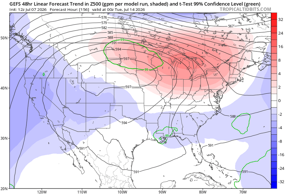
the last one trended east and this one has started edging
-

Hoisting the Sultan Signal: Heavy Rain Event July 5-7
WinterWolf replied to WxWatcher007's topic in New England
Ryan was concerned that some areas were in for flooding too…so what can you do? Modeling was throwing those ideas around. -

Hoisting the Sultan Signal: Heavy Rain Event July 5-7
CoastalWx replied to WxWatcher007's topic in New England
Finally, getting good rains. -
Hoisting the Sultan Signal: Heavy Rain Event July 5-7
weatherwiz replied to WxWatcher007's topic in New England
The amount of hype going around on this was insane. This was going to be nothing more but a much needed soaking rain for many...that is it. All these posts about models showing widespread 4-8" of rain, which by the way were showing jackpots across northwest CT and north when the axis of highest rains which much farther south which was mentioned of likely occurring. All this talk everywhere about flooding rains and blah blah. Steady soaking rain with a widespread 1-3" and of course some 3-6" amounts south where the axis ended up being....and of course spread out over a long duration. I mean were there even any flash flood warnings lol (maybe 1?). One of the most overhyped rain events ever. Nothing more than a soaking rain but I guess since how everyone thinks we're a desert now 3-4" is alarming -
3.41”
-

Hoisting the Sultan Signal: Heavy Rain Event July 5-7
SouthCoastMA replied to WxWatcher007's topic in New England
1.1" -
Hoisting the Sultan Signal: Heavy Rain Event July 5-7
WinterWolf replied to WxWatcher007's topic in New England
Stein dead and buried, and cremated here. When all is said and done..we’ll be upper 3’s to near 4” from this. Yes, no flooding, which was good, but a soaking soaker for sure. -
It doesn't seem like you will ever win the lottery, don't waste your money playing.
-
It's like the Orioles hitting ability, it's always an hour late.
-
Hoisting the Sultan Signal: Heavy Rain Event July 5-7
WinterWolf replied to WxWatcher007's topic in New England
We tried to tell him yesterday afternoon…he refused the good advice. Ya hate to see it. CT was always positioned to do well in this. Still raining here as we speak. -

Hoisting the Sultan Signal: Heavy Rain Event July 5-7
HIPPYVALLEY replied to WxWatcher007's topic in New England
Falmouth is officially over 5 inches. - Today
-

Hoisting the Sultan Signal: Heavy Rain Event July 5-7
Damage In Tolland replied to WxWatcher007's topic in New England
All of you were forecasting regional flooding and a few had 4-6” of rain for the area . None of those things happened. So sure there was more rain than I thought, but nothing like what you called for at various points the last few days . Let’s look in the mirror and own up. -
Just finalized reservations for flights, lodging and an SUV rental for a week in the Northern Rockies the first week of August. Planning to hike Glacier National Park, Yellowstone and Grand Teton with my son. Looks like some of the trails we plan to hit have been closed recently due to heavy rain and snow melt. Others due to heightened bear activity ! Hoping the forecast for that ridge to set up out west the next few weeks verifies. Will rely on bear spray for the rest.
-
.thumb.gif.f92b16c631a1d15d405ed77b33f0710d.gif)
Hoisting the Sultan Signal: Heavy Rain Event July 5-7
Torch Tiger replied to WxWatcher007's topic in New England
It did rain here. W -

Hoisting the Sultan Signal: Heavy Rain Event July 5-7
Ginx snewx replied to WxWatcher007's topic in New England
Analog 850 inflow is very wet for you. Some knew -
Snow rooms: https://www.nytimes.com/2026/07/04/style/snow-rooms-home-technoalpin.html?unlocked_article_code=1.v1A.xAsJ.i6M32dlKAMai&smid=url-share
-
An additional .06 overnight brings the total here to 3.81" for the event. No standing water shows how dry it has been and that the ground soaked up every drop.