andyhb Posted April 9, 2012 Share Posted April 9, 2012 More very large hail approaching Woodward again... Link to comment Share on other sites More sharing options...
Superstorm93 Posted April 9, 2012 Share Posted April 9, 2012 Two cells to the North of Woodword rotating now. Link to comment Share on other sites More sharing options...
SquatchinNY Posted April 9, 2012 Author Share Posted April 9, 2012 Any updates on TOG? Link to comment Share on other sites More sharing options...
AgeeWx Posted April 9, 2012 Share Posted April 9, 2012 Environment is noticeably cooler than that S and W of the storm. Wonder what this will do to the structure itself. Link to comment Share on other sites More sharing options...
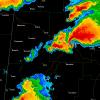
Superstorm93 Posted April 9, 2012 Share Posted April 9, 2012 Link to comment Share on other sites More sharing options...
SquatchinNY Posted April 9, 2012 Author Share Posted April 9, 2012 ... Link to comment Share on other sites More sharing options...
Buckeye05 Posted April 9, 2012 Share Posted April 9, 2012 Any updates on TOG? Spotter says it has lifted/become unorganized. Link to comment Share on other sites More sharing options...
OceanStWx Posted April 9, 2012 Share Posted April 9, 2012 The cell west of Woodward is flirting with baseball size hail again. Link to comment Share on other sites More sharing options...
Chinook Posted April 9, 2012 Share Posted April 9, 2012 Best mesocyclone strength index ever! Link to comment Share on other sites More sharing options...
cyclone77 Posted April 9, 2012 Share Posted April 9, 2012 Storm west of Woodward up near 55kft now. Link to comment Share on other sites More sharing options...
andyhb Posted April 9, 2012 Share Posted April 9, 2012 Quad county chasers have insane motion on their stream right now. Link to comment Share on other sites More sharing options...
Superstorm93 Posted April 9, 2012 Share Posted April 9, 2012 These cells are monsters aloft. Link to comment Share on other sites More sharing options...
thewxmann Posted April 9, 2012 Share Posted April 9, 2012 Reed Timmer: Meteorologist and Extreme Storm Chaser TVN on another tornado northeast of Vici and west of Mutual. Storm will slow down dramatically when tornado is produced then accelerate after occlusion. Looks like tornado will head just east of Vici, OK and will be rural areas southwest of Seiling thereafter. Looks to be wrapping in rain. Link to comment Share on other sites More sharing options...
Buckeye05 Posted April 9, 2012 Share Posted April 9, 2012 Funnel near Vici. Link to comment Share on other sites More sharing options...
Disc Posted April 9, 2012 Share Posted April 9, 2012 Another storm is hooking just south of Woodward. Some moderate rotation showing up on SRV as well. Link to comment Share on other sites More sharing options...
OceanStWx Posted April 9, 2012 Share Posted April 9, 2012 The meso looks to be weakening now. It's either another cycle or it is starting to feel the impact of the storms to the north. Link to comment Share on other sites More sharing options...
Superstorm93 Posted April 9, 2012 Share Posted April 9, 2012 The meso looks to be weakening now. It's either another cycle or it is starting to feel the impact of the storms to the north. Yeah, it looks like its getting caught up with the other storms to the north on ET. Link to comment Share on other sites More sharing options...
AgeeWx Posted April 9, 2012 Share Posted April 9, 2012 Almost looks like it's trying to line itself out now. Maybe outflow is producing a cold pool ahead of the Nrn storm. Link to comment Share on other sites More sharing options...
Superstorm93 Posted April 9, 2012 Share Posted April 9, 2012 Good portion of the SVR thunderstorm watch just upgraded to a tornado watch. Link to comment Share on other sites More sharing options...
Buckeye05 Posted April 9, 2012 Share Posted April 9, 2012 Both cells look to be weakening. Link to comment Share on other sites More sharing options...
AgeeWx Posted April 9, 2012 Share Posted April 9, 2012 Somebody smarter than me thinks this thing can still produce. 372 WFUS54 KOUN 092329 TOROUN OKC043-153-100000- /O.NEW.KOUN.TO.W.0008.120409T2329Z-120410T0000Z/ BULLETIN - EAS ACTIVATION REQUESTED TORNADO WARNING NATIONAL WEATHER SERVICE NORMAN OK 629 PM CDT MON APR 9 2012 THE NATIONAL WEATHER SERVICE IN NORMAN HAS ISSUED A * TORNADO WARNING FOR... EXTREME SOUTHEASTERN WOODWARD COUNTY IN NORTHWESTERN OKLAHOMA... NORTH CENTRAL DEWEY COUNTY IN NORTHWESTERN OKLAHOMA... * UNTIL 700 PM CDT * AT 628 PM CDT...RADAR AND STORM SPOTTERS OBSERVED A TORNADO NEAR MUTUAL. THE TORNADO WAS MOVING SOUTHEAST AT 25 MPH. * LOCATIONS IMPACTED INCLUDE... TALOGA...MUTUAL AND CESTOS. PRECAUTIONARY/PREPAREDNESS ACTIONS... IN ADDITION TO A TORNADO THREAT...THIS STORM LIKELY CONTAINS DAMAGING HAIL TO THE SIZE OF BASEBALLS OR LARGER. GET IN...GET DOWN...AND COVER UP. LEAVE MOBILE HOMES AND VEHICLES. TAKE COVER NOW IN A STORM SHELTER OR AN INTERIOR ROOM OF A STURDY BUILDING. STAY AWAY FROM DOORS AND WINDOWS. LAT...LON 3630 9914 3605 9883 3595 9915 3619 9931 TIME...MOT...LOC 2328Z 321DEG 22KT 3619 9918 Link to comment Share on other sites More sharing options...
SouthernNJ Posted April 9, 2012 Share Posted April 9, 2012 The storm southwest of Woodward produced more softballs at 622. It should be watched carefully as the meso may be trying to lower now that it dropped the hail. Link to comment Share on other sites More sharing options...
andyhb Posted April 9, 2012 Share Posted April 9, 2012 Cell in the Eastern TX Panhandle is a beast.... Link to comment Share on other sites More sharing options...
brettjrob Posted April 9, 2012 Share Posted April 9, 2012 Seems to me the lead storm went crazy as it entered a zone of lower LCLs where clouds hung around most of the afternoon. I sat this one out because I couldn't leave until about 2:30pm and thought it was too marginal to race out for. 95 times out of 100 these setups don't produce (or maybe just one bird fart spinup), but my hunch is that the lingering clouds out ahead of the initiation zone made the difference on this one. If this is/was the case, could be enhanced potential with the northwestern cell over the next 30 minutes or so. Link to comment Share on other sites More sharing options...
cyclone77 Posted April 9, 2012 Share Posted April 9, 2012 The VNX radar has to shoot through a lot of reflectivity to get to the far western meso. Don't think it's getting sampled as well as it could be. The way the reflectivity is wrapping up back there I think that cell is getting close to producing as well. Link to comment Share on other sites More sharing options...
OceanStWx Posted April 9, 2012 Share Posted April 9, 2012 The cell west of Sharon still going strong. Low level meso is strengthening, and still suspending a lot of reflectivity aloft (72 dBZ over 25kft). Not surprised more softballs were reported west of Woodward with this. Link to comment Share on other sites More sharing options...
cyclone77 Posted April 9, 2012 Share Posted April 9, 2012 Actually the latest scan shows over 120kts g2g west of Sharon at around 7500ft. Link to comment Share on other sites More sharing options...
OceanStWx Posted April 9, 2012 Share Posted April 9, 2012 Dueling BWERs. Two monster updrafts, as good as you'll ever see. Link to comment Share on other sites More sharing options...
SmokeEater Posted April 9, 2012 Share Posted April 9, 2012 Nice rotation, imo this thing isn't lining out just yet. Link to comment Share on other sites More sharing options...
Buckeye05 Posted April 9, 2012 Share Posted April 9, 2012 TX/OK state line storm should be watched. Link to comment Share on other sites More sharing options...

Recommended Posts
Archived
This topic is now archived and is closed to further replies.