OceanStWx Posted April 9, 2012 Share Posted April 9, 2012 Reports from KFOR of two tornadoes on the ground, I would guess north northeast of Sharon and another northwest. Link to comment Share on other sites More sharing options...
JoMo Posted April 9, 2012 Share Posted April 9, 2012 They are now reporting it roping out. Link to comment Share on other sites More sharing options...
andyhb Posted April 9, 2012 Share Posted April 9, 2012 BULLETIN - EAS ACTIVATION REQUESTEDTORNADO WARNING NATIONAL WEATHER SERVICE NORMAN OK 550 PM CDT MON APR 9 2012 THE NATIONAL WEATHER SERVICE IN NORMAN HAS ISSUED A * TORNADO WARNING FOR... SOUTH CENTRAL WOODWARD COUNTY IN NORTHWESTERN OKLAHOMA... DEWEY COUNTY IN NORTHWESTERN OKLAHOMA... * UNTIL 630 PM CDT * AT 546 PM CDT...RADAR AND STORM SPOTTERS OBSERVED A TORNADO NEAR SHARON. THE TORNADO WAS MOVING SOUTHEAST AT 30 MPH. * LOCATIONS IMPACTED INCLUDE... VICI...SHARON...CAMARGO...MUTUAL AND CESTOS. PRECAUTIONARY/PREPAREDNESS ACTIONS... IN ADDITION TO A TORNADO THREAT...THIS STORM LIKELY CONTAINS DAMAGING HAIL TO THE SIZE OF GRAPEFRUIT. GET IN...GET DOWN...AND COVER UP. LEAVE MOBILE HOMES AND VEHICLES. TAKE COVER NOW IN A STORM SHELTER OR AN INTERIOR ROOM OF A STURDY BUILDING. STAY AWAY FROM DOORS AND WINDOWS. Link to comment Share on other sites More sharing options...
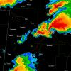
OceanStWx Posted April 9, 2012 Share Posted April 9, 2012 This boundary is more or less oriented NNW-SSE, and you can see how this cell has latched onto it and is deviating even farther right than the standard 30R75. Completely maximizing the tornado potential right now. Link to comment Share on other sites More sharing options...
Chinook Posted April 9, 2012 Share Posted April 9, 2012 Might be a bad scan, but latest scan shows 178kts inbound at around 11kft. Wow, look at this mesocyclone structure. I saw a -122.38 knots on base velocity there. Link to comment Share on other sites More sharing options...
thewxmann Posted April 9, 2012 Share Posted April 9, 2012 Marc Dillard reports wall cloud hugging the ground near Sharon; at least 3 tornadoes so far produced by the storm. Link to comment Share on other sites More sharing options...
OceanStWx Posted April 9, 2012 Share Posted April 9, 2012 Based on the KFOR chaser feed, that is a large bowl shaped wall cloud very close to the ground. Essentially the meso is lowering itself very close to the ground, which makes it very easy for the storm to drop tornadoes. Link to comment Share on other sites More sharing options...
Superstorm93 Posted April 9, 2012 Share Posted April 9, 2012 Might be a bad scan, but there's a 128knot bin on the south side. Link to comment Share on other sites More sharing options...
Buckeye05 Posted April 9, 2012 Share Posted April 9, 2012 Looks like something really major could happen by looking at the KFOR feed. Link to comment Share on other sites More sharing options...
OceanStWx Posted April 9, 2012 Share Posted April 9, 2012 Massive, massive rotation from this meso. It is spinning up all sorts of circulations on the fringes, and debris/dust is visible beneath some of these funnels that are shooting out of the side of the wall cloud. Link to comment Share on other sites More sharing options...
andyhb Posted April 9, 2012 Share Posted April 9, 2012 The inflow into this thing is ridiculous. Link to comment Share on other sites More sharing options...
SouthernNJ Posted April 9, 2012 Share Posted April 9, 2012 The storm near Fort Supply, 10-15 miles NW of Woodward, maybe should've had its own SVR polygon by the looks of things. Although it would have covered a small area. Link to comment Share on other sites More sharing options...
OceanStWx Posted April 9, 2012 Share Posted April 9, 2012 Confirmed injuries from hail/hail damage in Woodward via KFOR. Link to comment Share on other sites More sharing options...
Superstorm93 Posted April 9, 2012 Share Posted April 9, 2012 That cell is sucking up over 3000J/kg of CAPE and DEWPs in the mid-60's. Link to comment Share on other sites More sharing options...
cyclone77 Posted April 9, 2012 Share Posted April 9, 2012 Just a monster supercell. Looks like a cinnamon roll at times on certain scans. Link to comment Share on other sites More sharing options...
JoMo Posted April 9, 2012 Share Posted April 9, 2012 Large tornado with debris in the air east of Sharon. Link to comment Share on other sites More sharing options...
andyhb Posted April 9, 2012 Share Posted April 9, 2012 Large tornado/debris falling out of the air east of Sharon... Link to comment Share on other sites More sharing options...
Buckeye05 Posted April 9, 2012 Share Posted April 9, 2012 Large tornado with debris in the air reported headed for Mutual, OK. Just got very serious. Link to comment Share on other sites More sharing options...
AgeeWx Posted April 9, 2012 Share Posted April 9, 2012 Large tornado reported on the ground NW of Mutual with another smaller tor SSE of Sharon. Link to comment Share on other sites More sharing options...
OceanStWx Posted April 9, 2012 Share Posted April 9, 2012 As I mentioned earlier, despite relatively meager low level shear, this storm is maximizing its potential and coupled with such a well defined boundary has the potential to produce localized significant tornado damage (EF2+). Link to comment Share on other sites More sharing options...
andyhb Posted April 9, 2012 Share Posted April 9, 2012 Incredible signature now with that large tornado approaching Mutual. Link to comment Share on other sites More sharing options...
Buckeye05 Posted April 9, 2012 Share Posted April 9, 2012 Mutual is a tiny town, hoping it will just miss it. Link to comment Share on other sites More sharing options...
SquatchinNY Posted April 9, 2012 Author Share Posted April 9, 2012 Incredible signature now with that large tornado approaching Mutual. Link to comment Share on other sites More sharing options...
SquatchinNY Posted April 9, 2012 Author Share Posted April 9, 2012 http://en.wikipedia.org/wiki/Mutual,_Oklahoma Link to comment Share on other sites More sharing options...
Minnesota Meso Posted April 9, 2012 Share Posted April 9, 2012 Fort Supply area looking interesting as well Link to comment Share on other sites More sharing options...
OceanStWx Posted April 9, 2012 Share Posted April 9, 2012 My guess is that photos of this tornado/storm will be pretty spectacular. It is maintaining a LP structure, and it shold be providing very clear views of the base. Link to comment Share on other sites More sharing options...
Superstorm93 Posted April 9, 2012 Share Posted April 9, 2012 Cell is starting to hook out now. Link to comment Share on other sites More sharing options...
cyclone77 Posted April 9, 2012 Share Posted April 9, 2012 A few weaker couplets up near Woodward. Those two sups up near Woodward are moving south very quickly, and looks like it will catch up to the Sharon/Mutal sup soon. Wonder if we'll see sort of a fujiwara interaction. If that takes place the Mutual storm will probably slow up, and move a little more easterly very soon. The Woodward meso could eventually become very dominant. Gonna be interesting to watch. Link to comment Share on other sites More sharing options...
OceanStWx Posted April 9, 2012 Share Posted April 9, 2012 Absolutely keep an eye on the trailing cells too, they will be riding the same boundary, albeit with less favorable inflow. Link to comment Share on other sites More sharing options...
Buckeye05 Posted April 9, 2012 Share Posted April 9, 2012 Woodward storm starting to really crank up now as well. Link to comment Share on other sites More sharing options...

Recommended Posts
Archived
This topic is now archived and is closed to further replies.