brooklynwx99
-
Posts
6,229 -
Joined
-
Last visited
Content Type
Profiles
Blogs
Forums
American Weather
Media Demo
Store
Gallery
Everything posted by brooklynwx99
-
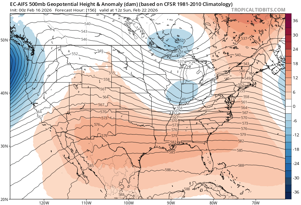
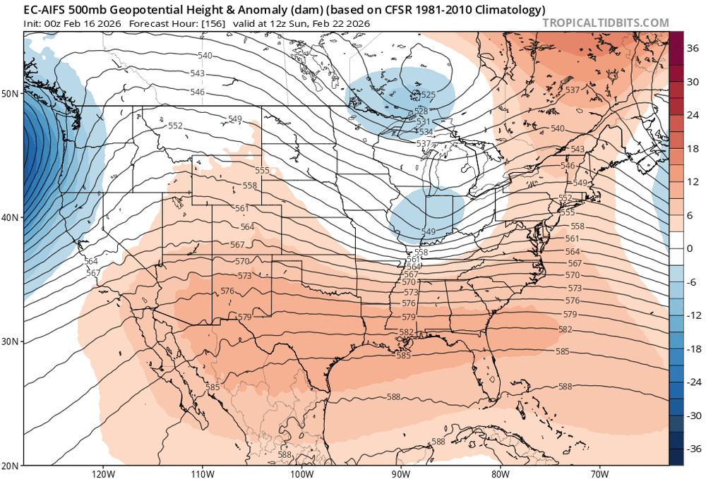
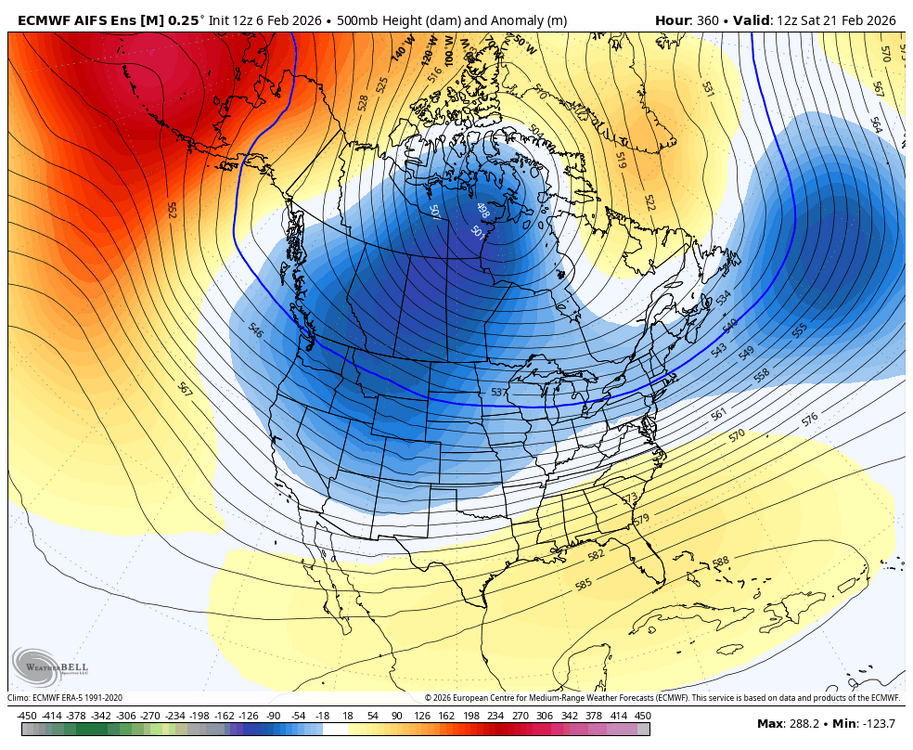
AIFS going for broke too
-
lots to like here IMO
-
lol
-
lol hold that thought
-
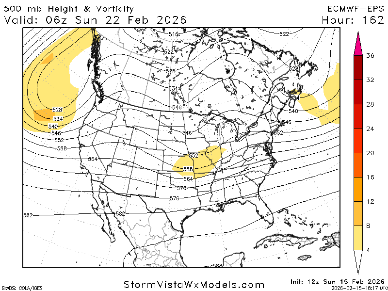
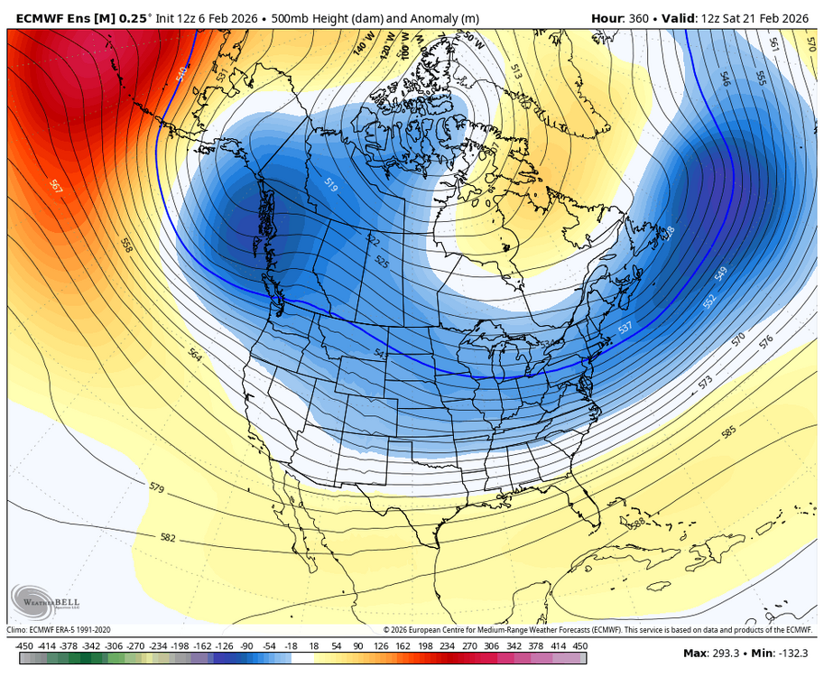
me too. just weird seeing the most skilled piece of guidance we have end up that aggressive. something will give by tomorrow
-
this would be quite the flop from the AIFS-ENS
-
spread tightened up
-
if only it wasn't the highest skill model we have at this range
-
why even look at the euro do this shit when you have the AIFS
-
well, euro is a full phaser
-
its ensemble has consistently been farther north FWIW
-
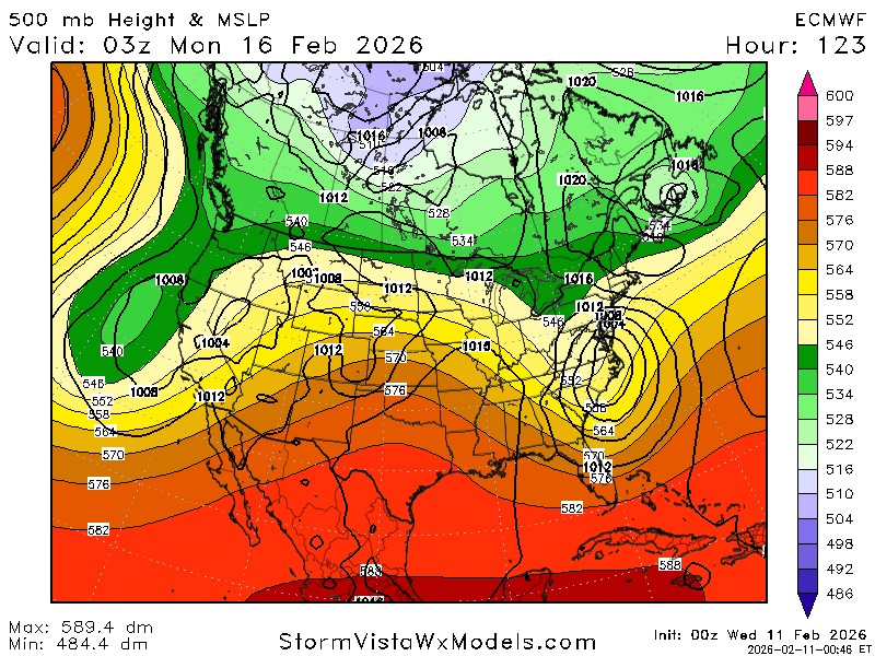
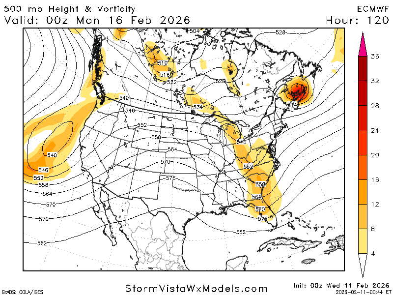
this can work. vort is a lot more defined than 00z
-
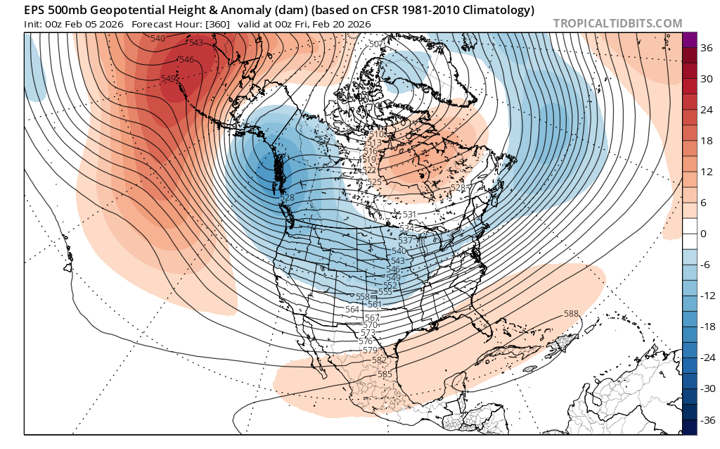
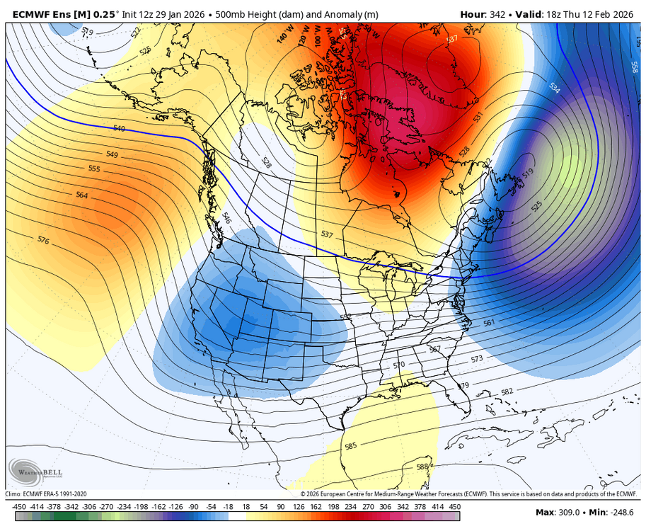
 still looking like the warmup after the 16th is transient as that -WPO builds poleward and closer to AK while -NAO blocking lingers. we get the TPV back into Canada as well sure, most of the cold is in the west, but this allows for a more active look here

-
still looking like the warmup after the 16th is transient as that -WPO builds poleward and closer to AK while -NAO blocking lingers. we get the TPV back into Canada as well sure, most of the cold is in the west, but this allows for a more active look here
-
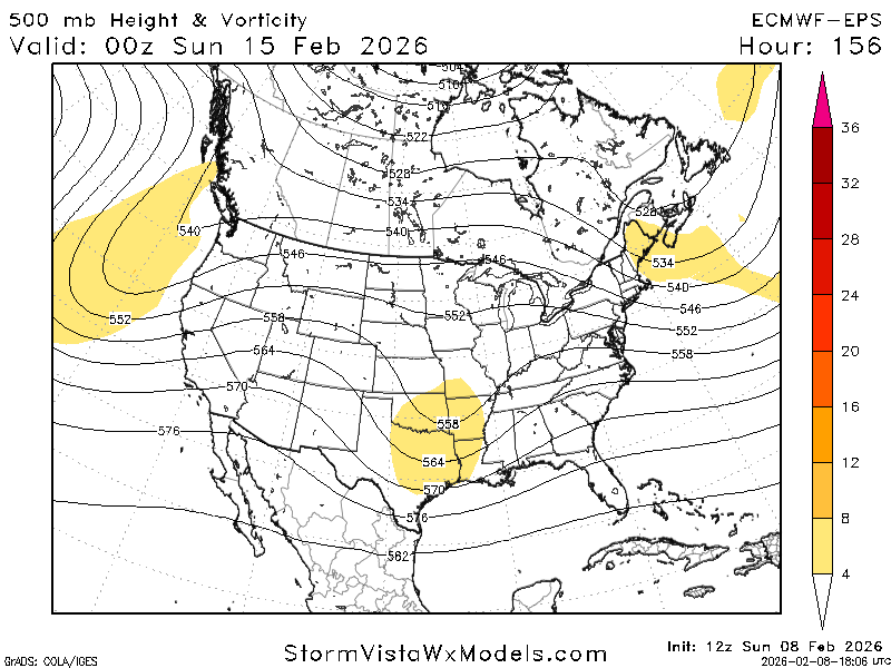
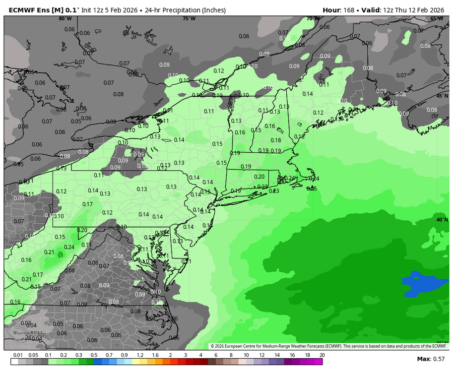
11-12th is more coherent on the EPS, pops a few coastals

-
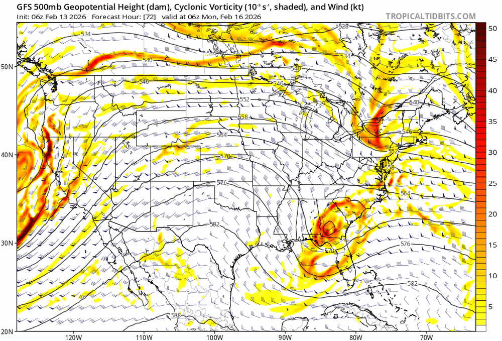
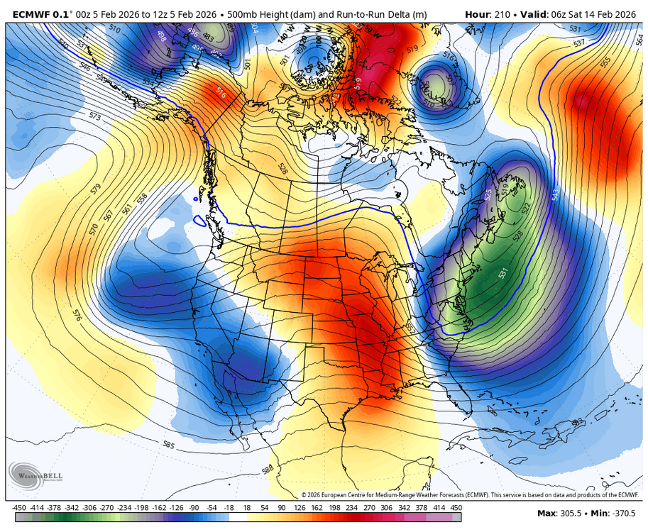
lol models have no clue. this is the run to run change, not regular 500mb
-
looks like any warmup is pretty brief with the -WPO building poleward... with some Canadian ridging / low NATL heights lingering, would remain conducive to some marginal threats

-
2025-2026 ENSO
brooklynwx99 replied to 40/70 Benchmark's topic in Weather Forecasting and Discussion
thanks for the kind words, snowman. always appreciated hopefully we see a continuation of this cold and wintry pattern… the beating the SPV is going to take likely helps us there -
2025-2026 ENSO
brooklynwx99 replied to 40/70 Benchmark's topic in Weather Forecasting and Discussion
well, here we go. not sure when exactly the blocking is going away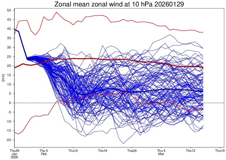
-
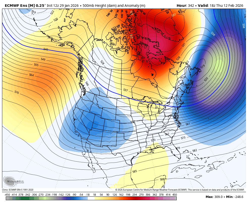
this is pretty striking. retrograding block and a legit 50/50 in place... vort over the Four Corners is making its way under the block
-
Possible coastal storm centered on Feb 1 2026.
brooklynwx99 replied to Typhoon Tip's topic in New England
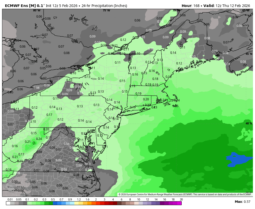
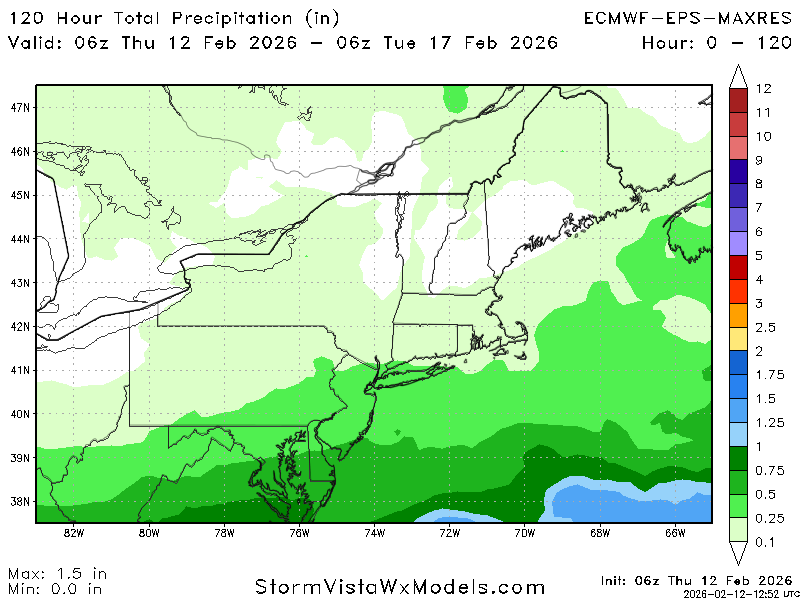
18z EPS had almost 1" liquid into Boston and the GFS and CMC both have nothing. what a world we live in -
Possible coastal storm centered on Feb 1 2026.
brooklynwx99 replied to Typhoon Tip's topic in New England
it's odd, one would think that the EPS would be "worse" than the GFS since there is less stretching, but that is not the case at all. such a weird setup
-
Possible coastal storm centered on Feb 1 2026.
brooklynwx99 replied to Typhoon Tip's topic in New England
lol. if the 00z holds i will get more excited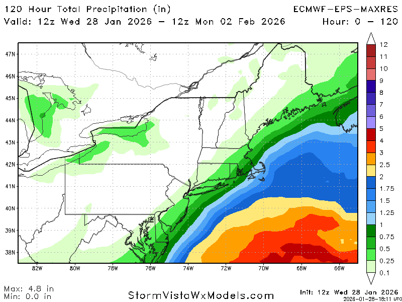
-
Possible coastal storm centered on Feb 1 2026.
brooklynwx99 replied to Typhoon Tip's topic in New England
yeah if it holds at 00z it's real -
Possible coastal storm centered on Feb 1 2026.
brooklynwx99 replied to Typhoon Tip's topic in New England
yeah, there has been a 18z euro tax. not sure why. but fun to see