brooklynwx99
-
Posts
6,233 -
Joined
-
Last visited
Content Type
Profiles
Blogs
Forums
American Weather
Media Demo
Store
Gallery
Everything posted by brooklynwx99
-
HOLY SHIT
-
ICON is going to crank
-

“Cory’s in NYC! Let’s HECS!” Feb. 22-24 Disco
brooklynwx99 replied to TheSnowman's topic in New England
this is right out of the KU playbook, it's coming -
“Cory’s in NYC! Let’s HECS!” Feb. 22-24 Disco
brooklynwx99 replied to TheSnowman's topic in New England
glue factory awaits. -
i have no words
-
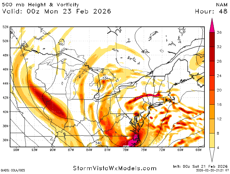
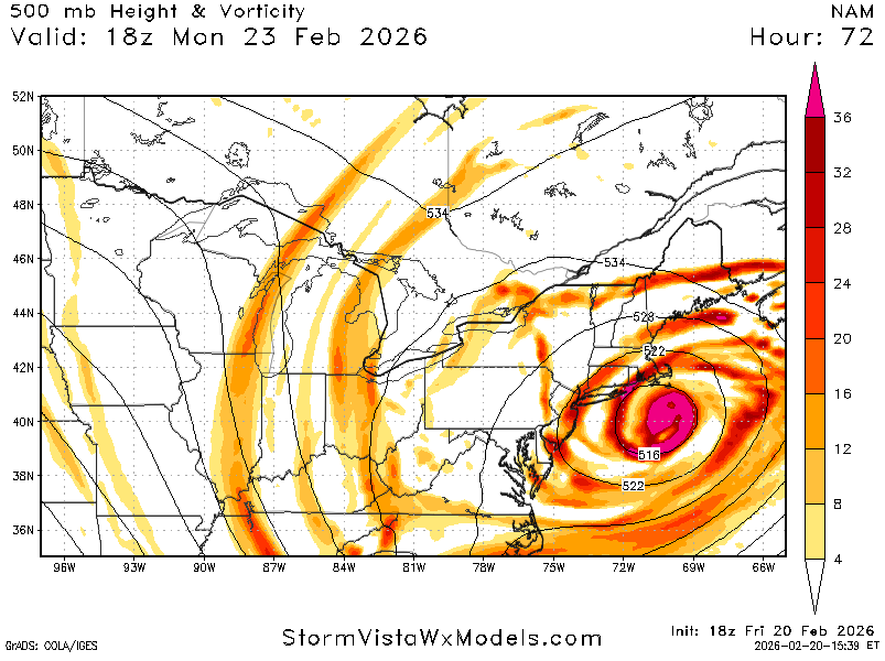
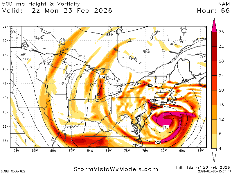
the NAM is somehow even more impressive. god bless
-
NAM looks great
-
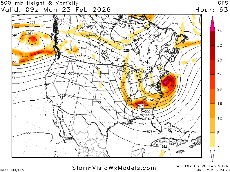
i think that this is arguably even more impressive. this is 15 years later and the only model that really showed this being a legit hit inside of 5 days was the GFS and every model bowed down to it. literally like Tony wrote a script
-
i'm so hype man. we needed this
-
“Cory’s in NYC! Let’s HECS!” Feb. 22-24 Disco
brooklynwx99 replied to TheSnowman's topic in New England
lol just put the fries in the bag
-
you are probably getting a blizzard warning
-
not enough time for it to propagate. this is one of the most insane things i have ever seen, the EPS looked like this 30 hours ago

-
“Cory’s in NYC! Let’s HECS!” Feb. 22-24 Disco
brooklynwx99 replied to TheSnowman's topic in New England
lol
-
i mean...
-
yeah this resembles every HECS we have had. textbook
-
legit possibility. can't forecast more than 12" for the city as it stands this second but there is certainly 18-24" upside
-
enjoy the MECS, it's been a long time coming
-
“Cory’s in NYC! Let’s HECS!” Feb. 22-24 Disco
brooklynwx99 replied to TheSnowman's topic in New England
they hated jesus too -
“Cory’s in NYC! Let’s HECS!” Feb. 22-24 Disco
brooklynwx99 replied to TheSnowman's topic in New England
tenor of the season, am i right -
welp
-
“Cory’s in NYC! Let’s HECS!” Feb. 22-24 Disco
brooklynwx99 replied to TheSnowman's topic in New England
.gif.fecdef27599a289597a401122274cf8a.gif)
-
.gif.a7448e18664b7bf0778b020424c7048b.gif)
-
NAM is significantly more phased

-
considering that the GFS has absolutely owned literally every other piece of guidance so far, I might give it a bit more credence
-
Feb 22nd/23rd "There's no way..." Storm Thread
brooklynwx99 replied to Maestrobjwa's topic in Mid Atlantic
well, fuck me