Jump to content

brooklynwx99

Meteorologist
  • Posts

    4,596
  • Joined

  • Last visited

Everything posted by brooklynwx99

  1. TPV stuff is so fickle. wouldn't surprise me to see a northern correction, but could keep going farther south. just gotta sit and wait. the synoptic pattern is solid enough with all of the LP in the northern ATL to prevent this from just flying north
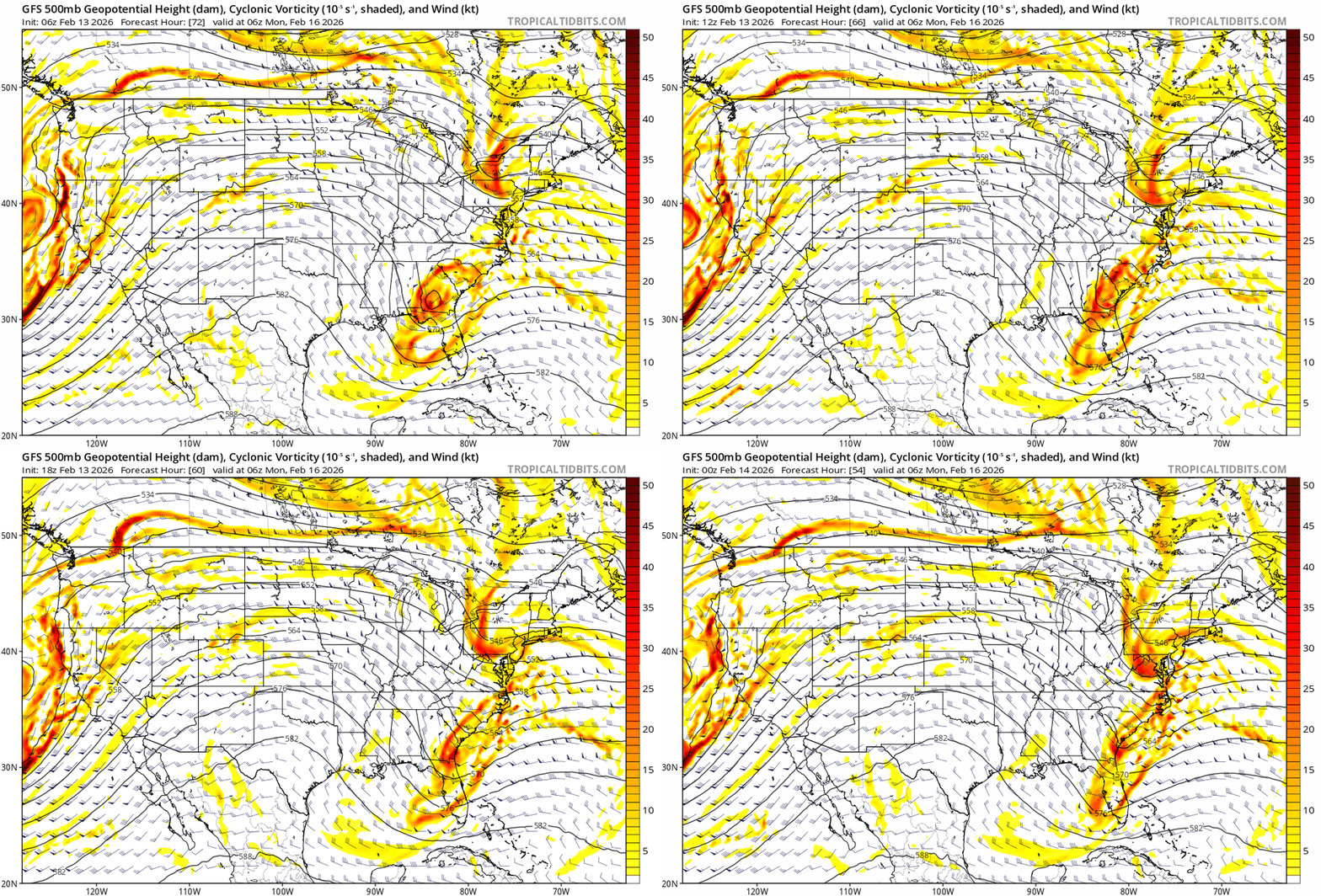
  2. ECMWF likely would have been GFS-like. slightly stronger and faster vort, but more confluence. note the wind barbs are more WNW-ly rather than W on the ECMWF, hence more of a pushback against latitude gain not sure how far this thing can really push north. you have a big ass TPV lobe sitting nearby
  3. get the amplitude a little higher and you have a sneaky nuke. some of the other GFS runs had quick hitting 3-6/4-8" type events
  4. you can pretty much think as the GFS as a southern member of the EPS. it's in the envelope now... not really an outlier like it was yesterday evening
  5. i think you're getting there, the trough is retrograding
  6. put some more coherent thoughts here, check them out if you'd like. they're still applicable to you guys
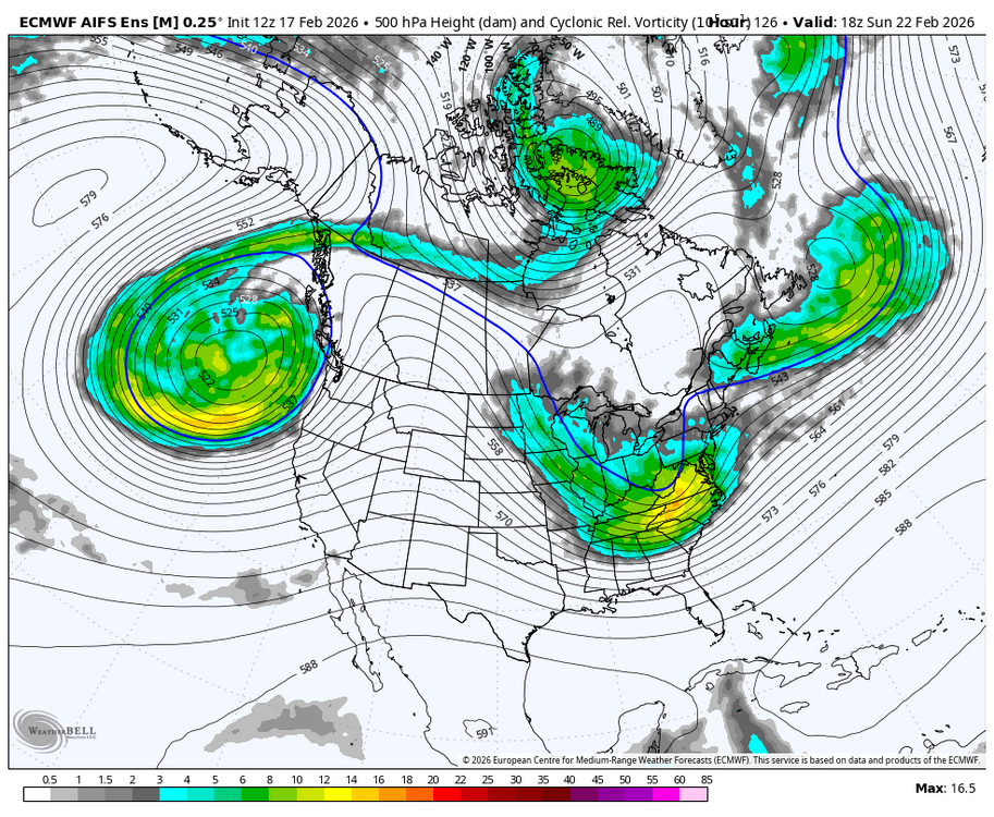
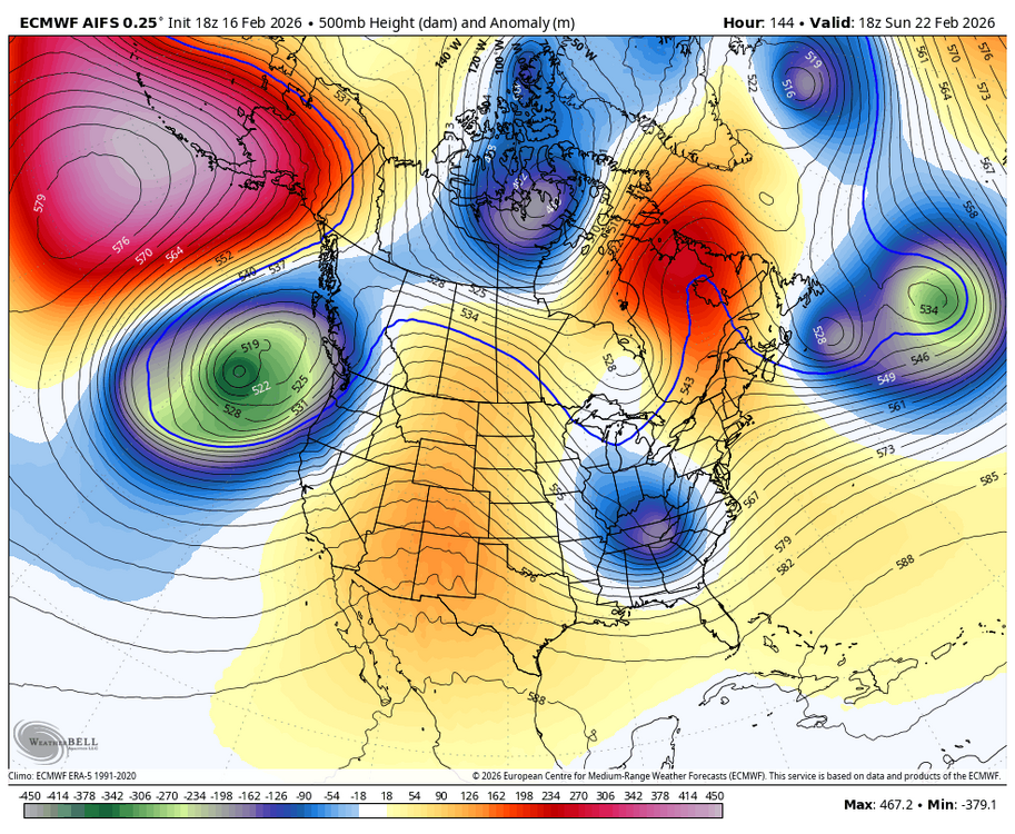
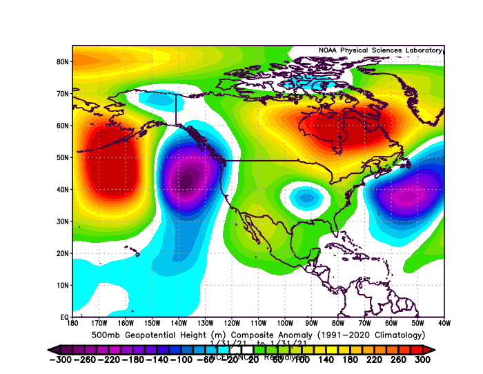
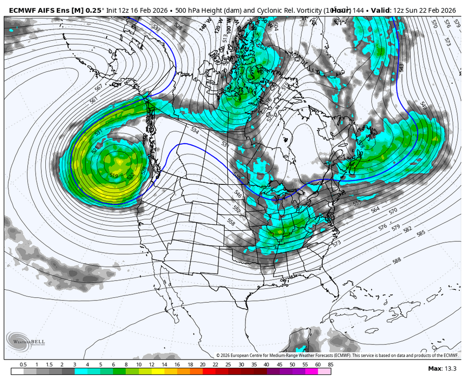
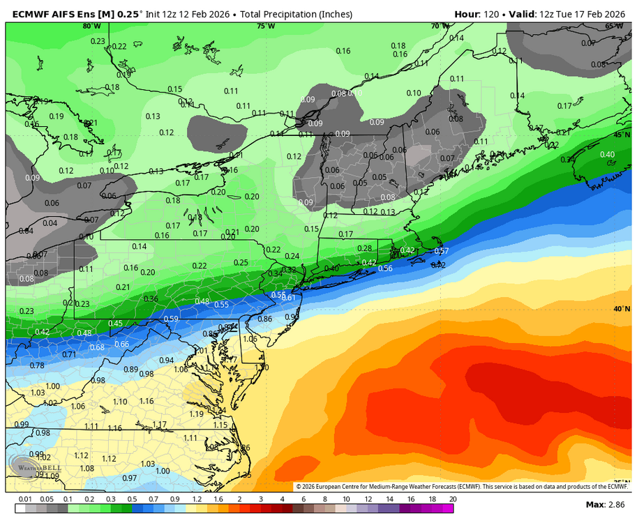
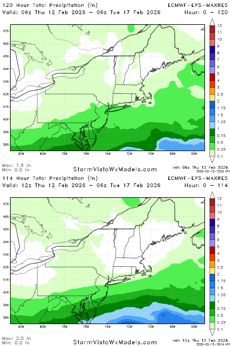
  7. decided to place some more coherent thoughts here. this is effectively a system where the northern and southern streams are in conflict and either phase or remain separate. the northern stream (NS) can be seen over the Dakotas, and the southern stream (SS) can be seen over the Four Corners region as we head through Sunday, it is a matter of how the two streams interact. there has been a consistent trend across guidance to push the NS ahead of the SS such that instead of phasing with the NS, it actually ends up compressing the flow, like so. the NS is strung out north of the Great Lakes, while the SS remains hung back over the Ozarks. this is a big departure from what we were seeing yesterday... GEFS trend loop attached, you can see the two streams drift apart finally, once we're at the start of next week, the SS vort is effectively running into a wall of confluence rather than phasing with the NS. this promotes an intense precipitation field from a potent SLP. the ensemble members from the EPS and GEFS are routinely sub-990mb. again, this is a consistent trend to increase confluence and decrease phasing looking from 12z yesterday to now: so, this leads to a SLP that's farther south rather the borderline inland runner that was showing up on earlier runs of the ECMWF and CMC. by the way, even the CMC has decidedly moved towards less stream interaction. confidence of 3" or more on the EPS has moved well south of where it was yesterday. this is a big move for the EPS, as it's generally pretty consistent, even at this range. the greatest snowfall remains to the north of I-78 and especially I-84: let's look at the general 500mb pattern across North America to see if any of this is even viable. we can see ridging developing across the high latitudes, which is representative of the pattern change that is ongoing at this time. there is AK ridging, providing some colder air into the flow, and there is a lobe of the polar vortex that's providing some confluence just north of the Great Lakes. there is also ample low pressure over the North Atlantic, which promotes more confluence than not. the southern stream shortwave has a much harder time raising heights ahead of it with the flow downstream, so this kind of shortwave moving ENE rather than NE or NNE is indeed viable. again, notice the trend with less stream interaction and lower heights in SE Canada are there any analogs that we can look at? there is only one that I'm really aware of, which is 2/23/87. this was also a pretty strong El Nino February, and I think the setup shares some features. both setups share the same kind of stream interaction that we're seeing... a potent SS vort and a northern stream vort that is generally out ahead of the system. there are a couple of differences, though. the first is that with this system, the northern stream did have a partial phase at the end, which is not what we're currently seeing (although possible!). second, there was a much more well established blocking pattern in place, as shown by the 500mb anomalies. there was much more confluence in the northern Atlantic, which is a more "classic" setup for a significant snowfall event. the 1987 event was a major snowfall event for the Mid-Atlantic, which is definitely unlikely here. however, take a bit of strength out of the eventual result (less phasing here) and shift things north (less confluence here), and the general axis and half of the total snowfall could be quite realistic so, we will see where things go from here. the whole setup is definitely a bit of a needle threader, as the confluence is not locked in and is pretty much entirely dependent on the movements of the northern stream vort. therefore, there can be a renewed trend back north or even a move back to a phasing scenario. however, it seems like the trend is for more destructive interference from the NS rather than constructive, which is leading to increased confidence in a more southern solution. I would still pinpoint north of I-84 as the safest bet to see anything legit out of this, but anyone north of I-78 is in play. this is also more of a latitude than longitude based event, so being on the coast isn't that big of a deal, it would just hurt ratios. hopefully we have more clarity tomorrow afternoon (doubtful)
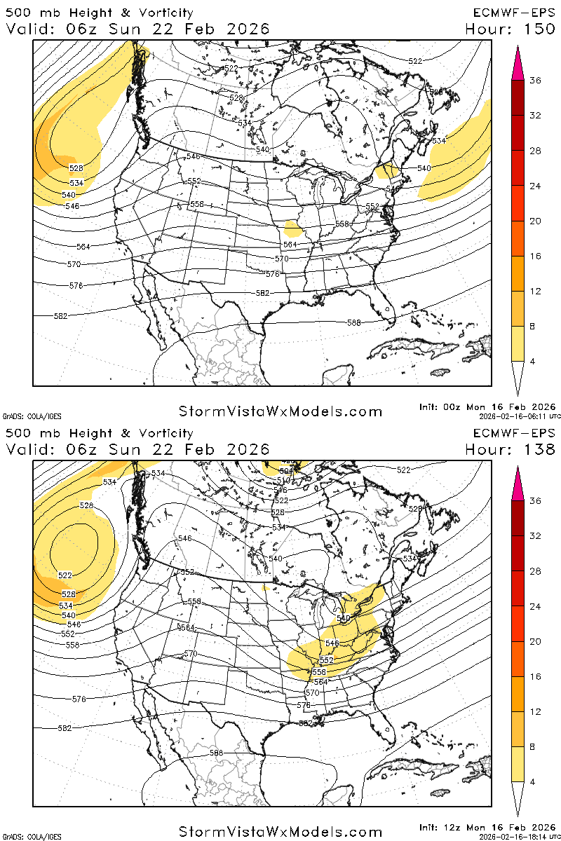
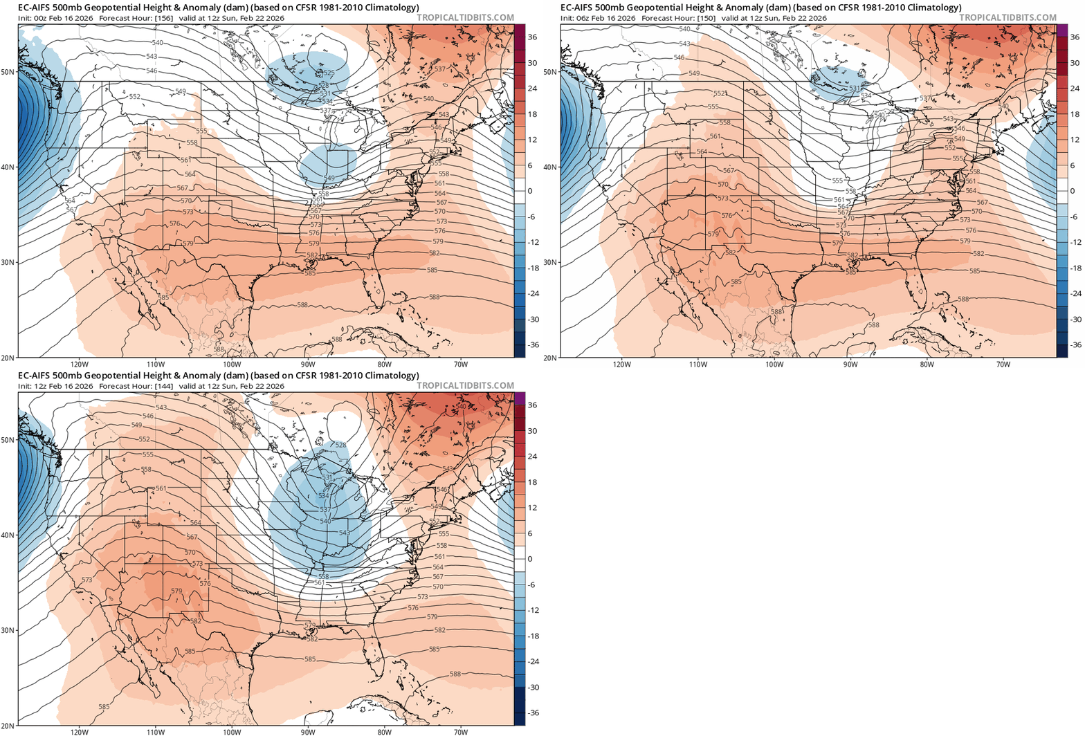
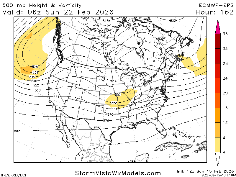
  8. EPS also ejects an amplifying wave for the 23rd. wild how clearly this shows up along with the PNA spike and decaying block. very favorable hemispheric look. this is the best threat IMO
  9. EPS also ejects an amplifying wave for the 23rd. wild how clearly this shows up along with the PNA spike and decaying block. very favorable hemispheric look
  10. when you increase the confluence, you also increase lift near it due to the convergence. so although there is less phasing, you'll still get very heavy precip dealing with a shortwave like that
  11. northern stream has a much more confluent orientation compared to 00z
  12. guidance is still screaming for the 24th as the Pacific trough retrogrades and the -NAO lessens
  13. here's why I like the 24th... the Pacific trough retros and you have a big amplification signal downstream as the block decays and confluence lessens. it's a recipe for a big storm
×
×
  • Create New...