brooklynwx99
-
Posts
6,233 -
Joined
-
Last visited
Content Type
Profiles
Blogs
Forums
American Weather
Media Demo
Store
Gallery
Everything posted by brooklynwx99
-

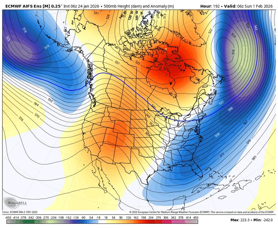
Possible coastal storm centered on Feb 1 2026.
brooklynwx99 replied to Typhoon Tip's topic in New England
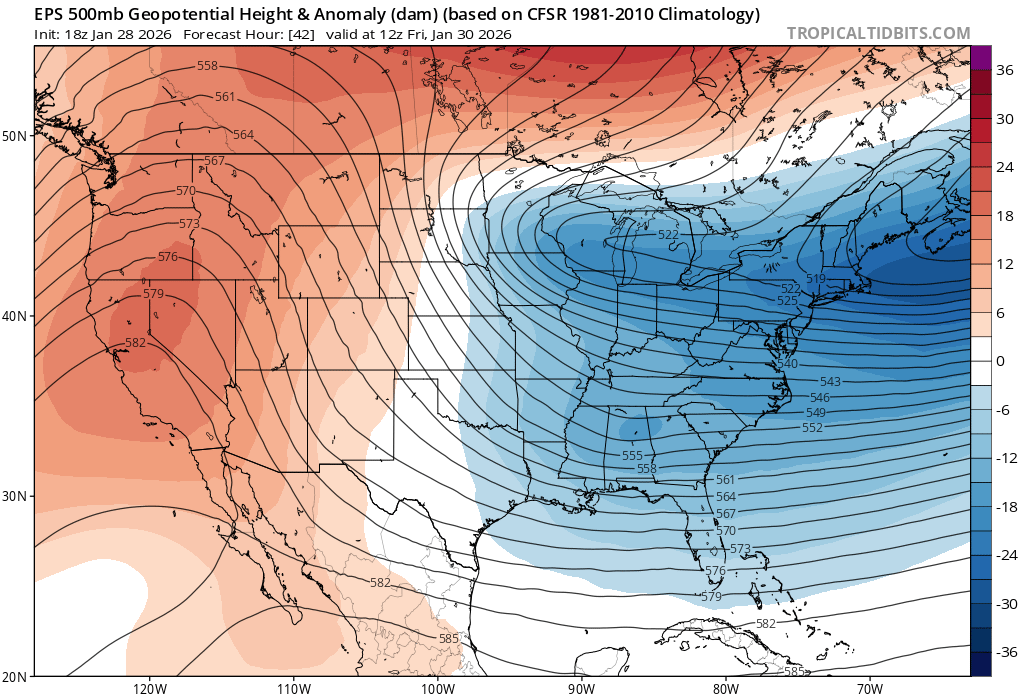
it's odd, one would think that the EPS would be "worse" than the GFS since there is less stretching, but that is not the case at all. such a weird setup
-
Possible coastal storm centered on Feb 1 2026.
brooklynwx99 replied to Typhoon Tip's topic in New England
lol. if the 00z holds i will get more excited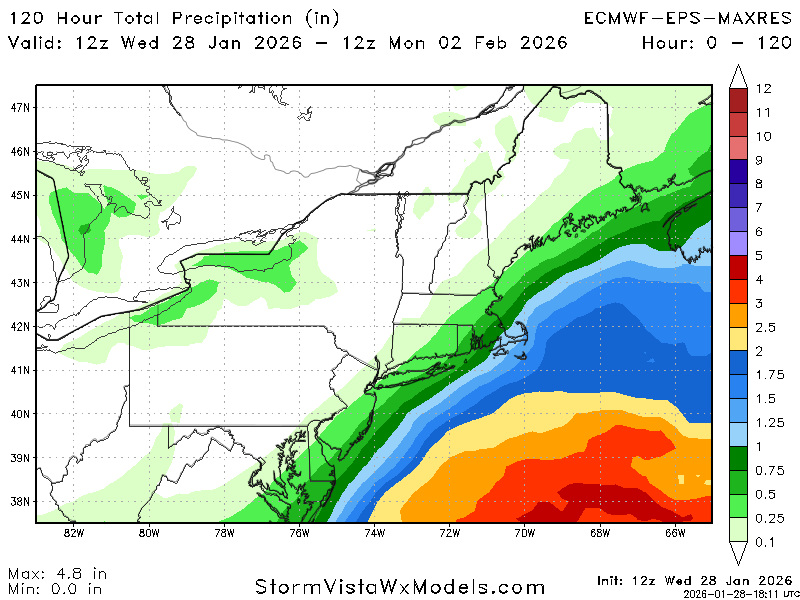
-
Possible coastal storm centered on Feb 1 2026.
brooklynwx99 replied to Typhoon Tip's topic in New England
yeah if it holds at 00z it's real -
Possible coastal storm centered on Feb 1 2026.
brooklynwx99 replied to Typhoon Tip's topic in New England
yeah, there has been a 18z euro tax. not sure why. but fun to see -
Possible coastal storm centered on Feb 1 2026.
brooklynwx99 replied to Typhoon Tip's topic in New England
they literally made the euro run at off hours so that it could be less accurate and more annoying to use. what a concept -
Possible coastal storm centered on Feb 1 2026.
brooklynwx99 replied to Typhoon Tip's topic in New England
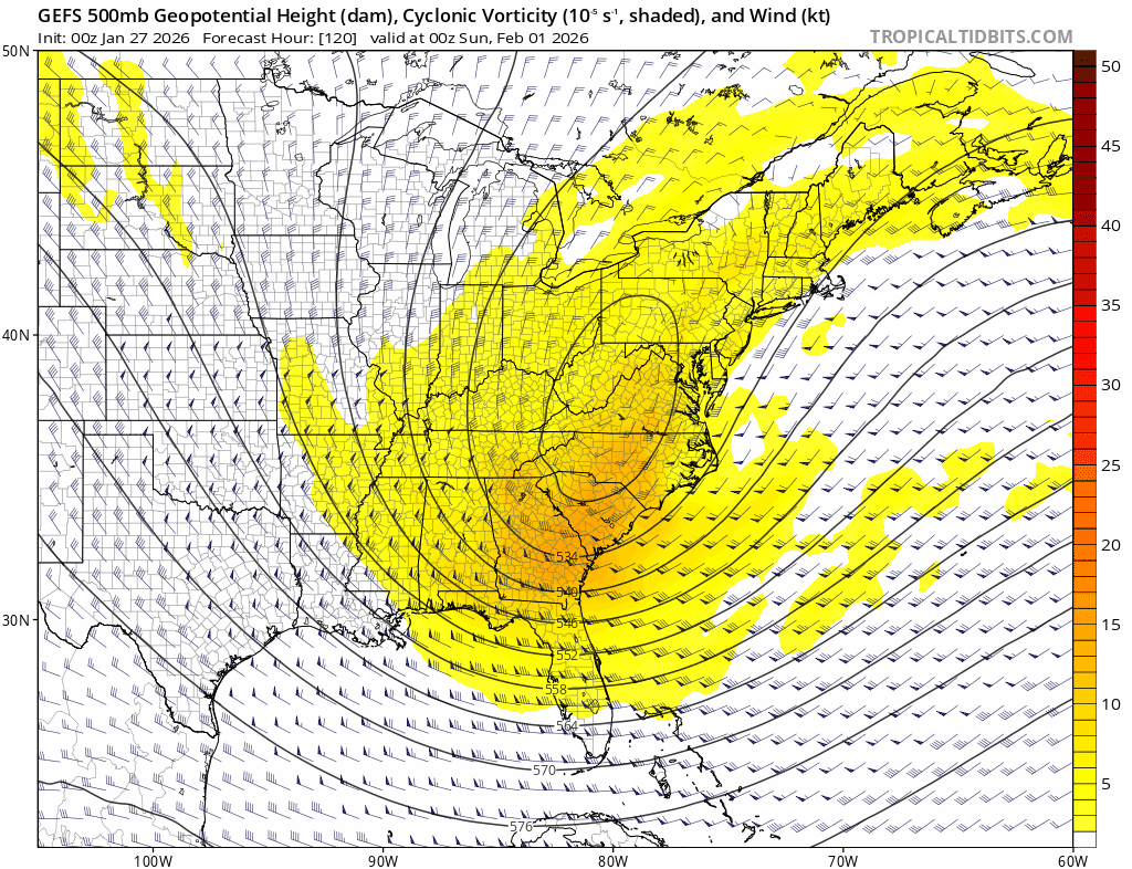
nice trend with the jet streak over ME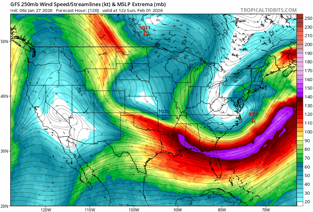
-
Possible coastal storm centered on Feb 1 2026.
brooklynwx99 replied to Typhoon Tip's topic in New England
EPS tripled precip from 12z lol -
Possible coastal storm centered on Feb 1 2026.
brooklynwx99 replied to Typhoon Tip's topic in New England
huge move by the EPS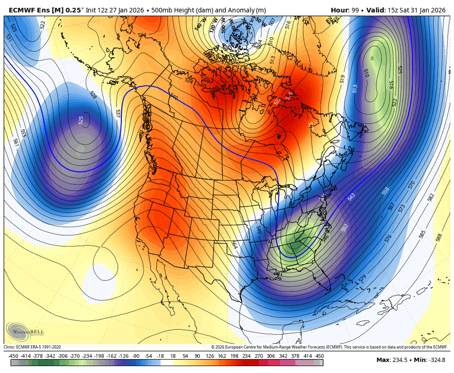
-
Possible coastal storm centered on Feb 1 2026.
brooklynwx99 replied to Typhoon Tip's topic in New England
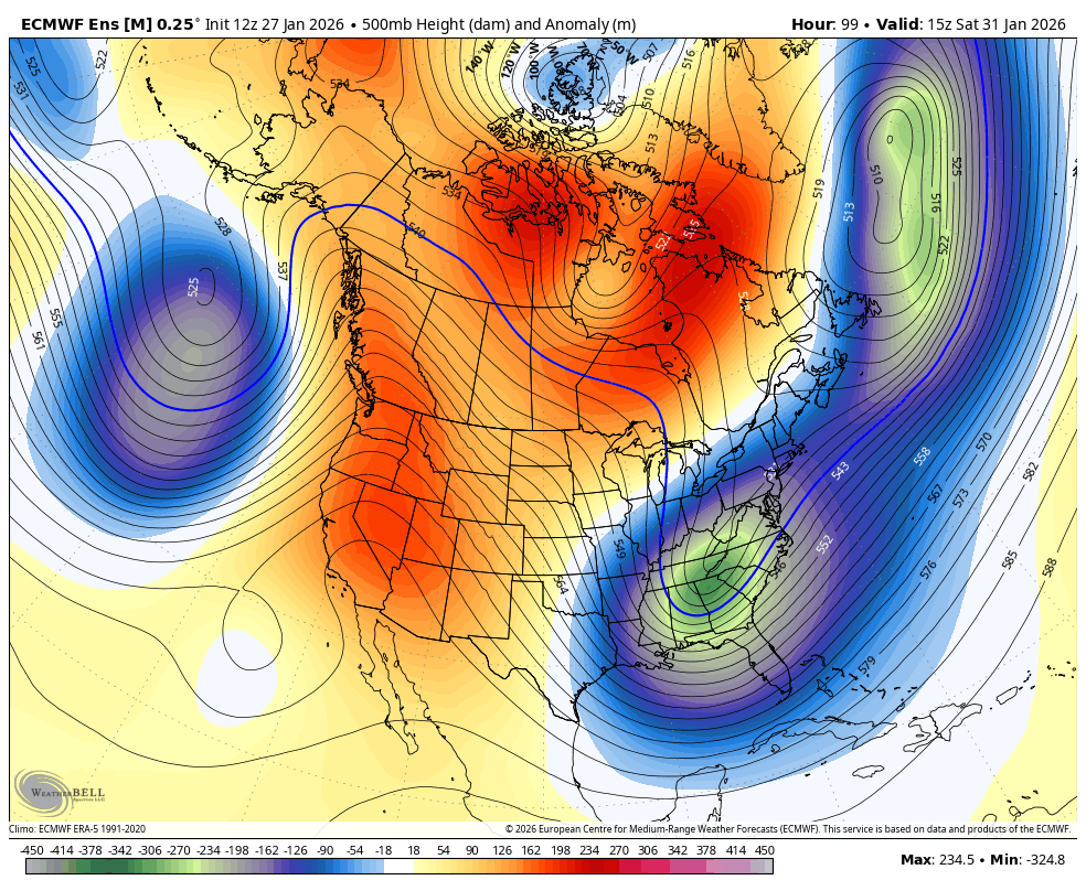
euro was quite a bit better with the confluence and overall alignment of the low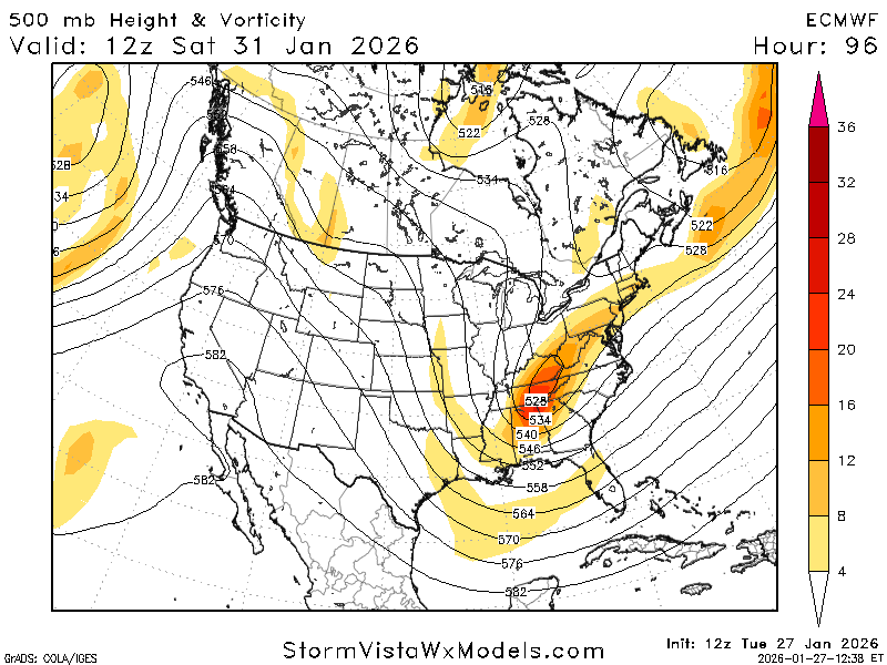
-
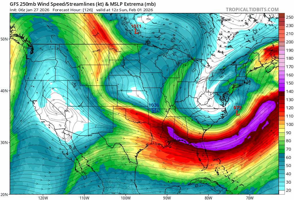
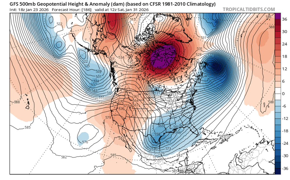
this speaks for itself. insane to see this 6 days out

-
Possible coastal storm centered on Feb 1 2026.
brooklynwx99 replied to Typhoon Tip's topic in New England
this speaks for itself. insane to see this 6 days out
-
you guys deserve this one, what a monster. probably ending up with 10-11" down here
-
this signal has really grown since yesterday

-
yeah, we have seen this signal grow since yesterday
-
Extreme Cold, Snow & Sleet: SECS 1/24 - 1/26
brooklynwx99 replied to TriPol's topic in New York City Metro
i see zero reason to deviate from 6-10" for the city and about 8-12" here closer to 287... using mostly a RGEM/ECMWF blend with some consideration for the NAM very strong 700mb FGEN will allow for rates up to 2"/hr for a time midday into the early-mid afternoon. should be a fun day tomorrow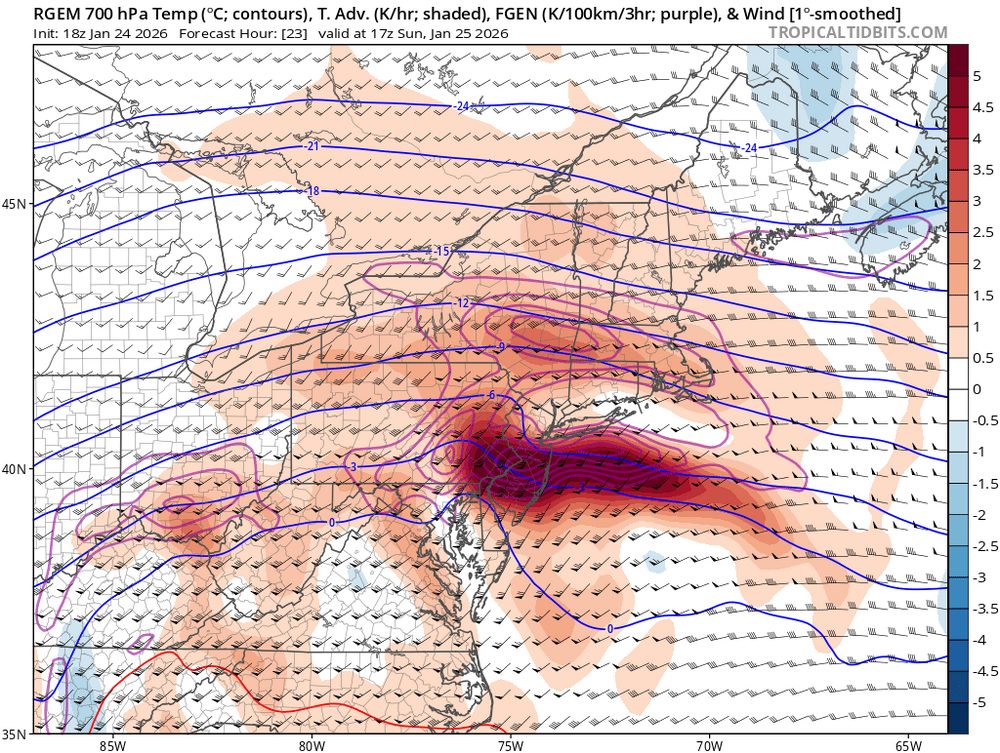
-
if the Pacific jet does not overwhelm things and push the trough axis too far east, then no, not really
-
no joke, this pattern is how you get a storm like that. two distinct vorts and a massive block rotting in central Canada encouraging a phase. the flow slows to a crawl
-
Extreme Cold, Snow & Sleet: SECS 1/24 - 1/26
brooklynwx99 replied to TriPol's topic in New York City Metro
lol how is this like every other SWFE in the last 5 years? temps are in the teens and you can get 2" per hour rates -
the fact that the CMC is a clear amped outlier and still delivers sig to borderline major snow is a testament to how favorable this setup is
-
Extreme Cold, Snow & Sleet: SECS 1/24 - 1/26
brooklynwx99 replied to TriPol's topic in New York City Metro
CMC looks like a clear amped outlier so far at 00z... even then, it's still 6-8" for the metro with some mix at the end, which shows how good this setup is -
Extreme Cold, Snow & Sleet: SECS 1/24 - 1/26
brooklynwx99 replied to TriPol's topic in New York City Metro
i doubt that happens with this kind of mid-level forcing moving in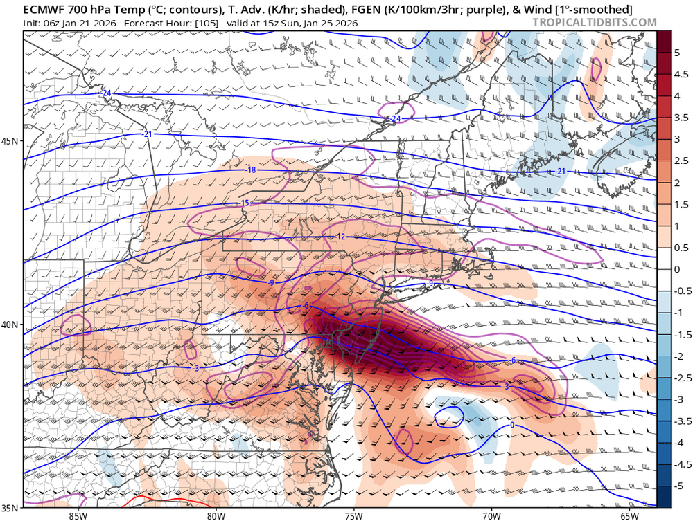
-
Extreme Cold, Snow & Sleet: SECS 1/24 - 1/26
brooklynwx99 replied to TriPol's topic in New York City Metro
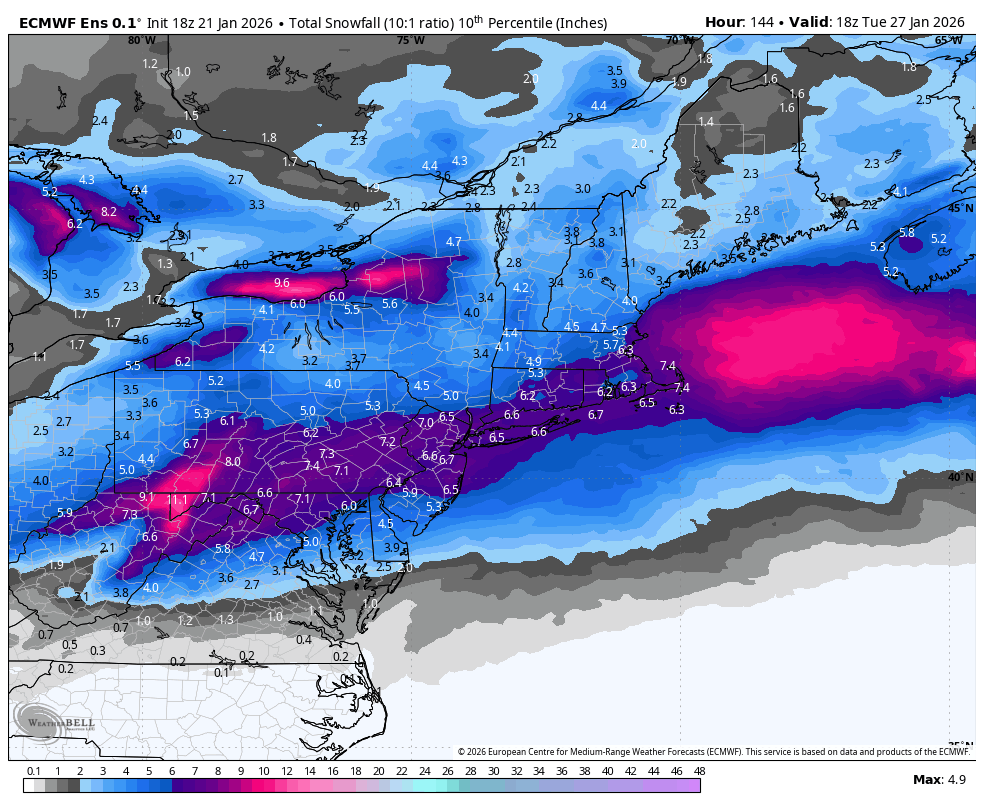
the 10th percentile on the EPS is a significant event. take a breath
-
exactly, the WAA is insane and i find it hard to believe you guys do without sig snowfall. it's just so cold going in and the 700mb FGEN will be off the charts
-
it's still uncomfy for you guys, but i still think most of the damage is done before any mixing... nobody should be complaining about 8" of snow in like 4 hours followed by some mix. if the mix does end up occurring at all
-
Extreme Cold, Snow & Sleet: SECS 1/24 - 1/26
brooklynwx99 replied to TriPol's topic in New York City Metro
everything still looks good here for a significant snowfall, some sleet potential at the end when precip is dying down notwithstanding