brooklynwx99
-
Posts
6,233 -
Joined
-
Last visited
Content Type
Profiles
Blogs
Forums
American Weather
Media Demo
Store
Gallery
Everything posted by brooklynwx99
-
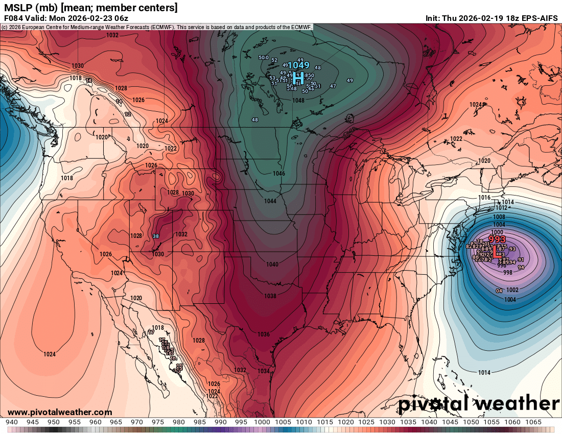
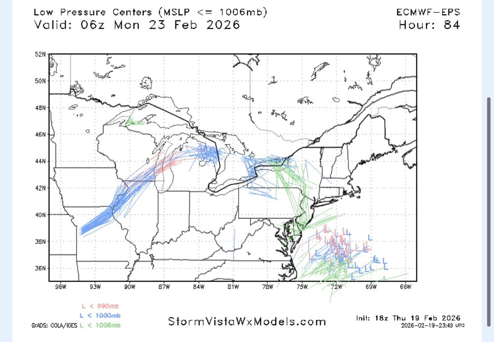
this is one of the biggest shifts I have ever seen from the EPS at this range. dumbfounding
-

“Cory’s in NYC! Let’s HECS!” Feb. 22-24 Disco
brooklynwx99 replied to TheSnowman's topic in New England
lol this just got real
-
“Cory’s in NYC! Let’s HECS!” Feb. 22-24 Disco
brooklynwx99 replied to TheSnowman's topic in New England

-
“Cory’s in NYC! Let’s HECS!” Feb. 22-24 Disco
brooklynwx99 replied to TheSnowman's topic in New England
this is sick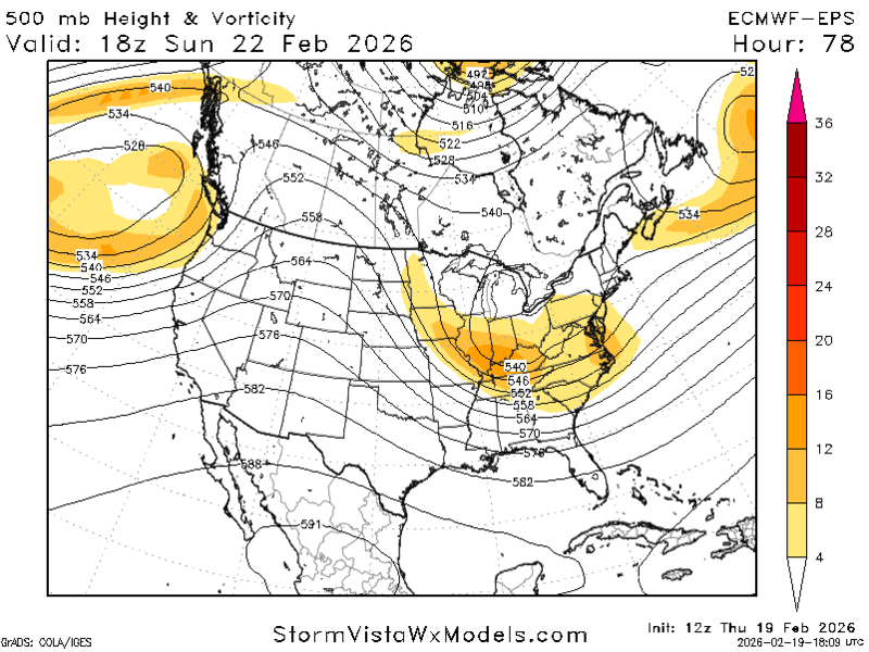
-
“Cory’s in NYC! Let’s HECS!” Feb. 22-24 Disco
brooklynwx99 replied to TheSnowman's topic in New England
the AIFS doing what it did gives more confidence that the euro shift is legit but we will obv want to see it hold at 00z -
“Cory’s in NYC! Let’s HECS!” Feb. 22-24 Disco
brooklynwx99 replied to TheSnowman's topic in New England
EPS is phasing at 51!
-
Feb 22nd/23rd "There's no way..." Storm Thread
brooklynwx99 replied to Maestrobjwa's topic in Mid Atlantic
EPS phasing on the mean. wtf
-
“Cory’s in NYC! Let’s HECS!” Feb. 22-24 Disco
brooklynwx99 replied to TheSnowman's topic in New England
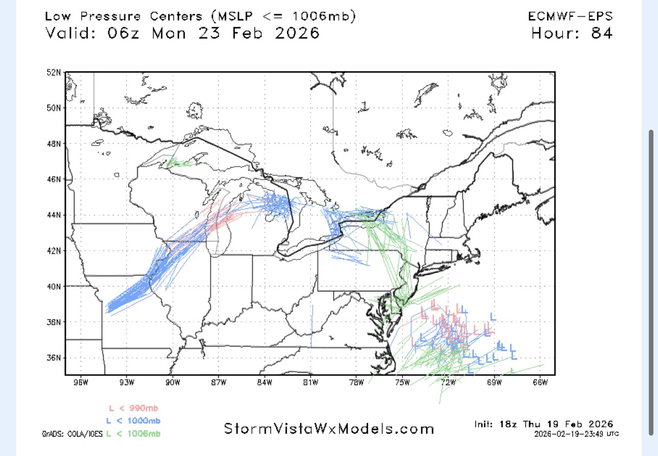
you can see the change on the EPS at like hr 12 with the NS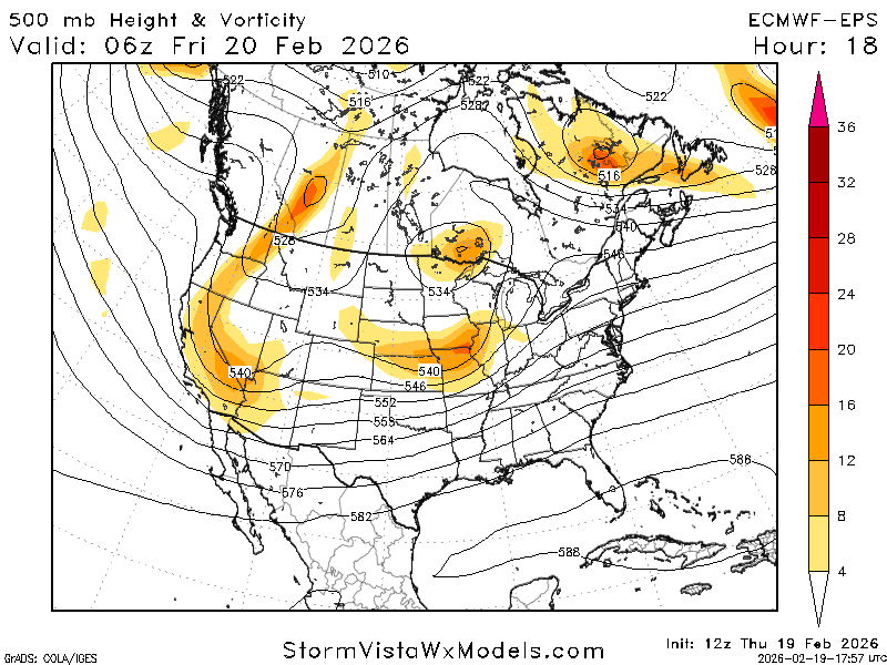
-
“Cory’s in NYC! Let’s HECS!” Feb. 22-24 Disco
brooklynwx99 replied to TheSnowman's topic in New England
NS looks like the GFS now. unreal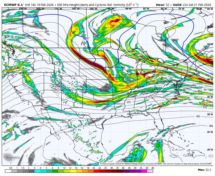
-
Feb 22nd/23rd "There's no way..." Storm Thread
brooklynwx99 replied to Maestrobjwa's topic in Mid Atlantic
absolute fucking cinema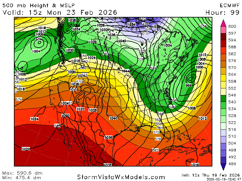
-
“Cory’s in NYC! Let’s HECS!” Feb. 22-24 Disco
brooklynwx99 replied to TheSnowman's topic in New England
LOL
-
“Cory’s in NYC! Let’s HECS!” Feb. 22-24 Disco
brooklynwx99 replied to TheSnowman's topic in New England
holy shit AIFS!!! -
“Cory’s in NYC! Let’s HECS!” Feb. 22-24 Disco
brooklynwx99 replied to TheSnowman's topic in New England
can see the cluster of western leaners become more potent here
-
“Cory’s in NYC! Let’s HECS!” Feb. 22-24 Disco
brooklynwx99 replied to TheSnowman's topic in New England
this will be by far the best or worst model performance i have ever seen (probably worst) -
Feb 22nd/23rd "There's no way..." Storm Thread
brooklynwx99 replied to Maestrobjwa's topic in Mid Atlantic
this is either going to be the best or the worst model performance i've ever seen (probably worst but hey it's fun to look at) -
“Cory’s in NYC! Let’s HECS!” Feb. 22-24 Disco
brooklynwx99 replied to TheSnowman's topic in New England
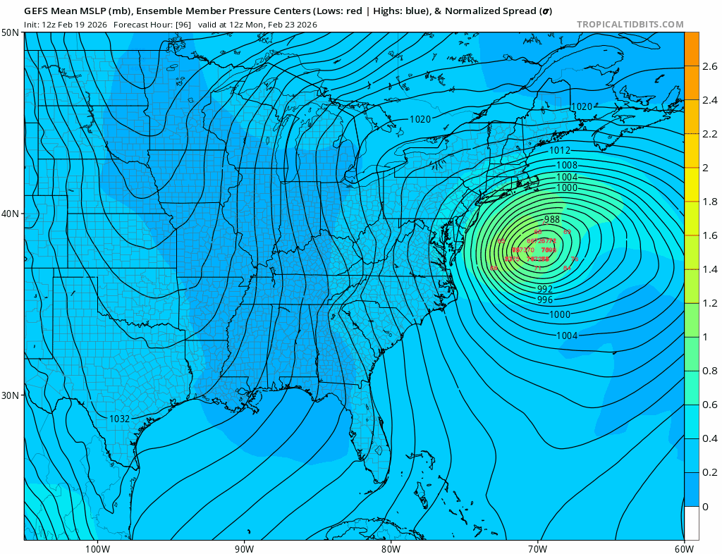
GFS with the hold of all holds
-
Feb 22nd/23rd "There's no way..." Storm Thread
brooklynwx99 replied to Maestrobjwa's topic in Mid Atlantic
god bless america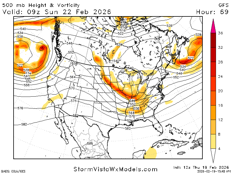
-
Feb 22nd/23rd "There's no way..." Storm Thread
brooklynwx99 replied to Maestrobjwa's topic in Mid Atlantic
why is the GFS the way it is -
“Cory’s in NYC! Let’s HECS!” Feb. 22-24 Disco
brooklynwx99 replied to TheSnowman's topic in New England
groan if you want, but it's really not that different. i'm still thinking this is a near miss but this is a super nonlinear setup -
“Cory’s in NYC! Let’s HECS!” Feb. 22-24 Disco
brooklynwx99 replied to TheSnowman's topic in New England
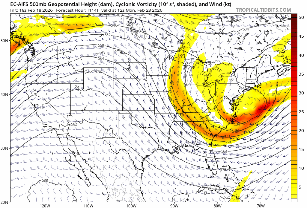
the funny thing is that when you look under the hood, the ECMWF and GFS are really not that different. this is such a high sensitivity setup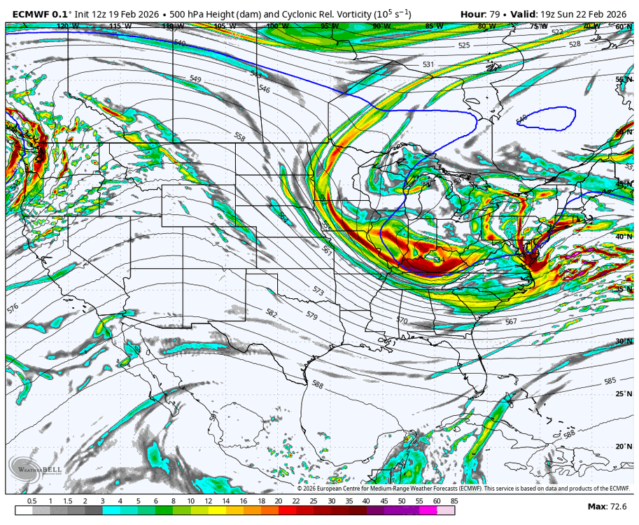
-
“Cory’s in NYC! Let’s HECS!” Feb. 22-24 Disco
brooklynwx99 replied to TheSnowman's topic in New England
GFS digs its heels in and CMC looks worse. incredible stuff -
“Cory’s in NYC! Let’s HECS!” Feb. 22-24 Disco
brooklynwx99 replied to TheSnowman's topic in New England
legit major storm for parts of SNE
-
“Cory’s in NYC! Let’s HECS!” Feb. 22-24 Disco
brooklynwx99 replied to TheSnowman's topic in New England
AIFS is significantly NW -
“Cory’s in NYC! Let’s HECS!” Feb. 22-24 Disco
brooklynwx99 replied to TheSnowman's topic in New England
not even being a weenie, but it seems like the AI is lagging the OPs a bit, it’s been the case with the GFS AI as well -
“Cory’s in NYC! Let’s HECS!” Feb. 22-24 Disco
brooklynwx99 replied to TheSnowman's topic in New England
GFS probably did the best, RGEM at least picked up on the fail yesterday 12z. euro was bad the whole way