

brooklynwx99
-
Posts
6,233 -
Joined
-
Last visited
Content Type
Profiles
Blogs
Forums
American Weather
Media Demo
Store
Gallery
Everything posted by brooklynwx99
-

Extreme Cold, Snow & Sleet: SECS 1/24 - 1/26
brooklynwx99 replied to TriPol's topic in New York City Metro
after like a foot of snow, yeah lmao -
Extreme Cold, Snow & Sleet: SECS 1/24 - 1/26
brooklynwx99 replied to TriPol's topic in New York City Metro
euro is a monster hit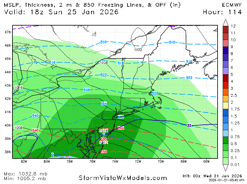
-
Extreme Cold, Snow & Sleet: SECS 1/24 - 1/26
brooklynwx99 replied to TriPol's topic in New York City Metro
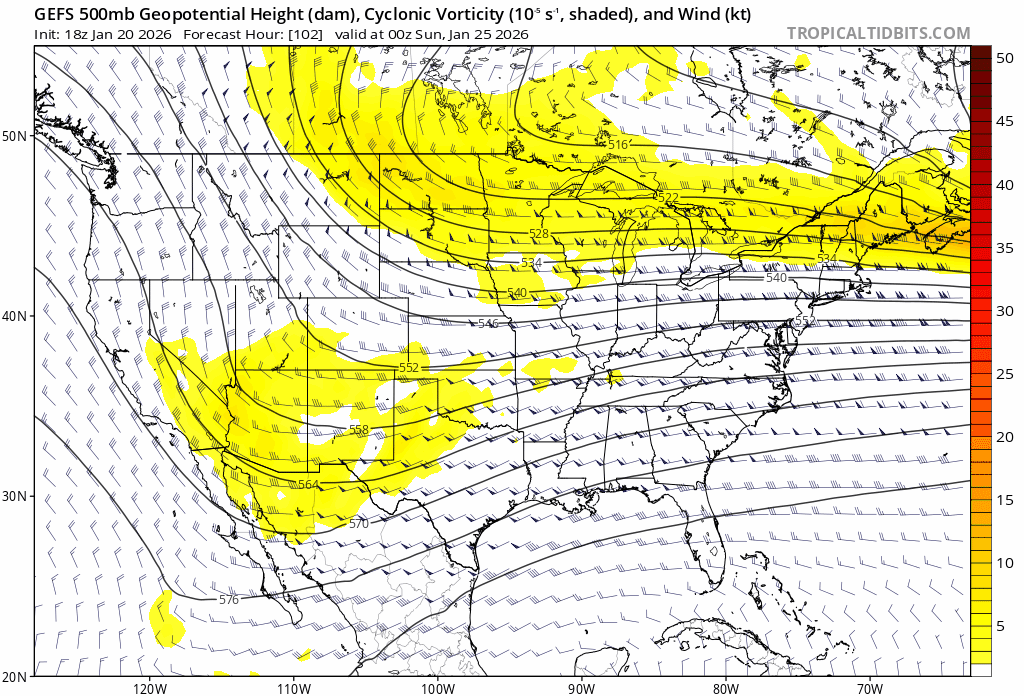
tough to ask for better here. textbook aloft for significant impacts
-
Extreme Cold, Snow & Sleet: SECS 1/24 - 1/26
brooklynwx99 replied to TriPol's topic in New York City Metro
i couldn't care less if some pellets mix in after 8-12" of snow -
the WAA is so insane that this is really hard to fuck up for MD/DC. the UKMET drives the low to Buffalo and you still get 12" of snow
-
Extreme Cold, Snow & Sleet: SECS 1/24 - 1/26
brooklynwx99 replied to TriPol's topic in New York City Metro
lol if this hugs the coast it's because there's a blizzard ongoing -
Extreme Cold, Snow & Sleet: SECS 1/24 - 1/26
brooklynwx99 replied to TriPol's topic in New York City Metro
GEFS is going to come north, more phasing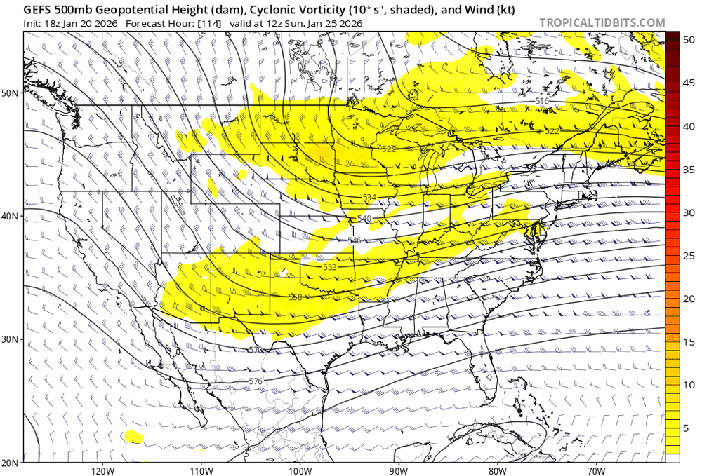
-
January 2026 regional war/obs/disco thread
brooklynwx99 replied to Baroclinic Zone's topic in New England
GEFS will be north, more phasing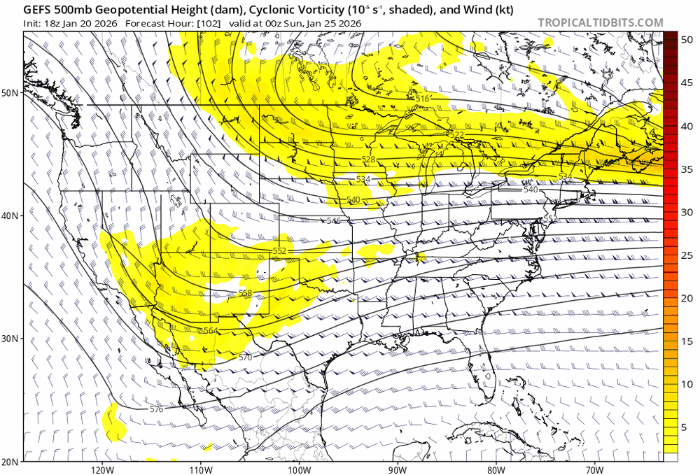
-
January 2026 regional war/obs/disco thread
brooklynwx99 replied to Baroclinic Zone's topic in New England
GFS is more in phase, going to be quite a bit better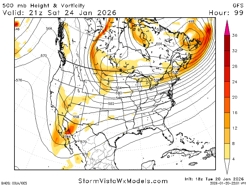
-
January 2026 regional war/obs/disco thread
brooklynwx99 replied to Baroclinic Zone's topic in New England
yeah, completely reversed the 18z shift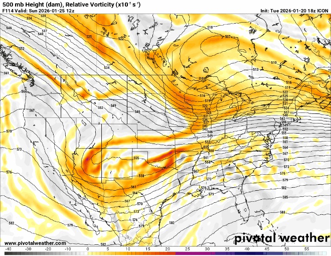
-
ICON is way better, not even close
-
January 2026 regional war/obs/disco thread
brooklynwx99 replied to Baroclinic Zone's topic in New England
this phasing trend has been happening for days now
-
Extreme Cold, Snow & Sleet: SECS 1/24 - 1/26
brooklynwx99 replied to TriPol's topic in New York City Metro
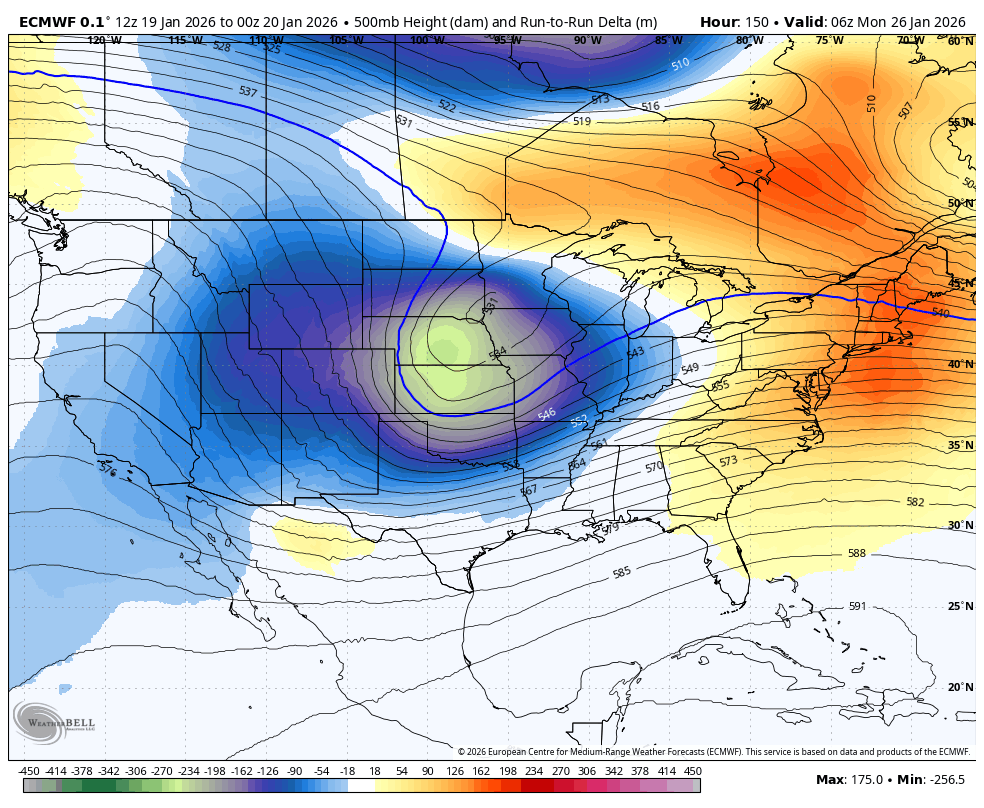
this is all you need to see. trend has been ongoing for two days now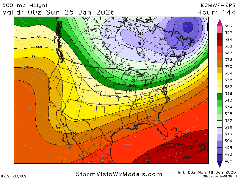
-
this is all you need to see. trend has been ongoing for two days now

-
January 2026 regional war/obs/disco thread
brooklynwx99 replied to Baroclinic Zone's topic in New England
we continue phasing
-
Extreme Cold, Snow & Sleet: SECS 1/24 - 1/26
brooklynwx99 replied to TriPol's topic in New York City Metro
EPS made the same shift towards more phasing and now has 0.75" liquid to NYC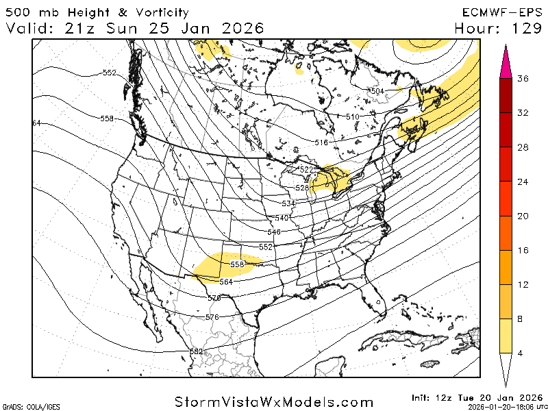
-
January 2026 regional war/obs/disco thread
brooklynwx99 replied to Baroclinic Zone's topic in New England
ECMWF is a full phaser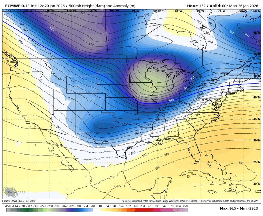
-
euro is a full phase. god damn
-
GFS is on crack, moving on. CMC, ICON, and UKMET are all looking euro-esque
-
Extreme Cold, Snow & Sleet: SECS 1/24 - 1/26
brooklynwx99 replied to TriPol's topic in New York City Metro
it’s overrunning to coastal -
Extreme Cold, Snow & Sleet: SECS 1/24 - 1/26
brooklynwx99 replied to TriPol's topic in New York City Metro
euro is a full phase, ends up tucking offshore. huge hit that run to run change is nuts
-
euro is phasing!!
-
Extreme Cold, Snow & Sleet: SECS 1/24 - 1/26
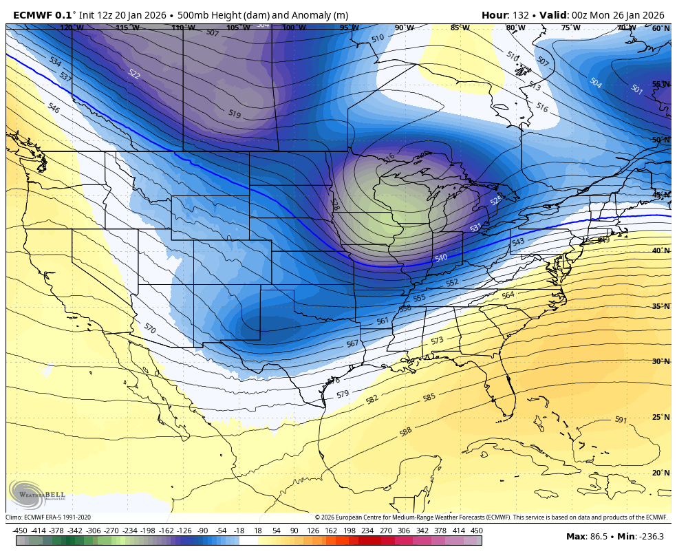
brooklynwx99 replied to TriPol's topic in New York City Metro
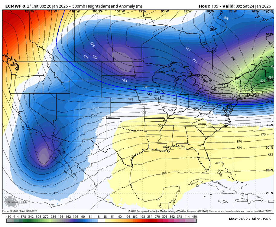
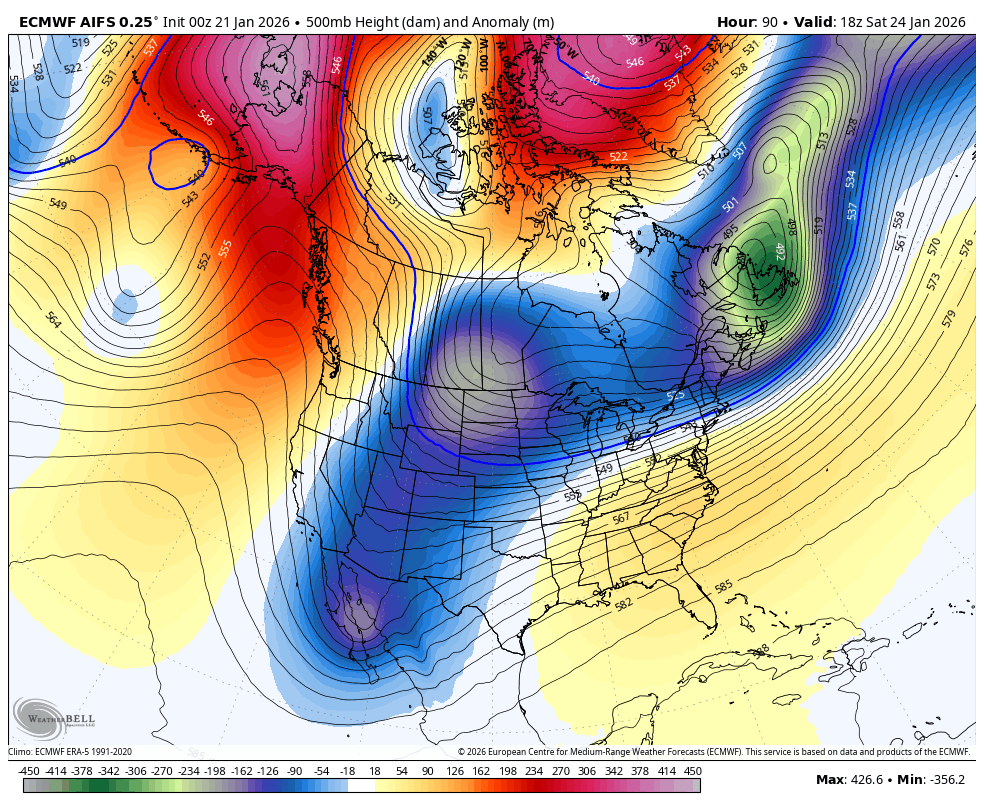
the TPV changing its orientation over the last day is big for us. went from centered over Nova Scotia to centered over the Plains. heights downstream have adjusted considerably higher as a result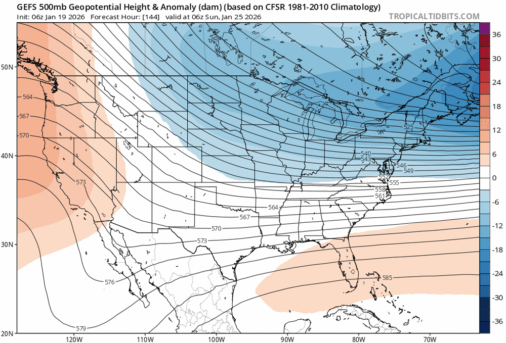
-
January 2026 regional war/obs/disco thread
brooklynwx99 replied to Baroclinic Zone's topic in New England
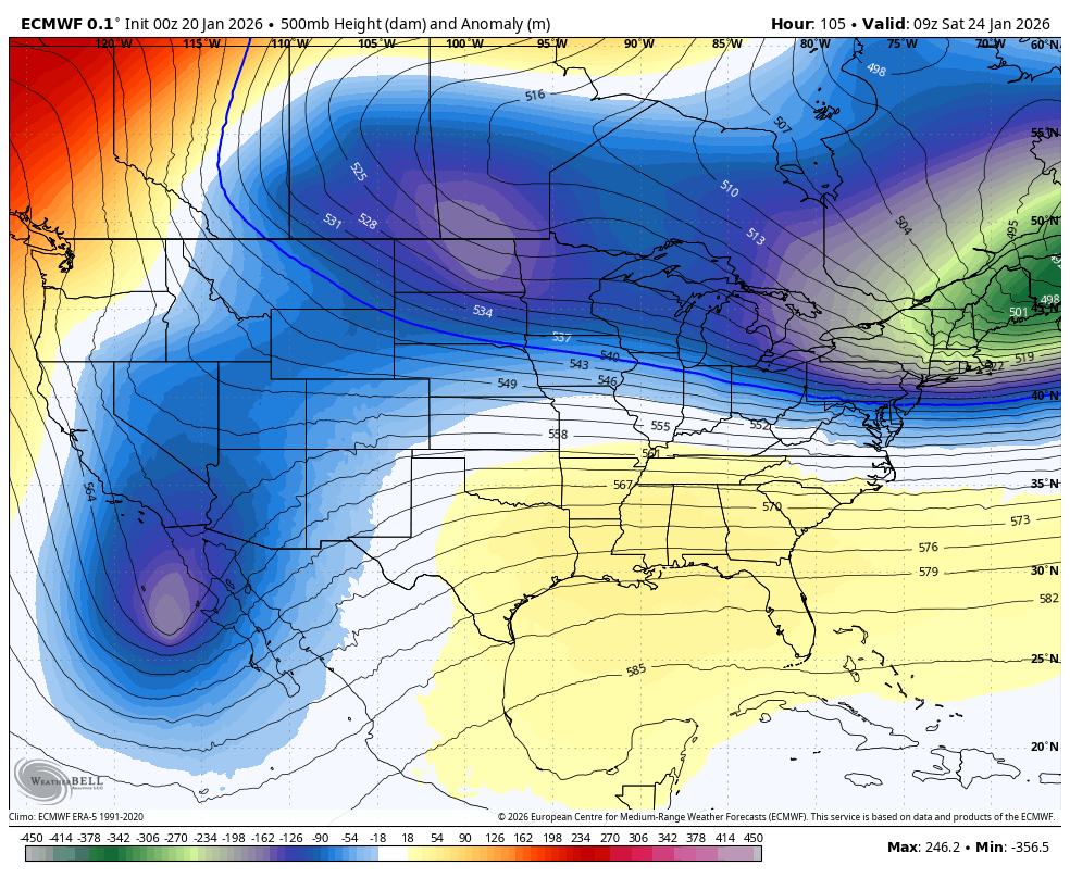
the trend with the TPV splitting in two more is what you want to see - allows for heights in the SE to rise more.thumb.gif.4065a6e63ae13f745b5a674f6b40bf38.gif)
-
Extreme Cold, Snow & Sleet: SECS 1/24 - 1/26
brooklynwx99 replied to TriPol's topic in New York City Metro
the trend with the TPV splitting in two more is what you want to see - allows for heights in the SE to rise more.thumb.gif.b23a3c5d2bb8e456fcd3ffc015eee7be.gif)


.gif.7d3c18b2671b71caf2e5e52a09c5d826.gif)
.gif.45c8448368d2a75d230b20ead12a1a95.gif)