brooklynwx99
-
Posts
6,233 -
Joined
-
Last visited
Content Type
Profiles
Blogs
Forums
American Weather
Media Demo
Store
Gallery
Everything posted by brooklynwx99
-

First Legit Storm Potential of the Season Upon Us
brooklynwx99 replied to 40/70 Benchmark's topic in New England
bro what -
First Legit Storm Potential of the Season Upon Us
brooklynwx99 replied to 40/70 Benchmark's topic in New England
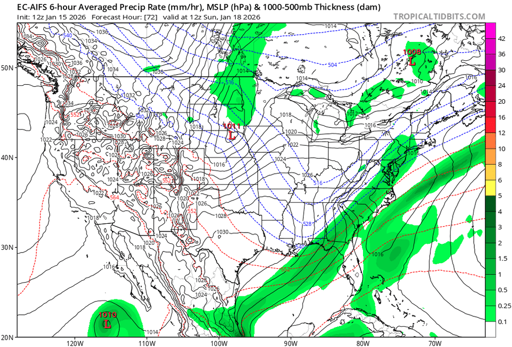
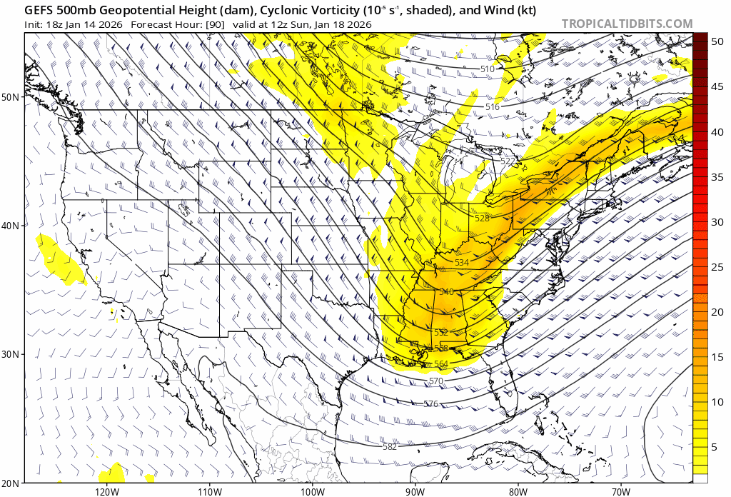
the RGEM is actually really similar to the AI models... has the main precip with the PVA ahead of the main vort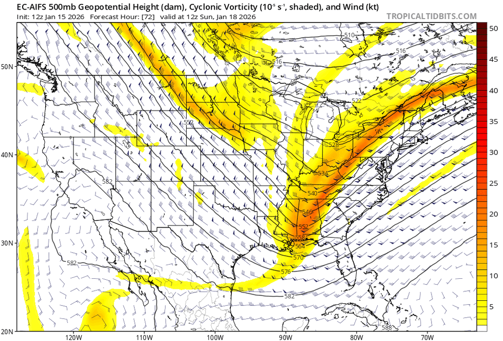
-
the Pacific trough pumps the PNA... that's part of the reason why it usually torches after big storms as the jet overextends
-
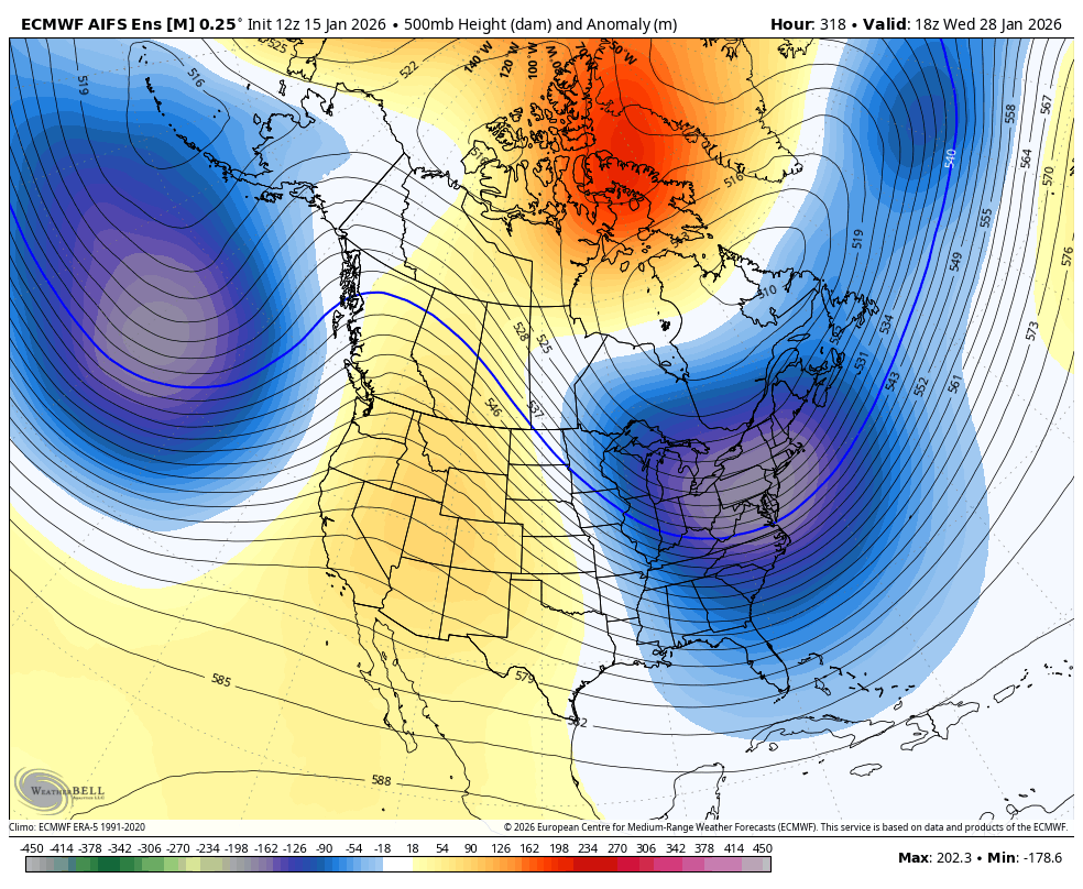
January 2026 regional war/obs/disco thread
brooklynwx99 replied to Baroclinic Zone's topic in New England
yup. first, moisture pushing into a cold dome and then a shot at a retrograding block to end the month. can't ask for more at this range
-
i'm just gonna leave this here

-
First Legit Storm Potential of the Season Upon Us
brooklynwx99 replied to 40/70 Benchmark's topic in New England
lol it only nails it if the solution is crappy. we've seen it amp up and do interesting things only to fall flat on its face -
First Legit Storm Potential of the Season Upon Us
brooklynwx99 replied to 40/70 Benchmark's topic in New England
it’s a bit more consolidated and precip is a bit farther west but still, not great -
First Legit Storm Potential of the Season Upon Us
brooklynwx99 replied to 40/70 Benchmark's topic in New England
euro looks like complete ass. comical -
First Legit Storm Potential of the Season Upon Us
brooklynwx99 replied to 40/70 Benchmark's topic in New England
notice how the vort is less involved in the broader trough… way more legit PVA here compared to the previous run as it pivots
-
First Legit Storm Potential of the Season Upon Us
brooklynwx99 replied to 40/70 Benchmark's topic in New England
CMC is a hit. continues to trend west -
First Legit Storm Potential of the Season Upon Us
brooklynwx99 replied to 40/70 Benchmark's topic in New England
yeah, in between. nice to see with the AI looking good and the CMC likely coming in amped -
First Legit Storm Potential of the Season Upon Us
brooklynwx99 replied to 40/70 Benchmark's topic in New England
AI is a legit hit -
First Legit Storm Potential of the Season Upon Us
brooklynwx99 replied to 40/70 Benchmark's topic in New England
CMC should come in hot, RGEM is amped.thumb.gif.60a6ce195893dd2cbf4384f366e64413.gif)
-
First Legit Storm Potential of the Season Upon Us
brooklynwx99 replied to 40/70 Benchmark's topic in New England
the AIFS-EPS is wetter, so that's nice. vort digs more -
First Legit Storm Potential of the Season Upon Us
brooklynwx99 replied to 40/70 Benchmark's topic in New England
thread of doom and despair -
First Legit Storm Potential of the Season Upon Us
brooklynwx99 replied to 40/70 Benchmark's topic in New England
yeah, vort was looking more SW which is what the GFS did, but the lead wave dampened it. still like seeing that shift with the vort -
2025-2026 ENSO
brooklynwx99 replied to 40/70 Benchmark's topic in Weather Forecasting and Discussion
who could have possibly seen this coming
-
probably close, but no cigar
-
GFS looks quite a bit more consolidated
-
January 2026 regional war/obs/disco thread
brooklynwx99 replied to Baroclinic Zone's topic in New England
it’s an average, you’re going to have members with the gradient south of the mean. not all that surprising -
January 2026 regional war/obs/disco thread
brooklynwx99 replied to Baroclinic Zone's topic in New England
hopefully we can eke something out before the 20th... the pattern looks to open up after the 22nd as more moisture gets involved and cold becomes more entrenched -
January 2026 regional war/obs/disco thread
brooklynwx99 replied to Baroclinic Zone's topic in New England
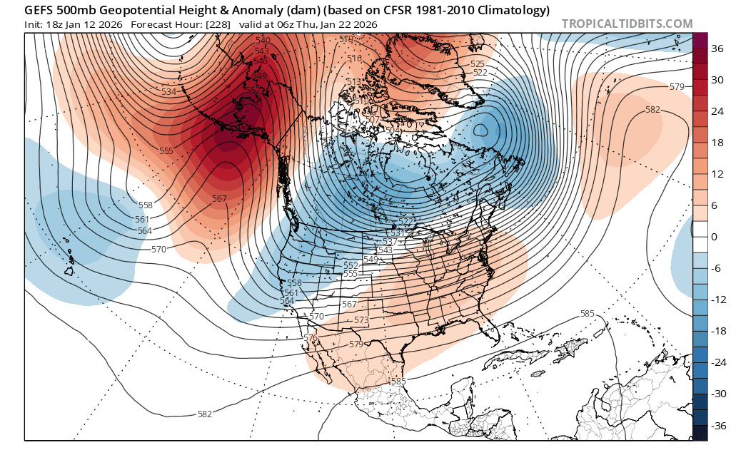
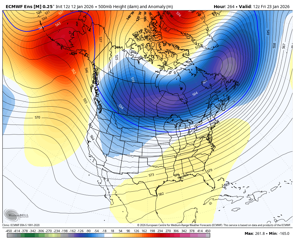
yeah, the 22-24th is a solid timeframe with established cold air, low heights over SE Canada, and some -NAO/-EPO. can see how you'd get something ejecting out of the west into cold air
-
January 2026 regional war/obs/disco thread
brooklynwx99 replied to Baroclinic Zone's topic in New England
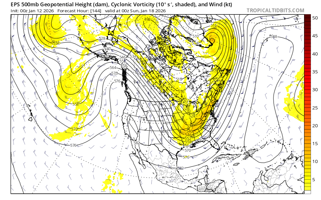
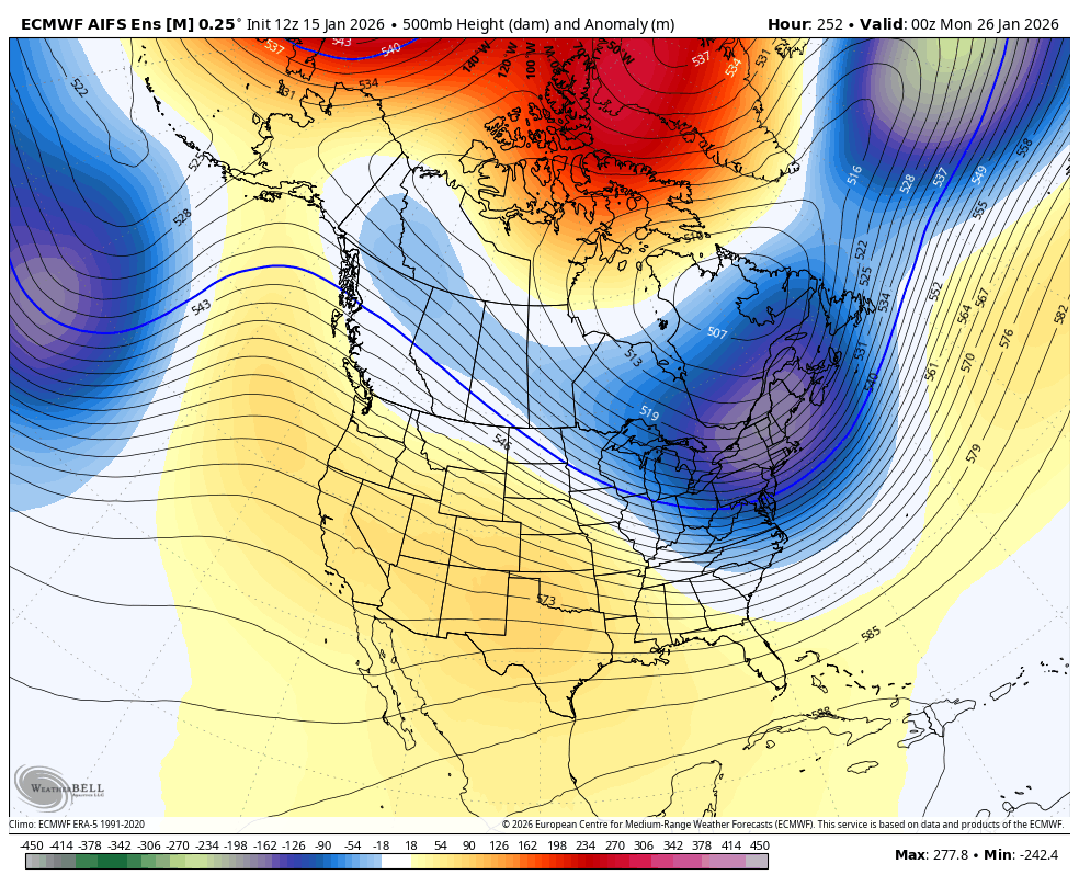
when you're forecasting past a week out, using ensembles and focusing on the broader pattern to point out timeframes of interest is generally the way to go. this will be taught in every forecasting classroom on the planet. now that we're a few days later on, we can see that there are two distinct waves rather than a single trough (which, by the way, some OP runs had) this is the way long range forecasting is... the data change sometimes. it doesn't make the process any less valid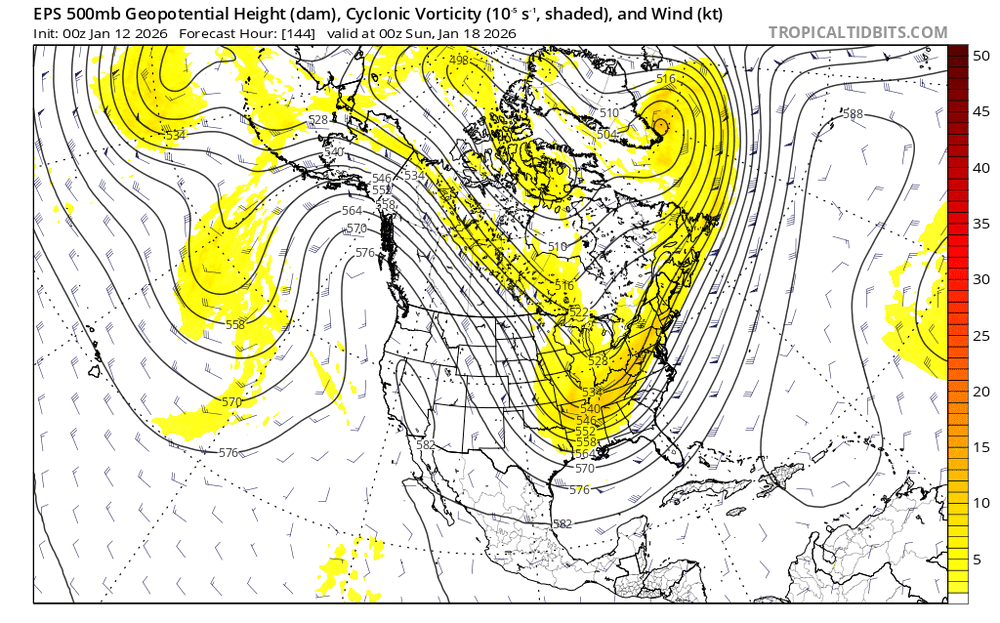
-
January 2026 regional war/obs/disco thread
brooklynwx99 replied to Baroclinic Zone's topic in New England
why are you like this, dude -
2025-2026 ENSO
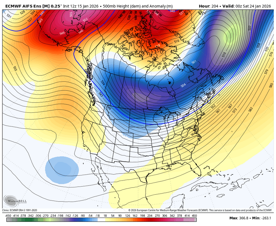
brooklynwx99 replied to 40/70 Benchmark's topic in Weather Forecasting and Discussion
yeah that can certainly happen... i think early Feb looks pretty good, though, as the favorable tropical forcing should stick around for a bit based on hovmollers


.gif.33754318262f6189efdf41bdc0b33d3b.gif)