brooklynwx99
-
Posts
6,233 -
Joined
-
Last visited
Content Type
Profiles
Blogs
Forums
American Weather
Media Demo
Store
Gallery
Everything posted by brooklynwx99
-

2025-2026 ENSO
brooklynwx99 replied to 40/70 Benchmark's topic in Weather Forecasting and Discussion
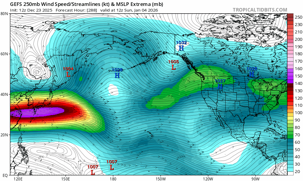
can also see the jet beginning to extend in the LR as another MJO wave traverses the MC along with strengthening +EAMT... as this wave enters the WHEM in mid-late Jan, we might have another favorable period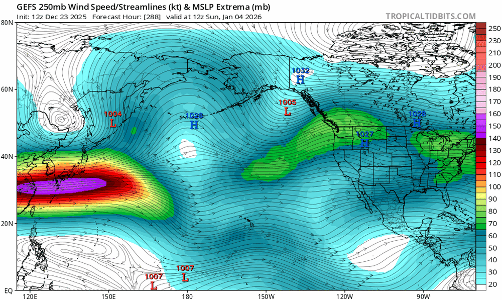
-
2025-2026 ENSO
brooklynwx99 replied to 40/70 Benchmark's topic in Weather Forecasting and Discussion
lol this is an absurd shift
-
December 2025 regional war/obs/disco thread
brooklynwx99 replied to Torch Tiger's topic in New England
this is pretty comical. NYE is now a legit timeframe to watch with that amplifying trough
-
December 2025 regional war/obs/disco thread
brooklynwx99 replied to Torch Tiger's topic in New England
really likes the NYE timeframe. has the TPV take a trip south and boom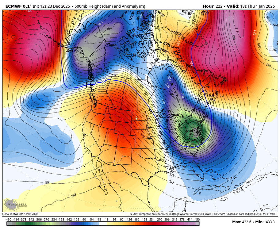
-
December 2025 regional war/obs/disco thread
brooklynwx99 replied to Torch Tiger's topic in New England
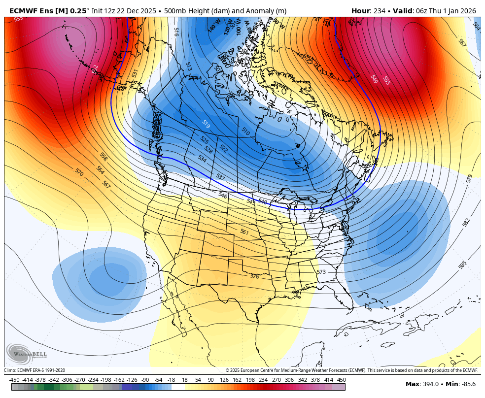
lol at this trend in the Pacific. went from an AK trough of doom to legit +PNA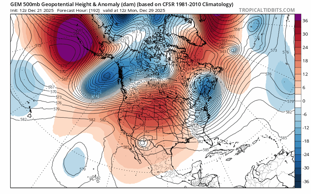
-
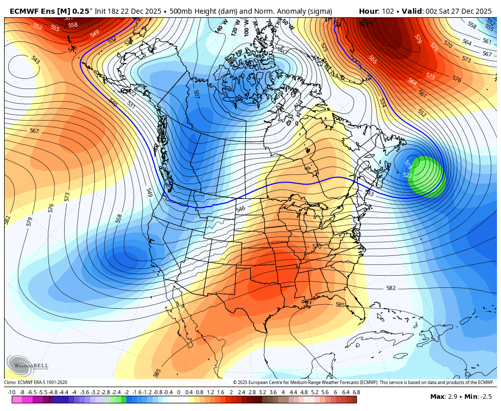
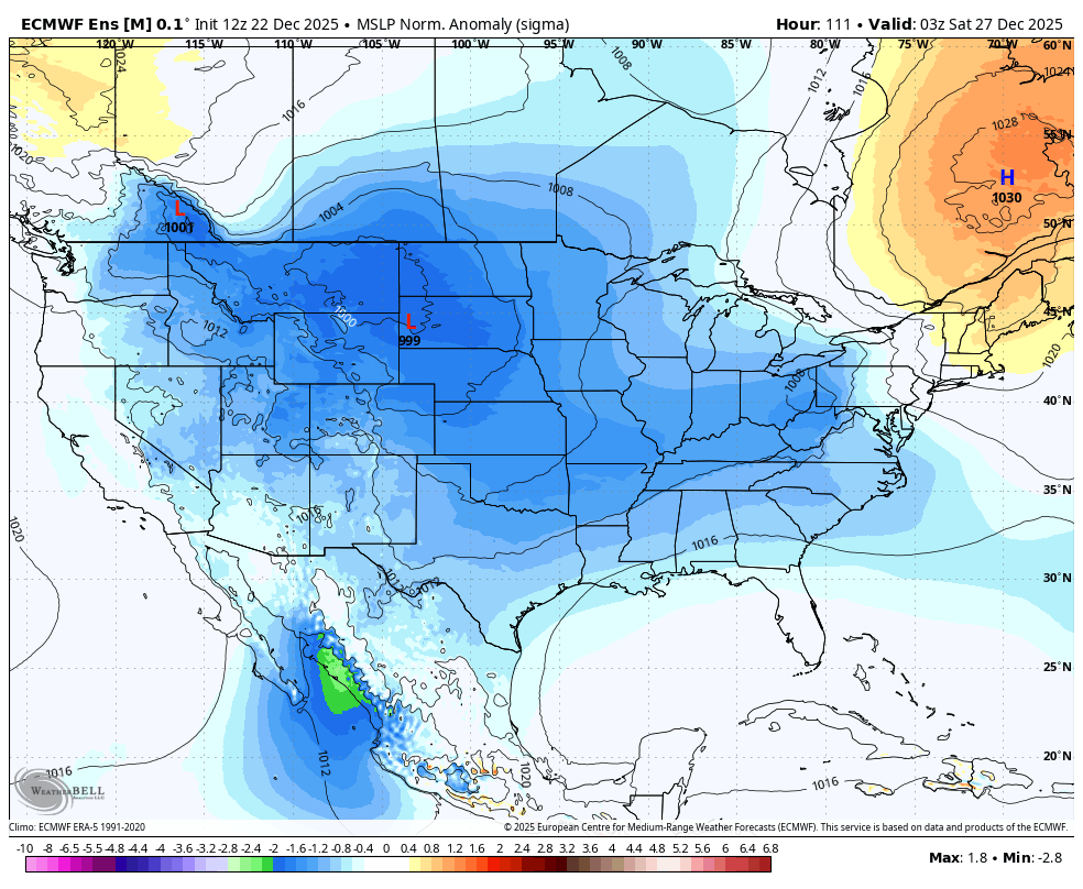
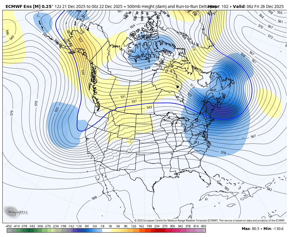
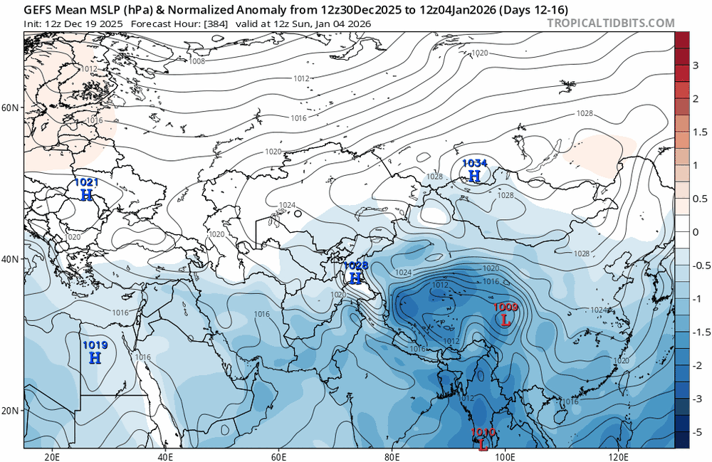
there is a nearly 3 sigma -NAO developing as this system moves in, so I would argue that blocking is indeed very strong

-
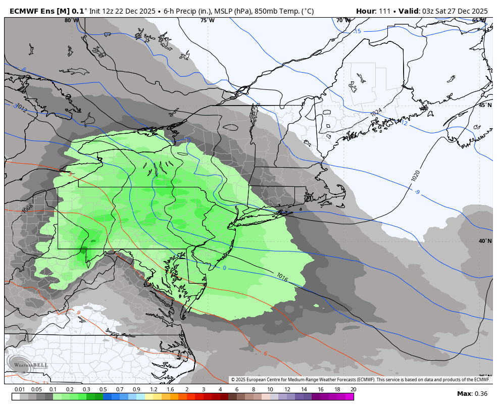
EPS continues to tick colder. mean is about 4" for NYC i generally like this kind of event... shove moisture into HP and you usually have success


-
2025-2026 ENSO
brooklynwx99 replied to 40/70 Benchmark's topic in Weather Forecasting and Discussion
lol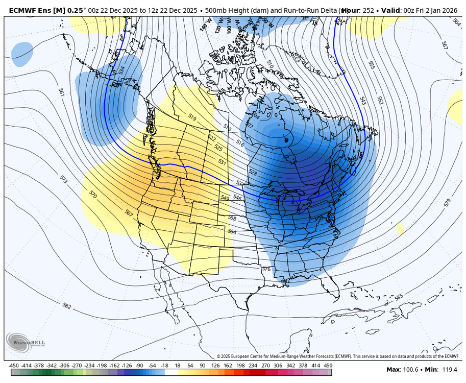
-
December 2025 regional war/obs/disco thread
brooklynwx99 replied to Torch Tiger's topic in New England
this is a potent setup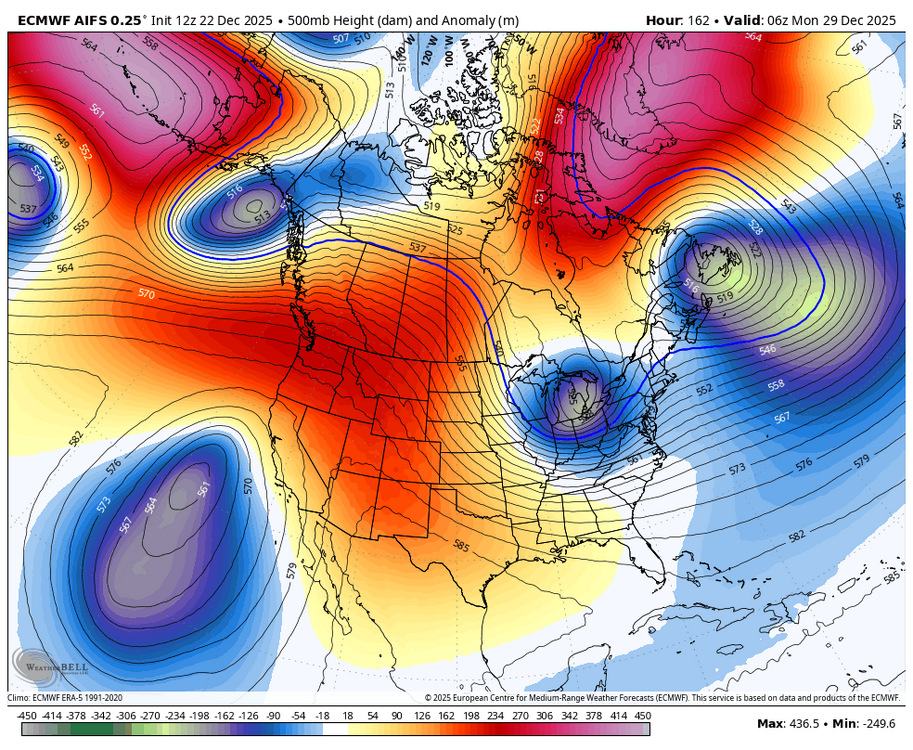
-
really easy to see how Friday's system trending colder and farther south increases the blocking due to stronger wave breaking, which then leads to a more favorable outcome for Monday if the block keeps trending in this way, Monday might hold some high end potential, especially up by you guys. TBD

-
December 2025 regional war/obs/disco thread
brooklynwx99 replied to Torch Tiger's topic in New England
really easy to see how Friday's system trending colder and farther south increases the blocking due to stronger wave breaking, which then leads to a more favorable outcome for Monday if the block keeps trending in this way, Monday might hold some high end potential, especially up by you guys. TBD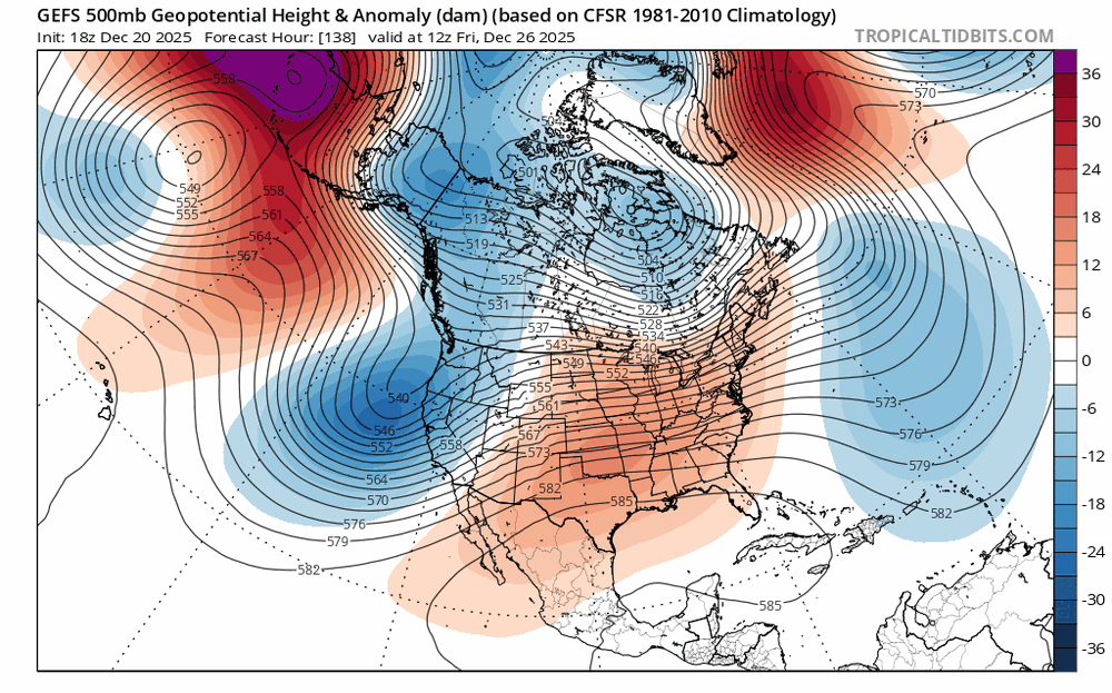
-
December 2025 regional war/obs/disco thread
brooklynwx99 replied to Torch Tiger's topic in New England
CMC is proof of that... more confluence -> farther south system Friday -> stronger block -> nuke Monday due to farther south ULL -
December 2025 regional war/obs/disco thread
brooklynwx99 replied to Torch Tiger's topic in New England
yup, and the confluence trending stronger for Friday strengthens the block, which helps Sunday trend better. just a series of dominoes -
December 2025 regional war/obs/disco thread
brooklynwx99 replied to Torch Tiger's topic in New England
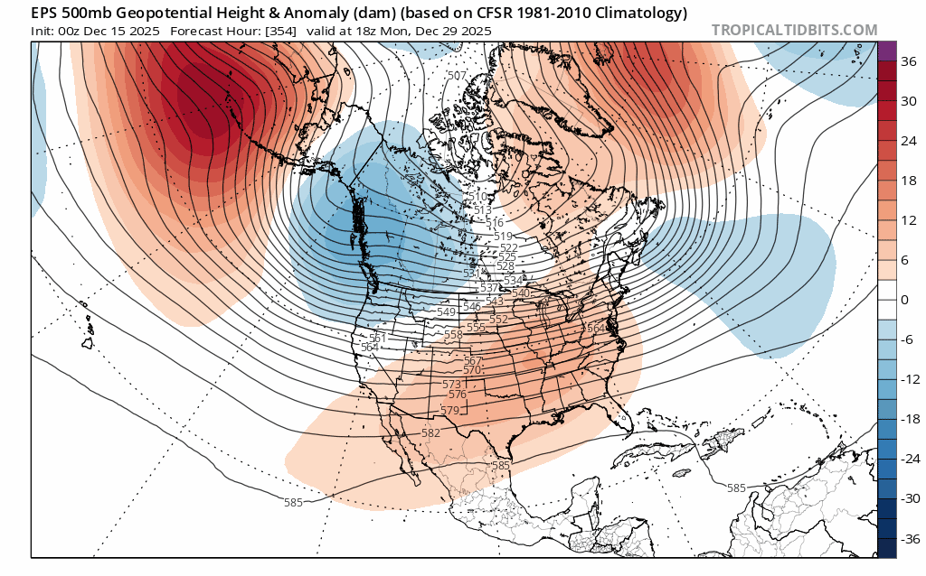
yeah, would be nice to get Friday and then maybe some better potential next week all I know is that if you get that strong and west based enough, dumb shit will happen. almost always does when you have a block that big. it isn't there yet, as the main vort tracks through the lakes, but it wouldn't take a lot to change that if you weaken that Pacific trough or retro it more -
December 2025 regional war/obs/disco thread
brooklynwx99 replied to Torch Tiger's topic in New England
this is absolutely pitiful lmao next week could end up legit if that block keeps uptrending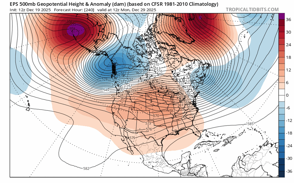
-
pretty legit trend in the confluence for late week. Fri-Sat is def a timeframe to watch for a legit thump

-
December 2025 regional war/obs/disco thread
brooklynwx99 replied to Torch Tiger's topic in New England
pretty legit trend in the confluence for late week. Fri-Sat is def a timeframe to watch for a legit thump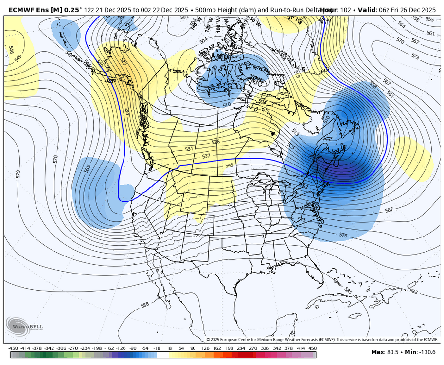
-
December 2025 regional war/obs/disco thread
brooklynwx99 replied to Torch Tiger's topic in New England
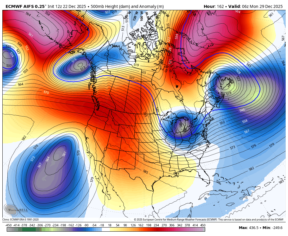
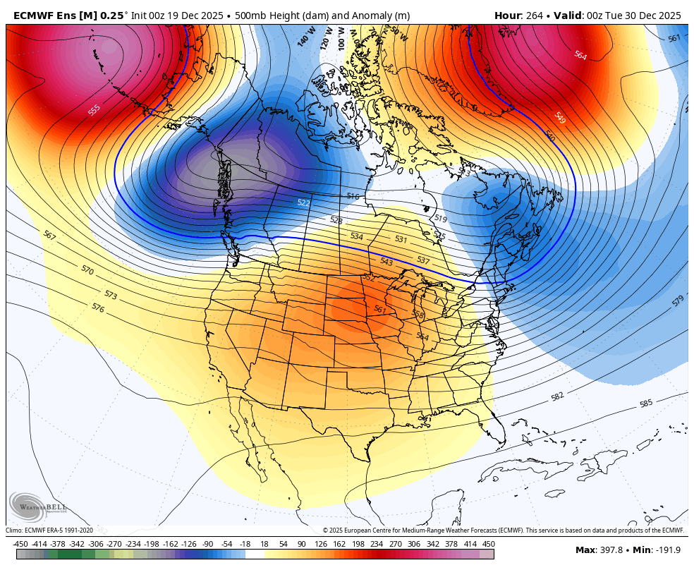
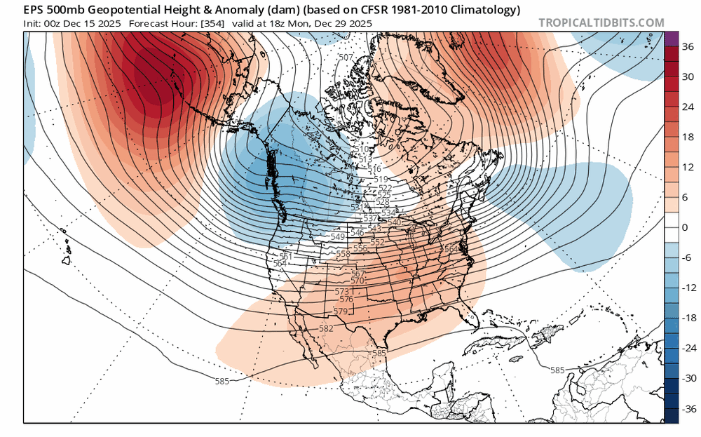
the trend west with the ridge axis around the 30th is nice to see... hopefully that continues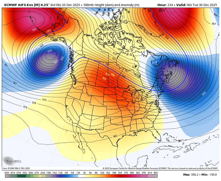
-
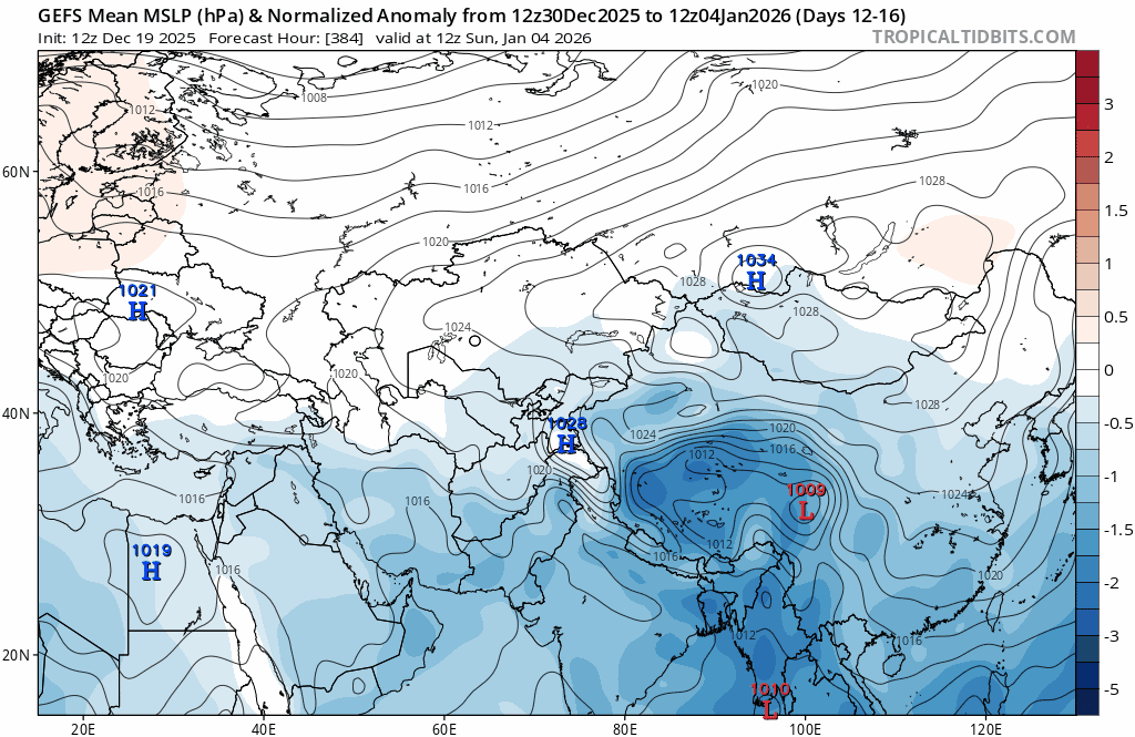
nice to see the -NAO strengthen and the Pacific trough weaken

-
December 2025 regional war/obs/disco thread
brooklynwx99 replied to Torch Tiger's topic in New England
nice to see the -NAO strengthen and the Pacific trough weaken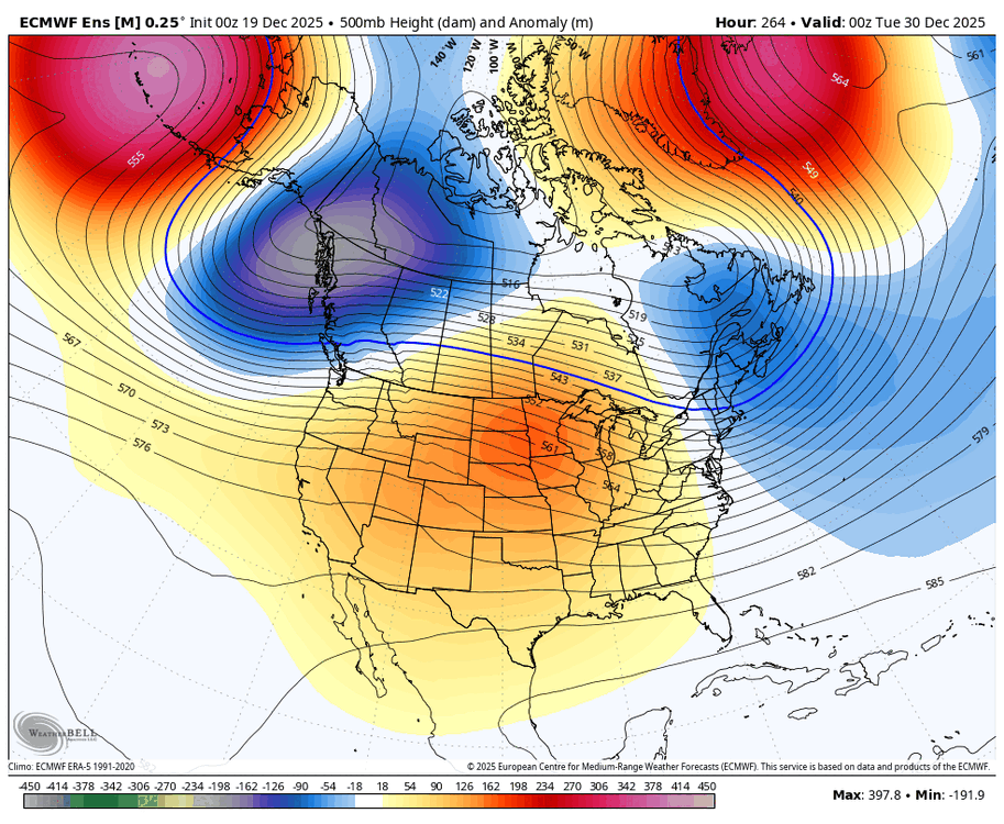
-
December 2025 regional war/obs/disco thread
brooklynwx99 replied to Torch Tiger's topic in New England
I've noticed that a lot of the AI stuff does pretty poorly with anomalous Atlantic blocks. they often struggle to get them to develop and wash them out too quickly when they occur. might make sense with the fact that they struggle with anomalous outcomes and they "smooth" things out a bit -
December 2025 regional war/obs/disco thread
brooklynwx99 replied to Torch Tiger's topic in New England
lol what the hell is the point of that then -
December 2025 regional war/obs/disco thread
brooklynwx99 replied to Torch Tiger's topic in New England
one of the only things that can really alleviate a shit Pacific with -WPO is a strong west based -NAO… just shunts everything west and changes the Pacific alignment -
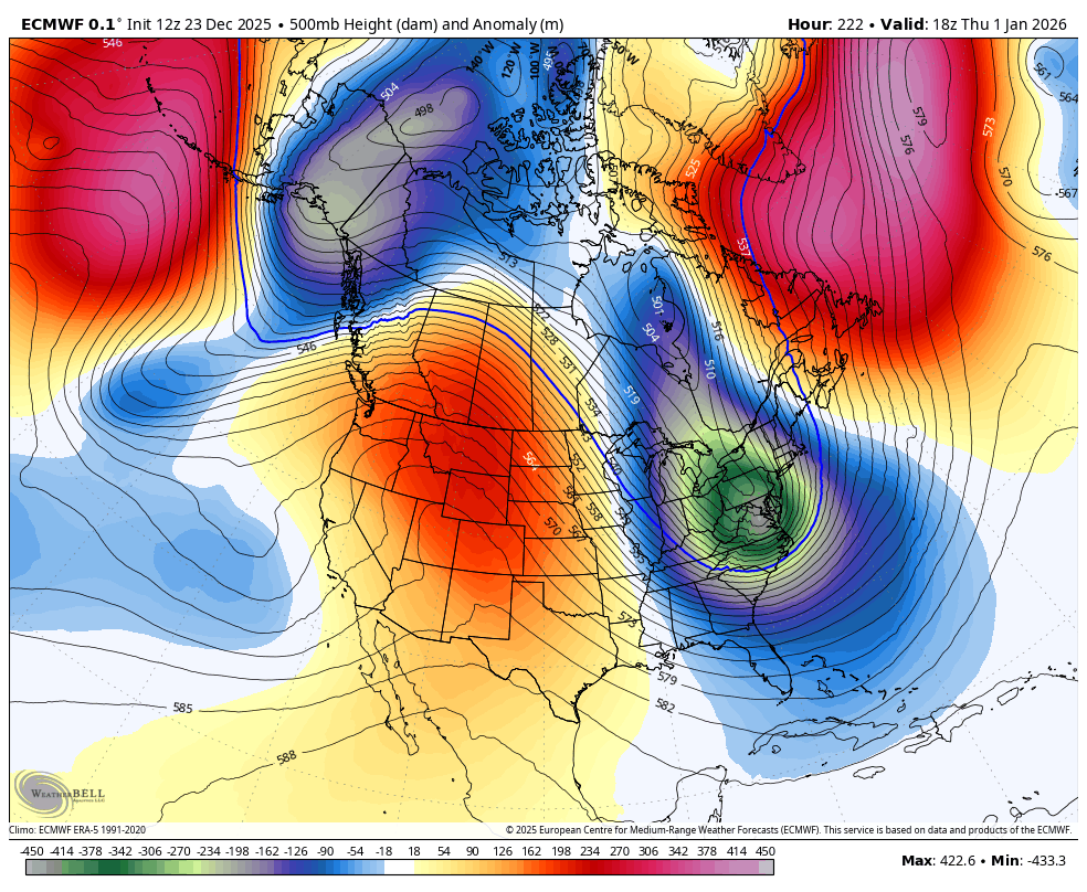
can’t say this isn’t becoming a bit more interesting. can see the ridge axis go from the OH Valley -> Plains as the -NAO cranks if you get that Pacific trough to retro a bit and allow the ridge axis to sit more near Montana, you reach a bit of an inflection point and you have legit coastal potential. we’ll see
-
December 2025 regional war/obs/disco thread
brooklynwx99 replied to Torch Tiger's topic in New England
can’t say this isn’t becoming a bit more interesting. can see the ridge axis go from the OH Valley -> Plains as the -NAO cranks if you get that Pacific trough to retro a bit and allow the ridge axis to sit more near Montana, you reach a bit of an inflection point and you have legit coastal potential. we’ll see