brooklynwx99
-
Posts
6,233 -
Joined
-
Last visited
Content Type
Profiles
Blogs
Forums
American Weather
Media Demo
Store
Gallery
Everything posted by brooklynwx99
-

December 2025 regional war/obs/disco thread
brooklynwx99 replied to Torch Tiger's topic in New England
don't worry, if it's wrong, it'll tick 10 miles NW at a time for twenty runs in a row -
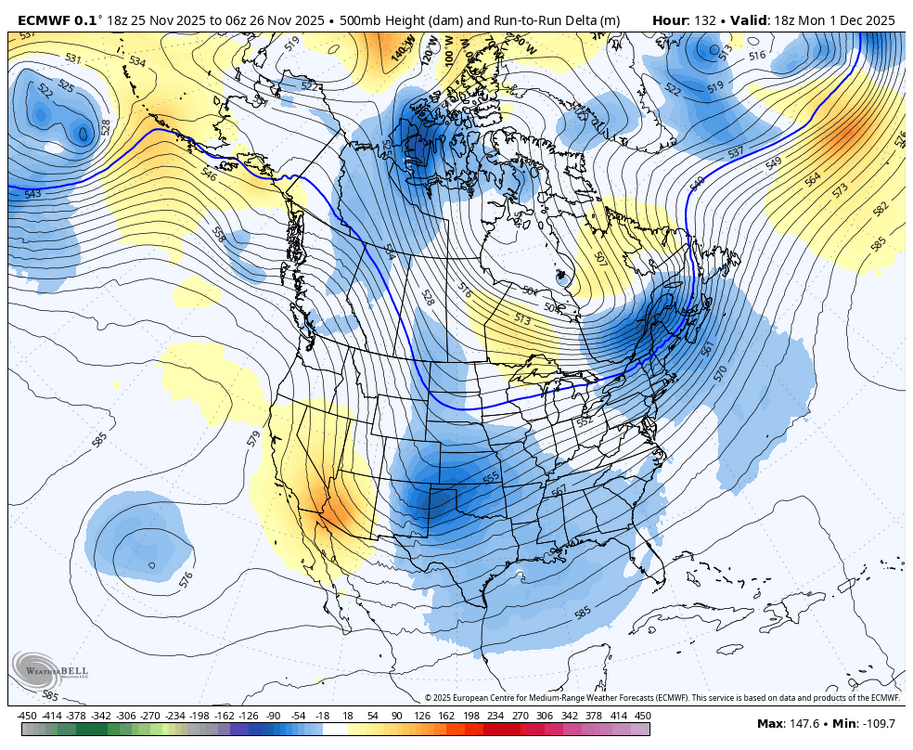
i like seeing the more consolidated trough along with the deeper press from the TPV into Maine on the 06z
-
2025-2026 ENSO
brooklynwx99 replied to 40/70 Benchmark's topic in Weather Forecasting and Discussion
I agree that they don’t look as good… given the MJO progression, I feel like the EPS makes more sense. we’ll see -
2025-2026 ENSO
brooklynwx99 replied to 40/70 Benchmark's topic in Weather Forecasting and Discussion
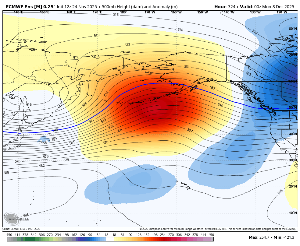
Pacific jet is trending more equatorward towards mid-month, leading to a better wave break and more poleward ridging near AK… this makes sense given the MJO
-
2025-2026 ENSO
brooklynwx99 replied to 40/70 Benchmark's topic in Weather Forecasting and Discussion
true. I think that Pacific trough is transient as the momentum from the poleward jet extension pushes into AK. then, as the MJO continues progressing, it wouldn't be surprising to see another equatorward extension... that period will become clearer over the next week or so I think we warm up for a week from like the 10-17th... what happens afterwards is more dubious -
2025-2026 ENSO
brooklynwx99 replied to 40/70 Benchmark's topic in Weather Forecasting and Discussion
if looking at RMM, the left of the COD is usually a cold signal as well -
2025-2026 ENSO
brooklynwx99 replied to 40/70 Benchmark's topic in Weather Forecasting and Discussion
yeah, the poleward extension should make things rougher for a week or so, then it should become more favorable again after the 15th as the MJO orbits even then, the TPV being nearby and a cold source region won't make it impossible to get lucky -
2025-2026 ENSO
brooklynwx99 replied to 40/70 Benchmark's topic in Weather Forecasting and Discussion
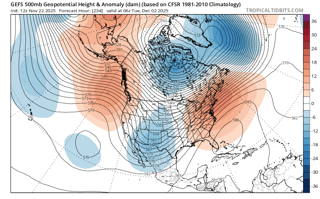
this is a pretty obvious colder shift. SE ridge is squashed, potentially opening up a risk for accumulating snow for the Northeast mid-week. can thank the more robust -EPO for that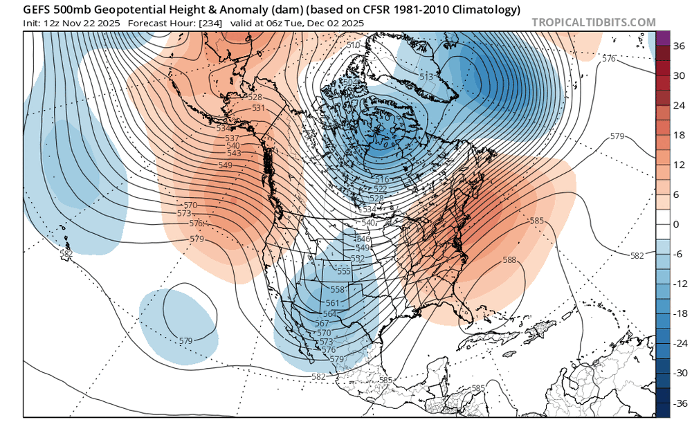
-
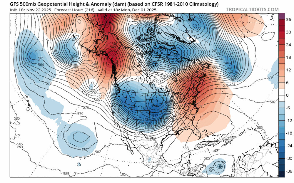
the trend towards more of a wave break in the Pacific might make the first week of the month interesting... more of a -EPO, which displaces more cold air south. combine that with some lingering vorticity in the SW, and overrunning opportunities may present themselves
-
2025-2026 ENSO
brooklynwx99 replied to 40/70 Benchmark's topic in Weather Forecasting and Discussion
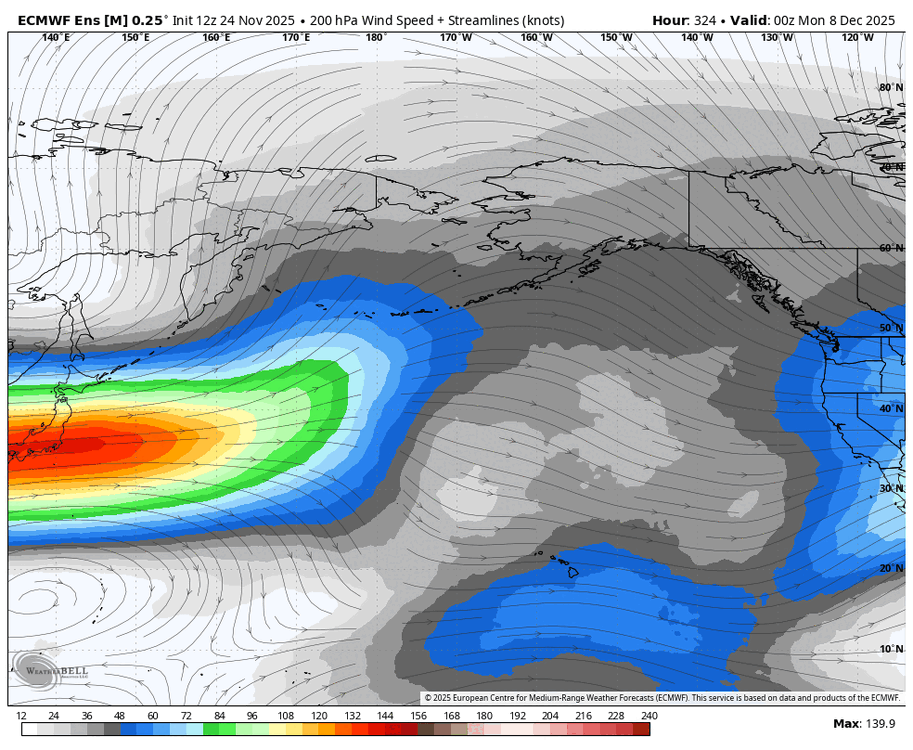
I would argue that the models are underdoing the Pacific jet and + heights near the WC and AK given that kind of tropical forcing unless the MJO can never get into 8, which I'm sure I'll be told -
2025-2026 ENSO
brooklynwx99 replied to 40/70 Benchmark's topic in Weather Forecasting and Discussion
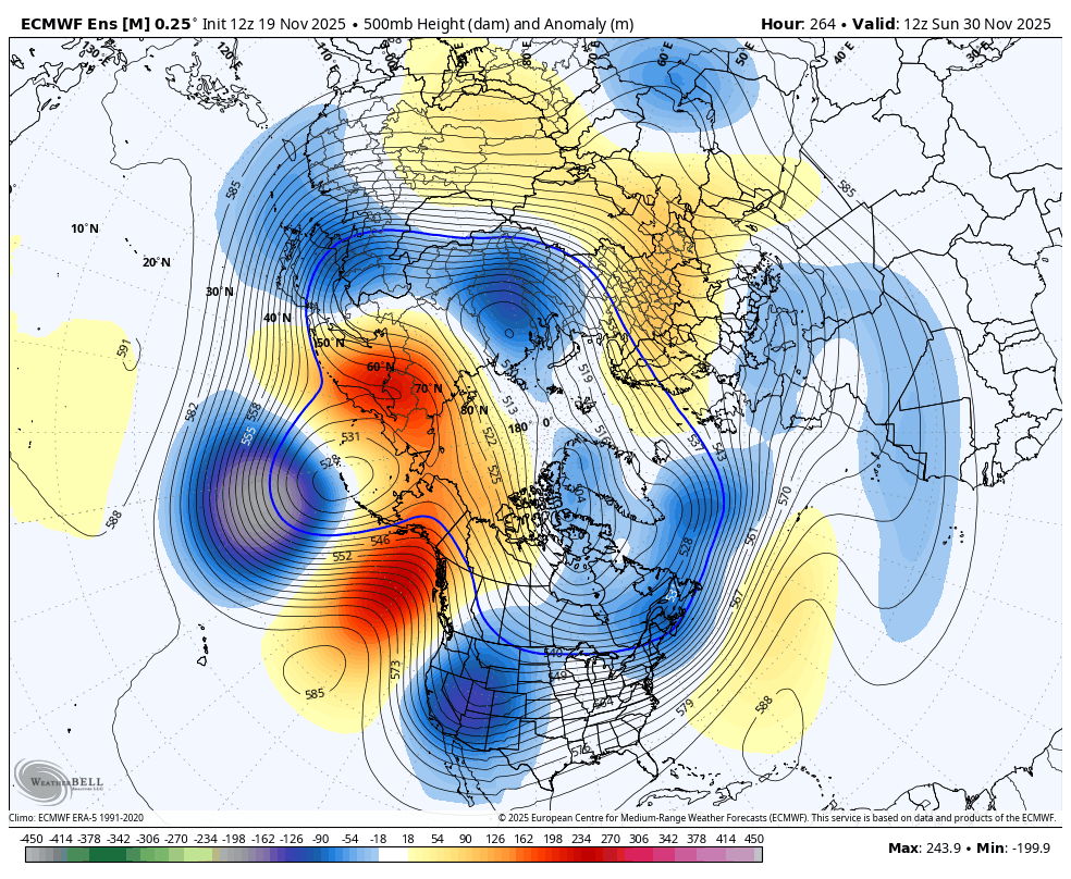
the TPV elongating like that into SE Canada should present opportunities for overrunning -
2025-2026 ENSO
brooklynwx99 replied to 40/70 Benchmark's topic in Weather Forecasting and Discussion
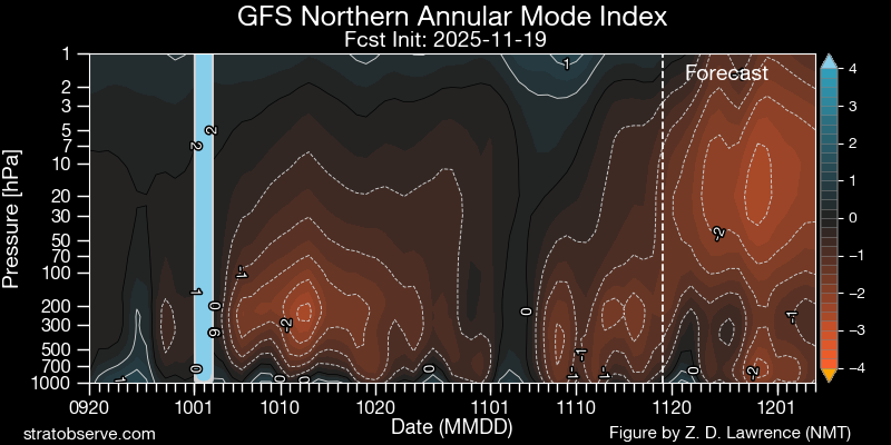
the lack of a prolonged SPV disruption lessens the risk of blocking this month... maybe late, but who knows this far out overall, looks pretty meh for the Northeast into mid-late month. the -WPO and TPV in Canada should continue to present snowfall risks, especially into New England, but large storms look unlikely as long as the NAO remains positive and the PNA negative should see the PNA rise later on in the month as the MJO continues to progress -
2025-2026 ENSO
brooklynwx99 replied to 40/70 Benchmark's topic in Weather Forecasting and Discussion
you usually get the wave breaking needed for -NAO when you get a huge cutter... you usually need -PNA to accomplish this -
2025-2026 ENSO
brooklynwx99 replied to 40/70 Benchmark's topic in Weather Forecasting and Discussion
honest question, is it possible for models in the 1-2 week range to show a pattern that you will actually get excited about? -
2025-2026 ENSO
brooklynwx99 replied to 40/70 Benchmark's topic in Weather Forecasting and Discussion
sure, we can play Monday morning QB and say "nooooo those patterns were actually bad because they didn't produce snow!" but that's disingenuous -
2025-2026 ENSO
brooklynwx99 replied to 40/70 Benchmark's topic in Weather Forecasting and Discussion
not to harp on last year, but models actually did a good job showing the amount of high latitude blocking that developed. to say that a good pattern never developed is just incorrect
-
2025-2026 ENSO
brooklynwx99 replied to 40/70 Benchmark's topic in Weather Forecasting and Discussion
explain to me how the pattern from last year never developed. i want receipts -
2025-2026 ENSO
brooklynwx99 replied to 40/70 Benchmark's topic in Weather Forecasting and Discussion
you are just full of surprises -
2025-2026 ENSO
brooklynwx99 replied to 40/70 Benchmark's topic in Weather Forecasting and Discussion
can you post some ensembles to back up your point? or just anything, really -
2025-2026 ENSO
brooklynwx99 replied to 40/70 Benchmark's topic in Weather Forecasting and Discussion
this is a pretty obvious P8 signal. there is very little, if any forcing showing up on the EPS over the Maritime Continent
-
the PV closer to us has been perturbed already. seems like this should couple pretty well
-
2025-2026 ENSO
brooklynwx99 replied to 40/70 Benchmark's topic in Weather Forecasting and Discussion
honest question, why are you even on twitter? I avoid twitter like the plague there are enough knowledgeable people here -
2025-2026 ENSO
brooklynwx99 replied to 40/70 Benchmark's topic in Weather Forecasting and Discussion
the weeklies should not run every day. so stupid -
2025-2026 ENSO
brooklynwx99 replied to 40/70 Benchmark's topic in Weather Forecasting and Discussion
can pretty easily see the N ATL trough feeding back on the Scandi ridge, which then increases heights in the NAO region... this elongates and presses the TPV south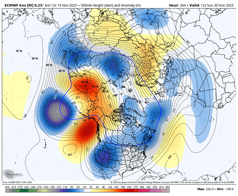
-
2025-2026 ENSO
brooklynwx99 replied to 40/70 Benchmark's topic in Weather Forecasting and Discussion
the EPS is just a day or two slower. it gets to the same point with a -NAO developing thanks to Scandi ridging (which is typical of SSW events)