brooklynwx99
-
Posts
6,233 -
Joined
-
Last visited
Content Type
Profiles
Blogs
Forums
American Weather
Media Demo
Store
Gallery
Everything posted by brooklynwx99
-
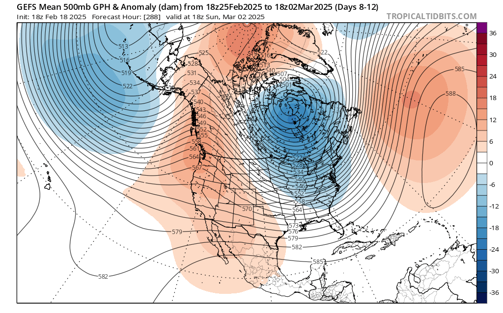
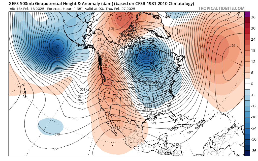
the trend with the PNA over the last model cycle has been pretty nice. went from a trough to a full latitude ridge on the GEFS over BC
-
agreed, though the trend for more -NAO probably does limit the extent of the warmth
-
dude that was two weeks ago, damn
-
it's an operational model at 10 days out. it will do that, as will any other OP at this range
-
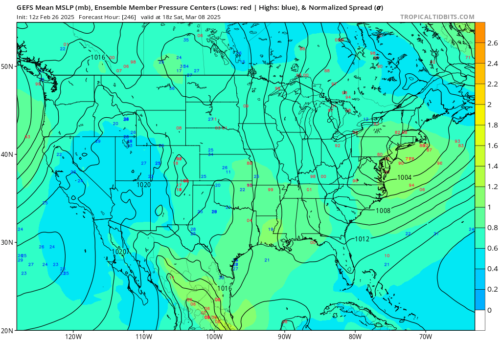
all ensembles maintain a signal for the 9-10th, just a matter of phasing. worth keeping an eye on
-
GEFS has quite a signal with lots of strong coastals
-
the transient 50/50 and -EPO do help this threat. the synoptics are there, it just needs to deliver with a phase
-
next shot at something more substantial is probably the 9-10th as the cutter drops the TPV down and a wave tries to amp into the colder airmass with the transient PNA spike. after that, it's likely curtains outside of NNE with some warm weather on the way
-
oh god please no
-
the AIFS humping is going to be unbearable for a while. past 5 days it isn't as good as any other model, really
-
he shits on every storm threat that has ever formed
-
i saw people even comparing this to Jan 2015. that was on a totally different level of fail. not even close
-
yeah, trust me, it was one of the more stunning model collapses in the last several years. absolutely sucked
-
yup, I will reassess in 2030 or so. the sample size is just too small and we could get blasted a few times to close the decade for all anyone knows. people also thought the massive WC ridges from 2013-15 were going to be the new norm. how laughable that seems now
-
i mean, it is, but 48 hours is a bit much. the models capitulated and it totally blew, but it was at 120-144 hours out. that happens. we're in agreement that it would be a different story if we were inside of three days god, i can't wait for an effective El Nino. hopefully next year
-
that's kinda silly. that attitude is borne out of frustration rather than anything scientific
-
yup, some people never understand that good patterns just increase the odds for snow, not guarantee it. we literally just saw that play out this week!
-
anything of substance to add? no? no wonder why mets barely post here anymore. doesn't seem to be an issue in other subforums
-
we'll have more chances into March. cold with -AO/-EPO persisting

-
yeah, it is absolutely not over

-
I'm banking on shorter wavelengths and a weak WAR to help us out here
-
this is quite a bit healthier. like seeing the -AO over the top too. pretty solid

-
 @Rjay lol
 -
the upper air pattern absolutely supported a large storm. that's what's so brutal about it. the "background state" stuff is bordering on pseudoscience. nobody can even truly explain what they mean when they say it
-
yeah, my guess is it has something to do with climate change. maybe higher velocities are messing with modeling or something like that. combine that with higher res, as you said, and it's a recipe for large swings though Feb 2021 was modeled very well and i can't imagine CC has accelerated that much in the last 4 years to mess with modeling that much. I don't want to overattribute either