brooklynwx99
-
Posts
6,233 -
Joined
-
Last visited
Content Type
Profiles
Blogs
Forums
American Weather
Media Demo
Store
Gallery
Everything posted by brooklynwx99
-
yeah, CMC is phasing
-
CMC is going to phase too
-
yeah, much more like foreign guidance
-
massive change on the GFS

-
massive change on the GFS

-
just a massive change on the GFS
-
lol you’d think this was an awful winter for the area. let’s ignore the EPS, 12z OP ECMWF, GEPS, UKMET because of the GFS and AIFS
-
it’s been flopping around for days. not any better than any other piece of guidance
-
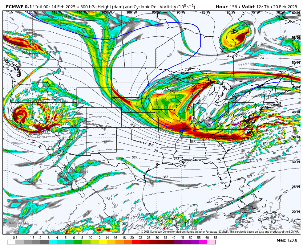
that isn't progressive. PNA is stronger and there is a strong closed low over MN. the low will pivot and bring PVA up
-
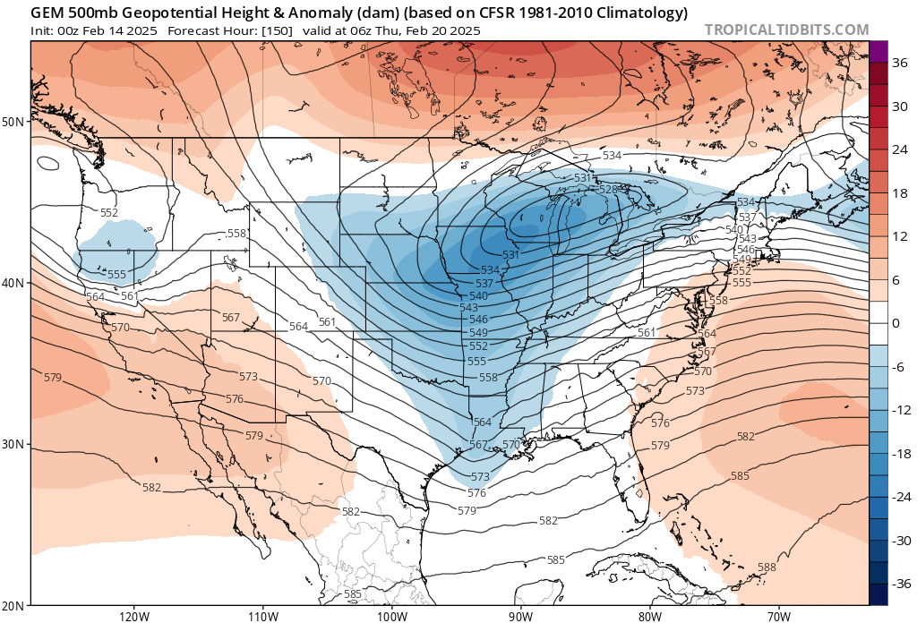
ECMWF looks just like the 12z EPS. nice to see

-
if this was the other way around with the GFS/GEFS only showing something and everything else relatively unenthused, the GFS would be launched to Pluto
-
that kicker actually helps pump the PNA for a brief time as the trough amps. pretty common before it flattens things, but if the spark is already lit it doesn't matter
-
EPS actually upped the ante from 00z
.thumb.png.d241b6c7509d68f4bd637ee254eaeaa8.png)
-
if the EPS has even a clue with this kind of look I think we're in for a significant event
.thumb.png.e8fa7878323df90b876e41d326a83029.png)
-
EPS is even more amped than 00z. insane for a mean at this range
.thumb.png.63326d37c8c8e21392a02fe47d10ad71.png)
-
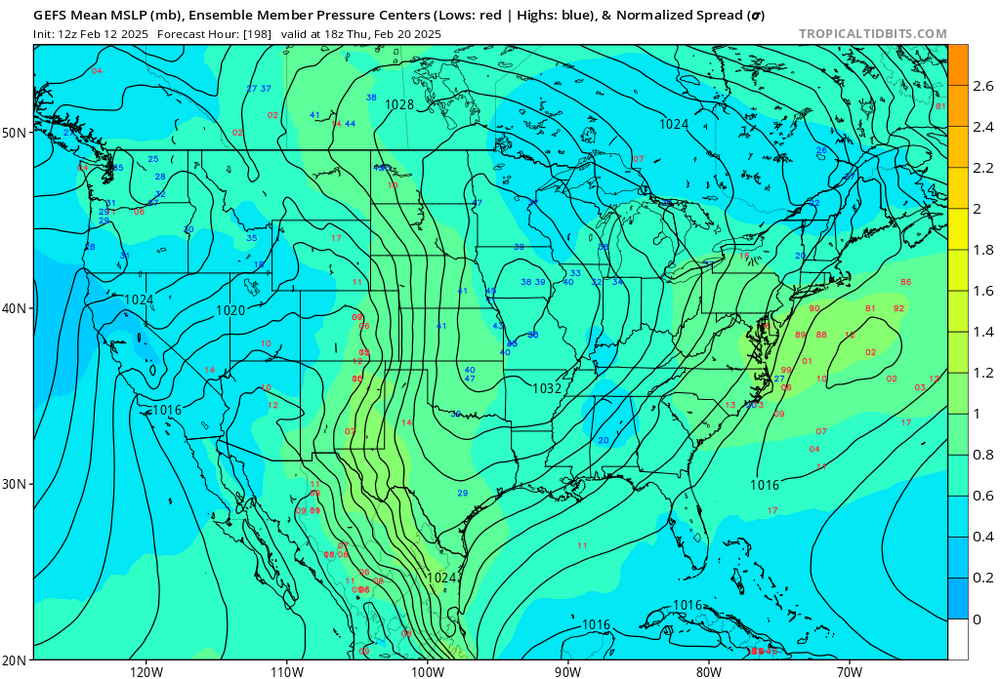
I would argue the GFS is the one with little to no support. GEPS, EPS, ECMWF, CMC, and UKMET all had amped solutions. GFS is the only one that’s pretty flat
-
EPS is very amplified. what a look btw, that isn’t a SE ridge linking with the -NAO… those are height rises downstream from the amping vort

-
EPS has trended back to its more exotic look from a couple days ago at 00z

-
EPS is sick
-
what a monster
-
honestly, the AIFS hasn't been any more consistent than any other model, and this storm is 8 days out. too much emphasis is placed on it IMO
-
there is some interest

-
nah i could go without being the scapegoat for less frozen water falling from the sky. i'm good
-
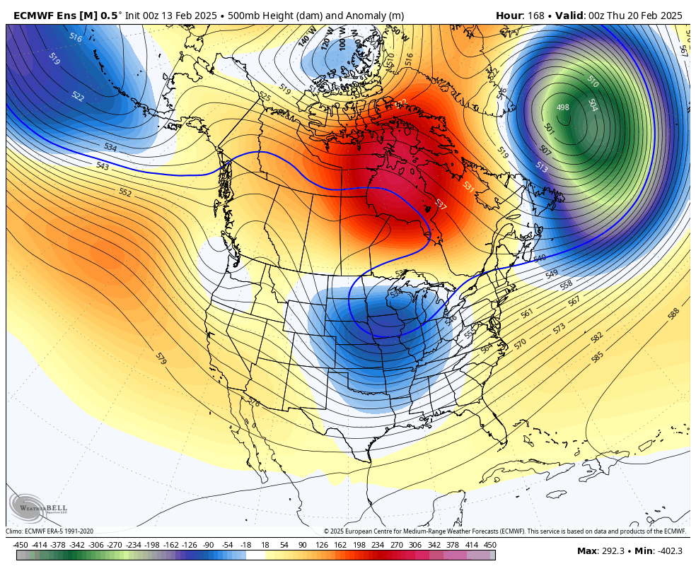
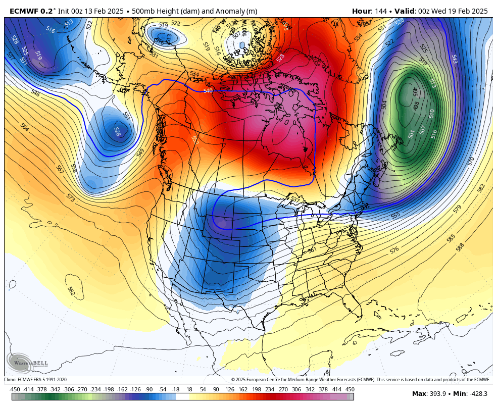
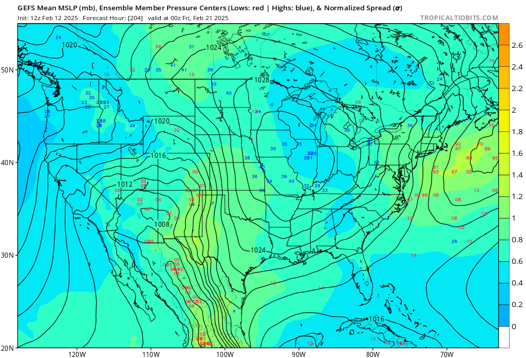
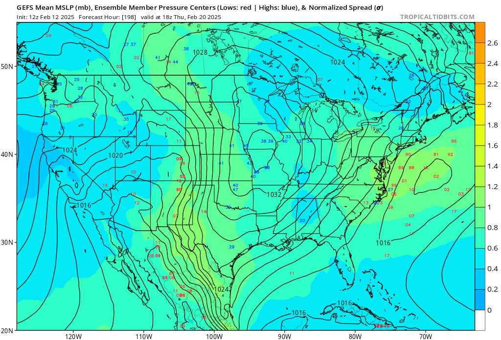
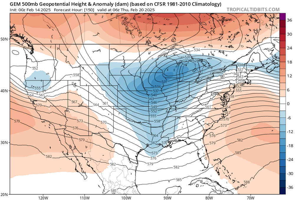
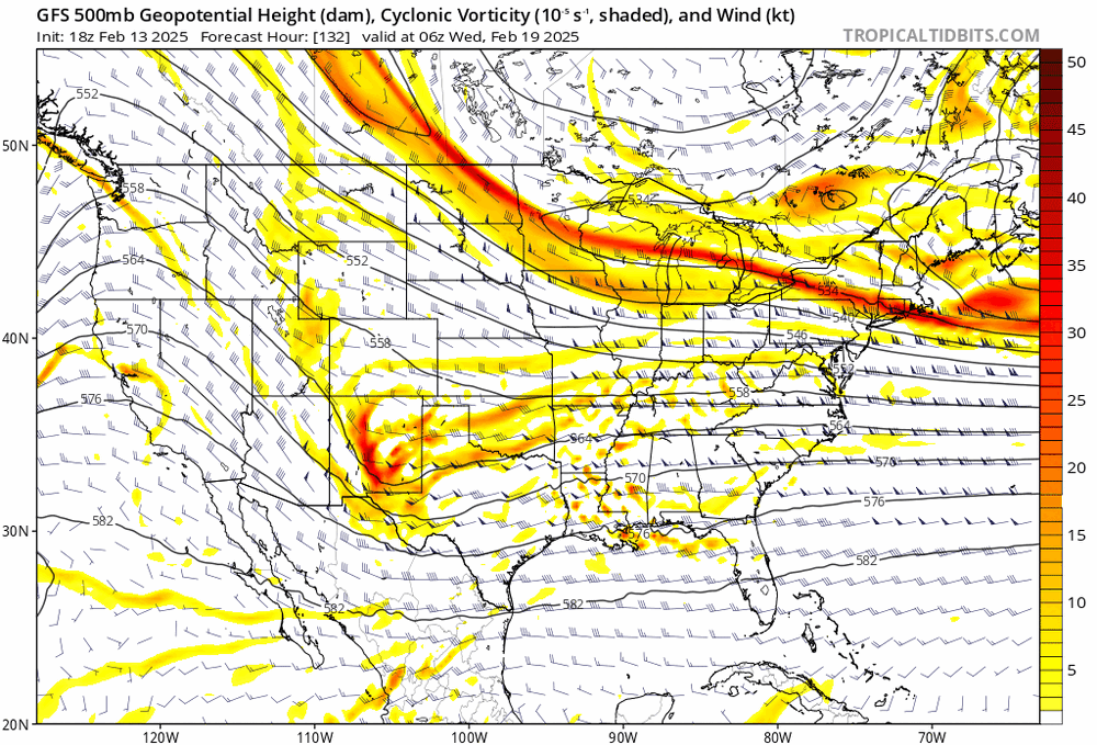
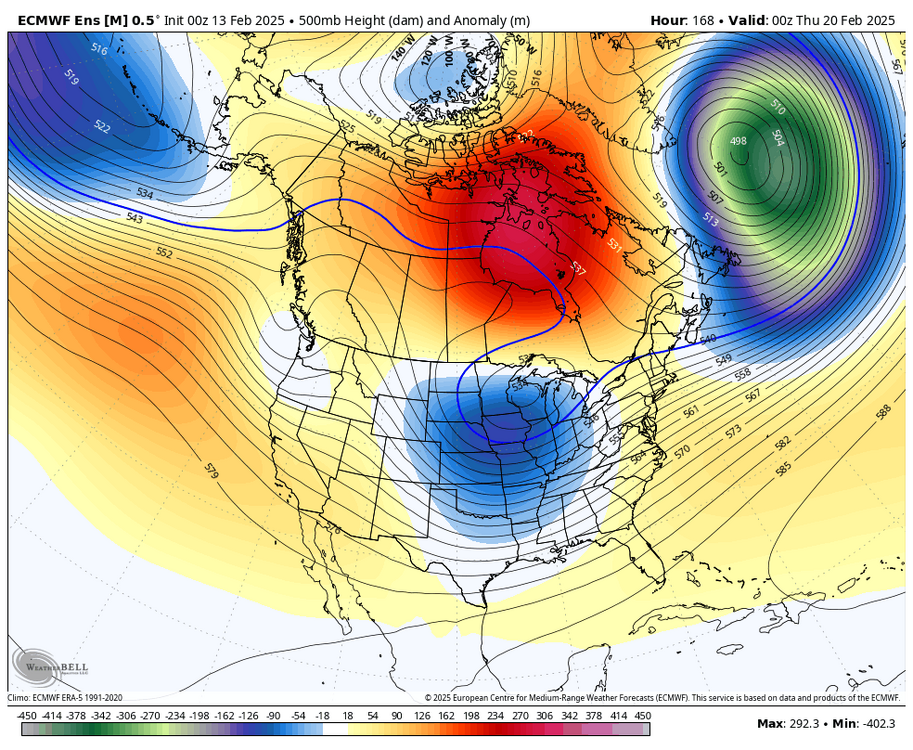
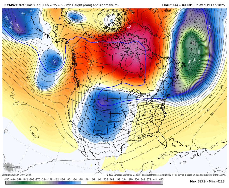
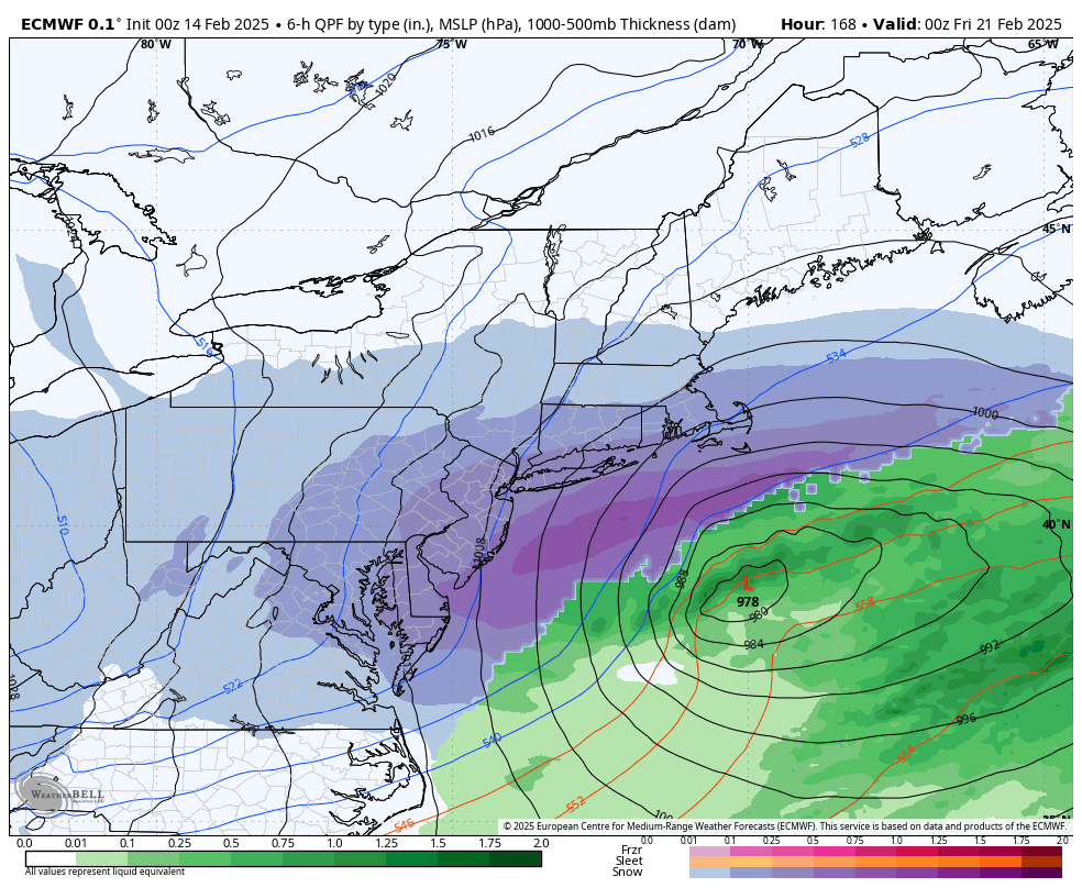
lol no model shows a cutter. could it get a little too close for comfort for the immediate coast, sure, but i find it highly unlikely that we see a system cut through the Apps. more likely to see suppression than a wet outcome here


.png.ee7130f7991b0a06d5fed7ee8bc47232.png)
.png.aa8090196a8b0d779ab9a9eedb5efb24.png)
.png.947a9025646294b0a6bdd914b42706ce.png)