brooklynwx99
-
Posts
6,233 -
Joined
-
Last visited
Content Type
Profiles
Blogs
Forums
American Weather
Media Demo
Store
Gallery
Everything posted by brooklynwx99
-
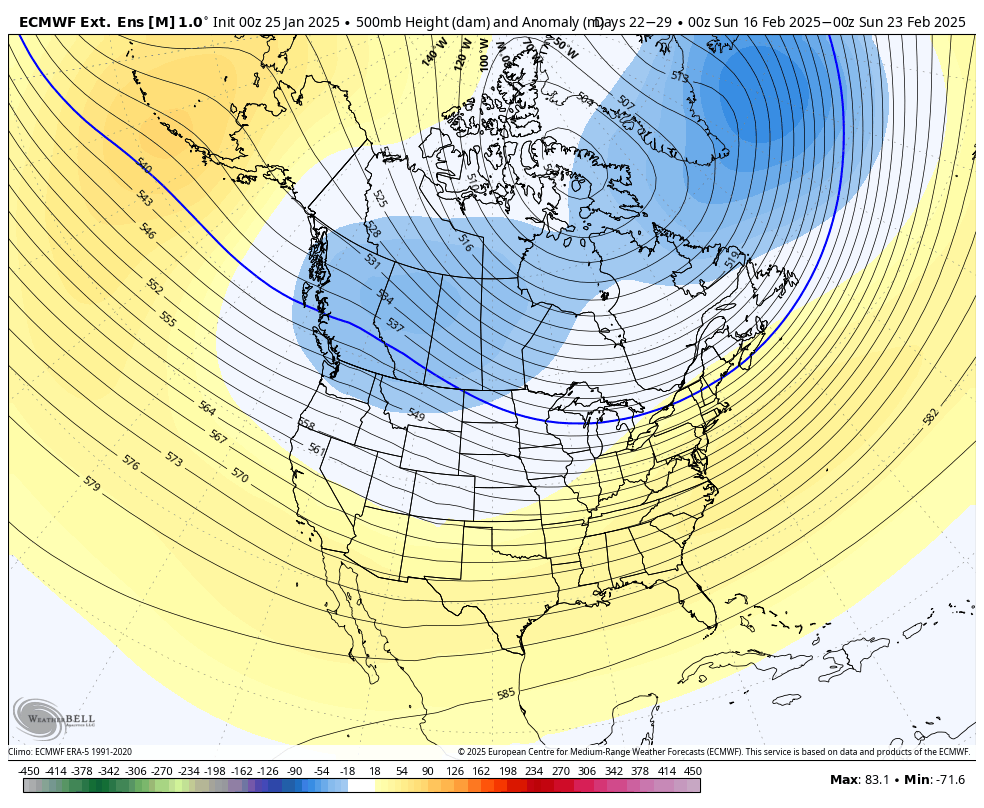
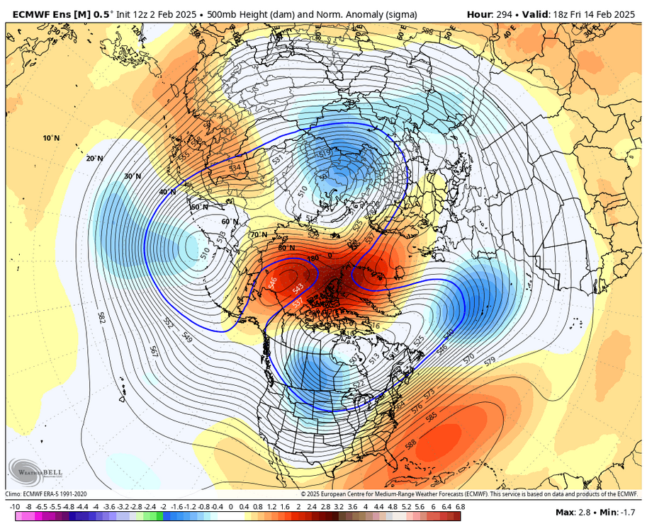
EPS has a 3 sigma block right over the pole. ridiculous
-
absolutely obscene EPS run. 3 sigma block right over the pole

-
absolutely absurd lmao

-
yup, looks like the EPS now
-
this is why I don't like using indices. when looking at the 500mb there's a pretty obvious -NAO on the GEFS
-
nobody could have seen this coming!

-
lol
-
yeah the EPS is... favorable. lmao tons of blocking, well AN precip, and cold
-
best EPS run i've seen since Feb 2021. ridiculous mean
-
the pattern did occur. just benefited south of the Mason-Dixon line the most. it happens
-
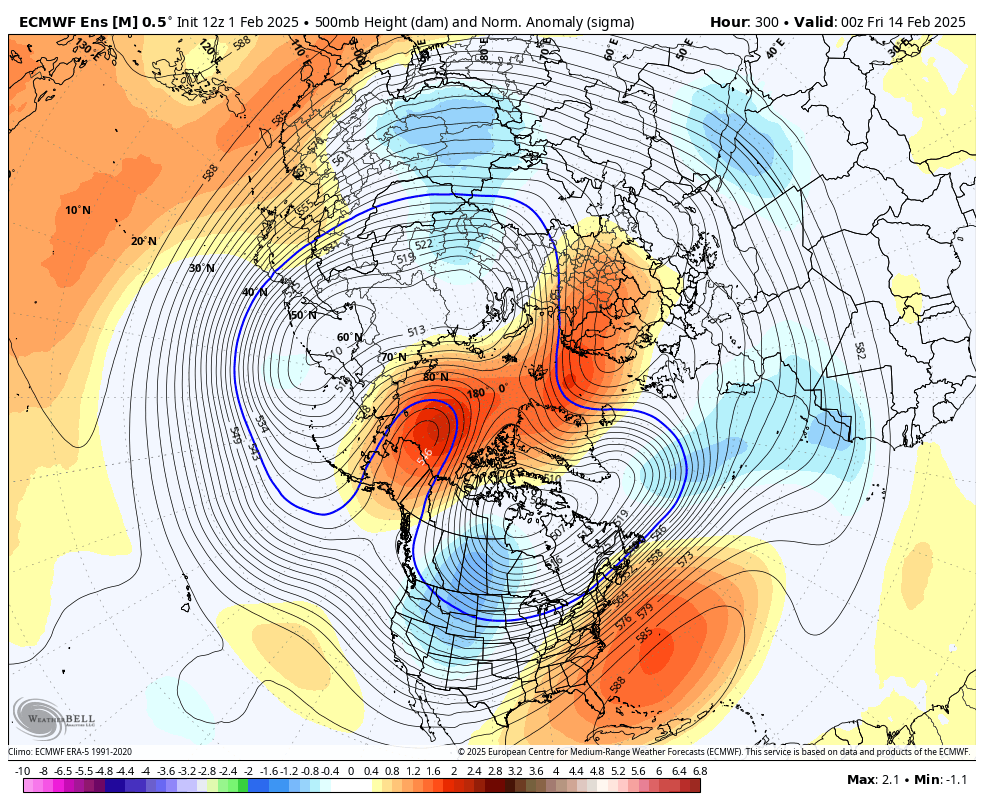
EPS has the retrograding block. 2 sigma ridge over the pole
-
i mean, wow

-
obviously not calling for anything that strong, but this does have similarities to March 2018. can't act like it doesn't. same -PNA to N ATL wavebreak that allows for a retrograde of the Scandi ridge into Greenland. combine that with a MJO pass through the Maritime Continent and a significant stratospheric disruption
-
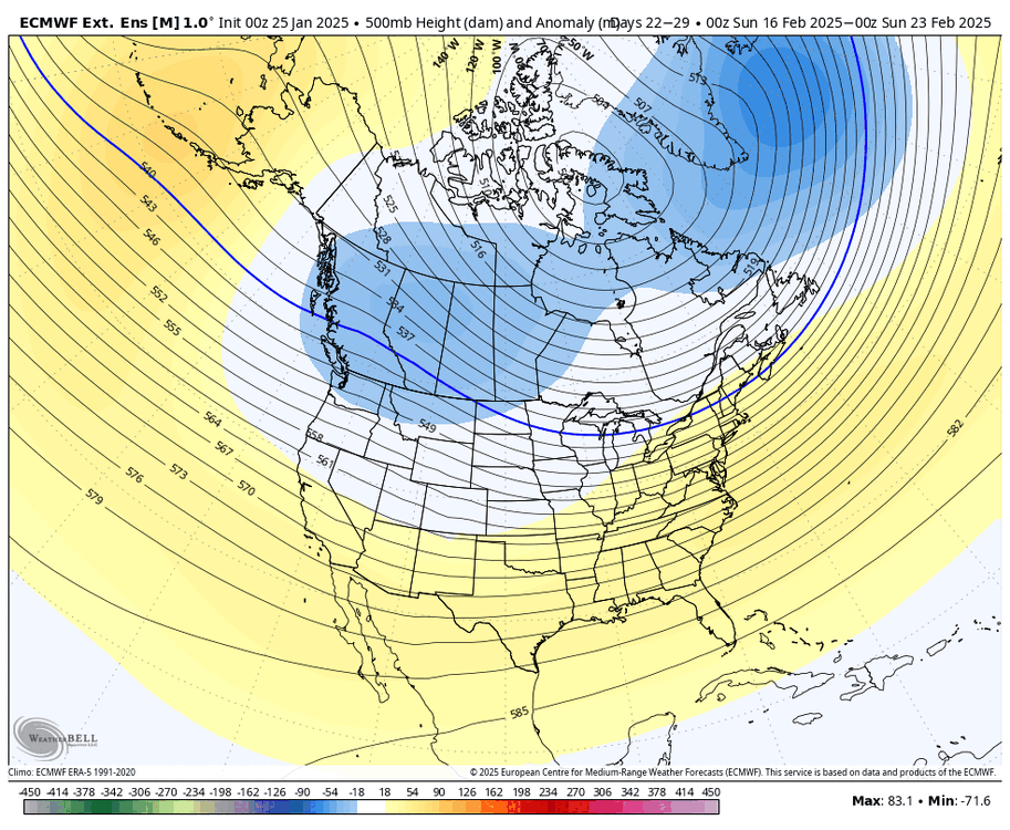
EPS is really ratcheting up the block in the LR. textbook progression
-
there's so much going for the blocking that I kinda have to believe it. the progression makes perfect sense. similar to March 2018 with the -PNA, retrograding Scandi ridge, N Atl wavebreaking and a strat assist. obv not going to be quite as anomalous but there are similarities
-
i'm really liking the burgeoning blocking signal. it all checks out... -PNA leads to N Atl wavebreaking which allows for retrogression of the Scandi ridge. couple that with a significant stratospheric disruption at 50mb and you're cooking up a block
-
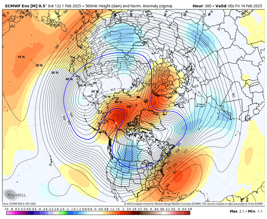
the ECMWF actually looks amazing aloft. massive blocking
-
i'm really liking the burgeoning blocking signal. it all checks out... -PNA leads to N Atl wavebreaking which allows for retrogression of the Scandi ridge. couple that with a significant stratospheric disruption at 50mb and you're cooking up a block
-
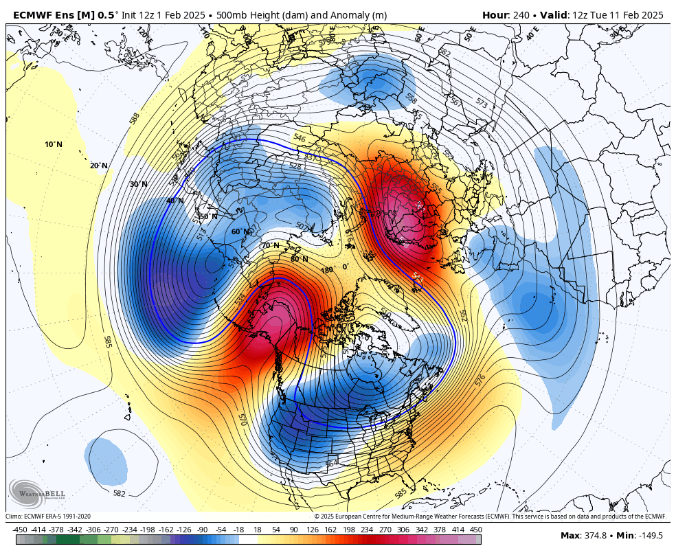
ECMWF gone wild after the Super Bowl. full on Arctic ridge bridge with -EPO/-NAO
-
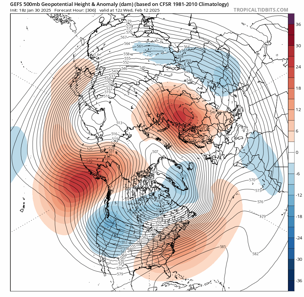
Scandi block getting stronger on the GEFS. much more of a wave breaking signal over the N ATL

-
Scandi block getting stronger on the GEFS. much more of a wave breaking signal over the N ATL

-
i think the 5th isn't much but the 8th could definitely be a solid front end thump to rain. and that's before any blocking gets going, which is looking more and more likely
-
that tweet on the last page has the NMME from Jan 8th. like are you serious lmao what use does that have right now
-
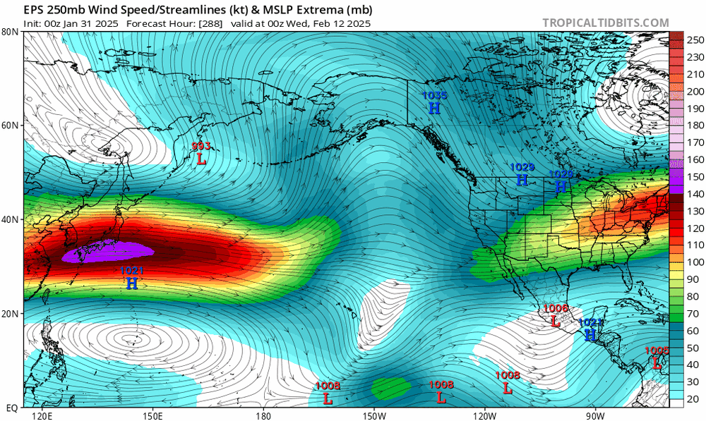
ENS and OP runs have a lot of chances with the boundary nearby and lots of moisture, even before the Scandi ridge tries to retrograde. could be looking at a pretty active period
-
ENS and OP runs have a lot of chances with the boundary nearby and lots of moisture, even before the Scandi ridge tries to retrograde. could be looking at a pretty active period